
Dilworth Upper Reservoir
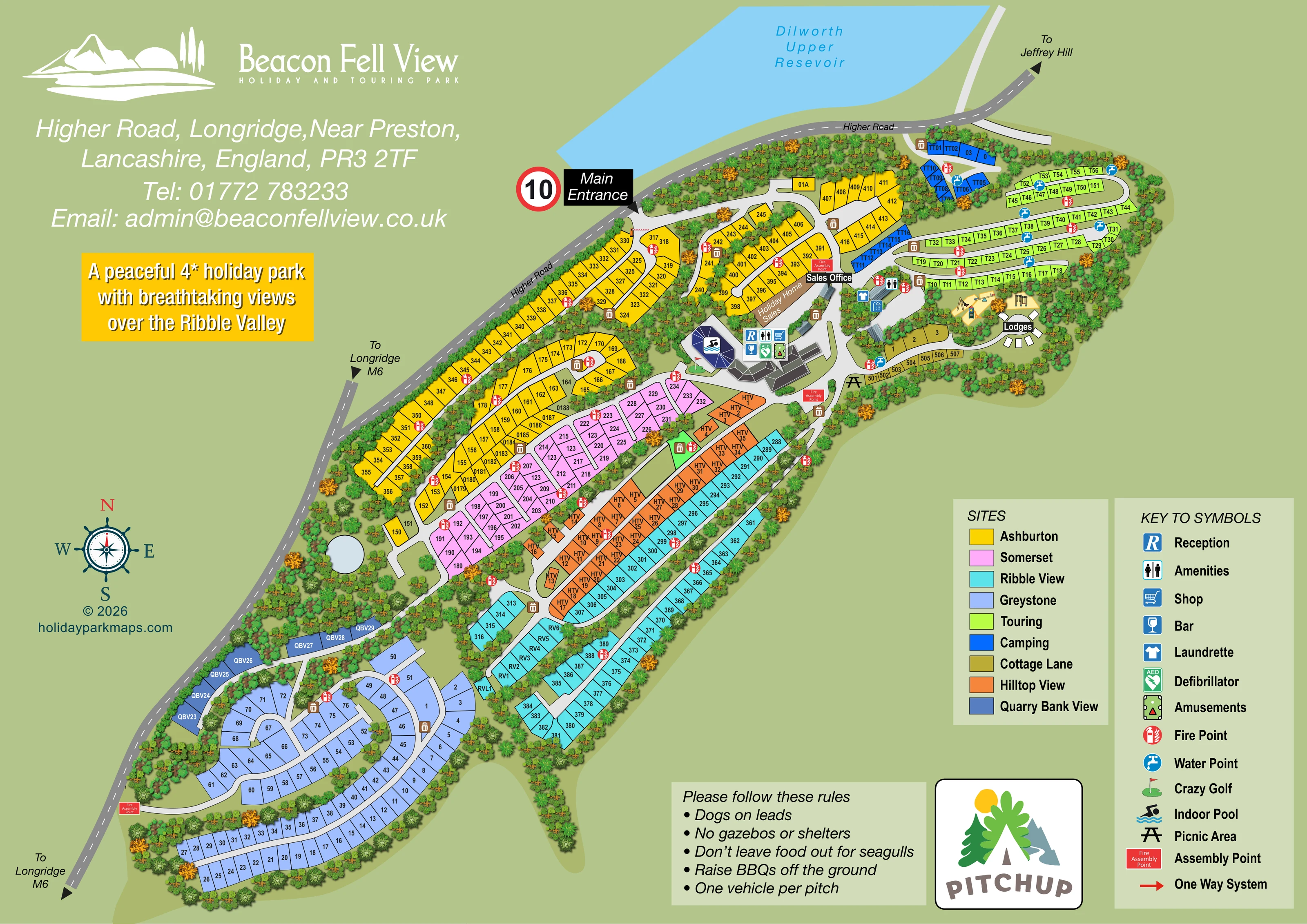
A large blue reservoir shape sits beyond Higher Road along the top edge of the composition.
ILLUSTRATED PARK MAP · P020
Beacon Fell View, Higher Road, Preston · United Kingdom
 Enlarge the map ↗
A SENSE OF THE PLACE
Beacon Fell View Holiday Park is located above Longridge in Lancashire, with countryside around the Forest of Bowland among the area's attractions. The park provides a base for holidays that combine rural outings with visits to nearby towns.
Holiday caravan accommodation is available through individual providers as well as the park's wider holiday home offering. The map helps visitors understand the site layout before arrival.
LOOK CLOSER
A large blue reservoir shape sits beyond Higher Road along the top edge of the composition.
Dense illustrated trees and shrubs define the perimeter, divide accommodation rows and soften the road junctions.
An unlabelled pale-blue rounded water feature appears among planting towards the western side of the park.
A reception symbol identifies the principal visitor-services building near the centre of the northern half of the plan.
Amenities symbols appear at the main facilities hub and at a smaller block near the touring and camping areas.
The shop symbol is grouped with other services at the main facilities building.
A bar symbol appears in the central facilities cluster.
Laundrette symbols are shown at the main facilities and the smaller northern amenities building.
A reception symbol identifies the principal visitor-services building near the centre of the northern half of the plan.
Amenities symbols appear at the main facilities hub and at a smaller block near the touring and camping areas.
The shop symbol is grouped with other services at the main facilities building.
A bar symbol appears in the central facilities cluster.
Laundrette symbols are shown at the main facilities and the smaller northern amenities building.
A green AED symbol marks a defibrillator at the main facilities hub.
The amusements symbol is placed alongside reception and other central services.
A swimming symbol overlays a distinctive blue-roofed building adjoining the central complex; the key identifies it as an indoor pool.
Small flag-and-green illustrations appear in the leisure area beside the lodges, corresponding to the crazy-golf symbol in the key.
Picnic-table symbols mark spaces near the facilities hub and lodge area.
The approach to the central hub includes a labelled Sales Office and an elongated building labelled Holiday Home Sales.
Repeated red fire-point symbols are distributed throughout the holiday-home, touring and camping areas.
Blue tap symbols are concentrated among the touring pitches, with another near the eastern holiday-home row.
Red labelled assembly-point panels appear near the sales-office area, below the main facilities and at the south-western end of the park.
Brown bin symbols are scattered beside internal roads and accommodation groups, although they are not explained in the printed symbol key.
A large blue reservoir shape sits beyond Higher Road along the top edge of the composition.
Dense illustrated trees and shrubs define the perimeter, divide accommodation rows and soften the road junctions.
An unlabelled pale-blue rounded water feature appears among planting towards the western side of the park.
A black Main Entrance label and arrow identify the access point beside Higher Road, accompanied by a circular 10 sign.
The boundary road is labelled Higher Road, with directional arrows towards Longridge and the M6 to the south-west and Jeffrey Hill to the north-east.
Pale internal roads form a long connecting spine, curved loops, short branches and parallel pitch-serving lanes.
A red directional arrow is explained in the key as One Way System; its placement on the site roads is not clearly established in the visible artwork.
READING THE MAP
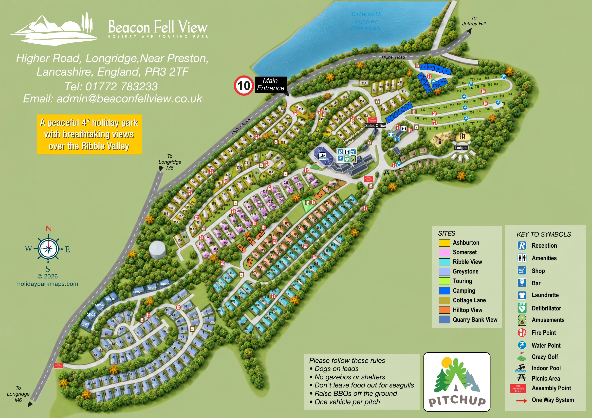
This map of Beacon Fell View Holiday and Touring Park presents a large, elongated park above Longridge in Lancashire. Higher Road follows the site's western edge, while Dilworth Upper Reservoir provides a recognisable landscape reference at the top of the page. The artwork combines a practical numbered plan with illustrated planting and distinctive communal buildings, helping visitors understand both the accommodation layout and the location of shared facilities.
Colour is the main organising device. Seven named holiday-home areas sit alongside separately coloured touring and camping pitches, with a labelled lodge area near the northern facilities. Pale roads connect the curved southern neighbourhoods to a central reception and leisure hub, then branch into the more compact touring section. An indoor pool, shop, bar, laundrette and other visitor services are identified through pictograms.
For a park with many similar-looking plots, the design gives visitors several useful reference points: their area colour, plot number, nearby road shape and planted boundaries. Separate legends, arrival directions and a compass support that detailed plan without requiring every facility name to be written across the site.
The plan stretches diagonally across the page, following Higher Road from the rounded south-western accommodation area to the touring pitches at the north-east. A marked main entrance leads towards the sales office and an illustrated facilities complex. External arrows indicate the directions to Longridge, the M6 and Jeffrey Hill, while a large blue shape beyond the road identifies Dilworth Upper Reservoir.
Most accommodation is drawn as flat, numbered polygons. Yellow Ashburton plots occupy much of the western and upper-central site; pink Somerset plots form a central block. Orange Hilltop View and turquoise Ribble View run in longer rows through the middle and eastern side. Pale-blue Greystone plots follow the looping roads at the southern end, with darker Quarry Bank View plots beside the western boundary. Ochre Cottage Lane plots appear in smaller groups near the eastern facilities. Lime-green touring pitches and blue camping pitches create a separate northern zone.
The main buildings receive more illustrative detail than the plots. A blue-roofed pool adjoins the dark-roofed central complex, where symbols identify reception, amenities, the shop, bar, laundrette, defibrillator and amusements. A smaller service building sits nearer the touring and camping areas. The labelled lodges and nearby leisure illustrations provide another destination on the eastern side. Picnic tables, water taps, bins, fire points and assembly-point panels add practical detail throughout the plan.
Dense belts of trees define boundaries and divide rows, with an unlabelled pond-like feature on the western side. Two separate legends explain area colours and facilities. The page also includes park branding, contact details, a compass and a rules panel. The enlarged detail is a crop of this same artwork, not an additional park section.
 Enlarge this map ↗
KEEP EXPLORING
Chosen for shared landscapes, accommodation or facilities.
 Explore the map ↗
United Kingdom
A colour-zoned coastal park map with touring areas, woodland trails, ponds and a leisure club.
 Explore the map ↗
United Kingdom
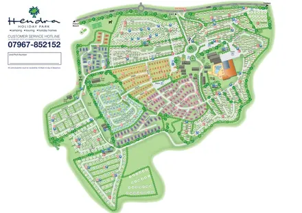
Colour-coded holiday homes, numbered pitch fields and a prominent pool complex on Hendra's whole-park plan.
 Explore the map ↗
United Kingdom
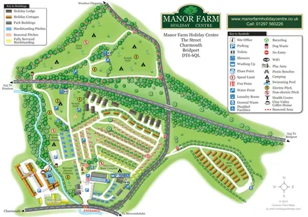
Colour-coded pitches, riverside camping and separate accommodation areas at Manor Farm Holiday Centre, Dorset.
Features may come from the sample artwork, its key or published park information. Approximate numbers describe the drawing and may cover only part of a park. They are intended to help you compare map examples. Current facilities and booking information should be checked with the park.
LET’S MAP YOUR PARK
For a map quotation, find your park and draw a rough boundary around it. The area you select helps us work out the design time and price.
Draw your park for a quote ↗Or talk to our map designers
01751 473136