
River Medway
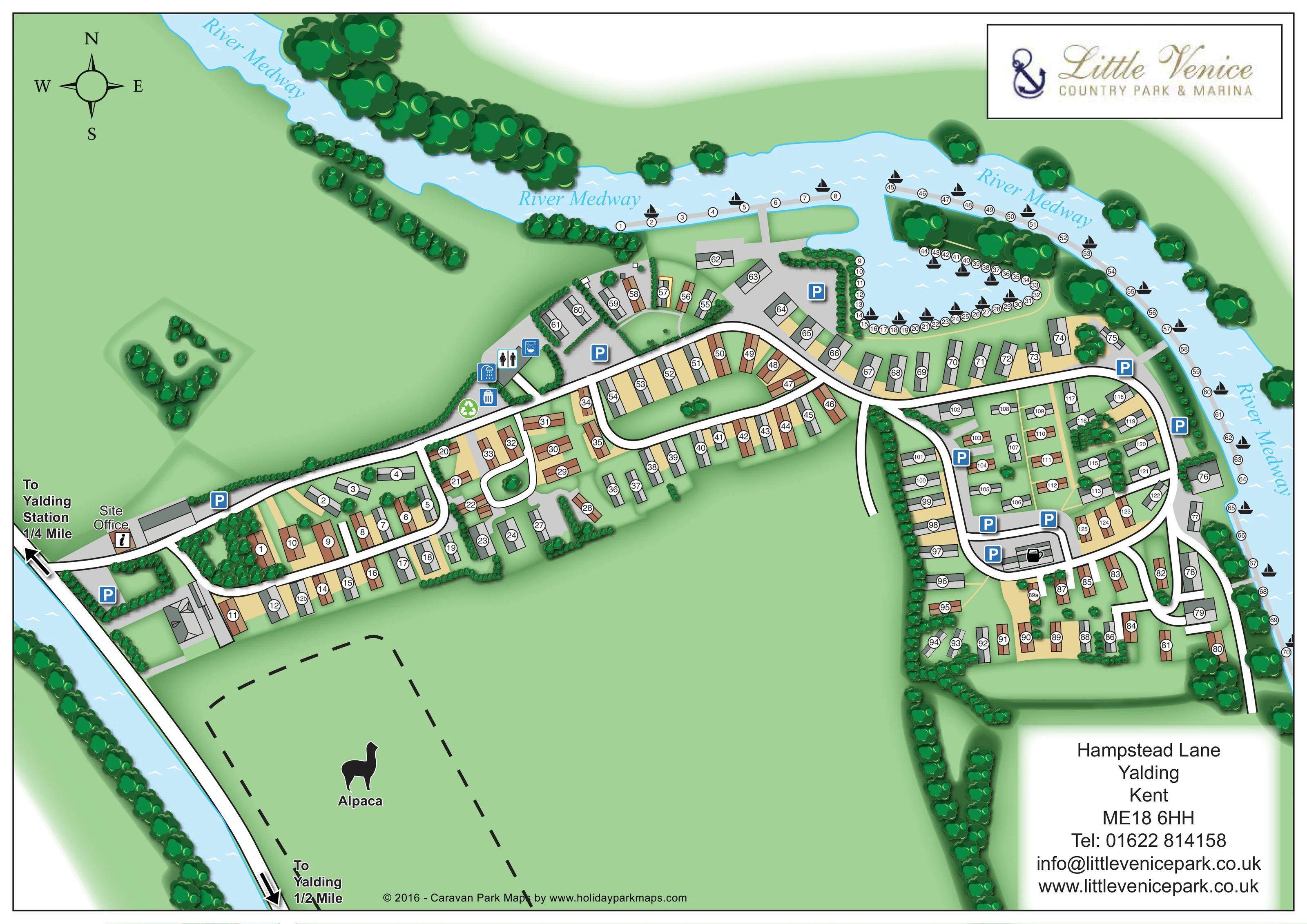
Named river sweeping across the top of the plan and down its eastern edge, illustrated in pale blue with white ripple marks.
ILLUSTRATED PARK MAP · P523
Hampstead Lane, Yalding, Kent · United Kingdom
 Enlarge the map ↗
A SENSE OF THE PLACE
Little Venice Country Park & Marina is based at Hampstead Lane, Yalding, Kent. This is a riverside holiday park and marina on the River Medway near Maidstone. The operator markets holiday lodges and floating waterlodges for purchase.
Riverside and marina boat moorings are advertised.
LOOK CLOSER
Named river sweeping across the top of the plan and down its eastern edge, illustrated in pale blue with white ripple marks.
A large dashed enclosure south of the western accommodation is labelled Alpaca and contains an animal silhouette.
Layered tree symbols line the riverbanks, marina peninsula and park boundaries, while smaller hedges and shrubs subdivide accommodation plots.
An additional pale-blue waterway runs diagonally along the western edge beside the approach route; it is not named on the artwork.
An inset basin has numbered berths around its banks and wooded peninsula, with further numbered moorings extending along the river. Black sailing-boat symbols distinguish the boating areas from the land-based accommodation.
Labelled office beside the western arrival road, accompanied by an information symbol.
Repeated blue P symbols identify parking near the entrance, central service buildings, marina and eastern accommodation loops.
Male/female toilet and shower pictograms mark the service-building cluster north of the main internal road.
Named river sweeping across the top of the plan and down its eastern edge, illustrated in pale blue with white ripple marks.
An inset basin has numbered berths around its banks and wooded peninsula, with further numbered moorings extending along the river. Black sailing-boat symbols distinguish the boating areas from the land-based accommodation.
Labelled office beside the western arrival road, accompanied by an information symbol.
Repeated blue P symbols identify parking near the entrance, central service buildings, marina and eastern accommodation loops.
Male/female toilet and shower pictograms mark the service-building cluster north of the main internal road.
A washing-machine pictogram marks the same central service-building area.
A blue bin symbol and green recycling symbol sit beside the central service area.
A black cup pictogram identifies a building within the eastern road loop; no accompanying text specifies its precise operation.
A large dashed enclosure south of the western accommodation is labelled Alpaca and contains an animal silhouette.
Layered tree symbols line the riverbanks, marina peninsula and park boundaries, while smaller hedges and shrubs subdivide accommodation plots.
An additional pale-blue waterway runs diagonally along the western edge beside the approach route; it is not named on the artwork.
White, black-edged roads form a west-to-east spine and several loops. Narrow pale-yellow lines provide secondary connections through parts of the eastern plots and marina peninsula.
Bold arrows at the western edge point towards Yalding Station and Yalding, with quarter-mile and half-mile annotations respectively.
A four-point compass in the upper-left corner places north towards the top of the page.
READING THE MAP
This illustrated map of Little Venice Country Park & Marina brings together two distinct parts of a waterside holiday setting: numbered holiday homes on land and boat moorings along the River Medway. Located at Yalding in Kent, the park is presented as a sequence of landscaped accommodation groups linked by curving roads, with the marina forming a prominent feature towards the top of the page.
Pale-blue water and dense green tree belts establish the setting immediately. The river sweeps around the northern and eastern sides, while a wooded peninsula gives the marina basin a distinctive shape. On land, white roads stand out against green plots and brown or grey roof illustrations, making the main route from the site office easy to follow.
The map also includes practical visitor references: parking, toilets, showers, laundry, waste and recycling symbols, plus directions towards Yalding and its railway station. A labelled alpaca enclosure adds an unusual landmark. This sample is particularly relevant to parks that need accommodation, boating facilities and a strong landscape identity to work together on one plan.
The single landscape-format artwork shows the park from above, with the western entrance feeding a long internal road towards the marina and eastern accommodation. The site office is labelled close to this arrival point, and nearby parking is marked with blue P symbols. External arrows indicate the routes towards Yalding Station and Yalding, with distance annotations printed beside them.
The land-based accommodation is organised into several groups rather than one uniform grid. In the western section, units sit along a compact loop and short branches. Further east, a longer oval-shaped road encloses a green strip, while the right-hand side contains a denser arrangement of curved roads, rows and small connecting paths. Each holiday home has a white circular number badge over a brown or grey roof plan. Trees, hedges and pale-yellow plot surfaces help separate neighbouring groups.
Above the main road, a service-building cluster carries toilet, shower and washing-machine symbols, with waste and recycling markers nearby. Parking is distributed through the park, including beside the marina. A cup pictogram marks a building within the eastern loop.
The River Medway is the main landscape feature, bending across the top and down the right-hand edge. Numbered moorings follow its bank and curve around a marina basin containing a wooded peninsula. Black sailing-boat symbols distinguish this numbering system from the accommodation. An unnamed waterway borders the western approach, while a dashed alpaca enclosure occupies open land below the western plots.
A compass, framed anchor logo and large contact panel complete the page. Layered tree canopies, soft shadows and white water ripples give the otherwise diagrammatic plan a recognisable illustrated character.
KEEP EXPLORING
Chosen for shared landscapes, accommodation or facilities.
 Explore the map ↗
United Kingdom
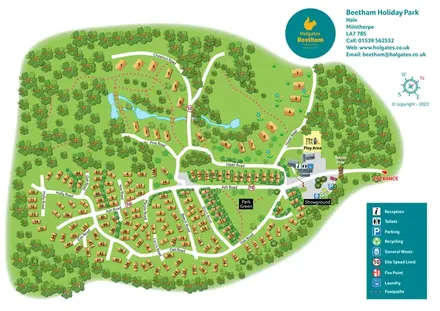
A woodland holiday-park plan with numbered homes, tree-named roads, walking loops and a distinctive entrance totem pole.
 Explore the map ↗
United Kingdom
Illustrated lakeside park plan with numbered holiday units, leisure buildings and a looping Woodland Walk.
 Explore the map ↗
United Kingdom
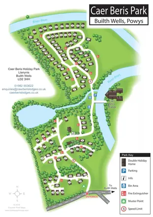
Portrait holiday-home park map with riverside loops, a tree-fringed pond and a separate manor landmark.
Features may come from the sample artwork, its key or published park information. Approximate numbers describe the drawing and may cover only part of a park. They are intended to help you compare map examples. Current facilities and booking information should be checked with the park.
TAKE A CLOSER LOOK
View the illustrated map in detail or choose a file to download. These are sample maps; contact the park for current visitor information.


LET’S MAP YOUR PARK
For a map quotation, find your park and draw a rough boundary around it. The area you select helps us work out the design time and price.
Draw your park for a quote ↗Or talk to our map designers
01751 473136