
Working farm and barn
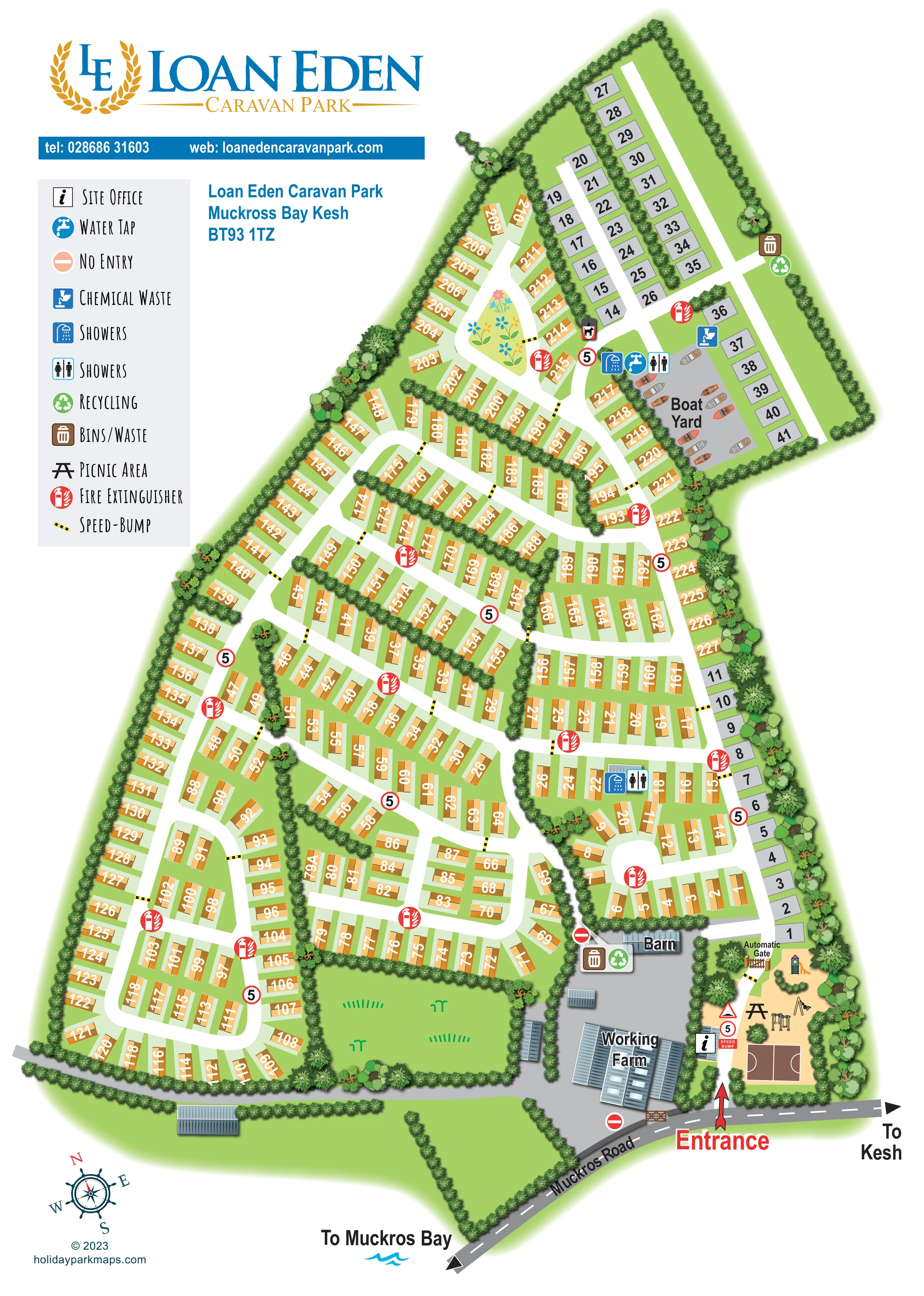
A substantial labelled farmyard with roofed buildings occupies the lower-right portion of the illustration. A separate barn is labelled at its upper edge.
ILLUSTRATED PARK MAP · P194
Muckross Bay, Kesh, Enniskillen · United Kingdom
 Enlarge the map ↗
A SENSE OF THE PLACE
Loan Eden Caravan Park is set on the shores of Muckross Bay near Kesh in the Fermanagh Lakelands. Its waterside position gives the park a distinctive setting for caravan holidays.
Touring provision is advertised alongside shared amenities described by the tourism listing, including laundry, play areas, a ball-games area and a seasonal shop. The map helps visitors locate the different areas within the grounds.
LOOK CLOSER
A substantial labelled farmyard with roofed buildings occupies the lower-right portion of the illustration. A separate barn is labelled at its upper edge.
Dense illustrated hedges enclose the park and divide accommodation rows, with larger individual trees especially prominent along the right-hand boundary.
An open green area lies beside the farmyard in the lower part of the plan. A flower-decorated island provides a distinctive landmark within the upper accommodation loop.
An information symbol marks a small building beside the entrance drive, immediately next to the recreation area.
A labelled gate spans the entrance lane beyond the office and play area.
A sandy-coloured recreation strip near the entrance contains illustrated swings, climbing equipment and a slide.
A brown rectangular court with white playing lines sits at the entrance end of the recreation strip.
A picnic-table symbol is positioned among the play equipment beside the entrance lane.
An information symbol marks a small building beside the entrance drive, immediately next to the recreation area.
A labelled gate spans the entrance lane beyond the office and play area.
A sandy-coloured recreation strip near the entrance contains illustrated swings, climbing equipment and a slide.
A brown rectangular court with white playing lines sits at the entrance end of the recreation strip.
A picnic-table symbol is positioned among the play equipment beside the entrance lane.
A labelled grey yard illustrated with small boats occupies the upper-right part of the plan, alongside accommodation pitches and service symbols.
Shower and male/female pictograms occur beside the boat yard and at a small building in the lower-right accommodation area. The legend labels both pictograms 'Showers'.
A blue tap symbol marks a water point beside the boat yard's shower and sanitary symbols.
A blue chemical-waste symbol is positioned beside the boat yard and adjacent grey pitches.
Paired brown waste-bin and green recycling symbols appear near the barn and at the far upper-right boundary.
An unkeyed bin pictogram bearing a dog silhouette appears at the junction near the boat-yard service area. It does not establish a park-wide pet policy.
Red circular extinguisher symbols are distributed throughout the accommodation roads.
Black-and-yellow speed-bump bars cross several internal lanes. Red-ringed 5 signs recur along the roads, while no-entry symbols distinguish accesses around the farm and barn.
A substantial labelled farmyard with roofed buildings occupies the lower-right portion of the illustration. A separate barn is labelled at its upper edge.
Dense illustrated hedges enclose the park and divide accommodation rows, with larger individual trees especially prominent along the right-hand boundary.
An open green area lies beside the farmyard in the lower part of the plan. A flower-decorated island provides a distinctive landmark within the upper accommodation loop.
The external road runs diagonally across the foot of the artwork. A large red arrow identifies the park entrance, with onward arrows towards Kesh and Muckros Bay.
A road-end direction label and blue wave motif indicate the bay beyond the depicted grounds; the shoreline itself is not drawn.
The park's tourism information mentions laundry provision and a seasonal shop. Neither is explicitly located or labelled in this artwork.
READING THE MAP
This illustrated map of Loan Eden Caravan Park presents a substantial caravan site near Muckross Bay, Kesh, in the Fermanagh Lakelands. Its tall portrait format follows the elongated shape of the grounds, bringing a dense network of numbered accommodation rows together with the park's entrance, recreation area, working farm and boat yard.
Orange caravan symbols and grey numbered pitches create two visually distinct accommodation groups. Broad white lanes remain easy to follow against the green grounds, while hedges divide the rows into smaller, recognisable sections. At the foot of the plan, a bold red entrance arrow leads from Muckros Road past the site office, play equipment, picnic area and ball-games court towards an automatic gate.
The waterside context is conveyed through the illustrated boats, a nautical compass rose and a direction marker towards the bay, rather than a drawn shoreline. A blue-and-gold logo and a compact pictorial key complete a practical visitor map whose character comes from the specific combination of caravan rows, farm buildings, planting and boating-related features.
The single portrait plan is organised around an irregular wedge of green grounds, widening at the bottom and tapering towards the upper boundary. Orange caravan symbols occupy most of the site, following perimeter lanes, parallel cross-roads and several rounded loops. Pale bases distinguish individual plots, and large white numbers turn with the accommodation symbols. Grey numbered pitches form a contrasting strip along the right-hand edge and a more regular group at the top.
Arrival is clearly anchored to Muckros Road. A large red arrow marks the entrance beside the working farm, with direction arrows pointing towards Kesh and Muckros Bay. The incoming lane passes a small office building and a sandy-coloured recreation area containing swings, climbing equipment, a slide, a picnic-table symbol and a marked ball-games court. An automatic gate separates this arrival section from the accommodation roads.
The farmyard is drawn in grey with several ribbed-roof buildings, including the labelled working farm and barn. Towards the upper right, a second grey area is labelled Boat Yard and filled with small illustrated boats. Nearby symbols identify showers, a water tap, chemical-waste disposal and sanitary facilities. Another shower and sanitary point appears in the lower-right accommodation area. Waste and recycling symbols are grouped near the barn and upper boundary, while red fire-extinguisher markers recur throughout the road network.
Dense hedges outline the park and divide selected rows, complemented by larger trees and an open grass area beside the farm. A flower-filled island adds a memorable landmark to an upper loop. The left-hand legend, prominent branding and lower-left compass complete the composition. The detail views enlarge portions of this same artwork rather than introducing separate park sections.
KEEP EXPLORING
Chosen for shared landscapes, accommodation or facilities.
 Explore the map ↗
United Kingdom
Woodland-framed Barnsoul map with mixed accommodation, shared facilities and paw-marked walking routes.
 Explore the map ↗
United Kingdom
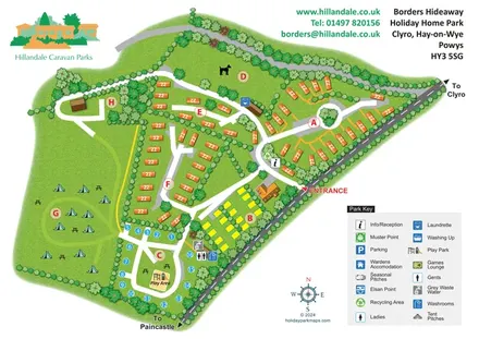
Illustrated Borders Hideaway map with leafy accommodation zones, camping field and a play-area loop.
 Explore the map ↗
United Kingdom
A wooded, streamside park map with a linked farm, café, touring and cottage area.
Features may come from the sample artwork, its key or published park information. Approximate numbers describe the drawing and may cover only part of a park. They are intended to help you compare map examples. Current facilities and booking information should be checked with the park.
LET’S MAP YOUR PARK
For a map quotation, find your park and draw a rough boundary around it. The area you select helps us work out the design time and price.
Draw your park for a quote ↗Or talk to our map designers
01751 473136