
Loch Insh
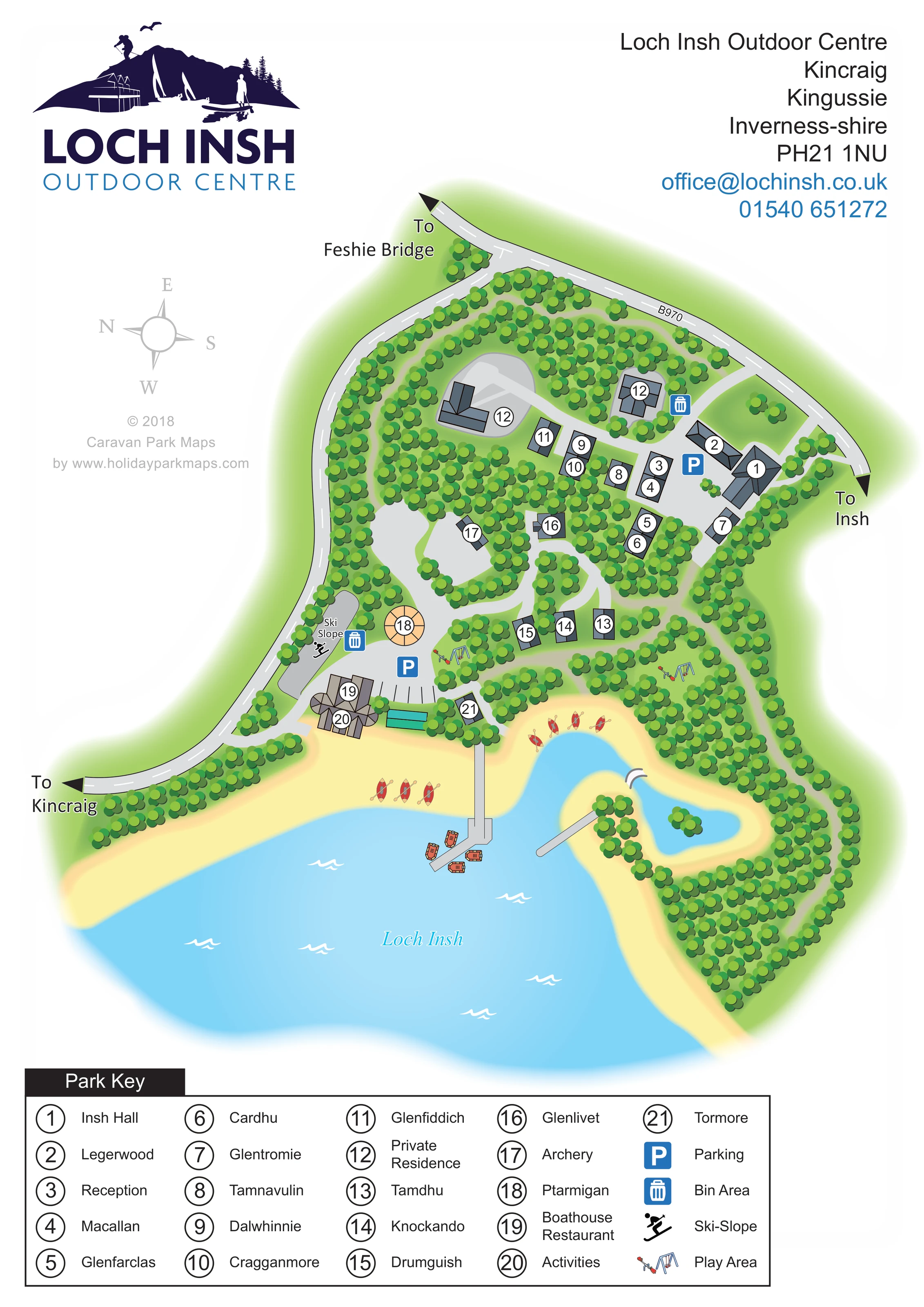
The named loch fills the lower part of the illustration, with a curved shoreline and a small inlet.
ILLUSTRATED PARK MAP · P526
Loch Insh Outdoor Centre, Kincraig, Kingussie, Inverness-shire · United Kingdom
 Enlarge the map ↗
A SENSE OF THE PLACE
Loch Insh Outdoor Centre is located at Kincraig in the foothills of the Cairngorms, near the lower end of Glen Feshie. The lochside centre provides a base for outdoor activities and stays in the area.
Its beach team handles activity enquiries and bookings. The map helps visitors understand the centre's layout and the relationship between buildings, access routes and the waterside spaces.
LOOK CLOSER
The named loch fills the lower part of the illustration, with a curved shoreline and a small inlet.
A broad pale-yellow shoreline wraps around the waterside facilities and follows a narrow inlet with a small vegetated islet.
Dense groups of stylised trees surround individual buildings, divide clearings and form a wooded peninsula beside the inlet.
Numbered reception location in the upper building cluster, close to Insh Hall, Legerwood and parking.
Named waterside restaurant building beside the lower parking area and activities building.
Numbered activities building at the lochside hub, immediately beside the Boathouse Restaurant.
Named archery location in a woodland clearing inland from the ski slope and waterside hub.
Elongated grey slope beside the western access road, identified by text and a skier pictogram.
Numbered reception location in the upper building cluster, close to Insh Hall, Legerwood and parking.
Named waterside restaurant building beside the lower parking area and activities building.
Numbered activities building at the lochside hub, immediately beside the Boathouse Restaurant.
Named archery location in a woodland clearing inland from the ski slope and waterside hub.
Elongated grey slope beside the western access road, identified by text and a skier pictogram.
Two swing-and-seesaw symbols locate play areas: one beside the lower parking area and another in the woodland closer to the inlet.
Blue parking symbols identify an upper arrival area near reception and a lower area beside Ptarmigan and the waterside facilities; the lower area includes drawn parking bays.
Blue bin symbols mark locations near the upper building cluster and beside the ski slope.
A named circular, segmented-roof structure beside the lower parking area. Its use is not specified in the key.
Two larger building footprints carry the private-residence key reference, distinguishing them from visitor destinations.
The named loch fills the lower part of the illustration, with a curved shoreline and a small inlet.
A broad pale-yellow shoreline wraps around the waterside facilities and follows a narrow inlet with a small vegetated islet.
Dense groups of stylised trees surround individual buildings, divide clearings and form a wooded peninsula beside the inlet.
Red paddle craft are drawn along the shore and small orange boats beside the main jetty. These convey the activity setting rather than an equipment inventory.
A long main jetty projects from the activities area into the loch, with a second angled jetty beside the inlet and a small curved crossing depicted at the inlet's neck.
The B970 borders the upper side of the centre. Directional arrows identify Feshie Bridge, Insh and Kincraig.
Pale-grey routes connect the upper arrival cluster, woodland buildings, lower parking and lochside hub, with branching paths around tree groups.
READING THE MAP
This illustrated map of Loch Insh Outdoor Centre brings together woodland buildings, outdoor activities and a distinctive lochside setting at Kincraig, near Kingussie. Rather than presenting rows of pitches, it shows a compact centre whose named buildings sit among trees, with reception inland and a restaurant and activities hub beside the water.
The shoreline is a major part of the composition. Pale-yellow beach areas curve around blue water, a small inlet and a wooded peninsula, while jetties and illustrated paddle craft establish the connection with watersports. Further inland, the map identifies archery, a ski slope and play areas, alongside parking and bin locations.
A numbered key keeps the plan readable without covering the woodland with building names. Individual roof shapes help visitors recognise destinations, including the circular Ptarmigan structure and the larger waterside buildings. Direction arrows towards Kincraig, Insh and Feshie Bridge connect the centre to its surroundings. The result is a useful sample for outdoor centres and small holiday sites that need accommodation, activity spaces and natural features explained together.
The portrait artwork places Loch Insh Outdoor Centre between a curving road boundary and a broad expanse of loch. The B970 is labelled along the upper edge, with arrows towards Feshie Bridge and Insh; a further road runs down the left side towards Kincraig. A compass indicates the plan's rotated orientation.
The upper arrival cluster contains Insh Hall, Legerwood, reception and several smaller named buildings around a parking area. Pale-grey internal routes branch through dense tree groups, connecting further buildings in woodland clearings. Names such as Macallan, Glenfarclas, Cardhu, Glenlivet and Tormore appear in the numbered key rather than as long labels on the plan. Private residences are also identified, while individual roof outlines provide visual landmarks.
Towards the lower left, the ski slope occupies an elongated grey strip beside the road. The archery location sits in a clearing above it. Nearby, the circular orange Ptarmigan structure overlooks the lower parking area, which leads to the Boathouse Restaurant and activities building. Two play-area illustrations and blue bin symbols add practical reference points without dominating the scene.
The waterfront is drawn with a wide yellow beach, red paddle craft and a long jetty extending into the loch. A second angled jetty, small curved crossing, inlet and vegetated islet give this part of the map a recognisable shape. Dense woodland continues around the peninsula to the right.
Large branding and contact details occupy the top of the page, while a five-column Park Key anchors the bottom. The enlarged key views show details from this same artwork, not separate sections of the centre.
KEEP EXPLORING
Chosen for shared landscapes, accommodation or facilities.
 Explore the map ↗
United Kingdom
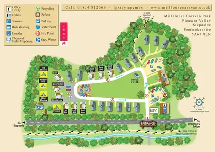
A tree-framed mixed-accommodation park map with a central green, service icons and coastal walking connections.
 Explore the map ↗
United Kingdom
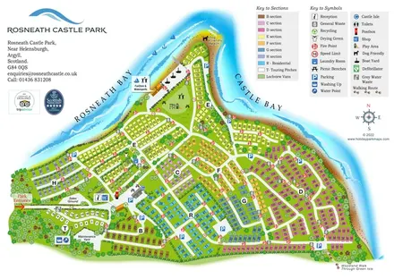
Colour-coded peninsula park map with numbered accommodation, waterfront recreation and shoreline walks.
 Explore the map ↗
United Kingdom
Illustrated coastal campsite plan with named fields, electric pitch colours, beach routes and the Afon Hen.
Features may come from the sample artwork, its key or published park information. Approximate numbers describe the drawing and may cover only part of a park. They are intended to help you compare map examples. Current facilities and booking information should be checked with the park.
TAKE A CLOSER LOOK
View the illustrated map in detail or choose a file to download. These are sample maps; contact the park for current visitor information.


LET’S MAP YOUR PARK
For a map quotation, find your park and draw a rough boundary around it. The area you select helps us work out the design time and price.
Draw your park for a quote ↗Or talk to our map designers
01751 473136