
Extensive woodland
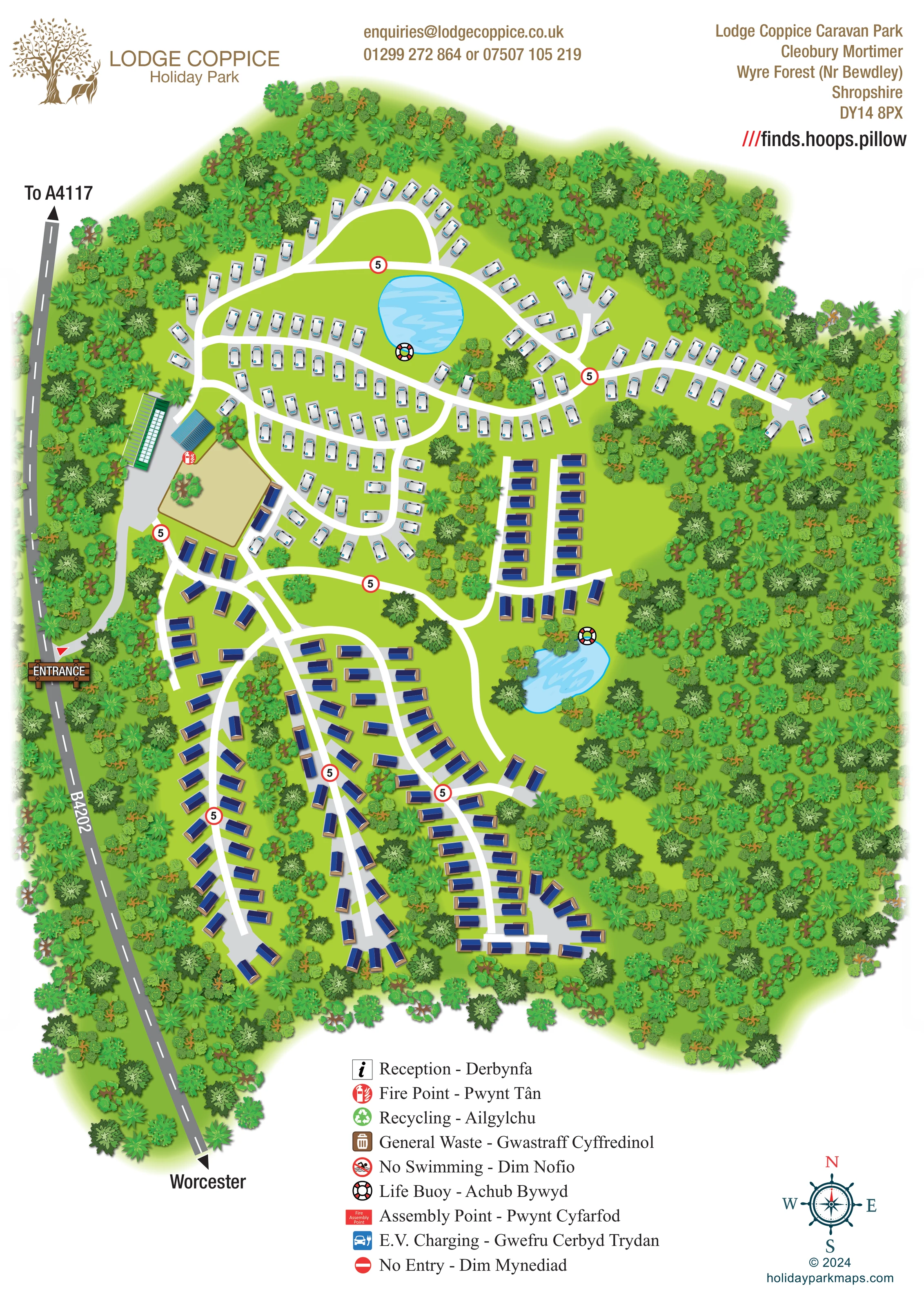
Dense illustrated tree cover encloses the park, fills much of its eastern side and forms planted fingers between accommodation lanes.
ILLUSTRATED PARK MAP · P195
Cleobury Mortimer, Wyre Forest near Bewdley, Shropshire · United Kingdom
 Enlarge the map ↗
A SENSE OF THE PLACE
Lodge Coppice Holiday Park is based at Cleobury Mortimer, Wyre Forest near Bewdley, Shropshire. This is a woodland park near Cleobury Mortimer in the Severn Valley. The park offers holiday-home ownership and seasonal touring.
Fishing pools, woodland walks and children's adventure playground are listed.
LOOK CLOSER
Dense illustrated tree cover encloses the park, fills much of its eastern side and forms planted fingers between accommodation lanes.
A rounded pond lies within the northern touring area; a smaller elongated pond sits beside the central-eastern holiday-home group.
A timber-style ENTRANCE sign marks the western access beside the B4202, with an internal approach leading towards the building cluster.
The western road is labelled B4202, with an arrow towards the A4117 at the top and Worcester at the bottom.
White routes connect the touring loops with southern holiday-home branches, terminal turning areas and the eastern accommodation group.
Red-ringed signs bearing 5 are placed at several internal junctions and along accommodation lanes.
Two contrasting green- and blue-roofed structures stand beside the approach, adjoining a large tan rectangular area. Their functions are not labelled.
A red fire-point symbol is positioned beside the entrance-side blue-roofed building and the tan area.
Dense illustrated tree cover encloses the park, fills much of its eastern side and forms planted fingers between accommodation lanes.
A rounded pond lies within the northern touring area; a smaller elongated pond sits beside the central-eastern holiday-home group.
Fishing pools are listed in the park information. The artwork depicts two ponds but does not label their use.
A timber-style ENTRANCE sign marks the western access beside the B4202, with an internal approach leading towards the building cluster.
The western road is labelled B4202, with an arrow towards the A4117 at the top and Worcester at the bottom.
White routes connect the touring loops with southern holiday-home branches, terminal turning areas and the eastern accommodation group.
Red-ringed signs bearing 5 are placed at several internal junctions and along accommodation lanes.
Two contrasting green- and blue-roofed structures stand beside the approach, adjoining a large tan rectangular area. Their functions are not labelled.
A red fire-point symbol is positioned beside the entrance-side blue-roofed building and the tan area.
Life-buoy symbols are placed beside both ponds.
Reception appears in the English–Welsh key; a corresponding location is not clearly marked on the plan.
Separate recycling and general-waste symbols are included in the key, without clearly identifiable placements on the illustrated plan.
The bilingual key includes a no-swimming symbol; it is not visibly placed beside the ponds.
A red fire assembly-point symbol is defined in the key, but its position is not clearly shown.
An electric-vehicle charging symbol appears in the key without a clearly identifiable mapped location.
The key defines a no-entry symbol, but no corresponding restriction point is clearly marked on the plan.
Woodland walks are listed in the park information; the artwork does not distinguish a dedicated walking-route network.
A children's adventure playground is listed in the park information, but no labelled playground is identifiable on this map.
READING THE MAP
This illustrated map of Lodge Coppice Holiday Park presents a woodland caravan park near Cleobury Mortimer, in the Wyre Forest area near Bewdley, Shropshire. Its portrait format follows the site's elongated shape, with the B4202 running down the western edge and a clearly marked entrance leading into the accommodation areas.
The map makes the two principal accommodation groups easy to distinguish. White touring caravans occupy the northern loops, while blue-roofed static holiday homes follow branching lanes through the central and southern parts of the park. Two bright blue ponds break up the green landscape and provide useful reference points within the plan.
Woodland is central to the artwork rather than a simple border treatment. Layered tree symbols surround the park, separate rows of accommodation and fill the broad eastern side. White internal roads remain visible against the green ground, supported by repeated red-ringed 5 signs. A tree-and-deer logo, English–Welsh symbol key and decorative compass rose complete a design focused on the park's overall layout and wooded character.
The single portrait plan combines an overhead layout with lightly dimensional caravan, roof and tree illustrations. The western boundary is anchored by the grey B4202, complete with a dashed centre line and arrows towards the A4117 and Worcester. A timber-style entrance sign marks the access, where a grey approach curves past two larger structures with green and blue roofs. A tan rectangular area sits alongside them, and a red fire-point symbol is placed nearby.
Across the northern section, white touring caravans stand on individual pale grey pads. Their rows follow interconnected curves, a rounded outer loop and short branches with turning spaces. A roughly circular blue pond sits within this network, with a life-buoy symbol at its edge. The white routes continue south into blue-roofed holiday-home areas, where long branches and terminal turning heads create a different pattern. A smaller, more regular group of holiday homes sits above the second, elongated pond on the eastern side.
Tree cover shapes the whole composition. Dense woodland wraps around the perimeter, expands across the east and forms strips between the southern accommodation lanes. Several foliage shapes and green tones give these wooded areas texture without obscuring the main routes. Red-ringed 5 signs punctuate junctions and lanes; individual homes and pitches are not numbered.
The lower margin contains a large English–Welsh key covering reception, fire points, waste, water safety, assembly, E.V. charging and no entry. Several of these are key entries rather than visibly located features. A nautical-style compass rose balances the key at lower right, while branding, contact and address information occupy the top margin.
KEEP EXPLORING
Chosen for shared landscapes, accommodation or facilities.
 Explore the map ↗
United Kingdom
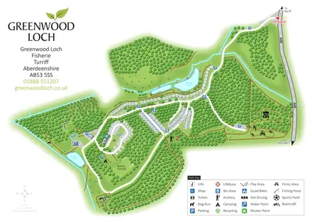
Woodland park map with pond-side holiday homes, touring, camping and outdoor activity areas.
 Explore the map ↗
United Kingdom
A lakeside holiday-park and fishery map with numbered accommodation, fishing positions and clearly grouped visitor services.
 Explore the map ↗
United Kingdom
A woodland estate park map combining caravan loops, touring pitches, riverside paths and Bruce’s Cave landmarks.
Features may come from the sample artwork, its key or published park information. Approximate numbers describe the drawing and may cover only part of a park. They are intended to help you compare map examples. Current facilities and booking information should be checked with the park.
LET’S MAP YOUR PARK
For a map quotation, find your park and draw a rough boundary around it. The area you select helps us work out the design time and price.
Draw your park for a quote ↗Or talk to our map designers
01751 473136