
Bee and beehive illustrations
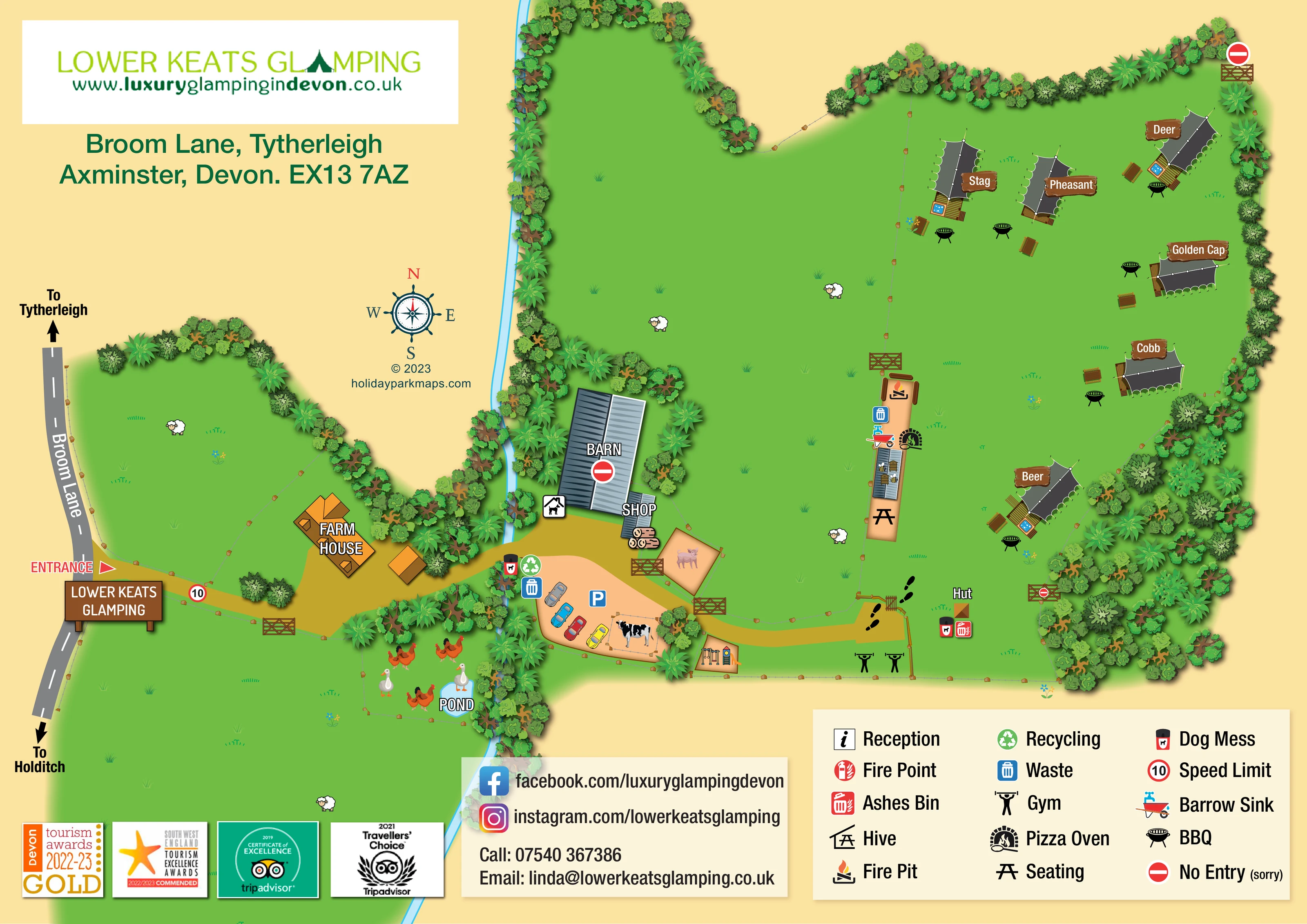
Small bees and beehives are drawn over a grey-roofed feature within the communal amenity strip.
ILLUSTRATED PARK MAP · P197
Broom Lane, Tytherleigh, Axminster, Devon · United Kingdom
 Enlarge the map ↗
A SENSE OF THE PLACE
Lower Keats Glamping offers safari-lodge stays at Tytherleigh near Axminster. Its small-farm setting includes goats, pigs, sheep and poultry, with opportunities for guests to meet the animals.
The lodges have their own bathrooms, kitchens and wood-burning stoves. Families, couples and groups can use the site as a countryside base, with the Jurassic Coast and surrounding East Devon landscape available to explore.
LOOK CLOSER
Small bees and beehives are drawn over a grey-roofed feature within the communal amenity strip.
Sheep occupy open paddocks, pigs and a cow are illustrated in small pens near the arrival area, and poultry appear around the pond.
A small blue pond labelled POND lies in the poultry enclosure south of the farmhouse.
A narrow blue watercourse runs roughly north–south through the middle of the farm, bordered by dense illustrated vegetation.
Dense, varied tree and shrub symbols frame irregular green fields; fine fence lines, posts and timber gates distinguish paddocks and the accommodation area.
A small building labelled SHOP adjoins the barn beside the arrival area; logs are illustrated alongside it.
The farmhouse sits beside the entrance drive, while a large grey-roofed barn stands beyond the stream. A no-entry symbol overlays the barn.
A peach-coloured parking area with cars and a blue P symbol lies near the shop and animal pens.
A small building labelled SHOP adjoins the barn beside the arrival area; logs are illustrated alongside it.
The farmhouse sits beside the entrance drive, while a large grey-roofed barn stands beyond the stream. A no-entry symbol overlays the barn.
A peach-coloured parking area with cars and a blue P symbol lies near the shop and animal pens.
A compact illustrated play area with swings and a slide sits along the southern edge of the internal drive.
Two gym pictograms identify an exercise area beside the southern boundary, close to the pedestrian entrance into the lodge field.
A fire-pit symbol and log-like seating occupy the northern end of a narrow shared amenity strip between the grazing field and lodges.
A distinctive oven pictogram marks the shared amenity strip beside the barrow sink.
A bespoke wheelbarrow-and-tap symbol identifies the sink within the shared amenity strip.
A picnic-table symbol marks seating at the southern end of the communal amenity strip.
Repeated black BBQ pictograms and timber furniture illustrations accompany the safari lodges.
Several lodge decks contain blue, bubble-marked inset tubs, visually presented as hot tubs rather than separately keyed facilities.
Grouped waste and recycling symbols appear beside parking; another waste point serves the shared amenity strip. Dog-waste symbols appear near parking and the hut, with an ashes-bin symbol beside the hut.
A small structure labelled Hut stands inside the southern part of the lodge field; its use is not specified.
Small bees and beehives are drawn over a grey-roofed feature within the communal amenity strip.
Sheep occupy open paddocks, pigs and a cow are illustrated in small pens near the arrival area, and poultry appear around the pond.
A small blue pond labelled POND lies in the poultry enclosure south of the farmhouse.
A narrow blue watercourse runs roughly north–south through the middle of the farm, bordered by dense illustrated vegetation.
Dense, varied tree and shrub symbols frame irregular green fields; fine fence lines, posts and timber gates distinguish paddocks and the accommodation area.
A red entrance arrow leads from Broom Lane onto an ochre drive past the farmhouse and towards parking and the southern lodge-field gate.
Black arrows at opposite ends of Broom Lane indicate Tytherleigh and Holditch.
Large black footprints emphasise the gated transition from the internal drive into the lodge field.
Red no-entry symbols mark the barn and selected boundary gates.
A circular 10 marker appears on the entrance drive and is explained as Speed Limit in the legend.
Reception is listed in the key, but a matching reception marker is not clearly identifiable on the plan.
The legend includes a fire-point symbol; its position is not clearly established on the illustrated plan.
An entry labelled Hive uses a roofed-table-like symbol. This should not be automatically equated with the separate bee and beehive illustrations.
READING THE MAP
This illustrated map of Lower Keats Glamping presents a small safari-lodge retreat within a farm setting at Tytherleigh, near Axminster in Devon. Rather than organising accommodation into numbered rows, it gives each lodge a rustic name plaque and places the tents within an open, tree-framed field. Timber decks, outdoor furniture, BBQ symbols and blue deck tubs add useful detail without overwhelming the spacious layout.
The farm is an important part of the illustration. Sheep paddocks, animal pens, a poultry pond and a tree-lined watercourse sit alongside the farmhouse, barn and shop. Arrival is explained through the Broom Lane entrance, a clearly coloured internal drive, parking and a footprint-marked gateway into the lodge field.
A narrow shared amenity area brings together the fire pit, pizza oven, barrow sink and seating, while play equipment and outdoor gym symbols appear near the southern boundary. The warm yellow background, bright green fields and layered foliage establish a countryside character. A large symbol key, compass, park branding and contact panel complete a map that combines guest orientation with a recognisable picture of the farm.
The single landscape-format artwork combines a whole-site illustration with branding and visitor information. Broom Lane runs down the left-hand side, with arrows towards Tytherleigh and Holditch. A red entrance arrow turns into an ochre drive, which passes the orange-roofed farmhouse before reaching a peach-coloured parking area near the barn and shop. The blue watercourse and its dense tree corridor form a strong visual division through the farm.
Beyond the arrival area, fenced paddocks contain sheep and smaller animal pens. Poultry surround the labelled pond south of the farmhouse. Gates and fine post-and-wire boundaries distinguish these spaces from the guest accommodation field, while a small play area and two gym symbols sit along the southern edge. Large footprints highlight the pedestrian gateway into the glamping area.
The safari lodges are spread around the upper and right-hand edges of the field. Stag, Pheasant, Deer, Golden Cap, Cobb and Beer each have a brown timber-style name plaque. Charcoal canvas roofs, white ridge details and striped timber decks make the accommodation readily recognisable. BBQ pictograms and outdoor furniture accompany the lodges; several decks also show blue inset tubs.
A narrow peach strip beside the central paddock groups the communal fire pit, barrow sink, pizza oven and picnic seating. Bee and beehive illustrations add another distinctive detail. A small hut and nearby disposal symbols occupy the southern part of the lodge field.
The lower-right legend explains facilities and operational markers in three columns. Park branding and the address fill the upper-left space, while award badges and a contact panel sit along the bottom. The additional detail views enlarge overlapping portions of this same composition; they are not separate map variants or additional accommodation areas.
KEEP EXPLORING
Chosen for shared landscapes, accommodation or facilities.
 Explore the map ↗
United Kingdom
A woodland estate park map combining caravan loops, touring pitches, riverside paths and Bruce’s Cave landmarks.
 Explore the map ↗
United Kingdom
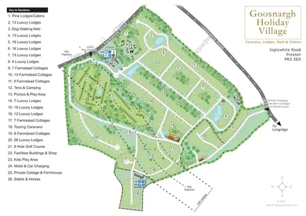
Numbered lodge and cottage areas, golf, ponds and shared facilities on a landscaped Goosnargh site plan.
 Explore the map ↗
United Kingdom
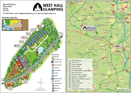
Animal-named glamping lodges, private hot tubs and a Durham-area locator on one illustrated page.
Features may come from the sample artwork, its key or published park information. Approximate numbers describe the drawing and may cover only part of a park. They are intended to help you compare map examples. Current facilities and booking information should be checked with the park.
LET’S MAP YOUR PARK
For a map quotation, find your park and draw a rough boundary around it. The area you select helps us work out the design time and price.
Draw your park for a quote ↗Or talk to our map designers
01751 473136