
Pond
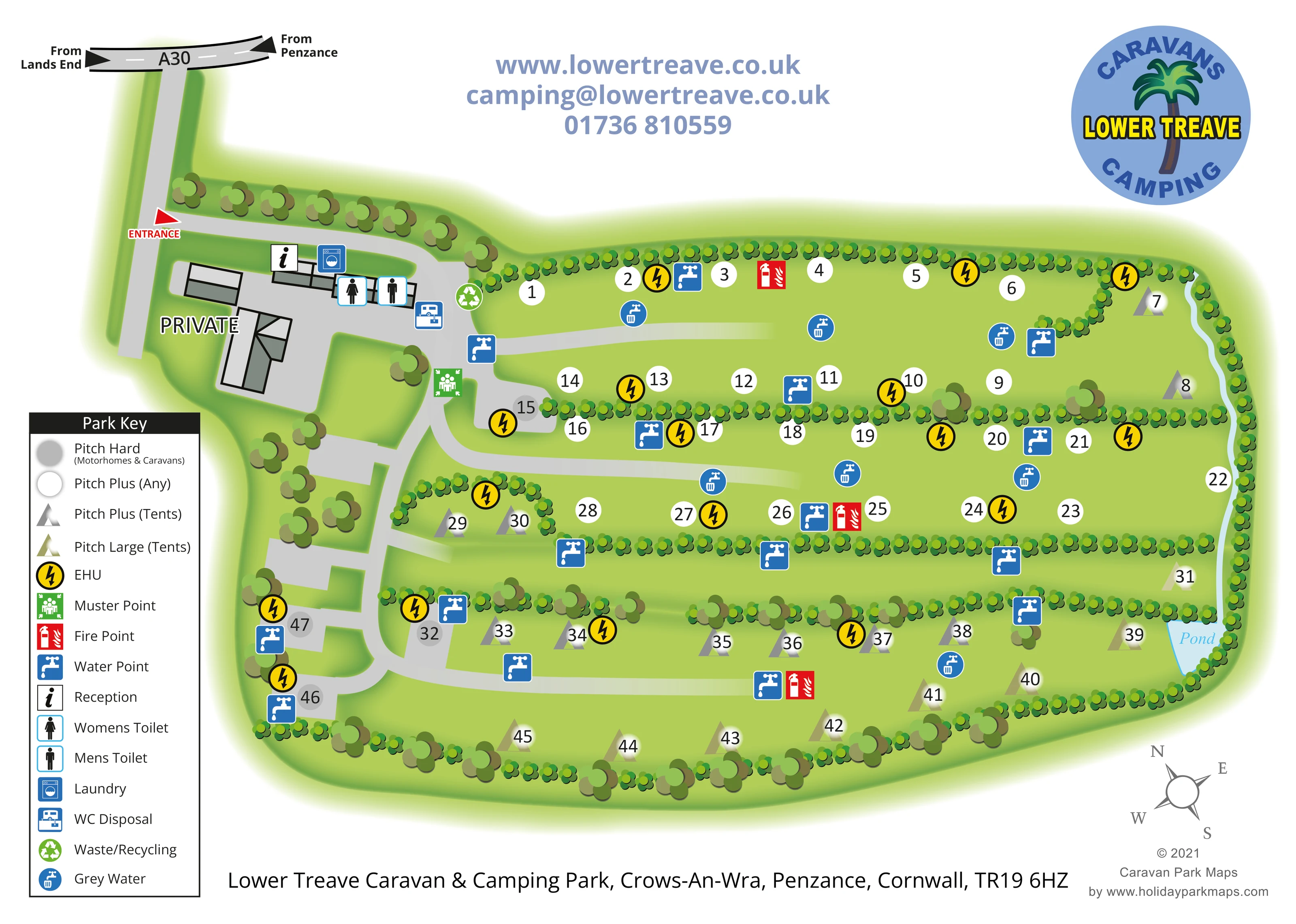
A small blue pond is labelled at the lower-right edge of the campsite, beside the tent-pitch area.
ILLUSTRATED PARK MAP · P531
Crows-An-Wra, Penzance, Cornwall · United Kingdom
 Enlarge the map ↗
A SENSE OF THE PLACE
This map records Lower Treave Caravan and Camping Park near Penzance in west Cornwall. The site's location beside the A30 placed it between Penzance and Land's End.
The artwork is retained as a historical campsite map example. Its layout remains useful for showing how pitches, facilities and access routes can be presented together, although the site is listed as permanently closed to camping.
LOOK CLOSER
A small blue pond is labelled at the lower-right edge of the campsite, beside the tent-pitch area.
Continuous rows of stylised shrubs divide the camping strips and enclose the site, with larger trees around the western buildings and lower boundary.
An information symbol identifies reception in the entrance-side building cluster.
Separate women's and men's toilet symbols appear together on the main service buildings near the entrance.
A blue washing-machine symbol marks the laundry within the entrance-side facilities cluster.
Yellow lightning-bolt circles mark EHU locations throughout the pitch areas.
Blue square tap symbols are distributed along pitch rows and near the western service area.
Blue circular tap-and-container symbols identify several grey-water points across the camping areas.
An information symbol identifies reception in the entrance-side building cluster.
Separate women's and men's toilet symbols appear together on the main service buildings near the entrance.
A blue washing-machine symbol marks the laundry within the entrance-side facilities cluster.
Yellow lightning-bolt circles mark EHU locations throughout the pitch areas.
Blue square tap symbols are distributed along pitch rows and near the western service area.
Blue circular tap-and-container symbols identify several grey-water points across the camping areas.
A dedicated disposal symbol appears beside the entrance-side service buildings.
A green recycling symbol marks the waste/recycling location at the edge of the arrival and service area.
Red fire-point symbols are placed in the upper, middle and lower pitch areas.
A green assembly symbol marks a muster point beside the western internal access route.
A small blue pond is labelled at the lower-right edge of the campsite, beside the tent-pitch area.
Continuous rows of stylised shrubs divide the camping strips and enclose the site, with larger trees around the western buildings and lower boundary.
The approach joins a short A30 road diagram labelled from Land's End and from Penzance. A red arrow identifies the park entrance.
A grey western access spine branches into broad lanes serving the hedged pitch strips.
Buildings and hard surfaces west of the main facilities are labelled PRIVATE, distinguishing them from visitor facilities.
READING THE MAP
This historical map of Lower Treave Caravan & Camping Park presents a compact touring and camping site at Crows-An-Wra, near Penzance in west Cornwall. Its approach diagram connects the entrance to the A30, with directions from Penzance and Land's End, before the plan opens into a series of green, hedge-divided pitch areas.
The map shows roughly 45–50 pitches using a straightforward combination of numbered circles and triangular tent symbols. The key distinguishes hardstanding pitches for caravans and motorhomes, any-use pitches and two tent-pitch categories. Reception, toilets and laundry sit together near the entrance, while water, electricity and disposal symbols carry practical information into the camping fields themselves.
A small pond, repeated hedgerows and rounded tree graphics give the plan its particular landscape character without obscuring the routes or pitch numbers. The large left-hand key, clear entrance arrow and prominent park branding make this a useful gallery example of a compact campsite map where pitch choice and everyday service locations need to be understood together. It is presented as an archive design example rather than a current visitor guide.
The plan is arranged around a western arrival area and an elongated campsite extending to the right. At the top left, a short section of the A30 carries directional labels from Land's End and Penzance. A grey approach leads down to the red entrance arrow, then turns towards a cluster of outlined buildings. Reception, laundry, women's and men's toilets, WC disposal and waste/recycling are identified here, while adjacent buildings are marked PRIVATE.
Beyond this cluster, the internal route branches into several broad lanes. Rows of small green shrubs divide the grass into long camping strips, making the organisation of the pitches visible before the visitor reads individual numbers. White circular markers represent Pitch Plus (Any), grey markers identify hardstanding pitches for motorhomes and caravans, and triangular markers distinguish the two tent categories. The lower field contains most of the larger tent pitches, with a small labelled pond tucked against its right-hand boundary.
The service symbols are deliberately conspicuous. Yellow lightning circles identify electric hook-up locations; blue squares mark water points; and blue circular symbols identify grey-water disposal. Red fire-point markers appear across the camping areas, and a green muster-point symbol sits beside the western access spine.
The single landscape-format artwork places a comprehensive Park Key at the lower left, contact details above the plan and the circular Lower Treave logo at the upper right. An address line, compass and designer credit complete the page. The accompanying enlargement shows the same key and part of the western pitch area in greater detail; it is not a separate section map or an additional accommodation area.
KEEP EXPLORING
Chosen for shared landscapes, accommodation or facilities.
 Explore the map ↗
United Kingdom
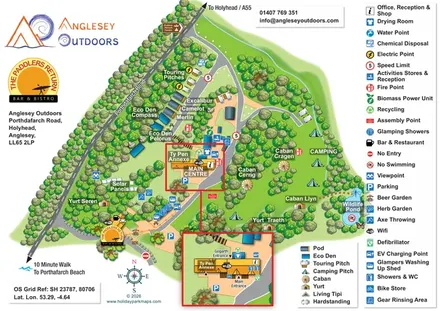
Illustrated camping and glamping map with an activity-centre inset and wildlife pond.
 Explore the map ↗
United Kingdom
Colour-coded accommodation, central leisure facilities and coastal paths on an illustrated headland park map.
 Explore the map ↗
United Kingdom
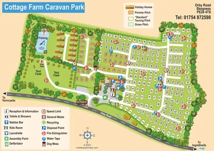
Illustrated touring and camping park map with numbered pitches, a fishing pond and a central farm courtyard.
Features may come from the sample artwork, its key or published park information. Approximate numbers describe the drawing and may cover only part of a park. They are intended to help you compare map examples. Current facilities and booking information should be checked with the park.
TAKE A CLOSER LOOK
View the illustrated map in detail or choose a file to download. These are sample maps; contact the park for current visitor information.


LET’S MAP YOUR PARK
For a map quotation, find your park and draw a rough boundary around it. The area you select helps us work out the design time and price.
Draw your park for a quote ↗Or talk to our map designers
01751 473136