
Planted wildlife area
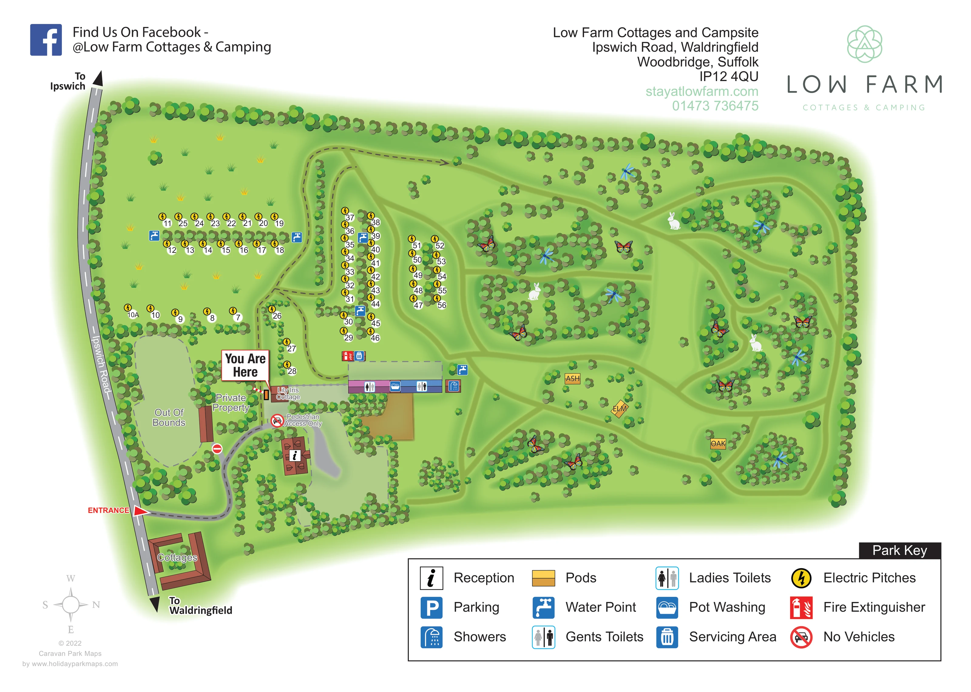
The right half contains irregular planted islands and pale green route-like clearings, illustrated with butterflies, dragonflies and rabbits.
ILLUSTRATED PARK MAP · P530
Low Farm Cottages and Campsite, Ipswich Road, Waldringfield, Woodbridge, Suffolk · United Kingdom
 Enlarge the map ↗
A SENSE OF THE PLACE
Low Farm Cottages and Campsite is located at Waldringfield near the River Deben in Suffolk. Self-catering properties, camping pitches and simple pods offer different ways to enjoy the rural setting.
Walking routes, cycle routes and bridleways can be accessed from the site. The pods sit in a wildlife area and provide basic shelter rather than fully serviced accommodation, complementing the farm's quieter camping spaces.
LOOK CLOSER
The right half contains irregular planted islands and pale green route-like clearings, illustrated with butterflies, dragonflies and rabbits.
Continuous perimeter planting encloses the site, while smaller tree belts separate pitch rows and frame internal lanes.
An information symbol marks reception in the red-roofed building just inside the entrance.
Symbols identify toilets and showers along the elongated central amenities building.
A blue washing-up symbol is positioned on the central amenities building.
Repeated blue tap symbols serve the pitch rows and the area beside the amenities building.
The servicing-area symbol appears beside the fire-extinguisher marker immediately above the amenities building.
A red extinguisher symbol marks a point near the central facilities.
An information symbol marks reception in the red-roofed building just inside the entrance.
Symbols identify toilets and showers along the elongated central amenities building.
A blue washing-up symbol is positioned on the central amenities building.
Repeated blue tap symbols serve the pitch rows and the area beside the amenities building.
The servicing-area symbol appears beside the fire-extinguisher marker immediately above the amenities building.
A red extinguisher symbol marks a point near the central facilities.
Yellow circular lightning symbols accompany the numbered campsite pitches.
Parking is included in the key, but a corresponding P marker is not clearly identifiable on the plan.
Ipswich Road runs down the left edge. A red entrance arrow leads into the site, with road directions towards Ipswich and Waldringfield.
A curving entrance lane reaches reception and branches towards the campsite through a narrow, tree-lined circulation spine.
A labelled pedestrian-only point and no-vehicles symbol appear beside Lily Iris Cottage and the reception approach.
A prominent red-bordered callout points to a location beside Lily Iris Cottage.
Separate labels distinguish private property and an outlined out-of-bounds area beside the road.
The right half contains irregular planted islands and pale green route-like clearings, illustrated with butterflies, dragonflies and rabbits.
Continuous perimeter planting encloses the site, while smaller tree belts separate pitch rows and frame internal lanes.
Each of the three ochre pod symbols has its own tree-name label within the planted right-hand area.
Park information describes access to walking routes, cycle routes and bridleways. These wider routes are not mapped as named external trails in this artwork.
READING THE MAP
This illustrated map of Low Farm Cottages and Campsite brings together a numbered camping area, cottage buildings and three named pods within a leafy Suffolk setting. Located on Ipswich Road at Waldringfield, near Woodbridge and the River Deben, the site is presented as two distinct environments: compact, planted pitch rows on the left and a more informal wildlife landscape on the right.
The map makes the arrival sequence easy to follow, from the roadside entrance to reception and the central amenities building. Electric-pitch symbols, water points and clearly keyed washing and toilet facilities support everyday orientation, while a prominent You Are Here marker provides a local reference beside Lily Iris Cottage.
Ash, Elm and Oak are picked out as individual pods among winding green corridors and clusters of trees. Butterflies, dragonflies and rabbits add character to this part of the drawing without replacing the practical information. The result is a useful sample for rural campsites and mixed-accommodation properties that need to show both their facilities and the landscape that gives different parts of the site their identity.
Ipswich Road forms the left edge of the plan, with arrows towards Ipswich and Waldringfield. A red entrance marker directs attention to the curved internal lane, which reaches a terracotta-roofed reception building before branching towards the campsite. A courtyard-like cottage group sits beside the road below the entrance; Lily Iris Cottage is labelled nearer the amenities and the large You Are Here pointer. Private property, an out-of-bounds area and a pedestrian-only connection are distinguished with local labels and restriction symbols.
The camping area occupies the upper-left and central portions of the drawing. Roughly 50 numbered pitches appear in short rows, with tree belts separating adjacent lines and framing the access route. Yellow lightning circles identify electric pitches, and repeated blue tap symbols mark water points. Immediately below the main pitch groups, a long amenities building carries symbols for ladies' and gents' toilets, showers and pot washing. Fire-extinguisher and servicing-area markers sit nearby.
The right-hand landscape is deliberately less regular. Pale green corridors weave around irregular islands of trees and shrubs, with the three ochre pod symbols labelled Ash, Elm and Oak. Enlarged butterflies, dragonflies and rabbits give this planted area a recognisable wildlife theme. Perimeter trees visually enclose both halves of the site.
A large Park Key explains the service and accommodation symbols along the lower-right margin, including a parking symbol whose position is not clearly marked in the plan. Above the drawing, the Low Farm branding and contact block balance a Facebook prompt. The lower-left compass establishes the unusual orientation, with north pointing right. The detail views enlarge the same lower-margin artwork rather than introducing another map or accommodation area.
KEEP EXPLORING
Chosen for shared landscapes, accommodation or facilities.
 Explore the map ↗
United Kingdom
Woodland-framed Barnsoul map with mixed accommodation, shared facilities and paw-marked walking routes.
 Explore the map ↗
United Kingdom
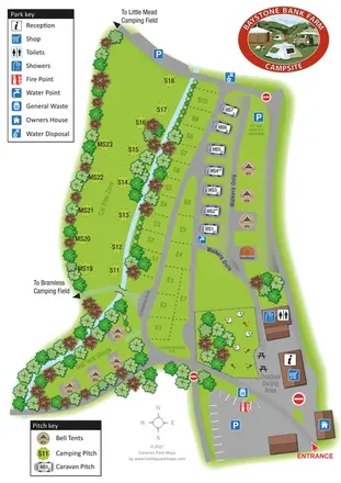
A stream-side farm campsite plan with car-free camping, caravan pitches and separate bell-tent areas.
 Explore the map ↗
United Kingdom
Woodland park map with mixed pitches, bell tents, lodges and a fishing lake.
Features may come from the sample artwork, its key or published park information. Approximate numbers describe the drawing and may cover only part of a park. They are intended to help you compare map examples. Current facilities and booking information should be checked with the park.
TAKE A CLOSER LOOK
View the illustrated map in detail or choose a file to download. These are sample maps; contact the park for current visitor information.


LET’S MAP YOUR PARK
For a map quotation, find your park and draw a rough boundary around it. The area you select helps us work out the design time and price.
Draw your park for a quote ↗Or talk to our map designers
01751 473136