
Loch Lomond
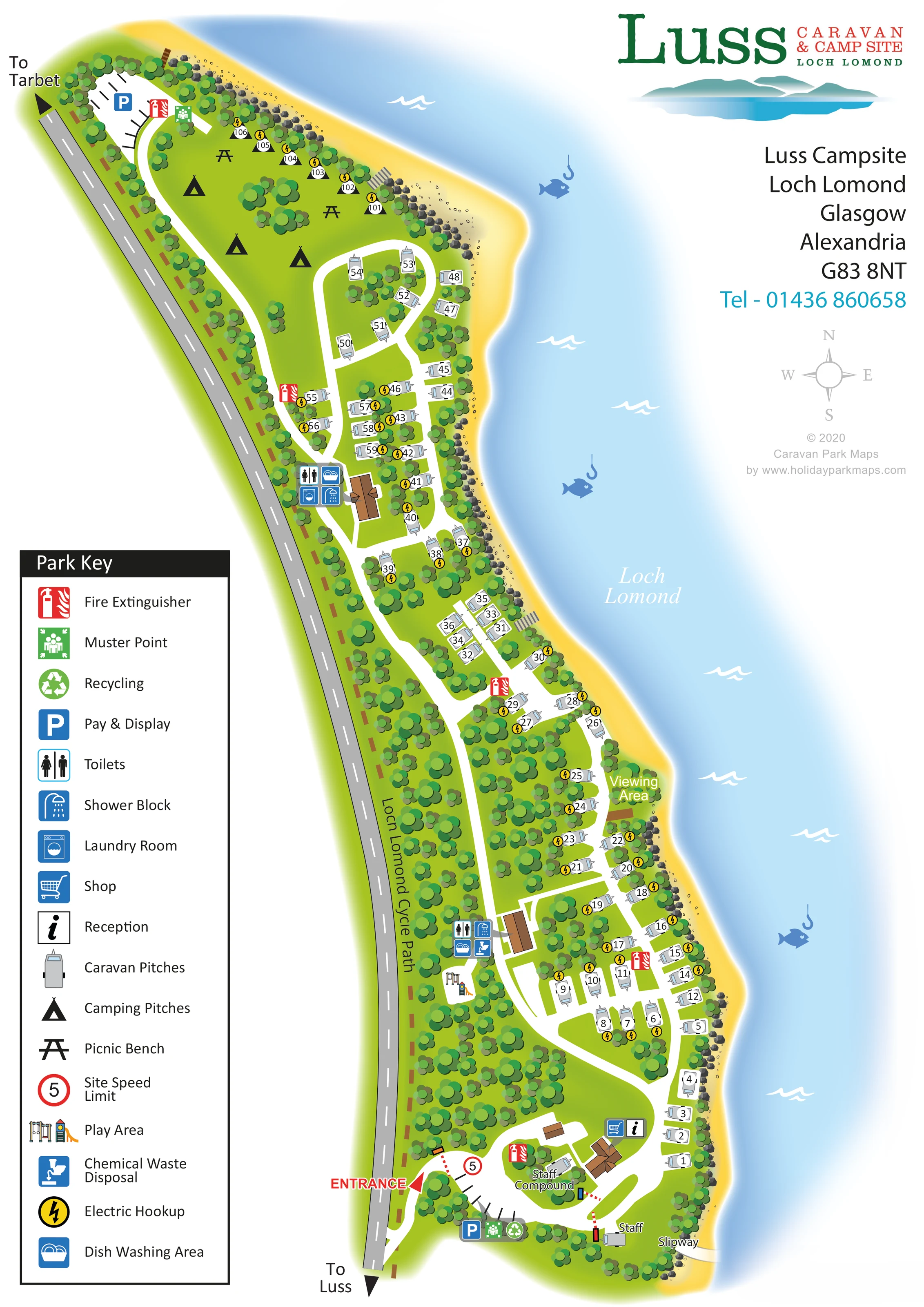
The loch fills the right side of the composition and defines the campsite's eastern boundary.
ILLUSTRATED PARK MAP · P532
Luss Campsite, Loch Lomond, Glasgow, Alexandria · United Kingdom
 Enlarge the map ↗
A SENSE OF THE PLACE
Luss Caravan and Campsite offers touring and camping near Loch Lomond. The village has a long association with camping and travel into the Highlands.
Pitch options include different sizes of hardstanding and electric or non-electric camping spaces. Some pitches have restrictions on larger vehicles and awnings, so the map is useful for understanding the layout alongside the park's booking information.
LOOK CLOSER
The loch fills the right side of the composition and defines the campsite's eastern boundary.
A continuous golden shore edged with scattered stones and boulders follows the touring and camping areas.
Dense stylised tree groups separate pitch pockets and form a substantial belt beside the roadside boundary.
Information symbol beside the southern entrance-area building.
Shopping-trolley symbol paired with reception near the main entrance.
Two amenity clusters along the internal route carry toilet and shower symbols.
Washing-machine symbol at the more northerly amenity building.
Dish-washing symbols appear at both amenity clusters.
Information symbol beside the southern entrance-area building.
Shopping-trolley symbol paired with reception near the main entrance.
Two amenity clusters along the internal route carry toilet and shower symbols.
Washing-machine symbol at the more northerly amenity building.
Dish-washing symbols appear at both amenity clusters.
Disposal symbol at the southern of the two amenity clusters.
Yellow lightning symbols identify electrical provision beside many touring pitches and the northern shore-side camping positions.
Small illustrated play equipment beside the southern amenity cluster, within the wooded interior.
Black bench symbols in the northern camping area.
Blue parking symbols identify parking areas near the entrance and at the northern end.
Green recycling symbol beside the southern parking area.
Red extinguisher symbols are distributed along the site; green muster-point symbols appear at the northern and southern parking areas.
A staff compound is labelled within the entrance loop, with a separate staff-labelled position near the southern shore.
The loch fills the right side of the composition and defines the campsite's eastern boundary.
A continuous golden shore edged with scattered stones and boulders follows the touring and camping areas.
Dense stylised tree groups separate pitch pockets and form a substantial belt beside the roadside boundary.
A labelled viewing area occupies a small projecting section of the middle shoreline.
A labelled slipway meets the loch at the southern end, close to the staff area.
The cycle path is labelled along the western roadside edge, outside the main accommodation lanes.
A red entrance arrow marks the southern access; black directional arrows on the external road point towards Luss and Tarbet.
White lanes branch and loop through the pitches. Short grey stepped-looking connections are drawn towards the shore in two places.
A red-ringed 5 sign appears at the entrance and is explained in the key as the site speed limit.
READING THE MAP
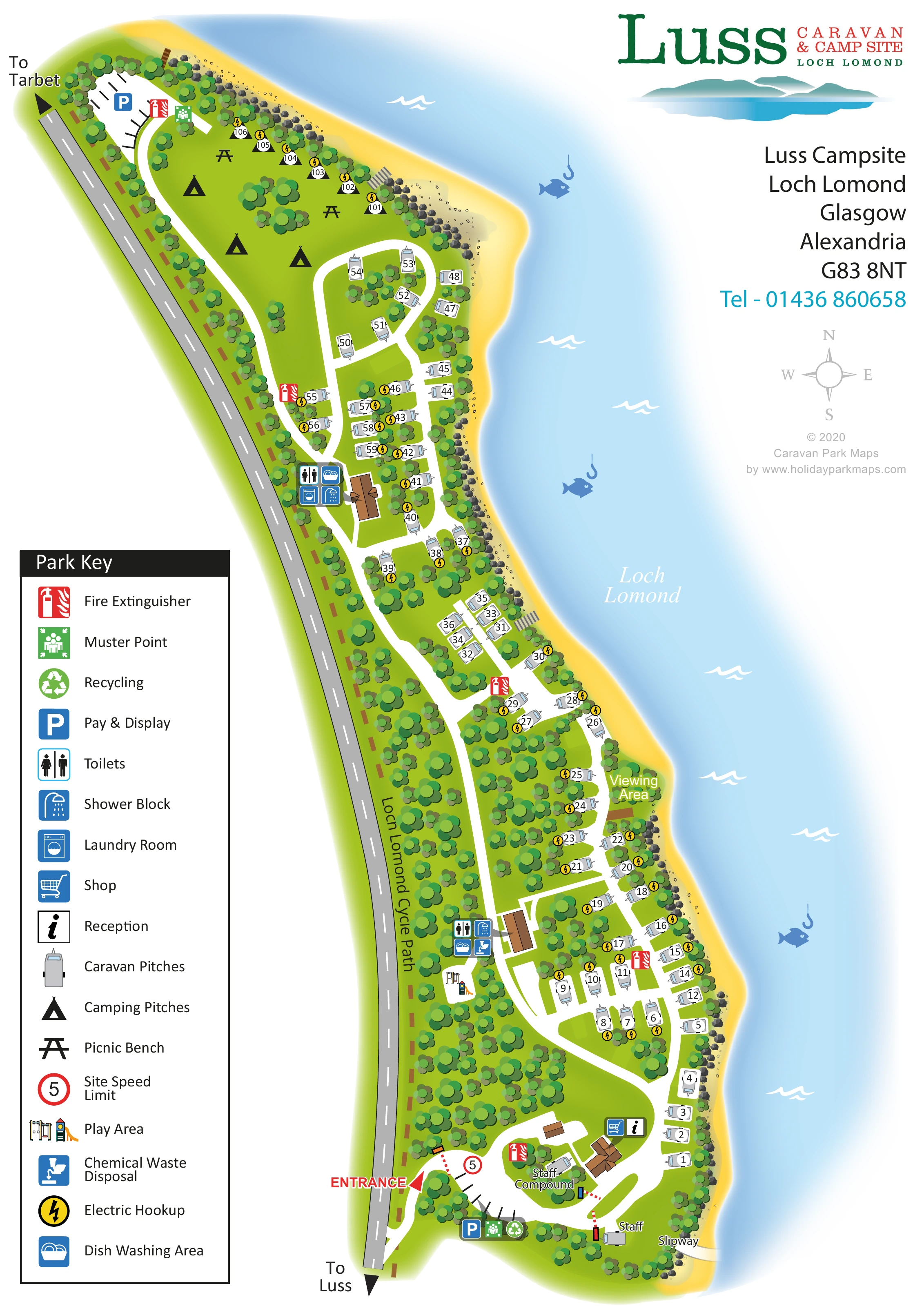
This illustrated map of Luss Campsite follows a narrow strip of ground between the roadside and Loch Lomond. The loch is central to the composition: pale blue water, a golden shoreline and scattered rocks run beside the touring pitches, while groups of rounded green trees give the plan its wooded character. The result is a map shaped around the campsite's setting rather than a rectangular grid of plots.
Numbered caravan pitches occupy most of the site, linked by white lanes that branch into small loops and shore-side rows. At the northern end, tent symbols and picnic benches distinguish the camping area. The southern entrance brings together parking, reception and the shop, with two amenity clusters positioned further along the internal route.
A large Park Key explains the accommodation, facilities and safety symbols. The labelled viewing area, slipway and Loch Lomond Cycle Path add useful destinations beyond the pitches themselves. With prominent Luss branding and a spacious portrait layout, this sample shows how an illustrated campsite map can combine practical orientation with a clear sense of place.
The plan presents the campsite as a long, curving ribbon, with the external road on the left and Loch Lomond on the right. A red entrance arrow marks access near the southern end. Here, a compact loop connects parking, reception, the shop and the labelled staff compound before the main internal lane continues north through the accommodation areas. Directional arrows on the road point towards Luss and Tarbet, and the Loch Lomond Cycle Path is labelled along the western boundary.
Touring caravans appear as individually rotated grey symbols with white number labels. Their arrangement varies from short shore-side rows to small groups around branching lanes, with dense tree clusters separating the spaces. Yellow lightning markers identify electric hookups at many pitches. The northern camping area is drawn as a more open green lawn with black tent silhouettes, picnic benches and a line of numbered electric positions near the shore.
Two brown-roofed amenity buildings are accompanied by grouped symbols for toilets, showers and dish washing. Laundry is marked at the northern cluster and chemical waste disposal at the southern one. A small play area sits nearby. Parking, recycling, fire extinguishers and muster points are also located through the plan, using the same symbols as the large left-hand key.
Along the water's edge, a labelled viewing area and southern slipway provide distinctive landmarks. Golden beach colouring, scattered boulders, pale blue water gradients and white wave marks establish the lochside setting. The single portrait design balances this detailed site plan with branding, contact information and a compass rose in the open upper-right space. Decorative fish-and-hook motifs enliven the water without functioning as mapped facility symbols.
KEEP EXPLORING
Chosen for shared landscapes, accommodation or facilities.
 Explore the map ↗
United Kingdom
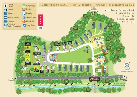
A tree-framed mixed-accommodation park map with a central green, service icons and coastal walking connections.
 Explore the map ↗
United Kingdom
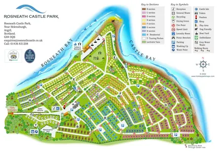
Colour-coded peninsula park map with numbered accommodation, waterfront recreation and shoreline walks.
 Explore the map ↗
United Kingdom
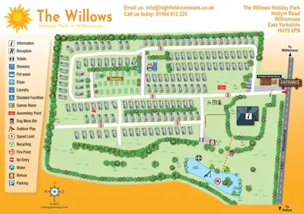
An overhead caravan and touring park map with sun branding, a pictogram key and an illustrated fishing lake.
Features may come from the sample artwork, its key or published park information. Approximate numbers describe the drawing and may cover only part of a park. They are intended to help you compare map examples. Current facilities and booking information should be checked with the park.
TAKE A CLOSER LOOK
View the illustrated map in detail or choose a file to download. These are sample maps; contact the park for current visitor information.


LET’S MAP YOUR PARK
For a map quotation, find your park and draw a rough boundary around it. The area you select helps us work out the design time and price.
Draw your park for a quote ↗Or talk to our map designers
01751 473136
 lusscamping_large.png