
Tree-lined perimeter and planted divisions
Dense illustrated tree belts surround much of the park, separate The Orchard from the central area and frame the road frontage.
ILLUSTRATED PARK MAP · P206
Amotherby Lane, Amotherby, Malton · United Kingdom
 Enlarge the map ↗
A SENSE OF THE PLACE
Malton Grange Country Park is based at Amotherby Lane, Amotherby, Malton. The lodge park is near Malton, between the North York Moors and Yorkshire Wolds. The park offers lodge ownership and self-catering short breaks.
Wi-Fi, dog-walking areas, walking routes and cycling routes are promoted.
LOOK CLOSER
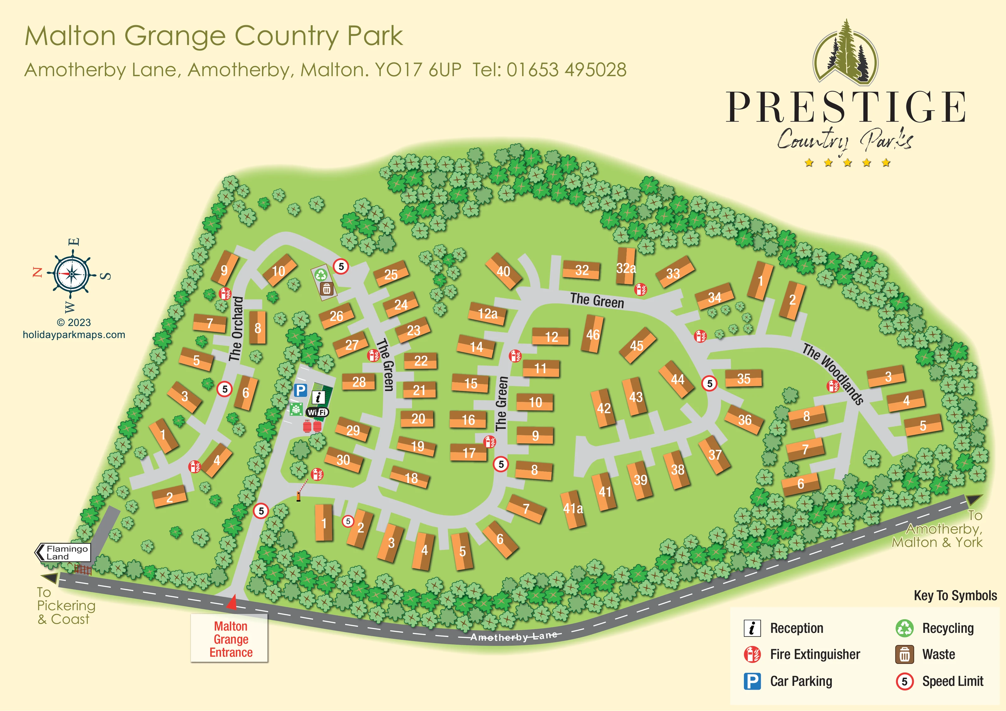
Dense illustrated tree belts surround much of the park, separate The Orchard from the central area and frame the road frontage.
Light-green ground, scattered trees and broad spaces within the road loops give the lodge layout an open, landscaped character.
An information symbol marks reception beside the entrance approach, near the boundary between The Orchard and The Green.
A blue parking symbol and white bay markings identify parking beside reception.
A Wi-Fi badge appears within the reception and parking cluster; it is not included in the six-item key.
A green recycling symbol marks a point towards the upper end of The Orchard, beside a waste symbol.
A brown waste-bin symbol is paired with the recycling point near the junction between The Orchard and The Green.
Repeated red fire-extinguisher symbols are distributed along the internal roads in all three accommodation areas.
An information symbol marks reception beside the entrance approach, near the boundary between The Orchard and The Green.
A blue parking symbol and white bay markings identify parking beside reception.
A Wi-Fi badge appears within the reception and parking cluster; it is not included in the six-item key.
A green recycling symbol marks a point towards the upper end of The Orchard, beside a waste symbol.
A brown waste-bin symbol is paired with the recycling point near the junction between The Orchard and The Green.
Repeated red fire-extinguisher symbols are distributed along the internal roads in all three accommodation areas.
A small green pictogram with people and inward arrows appears beside reception and parking. It is not explained in the printed key.
Red-ringed signs displaying 5 recur along the entrance approach and internal roads, matching the key's speed-limit symbol.
A red arrow and boxed entrance label identify the access from Amotherby Lane. A small barrier is illustrated further along the approach.
The adjoining road follows the lower edge of the artwork, drawn in dark grey with dashed white centre markings.
Road-end arrows point towards Pickering and the coast, and towards Amotherby, Malton and York. A separate roadside sign points towards Flamingo Land.
Pale-grey curving roads form loops and branching sections, with short spurs serving individual lodges.
Dense illustrated tree belts surround much of the park, separate The Orchard from the central area and frame the road frontage.
Light-green ground, scattered trees and broad spaces within the road loops give the lodge layout an open, landscaped character.
READING THE MAP
This illustrated map of Malton Grange Country Park presents a lodge park at Amotherby, near Malton, through a clear overhead layout. Orange lodge roofs stand out against green lawns and dense belts of trees, while pale-grey roads connect three named areas: The Orchard, The Green and The Woodlands. The result is a site plan that explains both the park's landscaped character and the practical route to an individual lodge.
Amotherby Lane runs across the lower edge of the artwork, with a prominent red entrance marker leading visitors towards reception and parking. Directional labels place the arrival in context, pointing towards Pickering and the coast in one direction, and Amotherby, Malton and York in the other. Within the park, numbered units, road-following area names and repeated service symbols support everyday navigation.
A warm cream background, olive headings and the large Prestige Country Parks logo give the page a coordinated identity. This sample is particularly relevant to lodge parks that need to combine plot-level wayfinding, a recognisable arrival point and an attractive representation of a wooded rural setting.
The plan is arranged around an elongated site beside Amotherby Lane. The Orchard forms a narrow strip on the left, separated from the larger central lodge area by a strong band of trees. The Green occupies much of the middle, with lodges set around curved roads, short access spurs and open grassed spaces. The Woodlands follows the right-hand curve of the park, where another group of lodges sits inside the tree-lined boundary. Roughly 70 lodge units are illustrated overall, using orange roof shapes, brown shading and large white numbers.
The main entrance is picked out by a red arrow from the public road and a boxed label below it. The approach leads towards a small illustrated barrier and the reception cluster, where an information symbol, blue parking marker, bay markings and Wi-Fi badge are grouped together. A small green assembly-point-style pictogram is also visible here. Recycling and waste symbols appear together towards the upper part of The Orchard. Red fire-extinguisher markers and red-ringed speed signs recur beside the internal roads.
Tree canopies are a major part of the composition: several shades of green distinguish the perimeter belts, internal screens and scattered planting between lodges. The grey public road has dashed white markings, making it visually distinct from the lighter internal routes. Destination arrows and a separate Flamingo Land sign extend the wayfinding beyond the park entrance.
The page has a large title and address at the upper left, operator branding at the upper right, a decorative compass at the left and a six-symbol key at the lower right. The accompanying detail views enlarge the entrance and legend from this same artwork; they are not separate park sections or additional accommodation plans.
KEEP EXPLORING
Chosen for shared landscapes, accommodation or facilities.
 Explore the map ↗
United Kingdom
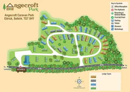
Tree-framed Angecroft Park map with colour-coded roofs, looping roads and a signed B709 entrance.
 Explore the map ↗
United Kingdom
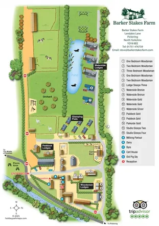
Portrait farm-stay map with pond-side lodges, glamping pods, orchard and illustrated animal paddocks.
 Explore the map ↗
United Kingdom
Woodland-framed Barnsoul map with mixed accommodation, shared facilities and paw-marked walking routes.
Features may come from the sample artwork, its key or published park information. Approximate numbers describe the drawing and may cover only part of a park. They are intended to help you compare map examples. Current facilities and booking information should be checked with the park.
LET’S MAP YOUR PARK
For a map quotation, find your park and draw a rough boundary around it. The area you select helps us work out the design time and price.
Draw your park for a quote ↗Or talk to our map designers
01751 473136