
Boundary watercourse
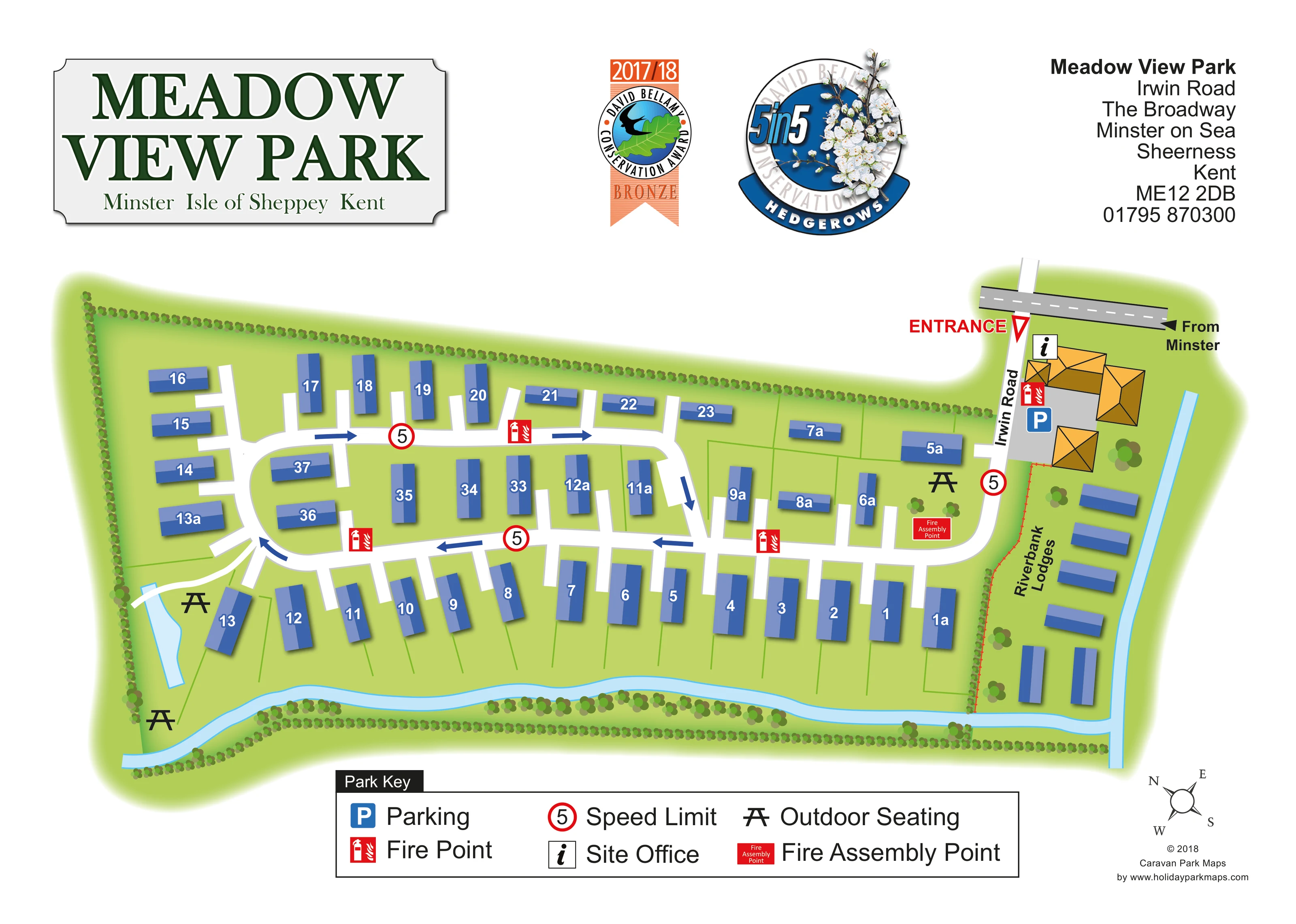
A pale-blue watercourse follows the lower edge of the park and turns up the eastern side beside Riverbank Lodges.
ILLUSTRATED PARK MAP · P538
Ash Lane, Minster-on-Sea, Sheerness, Kent · United Kingdom
 Enlarge the map ↗
A SENSE OF THE PLACE
Meadow View Park Homes and Lodges is based at Ash Lane, The Broadway, Minster on Sea, Sheerness, Kent. The operator describes a short walk to the seafront and clifftop walks; local shops and bus stop are nearby. Holiday park homes and lodges are offered for sale.
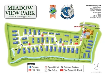
The map brings the site layout and its access routes together in one view, providing a reference for understanding the arrangement of the grounds.
LOOK CLOSER
A pale-blue watercourse follows the lower edge of the park and turns up the eastern side beside Riverbank Lodges.
A small elongated blue water feature lies beside the western seating area, with a short white crossing at its upper end.
Dotted hedgerows enclose much of the park, while clustered trees follow the lower watercourse and punctuate the entrance and lodge area.
The page header includes a 2017/18 David Bellamy Conservation Award Bronze badge and a separate 5 in 5 Hedgerows graphic. These are page graphics, not mapped facility locations.
An information symbol identifies the site office within the orange-roofed building cluster beside the entrance.
A blue parking symbol marks the grey arrival area beside the office buildings.
Picnic-table symbols mark seating near the western water feature and beside the eastern arrival area.
Red fire-point symbols recur along the internal roads and beside the entrance buildings.
An information symbol identifies the site office within the orange-roofed building cluster beside the entrance.
A blue parking symbol marks the grey arrival area beside the office buildings.
Picnic-table symbols mark seating near the western water feature and beside the eastern arrival area.
Red fire-point symbols recur along the internal roads and beside the entrance buildings.
A red labelled assembly point sits on the green space just west of Irwin Road, near outdoor seating.
The upper-right entrance is highlighted in red, with Irwin Road labelled vertically and an approach arrow marked From Minster.
Blue arrows indicate circulation around the main accommodation loop; short white spurs extend towards individual plots.
Red-ringed signs displaying 5 appear at the entrance and around the internal road network.
A pale-blue watercourse follows the lower edge of the park and turns up the eastern side beside Riverbank Lodges.
A small elongated blue water feature lies beside the western seating area, with a short white crossing at its upper end.
Dotted hedgerows enclose much of the park, while clustered trees follow the lower watercourse and punctuate the entrance and lodge area.
The page header includes a 2017/18 David Bellamy Conservation Award Bronze badge and a separate 5 in 5 Hedgerows graphic. These are page graphics, not mapped facility locations.
The operator describes the seafront and clifftop walks as a short walk away. Neither the coast nor those routes is depicted on this plan.
READING THE MAP
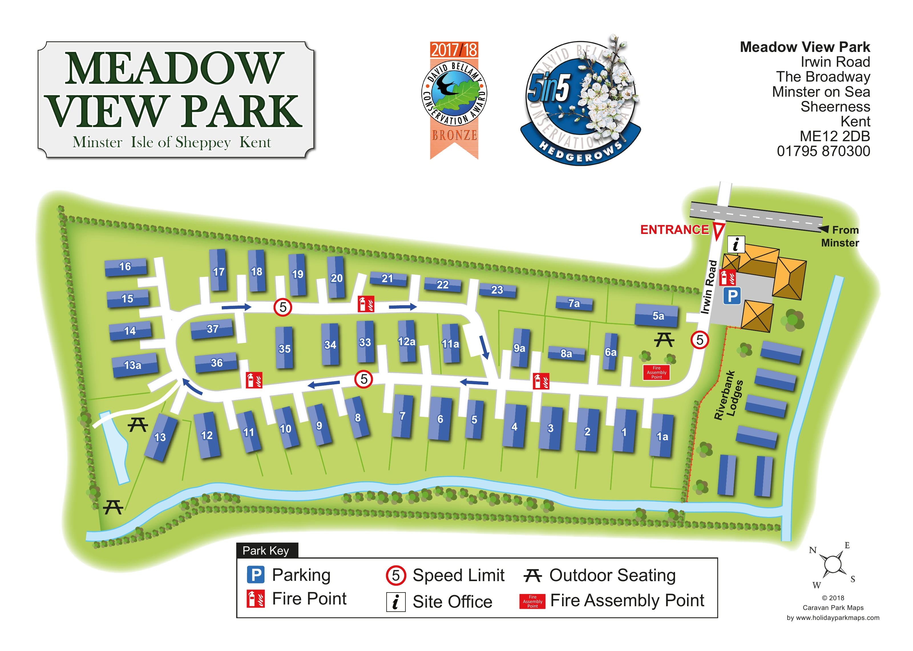
This illustrated map of Meadow View Park presents a compact holiday-home and lodge site in Minster-on-Sea, on Kent’s Isle of Sheppey. The plan brings the numbered accommodation, entrance buildings and internal roads together in a single landscape-format view, with a separate Riverbank Lodges area along the right-hand boundary.
Blue accommodation blocks stand out against bright green plots, while white roads and bold directional arrows make the circulation easy to follow. A pale-blue watercourse traces the lower and eastern edges of the grounds, accompanied by hedgerows and clusters of trees. Picnic-table symbols identify outdoor seating, and the entrance area groups the site office, parking and safety information where visitors first arrive.
The page also gives substantial space to the park’s identity: a large green name plaque, address panel and conservation graphics sit above the plan. For a small park with individually identified homes, this sample shows how a straightforward site diagram can combine practical wayfinding with a recognisable landscape setting.
The map is arranged as an elongated overhead plan, with the entrance at the upper right and most accommodation extending across the page to the left. An approach arrow labelled From Minster leads towards Irwin Road. Beside this arrival route, orange-roofed buildings, an information symbol and a blue parking marker identify the office and parking area.
The main internal road curves into a loop through the numbered homes. White road surfaces contrast strongly with the green grounds, and blue arrows show the intended direction of circulation. Short spurs reach into the plots, while thin green lines suggest their boundaries. The blue accommodation blocks turn to suit each row: some run along the upper edge, others face the lower perimeter road, and another group occupies the middle of the loop. Their white identifiers remain more prominent than the finer landscape detail.
To the right, Riverbank Lodges is named vertically within a narrow strip of unnumbered units. A pale-blue watercourse runs beside this area and continues across the lower boundary. Dotted hedges and clustered trees frame the water and outer edges. At the western end, another small water feature and a short white crossing sit near picnic-table symbols.
Red fire-point icons appear around the roads, and a labelled fire assembly point is placed near the entrance-side seating. The broad Park Key below the illustration explains these symbols alongside parking, the site office and speed-limit signs. A compass rose completes the plan. The accompanying detail images enlarge this same lower-page key; they are not separate park sections or additional accommodation maps.
KEEP EXPLORING
Chosen for shared landscapes, accommodation or facilities.
 Explore the map ↗
United Kingdom
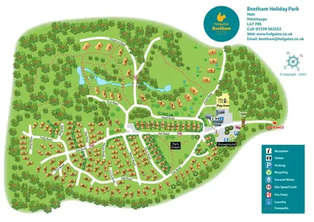
A woodland holiday-park plan with numbered homes, tree-named roads, walking loops and a distinctive entrance totem pole.
 Explore the map ↗
United Kingdom
Illustrated lakeside park plan with numbered holiday units, leisure buildings and a looping Woodland Walk.
 Explore the map ↗
United Kingdom
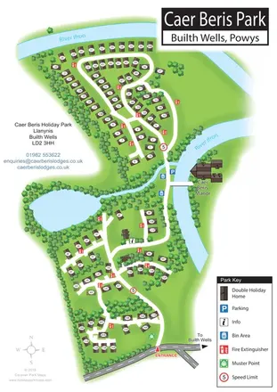
Portrait holiday-home park map with riverside loops, a tree-fringed pond and a separate manor landmark.
Features may come from the sample artwork, its key or published park information. Approximate numbers describe the drawing and may cover only part of a park. They are intended to help you compare map examples. Current facilities and booking information should be checked with the park.
TAKE A CLOSER LOOK
View the illustrated map in detail or choose a file to download. These are sample maps; contact the park for current visitor information.


LET’S MAP YOUR PARK
For a map quotation, find your park and draw a rough boundary around it. The area you select helps us work out the design time and price.
Draw your park for a quote ↗Or talk to our map designers
01751 473136
 meadowview_large.png