
Boating water
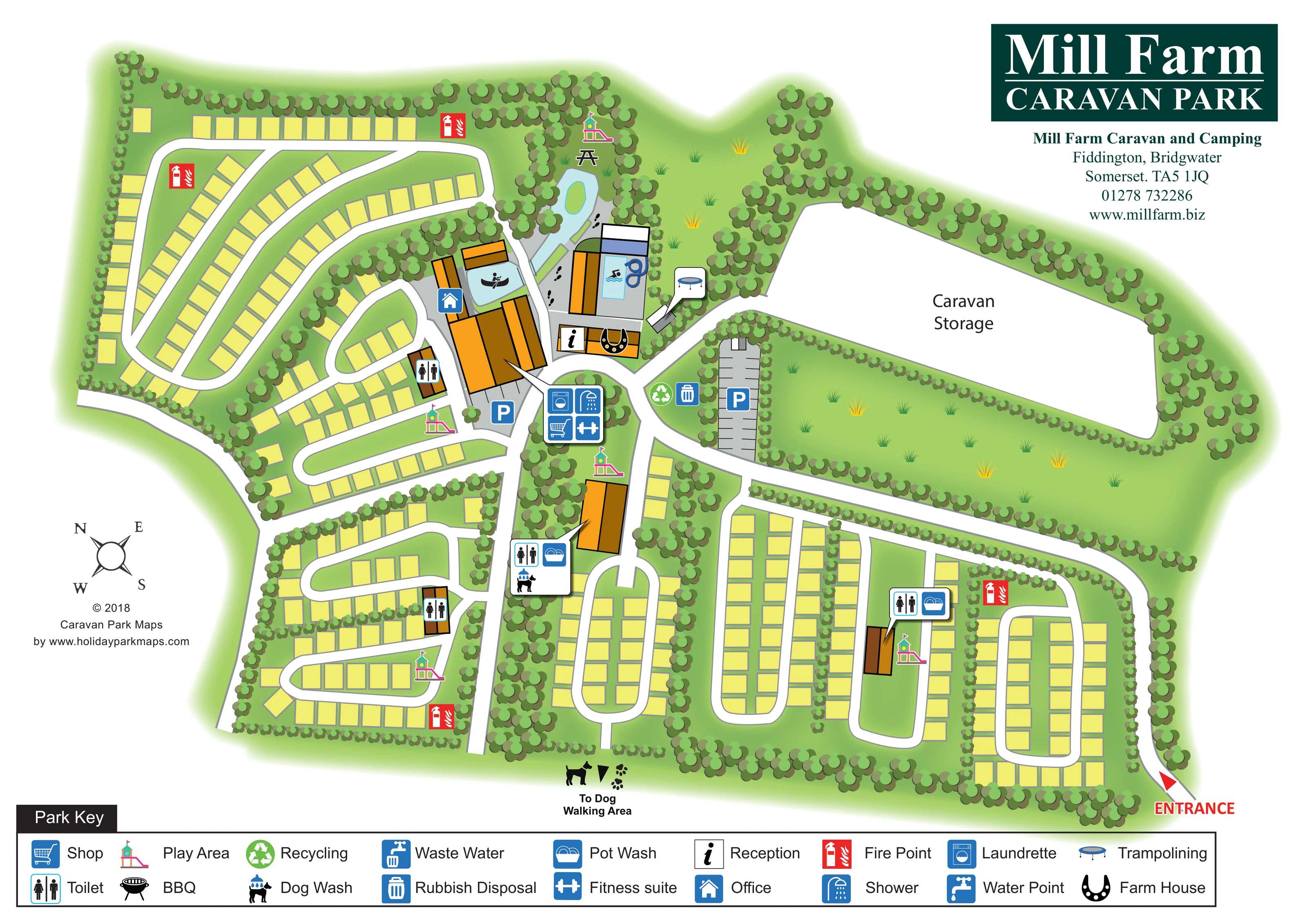
A pale-blue water area beside the central buildings contains a small boat and paddler illustration.
ILLUSTRATED PARK MAP · P542
Watery Lane, Fiddington, Bridgwater, Somerset · United Kingdom
 Enlarge the map ↗
A SENSE OF THE PLACE
Mill Farm Caravan and Camping is located between the Quantock Hills and the Somerset coast near Bridgwater. The grounds include a boating lake and shared recreation facilities.
The operator's current notice describes restricted use for seasonal pitch holders, storage customers and certain other users. The map is retained as a park layout example, without presenting ordinary touring or tent stays as generally available.
LOOK CLOSER
A pale-blue water area beside the central buildings contains a small boat and paddler illustration.
An elongated pale-blue pond with a green island sits above the main buildings, enclosed by trees and a grey waterside strip.
Continuous tree belts enclose the park and divide the pitch sections, while smaller hedge symbols border roads and storage.
Broad green spaces with scattered grass tufts separate the upper leisure cluster, storage area and eastern approach road.
A red arrow and prominent ENTRANCE label mark the approach at the lower-right edge.
White, grey-edged roads link the entrance, central facilities and multiple pitch sections, using elongated loops and curved branches.
An information symbol marks reception on the small central building beside the farmhouse symbol.
A blue house symbol identifies the office within the central building cluster, beside the illustrated boating water.
A red arrow and prominent ENTRANCE label mark the approach at the lower-right edge.
White, grey-edged roads link the entrance, central facilities and multiple pitch sections, using elongated loops and curved branches.
An information symbol marks reception on the small central building beside the farmhouse symbol.
A blue house symbol identifies the office within the central building cluster, beside the illustrated boating water.
A horseshoe pictogram marks the farm house in the reception-side building.
A grouped blue callout near the central junction locates the shop, laundrette, showers and fitness suite together.
Toilet symbols appear on several service buildings. Pot-wash symbols accompany the central-lower and right-hand service-block callouts.
A dog-under-shower pictogram is grouped with toilets and pot washing at the central-lower service block.
Colourful climbing-frame symbols locate play areas beside the upper water feature and within several pitch sections.
A trampoline symbol with a white pointer marks a recreation spot between the central buildings and caravan storage.
A turquoise rectangular pool with a swimmer pictogram and blue slide is drawn within the upper central leisure complex; it has no separate entry in the key.
A pale-blue water area beside the central buildings contains a small boat and paddler illustration.
An elongated pale-blue pond with a green island sits above the main buildings, enclosed by trees and a grey waterside strip.
A black picnic-table illustration appears between the upper pond and a play-area symbol.
Blue P markers identify parking beside the central buildings and in a narrow marked bay area next to caravan storage.
A large, unfilled, tree-bordered area occupies the upper-right side and is explicitly labelled Caravan Storage.
Recycling and rubbish-disposal symbols are grouped at the central road junction near the storage-side parking.
Red fire-point symbols are distributed through the upper-left, lower-left and lower-right pitch sections.
A dog, arrow and footprints at the lower edge indicate 'To Dog Walking Area'; the walking area itself is outside the drawn plan.
Continuous tree belts enclose the park and divide the pitch sections, while smaller hedge symbols border roads and storage.
Broad green spaces with scattered grass tufts separate the upper leisure cluster, storage area and eastern approach road.
A barbecue pictogram is included in the key, but a matching location is not clearly identifiable in the main plan.
The key includes a water-point symbol; no matching positioned symbol is clearly visible on the plan.
Waste water is defined in the key, without a clearly identifiable corresponding location in the main illustration.
READING THE MAP
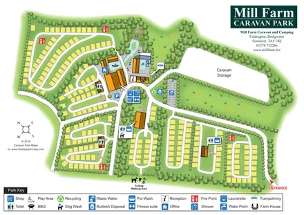
This illustrated map of Mill Farm Caravan and Camping Park in Fiddington, Somerset, brings a substantial pitch layout, central leisure facilities and a separate caravan storage area onto one landscape page. Set between the Quantock Hills and the Somerset coast near Bridgwater, the park is represented through pale-yellow pitch blocks, looping white roads and substantial belts of trees.
The entrance is clearly marked at the lower right, with the approach road leading towards a central cluster of buildings, parking and visitor facilities. Around this hub, the artwork depicts boating water, a swimming pool and slide, trampolining and play areas. Further play and service points appear among the pitch sections, while an arrow indicates the direction to the dog walking area beyond the plan.
A dark-green title panel and a broad, two-row facility key give the illustration a clear page structure. This sample is particularly relevant to parks that need to explain several pitch neighbourhoods and shared amenities without filling the drawing with individual plot labels. It presents the layout as mapped, rather than advertising current touring or camping availability.
The plan is arranged around a central junction, with most accommodation pitches occupying the left side and lower half of the page. At the upper left, curved roads form a broad, fan-like arrangement of pitch rows. Below them, smaller loops create separate sections, while the lower-right area uses longer, narrower loops. Yellow rectangles provide a consistent pitch language throughout, and tree belts make the divisions between sections easy to recognise.
From the lower-right entrance, the main approach follows the outside of the eastern pitch blocks and passes beneath the large Caravan Storage enclosure. Parking bays sit near the storage-side junction, with another parking marker beside the main buildings. Reception, the office and farm house are identified within the central complex. A grouped callout locates the shop, laundrette, showers and fitness suite nearby.
The leisure cluster includes a drawn swimming pool with a blue slide, boating water with a paddler, and an elongated island pond above the buildings. A picnic table and play symbol sit near the upper pond, and a trampoline is marked beside the storage approach. Additional play areas punctuate the pitch sections. Toilet buildings are spread across the site, with pot washing and a dog wash identified in service callouts. Recycling, rubbish disposal and red fire-point symbols add practical orientation detail.
The page combines an overhead road plan with slightly raised building illustrations and layered tree canopies. Its bottom key explains the facility symbols, including some entries whose locations are not clearly marked in the main drawing. A compass sits at lower left, and an arrow along the bottom edge points towards dog walking. The accompanying detail views enlarge the same legend rather than showing additional park sections.
KEEP EXPLORING
Chosen for shared landscapes, accommodation or facilities.
 Explore the map ↗
United Kingdom
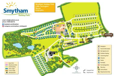
Colour-coded accommodation, woodland ponds and a Tarka Trail footpath on Smytham’s illustrated park map.
 Explore the map ↗
United Kingdom
Trevornick’s colour-coded park map, with mixed accommodation, fishing ponds, golf and wooded trails.
 Explore the map ↗
United Kingdom
Woodland-framed Barnsoul map with mixed accommodation, shared facilities and paw-marked walking routes.
Features may come from the sample artwork, its key or published park information. Approximate numbers describe the drawing and may cover only part of a park. They are intended to help you compare map examples. Current facilities and booking information should be checked with the park.
TAKE A CLOSER LOOK
View the illustrated map in detail or choose a file to download. These are sample maps; contact the park for current visitor information.


LET’S MAP YOUR PARK
For a map quotation, find your park and draw a rough boundary around it. The area you select helps us work out the design time and price.
Draw your park for a quote ↗Or talk to our map designers
01751 473136