
Tree belts and wooded compartments
Dense repeated tree canopies enclose the boundary, divide accommodation groups and surround the ponds.
ILLUSTRATED PARK MAP · P543
Hughley, near Shrewsbury, Shropshire · United Kingdom
 Enlarge the map ↗
A SENSE OF THE PLACE
Mill Farm Holiday Park is based at Hughley, near Shrewsbury, Shropshire. This is a family-run park in a valley below Wenlock Edge. The park accepts touring caravans, motorhomes and tents, including fully serviced hardstanding options.
The park lists three fishing pools, shower block, recreation room, table tennis and chemical waste disposal.
LOOK CLOSER
Dense repeated tree canopies enclose the boundary, divide accommodation groups and surround the ponds.
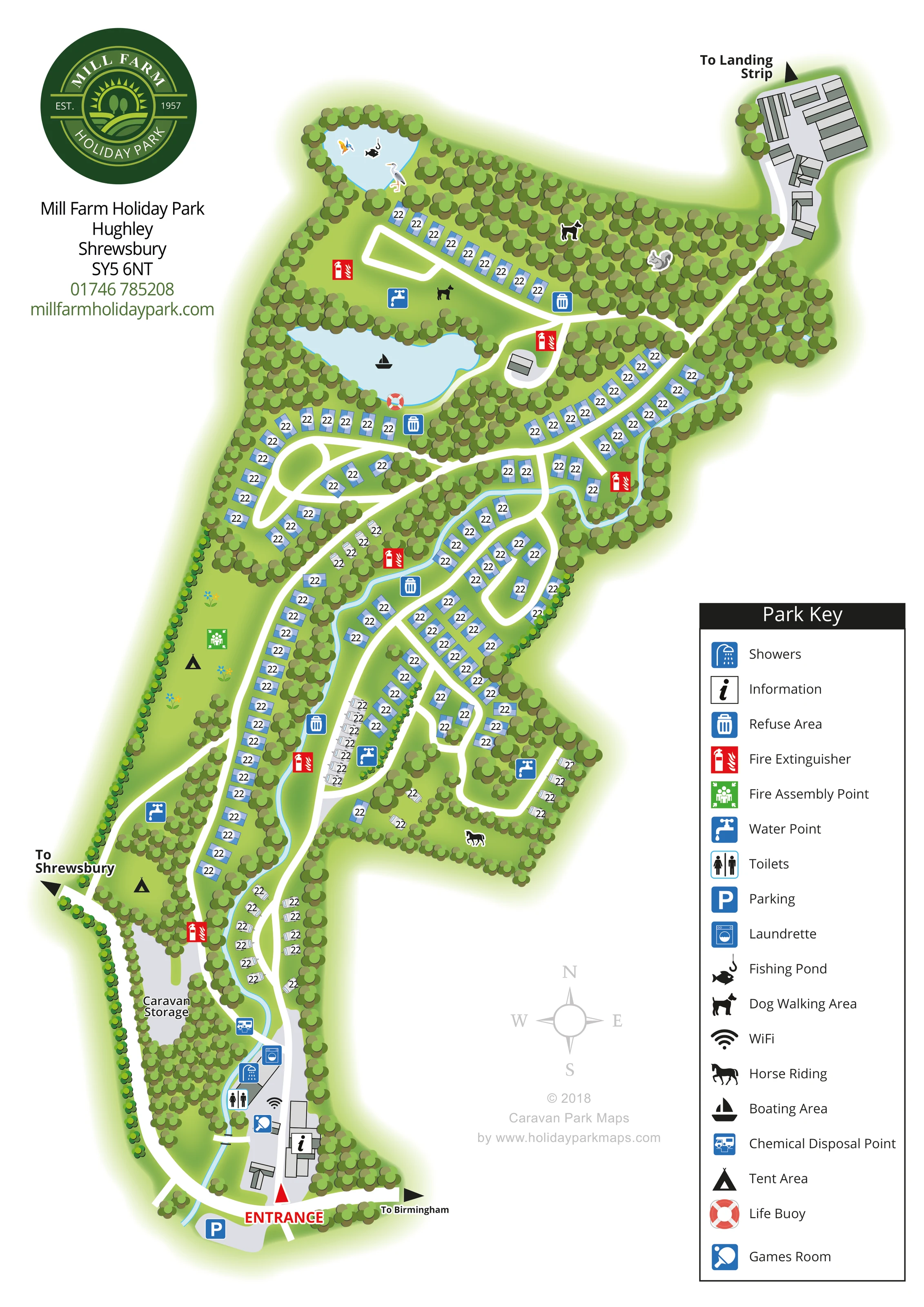
A narrow pale-blue watercourse threads through the centre and down towards the entrance, widening locally between pitch rows.
An information symbol marks a building beside the southern entrance.
A blue parking symbol marks the grey parking area immediately outside the entrance.
Shower and toilet symbols are grouped at the entrance-side service buildings.
A washing-machine symbol identifies the laundrette within the southern facilities cluster.
A table-tennis bat symbol marks the games room near the information point.
A WiFi symbol appears beside the entrance-side buildings; no coverage area is drawn.
An information symbol marks a building beside the southern entrance.
A blue parking symbol marks the grey parking area immediately outside the entrance.
Shower and toilet symbols are grouped at the entrance-side service buildings.
A washing-machine symbol identifies the laundrette within the southern facilities cluster.
A table-tennis bat symbol marks the games room near the information point.
A WiFi symbol appears beside the entrance-side buildings; no coverage area is drawn.
A chemical-disposal symbol is placed just north of the main facilities cluster, beside the internal route and watercourse.
Blue tap symbols are distributed through the northern, central and western accommodation areas.
Blue bin symbols mark several service points along the internal roads.
Red fire-extinguisher symbols provide conspicuous reference points throughout the plan.
A green assembly symbol appears in the western open grass area.
The small northern pond contains the fish-and-hook symbol identified in the key as a fishing pond.
A boat symbol marks the larger pond below the northern fishing pond.
A red-and-white life-buoy symbol is positioned on the southern edge of the boating pond.
Dog symbols identify grass and wooded areas in the northern part of the park.
A horse-and-rider symbol marks a wooded clearing on the south-eastern side; no riding route or operating details are shown.
A long grey area west of the southern access road is labelled Caravan Storage.
Dense repeated tree canopies enclose the boundary, divide accommodation groups and surround the ponds.
A narrow pale-blue watercourse threads through the centre and down towards the entrance, widening locally between pitch rows.
The entrance is labelled in red at the southern end. Black arrows indicate directions to Shrewsbury and Birmingham.
White roads extend north from the entrance and branch into loops, curved spurs and short connecting routes.
A north-eastern access spur passes a group of grey structures and ends at an arrow labelled To Landing Strip. The landing strip itself is not depicted.
READING THE MAP
This illustrated map of Mill Farm Holiday Park at Hughley, near Shrewsbury, presents a long, wooded site as a connected series of curved accommodation areas. The southern entrance provides a clear starting point, with parking, information and the main visitor facilities gathered nearby. From there, white internal roads lead north between caravan rows, grassy camping areas and substantial belts of trees.
Water is an important part of the composition. A narrow blue watercourse winds through the park, while two prominent ponds give the northern section recognisable landmarks. Fishing and boating symbols distinguish their mapped uses, and dog-walking symbols identify nearby outdoor areas.
The portrait page combines a large circular park logo with an extensive right-hand key. Blue facility signs, red fire-extinguisher markers and black activity pictograms make practical information easy to pick out against the green landscape. This sample is particularly relevant to rural touring and camping parks that need to explain an irregular layout, dispersed service points and leisure areas within one coherent visitor map.
The plan is arranged around a southern entrance, marked with red lettering and a triangular pointer. Parking sits just outside, while information, showers, toilets, a laundrette, WiFi and a games room are grouped around the buildings immediately inside. A chemical-disposal point appears slightly farther north. The long grey caravan-storage area occupies a separate strip to the west of this arrival route.
Beyond the entrance, the internal roads divide into a succession of curved branches and loops. Blue accommodation markers line the longer runs, with white caravan silhouettes forming smaller clusters. Tree belts separate these groups, and tent symbols identify open camping ground on the western side. A pale-blue watercourse passes between accommodation rows and continues towards the bottom of the plan, adding a useful visual thread through the otherwise branching layout.
The northern section contains two prominent tree-fringed ponds. The smaller pond carries a fishing symbol; the larger one is marked for boating and has a life buoy shown at its edge. Dog-walking symbols appear in northern clearings, while a horse-and-rider symbol identifies an area farther south-east. Water points, refuse areas and fire extinguishers are distributed through the park, with a fire assembly point on the western grassland.
A north-eastern spur passes grey structures before pointing towards a landing strip outside the drawing. Other arrows indicate Shrewsbury and Birmingham. The large Park Key explains the symbols, supported by a compass rose in the surrounding white space. The accompanying enlarged view reproduces this key and adjacent artwork; it is a detail of the same design, not an additional park section.
KEEP EXPLORING
Chosen for shared landscapes, accommodation or facilities.
 Explore the map ↗
United Kingdom
A woodland estate park map combining caravan loops, touring pitches, riverside paths and Bruce’s Cave landmarks.
 Explore the map ↗
United Kingdom
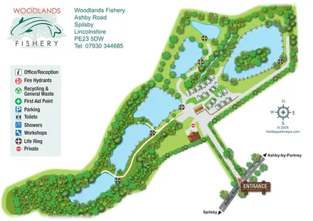
Illustrated fishery map with lakeside routes, wooded waters and a compact touring area.
 Explore the map ↗
United Kingdom
Woodland park map with mixed pitches, bell tents, lodges and a fishing lake.
Features may come from the sample artwork, its key or published park information. Approximate numbers describe the drawing and may cover only part of a park. They are intended to help you compare map examples. Current facilities and booking information should be checked with the park.
TAKE A CLOSER LOOK
View the illustrated map in detail or choose a file to download. These are sample maps; contact the park for current visitor information.


LET’S MAP YOUR PARK
For a map quotation, find your park and draw a rough boundary around it. The area you select helps us work out the design time and price.
Draw your park for a quote ↗Or talk to our map designers
01751 473136