
Gill Beck
A winding blue watercourse follows the western and southern edges, dividing and enclosing parts of the park.
ILLUSTRATED PARK MAP · P217
Mill Lane, Hawksworth, West Yorkshire · United Kingdom
 Enlarge the map ↗
A SENSE OF THE PLACE
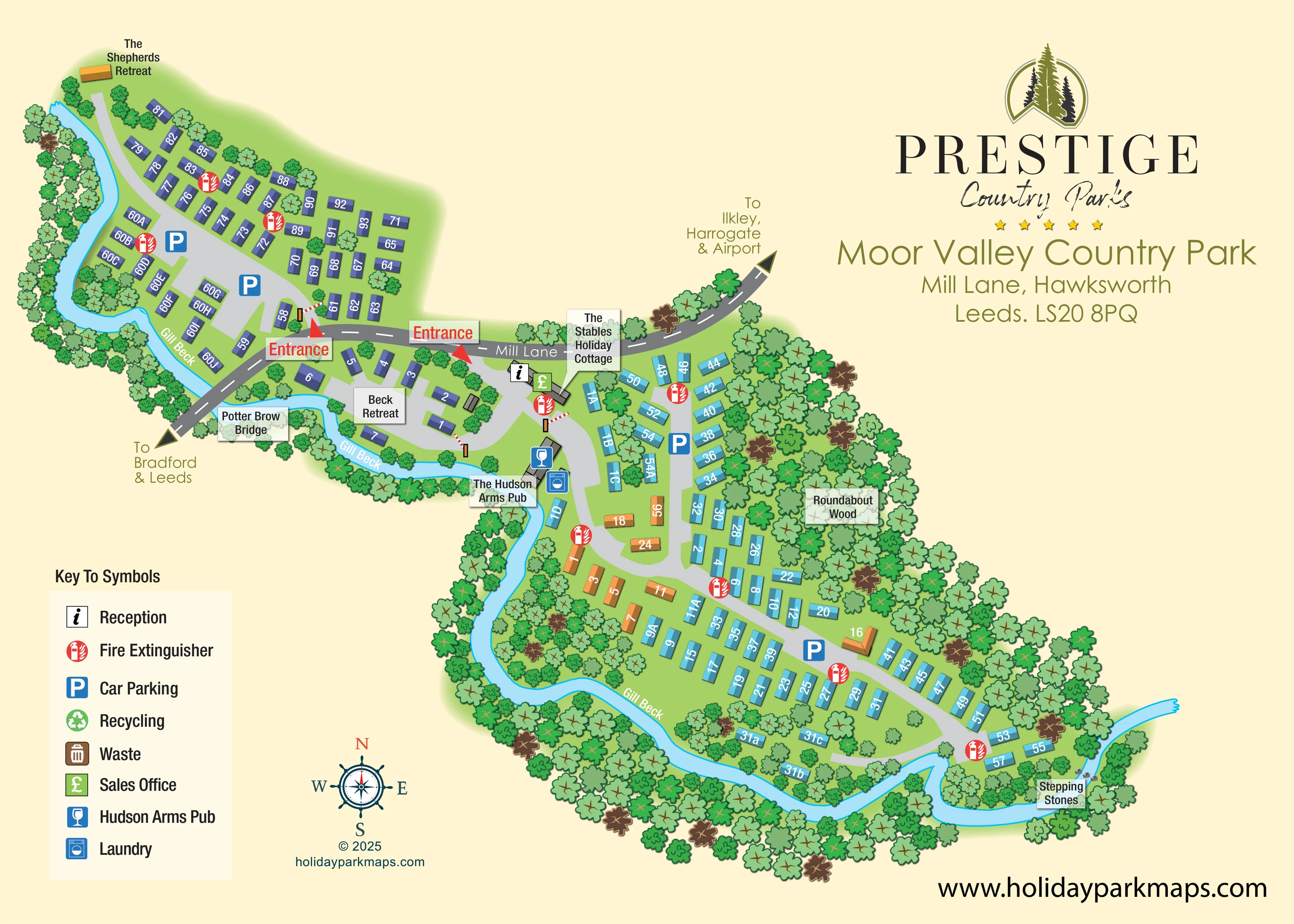
Moor Valley Country Park is based at Mill Lane, Hawksworth, West Yorkshire. This is a rural setting at Hawksworth, within reach of Leeds, Bradford, Harrogate and the Yorkshire Dales. The gated country park offers lodge ownership.
The Hudson's Arms pub is identified as within the park.
LOOK CLOSER
A winding blue watercourse follows the western and southern edges, dividing and enclosing parts of the park.
Named woodland forms the broad eastern backdrop to the main accommodation section.
Dense tree belts follow the beck and park perimeter, with individual trees between accommodation rows.
Named small accommodation enclave between Mill Lane and Gill Beck.
Information symbol beside the central entrance, close to the sales office and holiday cottage.
Green pound-sign symbol identifies the sales office in the central arrival cluster.
Named building beside Gill Beck, marked with the blue drinks-glass symbol.
Washing-machine symbol beside the pub and central beck-side buildings.
Information symbol beside the central entrance, close to the sales office and holiday cottage.
Green pound-sign symbol identifies the sales office in the central arrival cluster.
Named building beside Gill Beck, marked with the blue drinks-glass symbol.
Washing-machine symbol beside the pub and central beck-side buildings.
Several blue parking symbols serve the north-western and larger eastern accommodation sections.
Repeated red extinguisher symbols appear throughout the accommodation areas.
A green recycling symbol is included in the key; its position is not clearly identifiable on the plan.
A brown waste-bin symbol is included in the key; its position is not clearly identifiable on the plan.
A winding blue watercourse follows the western and southern edges, dividing and enclosing parts of the park.
Named woodland forms the broad eastern backdrop to the main accommodation section.
Dense tree belts follow the beck and park perimeter, with individual trees between accommodation rows.
Public road crosses the upper-middle plan, separating the north-western cluster from the central and eastern areas.
Two entrances are prominently labelled from Mill Lane. Red-and-white barrier illustrations mark access points on the internal roads.
Named crossing where Mill Lane passes over Gill Beck at the western approach.
A labelled stepping-stone crossing appears across the beck at the south-eastern end.
Road-end arrows point towards Bradford and Leeds, and towards Ilkley, Harrogate and the airport.
Named small accommodation enclave between Mill Lane and Gill Beck.
Named orange building at the north-western tip; its function is not explained by the key.
READING THE MAP
This illustrated map of Moor Valley Country Park places its woodland and waterside setting at the centre of the visitor experience. Located on Mill Lane in Hawksworth, West Yorkshire, the park is shown as several connected accommodation areas shaped by the winding course of Gill Beck. Dense tree belts, the named Roundabout Wood and a stepping-stone crossing give the plan recognisable landscape landmarks rather than leaving the grounds as an anonymous grid.
The artwork combines numbered accommodation blocks with practical arrival information. Two entrances from Mill Lane are highlighted in red, while parking, reception, the sales office, laundry and The Hudson Arms Pub are identified through a compact symbol system. Beck Retreat and The Stables Holiday Cottage add named destinations around the central approach.
A warm cream background and green landscape palette support the prominent Prestige Country Parks branding in the upper-right corner. Purple, turquoise and orange accommodation symbols make the rows visually distinct, while white identifiers help visitors locate individual units. The result is a useful sample for lodge parks needing to explain a divided layout without losing the character of their surroundings.
The plan follows an irregular diagonal footprint from the north-western tip to the south-eastern bend of Gill Beck. Mill Lane crosses the upper-middle portion, with Potter Brow Bridge labelled on the western approach. Direction arrows extend the road beyond the park towards Bradford and Leeds on one side, and Ilkley, Harrogate and the airport on the other. Two red entrance markers identify the main access points.
North of the lane, purple numbered accommodation blocks form a compact road-served cluster with parking areas and trees between the rows. The Shepherds Retreat is labelled at its far end. Immediately south of the lane, Beck Retreat occupies a smaller enclave beside the water. Reception and the sales office sit near the central entrance, alongside The Stables Holiday Cottage. The Hudson Arms Pub and laundry are marked farther down beside the beck.
The larger eastern and southern section uses turquoise accommodation blocks interspersed with orange units. Its roads curve through the site, with parking symbols and repeated fire-extinguisher markers distributed along the routes. Roundabout Wood creates a substantial eastern boundary, while Gill Beck sweeps around the southern grounds towards the labelled stepping stones. Individual trees soften the accommodation rows; denser layered canopies distinguish woodland and waterside margins.
The lower-left key explains eight facility symbols, including recycling and waste, although those two locations are not clearly shown on the plan. A decorative compass provides orientation. The single landscape-format artwork is accompanied by an overlapping enlargement of the legend and adjacent beck-side detail, not a separate park section or additional map variant. Throughout, numbered blocks and simple building drawings keep the emphasis on navigation rather than architectural detail.
KEEP EXPLORING
Chosen for shared landscapes, accommodation or facilities.
 Explore the map ↗
United Kingdom
Woodland-framed Barnsoul map with mixed accommodation, shared facilities and paw-marked walking routes.
 Explore the map ↗
United Kingdom
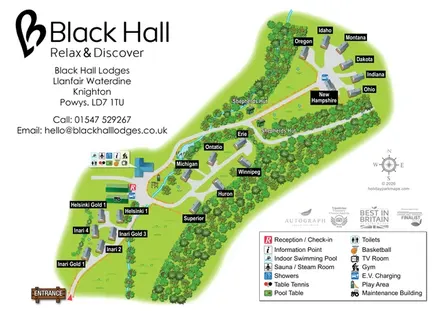
Named lodges, shepherds' huts and a shared leisure hub in a wooded countryside plan.
 Explore the map ↗
United Kingdom
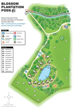
Illustrated lakeside pod map with woodland arrival routes, named lodges and a waterside circuit.
Features may come from the sample artwork, its key or published park information. Approximate numbers describe the drawing and may cover only part of a park. They are intended to help you compare map examples. Current facilities and booking information should be checked with the park.
LET’S MAP YOUR PARK
For a map quotation, find your park and draw a rough boundary around it. The area you select helps us work out the design time and price.
Draw your park for a quote ↗Or talk to our map designers
01751 473136