
Parkland orchard
A substantial labelled green space south of the main accommodation rows, separated from adjoining recreation areas by low planting.
ILLUSTRATED PARK MAP · P226
Llanfair Caereinion, Welshpool; A458 junction with A495 · United Kingdom
 Enlarge the map ↗
A SENSE OF THE PLACE
Neuadd Bridge Caravan Park is a family-run holiday park near Llanfair Caereinion in Mid Wales. Its countryside location is reached from the A458 west of Welshpool.
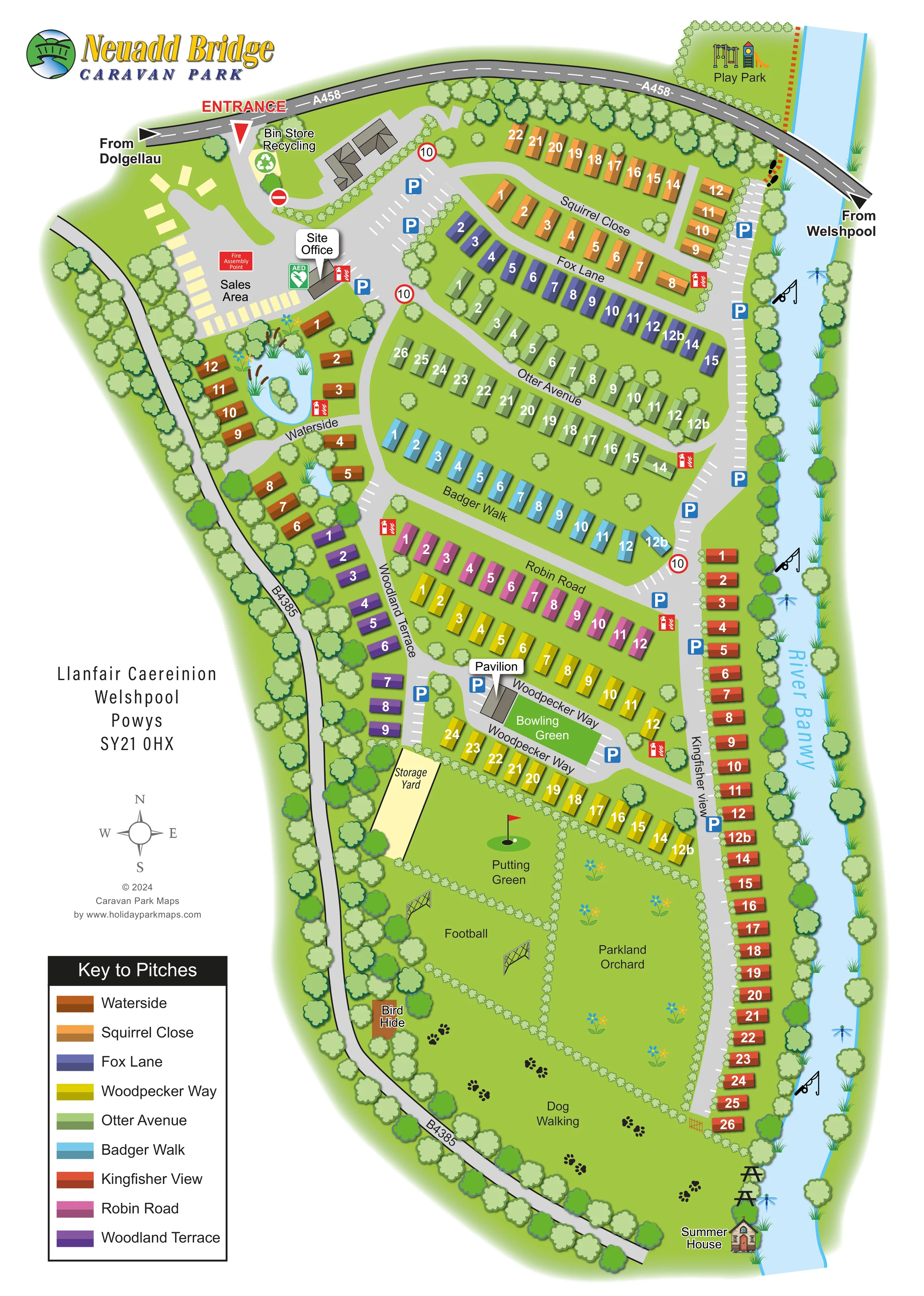
The park map illustrates the layout of caravan plots and access routes. It provides a practical overview for visitors and holiday homeowners using the site as a base in this part of Powys.
LOOK CLOSER
A substantial labelled green space south of the main accommodation rows, separated from adjoining recreation areas by low planting.
The pale-blue river forms the entire eastern edge of the composition, with trees, reeds and decorative dragonflies along its banks.
Two small blue water features sit among the Waterside caravans; the larger has an island and decorative marginal planting.
Dense stylised tree belts frame the roads and river, while smaller shrubs divide plots and southern recreation spaces.
Labelled building beside the entrance-side parking and sales area.
A separate display area of pale rectangular units near the site office.
Labelled near the entrance, with a green recycling symbol.
Blue P symbols and white bay markings identify parking near the office, along the eastern access road and around the pavilion.
Labelled building beside the entrance-side parking and sales area.
A separate display area of pale rectangular units near the site office.
Labelled near the entrance, with a green recycling symbol.
Blue P symbols and white bay markings identify parking near the office, along the eastern access road and around the pavilion.
Repeated red fire-equipment symbols are distributed around the accommodation roads. A fire assembly point is labelled in the sales area, and a green AED symbol appears beside the site office.
A tree-edged play area with illustrated play equipment is shown beyond the A458 at the north-eastern corner.
A grey-roofed building beside Woodpecker Way and the bowling green.
A bright green rectangular playing surface adjacent to the pavilion.
A labelled lawn in the southern recreation area, illustrated with a golf hole and red flag.
An open grass area below the putting green, marked by two illustrated goals.
A substantial labelled green space south of the main accommodation rows, separated from adjoining recreation areas by low planting.
A broad southern lawn labelled Dog Walking, reinforced by a trail of paw-print graphics.
A small brown structure at the wooded western edge of the southern green space.
A detailed miniature building at the southern riverside tip of the park.
Picnic-table symbols appear beside the river near the summer house.
Fishing-rod symbols mark several places along the River Banwy. They communicate a fishing association without specifying permissions or access conditions.
A pale enclosed area west of Woodpecker Way and the putting green.
The pale-blue river forms the entire eastern edge of the composition, with trees, reeds and decorative dragonflies along its banks.
Two small blue water features sit among the Waterside caravans; the larger has an island and decorative marginal planting.
Dense stylised tree belts frame the roads and river, while smaller shrubs divide plots and southern recreation spaces.
A red entrance marker identifies access from the A458. Direction arrows name Dolgellau and Welshpool; the B4385 runs down the western edge.
Nine wildlife-themed neighbourhood names are repeated on the plan and in the pitch key. A riverside spine connects the central rows and Kingfisher View.
Circular 10 signs and a no-entry symbol appear on the internal road network.
A compass rose and the park's Llanfair Caereinion, Welshpool, Powys address sit in the white margin.
READING THE MAP
This illustrated map of Neuadd Bridge Caravan Park presents a long riverside site near Llanfair Caereinion in Mid Wales. The River Banwy runs down the right-hand side, while tree-lined roads frame the northern and western boundaries. Within that distinctive outline, approximately 150 caravan plots are organised into nine named neighbourhoods, each with its own colour in the pitch key.
The plan balances practical arrival information with a clear picture of the park's outdoor spaces. The entrance, site office, sales area and recycling point sit together near the A458. Named internal roads lead through the caravan rows towards the pavilion and bowling green, then on to putting, football, orchard and dog-walking areas in the southern part of the site. A bird hide, riverside picnic tables and a small summer house add recognisable destinations beyond the accommodation.
Rather than drawing every feature in the same way, the artwork combines simple numbered caravan blocks with more expressive trees, ponds and recreational symbols. It is a useful sample for parks that need to explain several accommodation neighbourhoods without losing the character of a landscaped setting.
The single portrait plan follows the park's elongated shape between the River Banwy and the B4385, with the A458 crossing the top of the artwork. A prominent red entrance label marks the northern arrival point. Nearby, the map shows the bin store and recycling point, a sales display area, the site office, parking, an AED symbol and a fire assembly point. The play park occupies a separate tree-edged area beyond the A458 at the north-eastern corner.
Accommodation is organised through a nine-colour system. Squirrel Close and Fox Lane form regular rows in the upper section, with Otter Avenue, Badger Walk and Robin Road stepping southwards. Woodpecker Way wraps around the pavilion and bowling green. Woodland Terrace follows the wooded western side, while the long Kingfisher View row tracks the river. Waterside is more loosely arranged around two small ponds, including a larger pond with an island. White plot numbers sit directly on the two-tone caravan symbols, and the large pitch key repeats each neighbourhood's name and colour.
Parking bays and blue P symbols recur along the road network, alongside red fire-equipment markers and circular 10 signs. Below the main accommodation, planted boundaries divide the putting green, football area and parkland orchard. Paw-print graphics identify the broad dog-walking lawn. A bird hide sits towards the western tree belt, while picnic-table symbols and a detailed summer-house illustration mark the southern riverbank. Fishing-rod symbols also appear along the river.
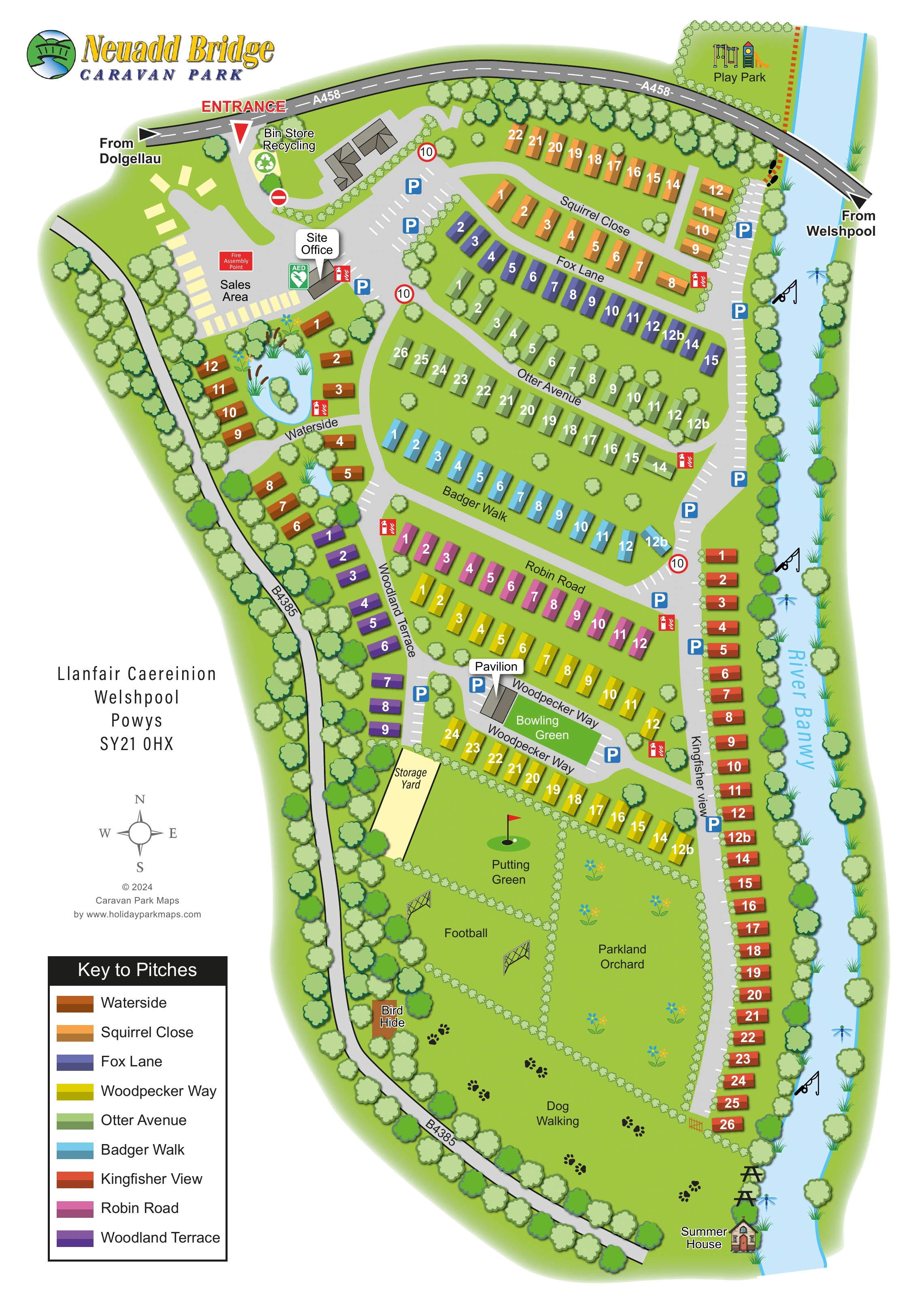
The white left-hand margin holds the park branding, address, compass, designer credit and pitch key. The detail enlargements show portions of this same artwork, particularly the legend and southern landscape, rather than additional sites or separate map variants.
KEEP EXPLORING
Chosen for shared landscapes, accommodation or facilities.
 Explore the map ↗
United Kingdom
A woodland estate park map combining caravan loops, touring pitches, riverside paths and Bruce’s Cave landmarks.
 Explore the map ↗
United Kingdom
Illustrated lakeside park plan with numbered holiday units, leisure buildings and a looping Woodland Walk.
 Explore the map ↗
United Kingdom
A lakeside holiday-park and fishery map with numbered accommodation, fishing positions and clearly grouped visitor services.
Features may come from the sample artwork, its key or published park information. Approximate numbers describe the drawing and may cover only part of a park. They are intended to help you compare map examples. Current facilities and booking information should be checked with the park.
TAKE A CLOSER LOOK
View the illustrated map in detail or choose a file to download. These are sample maps; contact the park for current visitor information.


LET’S MAP YOUR PARK
For a map quotation, find your park and draw a rough boundary around it. The area you select helps us work out the design time and price.
Draw your park for a quote ↗Or talk to our map designers
01751 473136
 neuaddmap_large.png