
The Duck Pond
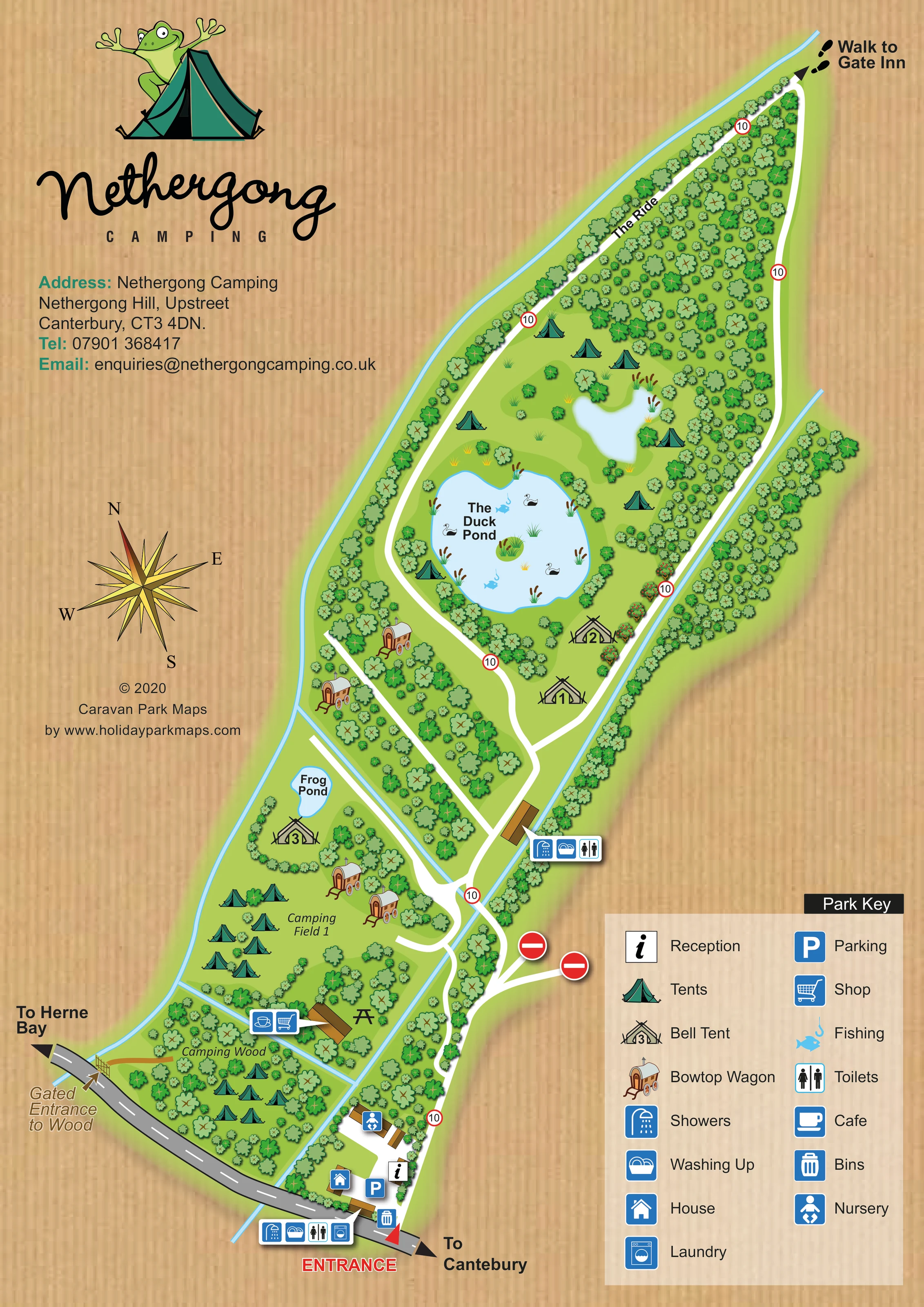
The large central pond is named and illustrated with waterbirds, reeds, fishing symbols and a small planted island.
ILLUSTRATED PARK MAP · P547
Nethergong Hill, Upstreet, Canterbury · United Kingdom
 Enlarge the map ↗
A SENSE OF THE PLACE
Nethergong Camping is based at Nethergong Hill, Upstreet, Canterbury. This is a family-run site with wooded and open areas in East Kent. The park offers tent/campervan stays and glamping in bell tents, shepherds' huts, a wagon and vintage caravans.
The operator about page describes two lakes, a small café/shop and a pizza oven.
LOOK CLOSER
The large central pond is named and illustrated with waterbirds, reeds, fishing symbols and a small planted island.
A smaller named pond lies beside a bell tent at the upper edge of Camping Field 1.
A small unlabelled waterbody sits above The Duck Pond. Narrow blue channels follow boundaries and divide parts of the lower camping area.
Dense illustrated trees enclose the long upper section, border routes and create smaller camping clearings. Open grass is interspersed with shrubs and reed planting.
An information symbol locates reception within the roadside arrival cluster near the main entrance.
A blue parking symbol marks the arrival area beside reception and the house.
Combined café and shop icons point to a brown-roofed building between Camping Field 1 and Camping Wood.
A black picnic-table silhouette is shown beside the café/shop building.
An information symbol locates reception within the roadside arrival cluster near the main entrance.
A blue parking symbol marks the arrival area beside reception and the house.
Combined café and shop icons point to a brown-roofed building between Camping Field 1 and Camping Wood.
A black picnic-table silhouette is shown beside the café/shop building.
Grouped icon callouts identify facilities at the entrance and at a second building farther along the internal route.
A washing-machine icon appears in the entrance-area amenities callout.
A bin symbol is placed beside the main entrance route.
A house icon identifies a building within the arrival cluster.
A baby pictogram, identified as Nursery in the key, marks a building north of reception. The artwork does not explain the nature of this use.
Fish-and-hook symbols appear within The Duck Pond and are explained as Fishing in the key.
The large central pond is named and illustrated with waterbirds, reeds, fishing symbols and a small planted island.
A smaller named pond lies beside a bell tent at the upper edge of Camping Field 1.
A small unlabelled waterbody sits above The Duck Pond. Narrow blue channels follow boundaries and divide parts of the lower camping area.
Dense illustrated trees enclose the long upper section, border routes and create smaller camping clearings. Open grass is interspersed with shrubs and reed planting.
A red ENTRANCE label and arrow identify the arrival point off the grey road at the bottom of the page. Road-end arrows indicate Herne Bay and Canterbury.
A separate gate and short brown access route connect the roadside directly to Camping Wood.
The named white route follows the long wooded side of the upper site towards its narrow tip.
Footprints and an outward arrow at the upper tip indicate a walking connection to Gate Inn.
Red-bordered 10 signs repeat along the white routes, while two no-entry symbols mark side branches near the lower junction.
A pizza oven is mentioned in the operator information but is not separately located or labelled on this map.
READING THE MAP
This illustrated map of Nethergong Camping presents a wooded campsite at Upstreet, near Canterbury in East Kent. Rather than organising the page around rows of numbered pitches, it uses trees, grassy clearings and ponds to explain the site's character and the relationship between its camping areas. Camping Field 1 and Camping Wood are clearly named, while bell tents and bowtop wagons receive their own distinctive drawings.
The long site stretches diagonally across a portrait page, from the roadside entrance and reception area towards a narrow woodland tip. White routes lead through the green landscape, with The Ride and a signed walk to Gate Inn adding useful orientation beyond the immediate arrival area. The Duck Pond forms a prominent central landmark, illustrated with waterbirds, reeds and fishing symbols.
A frog-and-tent logo, large script wordmark and warm woodgrain background give the artwork an informal camping identity. Practical information remains easy to find through blue facility icons, grouped building callouts and a substantial two-column key. The result is a useful sample for campsites that need to explain open camping areas and individual glamping accommodation within a landscape-led layout.
The single-page artwork places the main entrance along the grey approach road at the bottom of the plan. Reception, parking, a house and a building marked Nursery form a compact arrival cluster. A nearby callout groups showers, washing-up facilities, toilets and laundry, while a bin symbol sits beside the entrance route. Direction arrows at the road ends point towards Herne Bay and Canterbury.
Beyond arrival, broad white routes branch through the site. Camping Wood occupies a tree-filled lower section with its own gated roadside entrance. Immediately above, Camping Field 1 contains looser tent illustrations on open grass, together with bowtop wagons and a bell tent beside Frog Pond. A café and shop share a building at the boundary between the two camping areas, with a picnic-table symbol nearby. Another building farther inland is identified with shower, washing-up and toilet icons.
The upper part of the map is dominated by woodland and water. The Duck Pond is a large, irregular blue shape with reeds, birds, fishing symbols and a planted island. A smaller unlabelled waterbody lies above it. Tents appear in surrounding clearings, while additional bell tents and wagons sit along the connecting routes. Narrow blue channels trace site edges and divide parts of the lower ground.
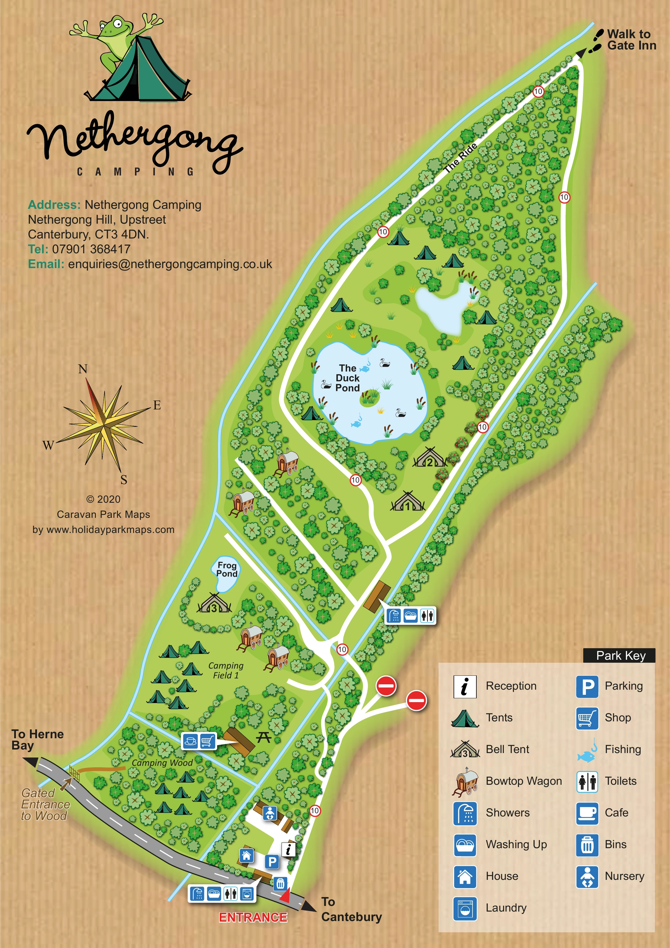
The Ride follows the wooded upper section towards a footprint-marked walk to Gate Inn. Repeated red-bordered 10 signs and two no-entry symbols add traffic-related cues. A compass rose supports orientation, and the lower-right key explains both pictorial accommodation and service icons. The accompanying enlarged views show the entrance and key in more detail; they are crops of this same design, not separate map variants.
KEEP EXPLORING
Chosen for shared landscapes, accommodation or facilities.
 Explore the map ↗
United Kingdom
Woodland holiday-park map with named accommodation areas, touring loops and illustrated recreation facilities.
 Explore the map ↗
United Kingdom
Portrait park map with mixed touring pitches, seasonal rows, ponds and an extensive dog walk.
 Explore the map ↗
United Kingdom
A woodland estate park map combining caravan loops, touring pitches, riverside paths and Bruce’s Cave landmarks.
Features may come from the sample artwork, its key or published park information. Approximate numbers describe the drawing and may cover only part of a park. They are intended to help you compare map examples. Current facilities and booking information should be checked with the park.
TAKE A CLOSER LOOK
View the illustrated map in detail or choose a file to download. These are sample maps; contact the park for current visitor information.


LET’S MAP YOUR PARK
For a map quotation, find your park and draw a rough boundary around it. The area you select helps us work out the design time and price.
Draw your park for a quote ↗Or talk to our map designers
01751 473136
 nethergongmappor_large.png