
Central green and planting
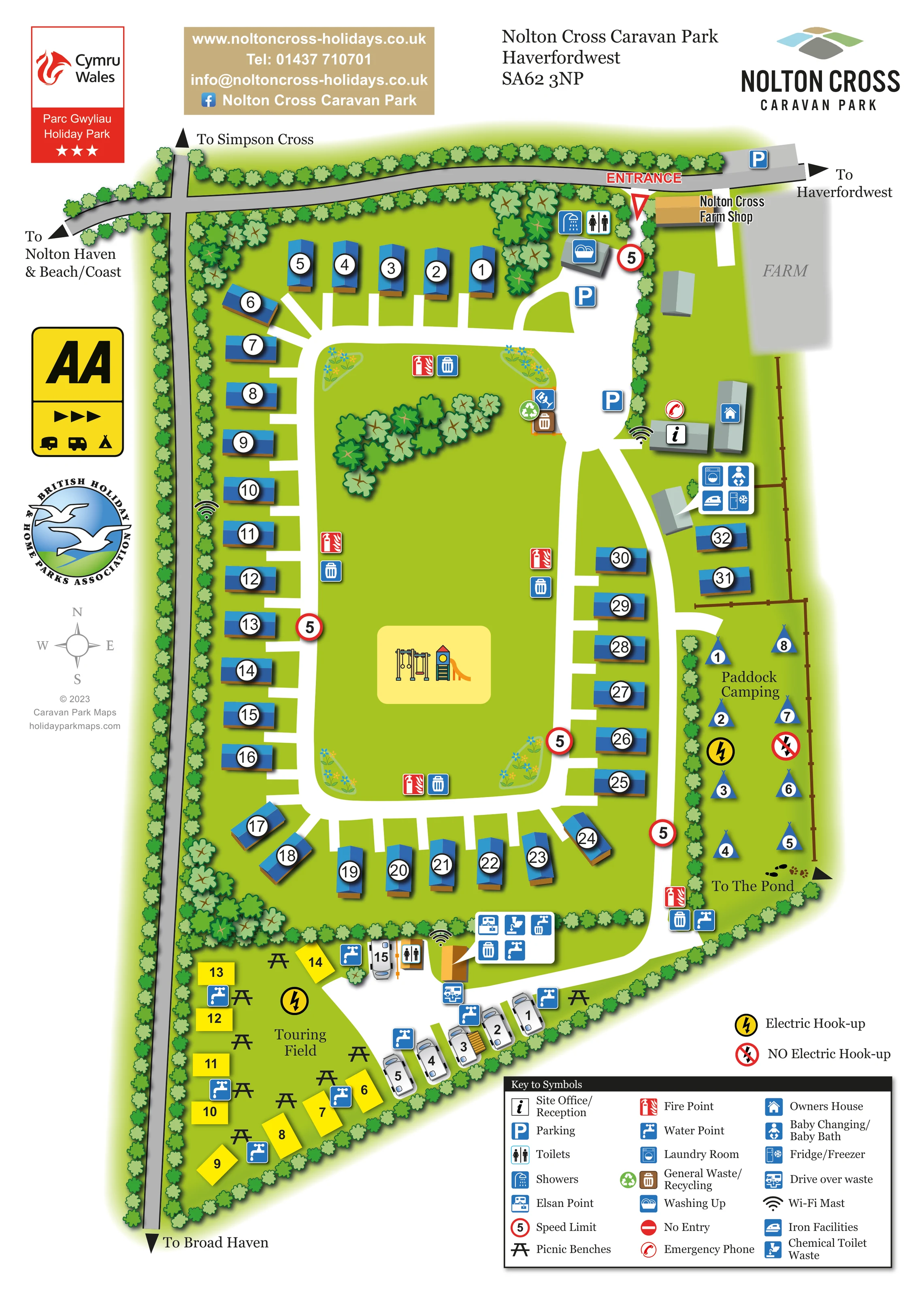
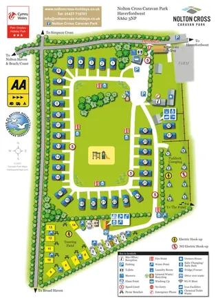
A broad green occupies the centre of the caravan loop, with a tree cluster, corner flowerbeds and the play area.
ILLUSTRATED PARK MAP · P227
Nolton Cross Caravan Park, Haverfordwest · United Kingdom
 Enlarge the map ↗
A SENSE OF THE PLACE
Nolton Cross Caravan Park offers holiday caravans, touring and camping inland from Nolton Haven in Pembrokeshire. Open countryside views extend towards the Preseli Hills and the coast.
Touring spaces occupy a separate area from the static caravans, with electric connections and some hardstandings. Heated washrooms support stays, and the beaches and paths around St Brides Bay provide options for days out.
LOOK CLOSER
A broad green occupies the centre of the caravan loop, with a tree cluster, corner flowerbeds and the play area.
Repeated leafy tree symbols frame the roads and park perimeter, with denser clusters at selected corners and brown fencing along the eastern paddock.
A large muted-grey area labelled FARM lies beyond the entrance-side buildings.
A red entrance label and triangular marker identify the turn off the northern road beside Nolton Cross Farm Shop.
The information symbol marks a building on the eastern side of the arrival area.
Parking symbols appear on the northern roadside and within the entrance-side arrival area.
A named shop building stands immediately beside the entrance, adjoining the area labelled FARM.
Toilet and shower symbols identify the northern amenity building, with further toilet provision shown beside the touring facilities.
A red entrance label and triangular marker identify the turn off the northern road beside Nolton Cross Farm Shop.
The information symbol marks a building on the eastern side of the arrival area.
Parking symbols appear on the northern roadside and within the entrance-side arrival area.
A named shop building stands immediately beside the entrance, adjoining the area labelled FARM.
Toilet and shower symbols identify the northern amenity building, with further toilet provision shown beside the touring facilities.
Dishwashing symbols appear at the northern amenity building and in the southern touring service cluster.
A callout beside an eastern building groups laundry, baby changing/baby bath, ironing and fridge/freezer symbols.
The southern service area carries Elsan, chemical toilet waste and drive-over waste symbols.
Repeated tap symbols are distributed through the touring area and near the southern end of the camping paddock.
Bin symbols recur around the main loop and service areas; a recycling symbol is shown near the northern part of the central green.
Red fire-point symbols are distributed around the central caravan area and beside the camping route.
A red telephone symbol appears beside the reception building.
Wireless symbols mark points near reception, the western caravan row and the southern service area; the artwork does not define coverage.
A blue house symbol identifies a long building beside reception on the eastern boundary.
An illustrated swing frame and slide occupy a pale-yellow rounded rectangle within the central green.
Black picnic-table symbols are spread through the southern Touring Field.
A yellow lightning symbol identifies electric provision in the Touring Field. Both electric and crossed-out non-electric symbols appear in Paddock Camping.
Red-bordered circular signs labelled 5 recur along the internal routes.
A no-entry symbol is included in the key; no clear corresponding location is identified on the main plan.
A broad green occupies the centre of the caravan loop, with a tree cluster, corner flowerbeds and the play area.
Repeated leafy tree symbols frame the roads and park perimeter, with denser clusters at selected corners and brown fencing along the eastern paddock.
Footprints and an outward arrow beside Paddock Camping are labelled To The Pond. The pond itself is outside the illustrated plan.
Road-edge arrows point towards Haverfordwest, Simpson Cross, Broad Haven and Nolton Haven and Beach/Coast.
A large muted-grey area labelled FARM lies beyond the entrance-side buildings.
READING THE MAP
This illustrated map of Nolton Cross Caravan Park brings together static caravans, touring pitches and paddock camping in one compact portrait layout. Set inland from Nolton Haven in Pembrokeshire, the park is introduced through both its internal arrangement and the surrounding road connections, with arrows towards Haverfordwest, Simpson Cross, Broad Haven and the beach and coast.
The main visual anchor is a large central green enclosed by a white access loop. Blue-roofed caravans sit around its edges, while a swing-and-slide illustration makes the children's play area easy to recognise. The separate Touring Field fills the tapered southern end of the plan, and Paddock Camping forms a narrow strip along the eastern boundary.
Numbered accommodation markers work alongside a detailed facility key, helping visitors distinguish their pitch from the places they need during a stay. Reception, parking, washrooms, washing-up facilities and touring service points are shown without obscuring the overall layout. Tree-lined boundaries, small flowerbeds and the neighbouring farm shop give the plan a recognisable setting rather than presenting it as a bare arrangement of pitches.
The single portrait artwork combines the park plan, local road directions, branding and a comprehensive symbol key. Across the top, a grey road passes the entrance and Nolton Cross Farm Shop; a junction on the left connects the routes towards Simpson Cross, Nolton Haven and Broad Haven. The entrance is picked out in red, with parking and the first amenity building immediately inside.
A broad white route leads past reception and the owners' house before joining the main caravan circulation. Most static caravans surround a rounded rectangular green, reached by short white pitch spurs. Their blue roofs and circular number discs contrast with the grass, making the accommodation pattern easy to scan. Within the green are a cluster of trees, small corner flowerbeds and a yellow-backed illustration of swings and a slide.
On the eastern side, a fenced paddock contains numbered tent-shaped camping markers. Electric and non-electric symbols distinguish the available pitch notation, and footprints with an arrow point off the plan towards the pond. At the southern end, the separate Touring Field uses yellow numbered rectangles and white caravan illustrations, interspersed with picnic benches and water points.
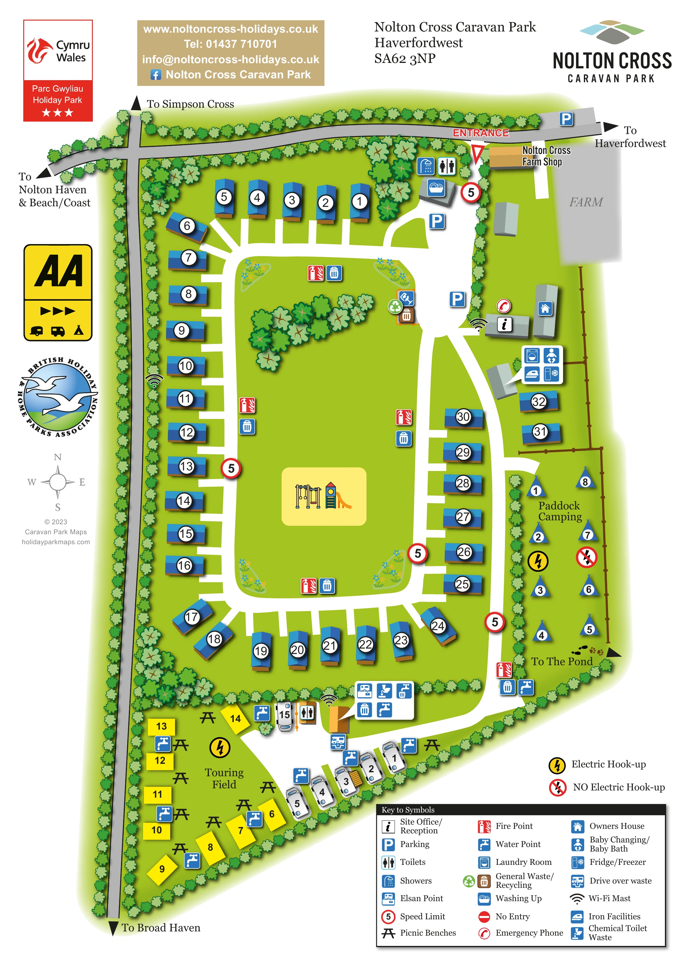
Service information is especially detailed. Symbols identify toilets, showers and washing-up areas, while a building callout groups laundry, baby changing, ironing and fridge/freezer facilities. The southern service cluster marks Elsan, chemical toilet waste and drive-over waste provision. Fire points, bins, recycling, Wi-Fi masts and an emergency phone are also located on the plan. A three-column legend explains the pictograms, with the electric hook-up key placed above it. The accompanying detail images enlarge portions of this same sheet rather than adding another map variant.
KEEP EXPLORING
Chosen for shared landscapes, accommodation or facilities.
 Explore the map ↗
United Kingdom
A colour-zoned coastal park map with touring areas, woodland trails, ponds and a leisure club.
 Explore the map ↗
United Kingdom
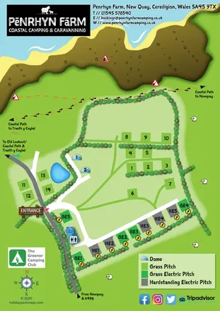
A colourful coastal farm campsite map with electric pitches, geodesic domes and footprint-marked walking routes.
 Explore the map ↗
United Kingdom
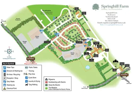
Mixed-accommodation farm map with separate entrances, touring loops, wigwams, cottages and an open camping meadow.
Features may come from the sample artwork, its key or published park information. Approximate numbers describe the drawing and may cover only part of a park. They are intended to help you compare map examples. Current facilities and booking information should be checked with the park.
TAKE A CLOSER LOOK
View the illustrated map in detail or choose a file to download. These are sample maps; contact the park for current visitor information.


LET’S MAP YOUR PARK
For a map quotation, find your park and draw a rough boundary around it. The area you select helps us work out the design time and price.
Draw your park for a quote ↗Or talk to our map designers
01751 473136