
Shop Field, Wood Path Field and Caravan Field
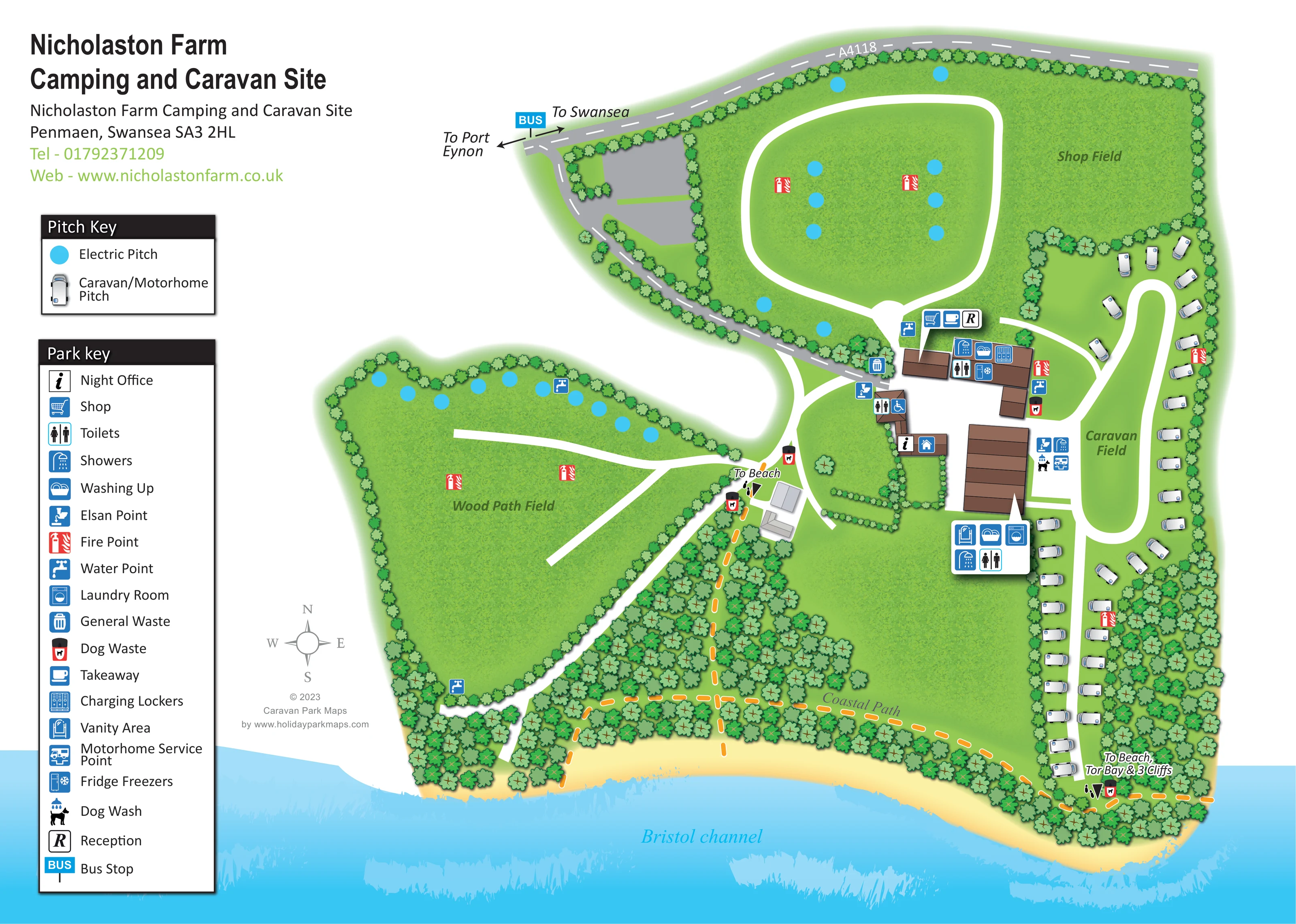
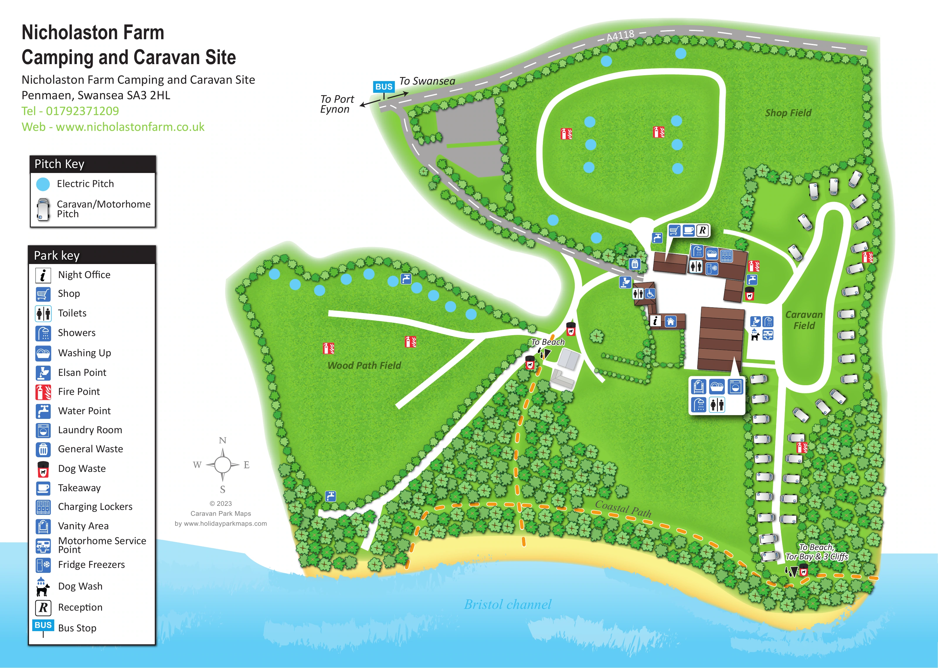
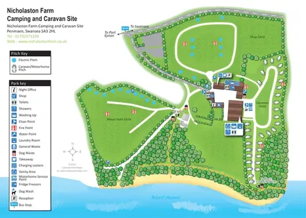
Three named areas provide the map's main spatial framework: a broad northern field, a western wedge-shaped field and an elongated eastern caravan area.
ILLUSTRATED PARK MAP · P551
Nicholaston Farm Camping and Caravan Site, Penmaen, Swansea · United Kingdom
 Enlarge the map ↗
A SENSE OF THE PLACE
Nicholaston Farm is a working family farm and campsite on the Gower Peninsula. Its south-facing meadow overlooks Tor Bay and Crawley Woods, with access to the coast between Oxwich and Three Cliffs Bay.
Tents, caravans and motorhomes are welcomed. Modern amenity blocks, heated facilities and a shop support stays, while the Gower Coast Path and nearby beaches provide opportunities for exploring outdoors.
LOOK CLOSER
Three named areas provide the map's main spatial framework: a broad northern field, a western wedge-shaped field and an elongated eastern caravan area.
Tree-symbol borders enclose the fields, while denser woodland fills the coastal edge and the space south of the central buildings.
A yellow shoreline and broad blue Bristol Channel form the lower edge of the illustration.
An R symbol identifies reception beside the shop and takeaway symbols at the central building group.
The information-style night-office symbol is placed on a smaller building south-west of the main amenity cluster.
Shopping-trolley and cup symbols sit together near reception, between Shop Field and the central courtyard.
Toilet and shower symbols mark several locations around the central buildings. A wheelchair symbol accompanies one toilet location, without establishing wider accessibility provision.
Washing-up symbols appear in the main building cluster and the southern amenity-symbol panel.
An R symbol identifies reception beside the shop and takeaway symbols at the central building group.
The information-style night-office symbol is placed on a smaller building south-west of the main amenity cluster.
Shopping-trolley and cup symbols sit together near reception, between Shop Field and the central courtyard.
Toilet and shower symbols mark several locations around the central buildings. A wheelchair symbol accompanies one toilet location, without establishing wider accessibility provision.
Washing-up symbols appear in the main building cluster and the southern amenity-symbol panel.
A washing-machine symbol appears in the southern amenity group beside the larger brown-roofed building.
A locker symbol is placed with the facilities on the northern side of the main building cluster.
The fridge-freezer symbol appears with the main amenity-building icons.
The mirror-style vanity symbol is included in the southern amenity panel.
Elsan symbols occur near the central buildings, with a motorhome-service symbol in the group beside Caravan Field.
A dog-under-shower symbol is placed beside the central buildings on the Caravan Field side.
Repeated tap symbols identify water points around the field edges and central facilities.
Red fire-point symbols are distributed through Shop Field, Wood Path Field and Caravan Field.
General waste is marked near the main facilities; dog-waste bins appear near buildings and walking-route exits.
Bright cyan circles indicate electric pitches in Shop Field and along the northern edge of Wood Path Field.
Three named areas provide the map's main spatial framework: a broad northern field, a western wedge-shaped field and an elongated eastern caravan area.
Tree-symbol borders enclose the fields, while denser woodland fills the coastal edge and the space south of the central buildings.
A yellow shoreline and broad blue Bristol Channel form the lower edge of the illustration.
An orange dashed route threads through the coastal woodland and along the southern side of the site.
Walking exits are labelled To Beach near the central-western junction and To Beach, Tor Bay & 3 Cliffs at the southern end of Caravan Field. Small footprint symbols reinforce the pedestrian destinations.
The A4118 runs across the top of the map, with arrows towards Port Eynon and Swansea. A grey approach descends to the central buildings.
A blue BUS marker is shown beside the A4118 near the site approach.
READING THE MAP
This illustrated map of Nicholaston Farm Camping and Caravan Site places its three named fields between the A4118 and the wooded shore of the Bristol Channel. Set on the Gower Peninsula at Penmaen, the campsite is presented as a collection of open grass areas, touring pitches and central service buildings, with beach access woven into the visitor information.
Shop Field occupies the broad northern section, Wood Path Field spreads towards the west, and Caravan Field follows a long loop on the eastern side. Blue dots identify electric pitches, while small caravan and motorhome illustrations show the touring layout. The map avoids a numbered plot grid, relying instead on field names, clear circulation routes and recognisable facility symbols.
Its coastal character is especially prominent: dense illustrated trees border a yellow shoreline, the Bristol Channel fills the lower edge, and an orange dashed Coastal Path connects with labelled beach routes. Two separate keys explain pitches and facilities, making this a useful sample for campsites that need to show both practical services and their relationship with surrounding countryside.
The plan is organised around three green, tree-bounded fields and a central cluster of brown-roofed buildings. The A4118 follows the northern edge, with a bus-stop marker and arrows towards Swansea and Port Eynon. From this road, a grey approach curves down to the main facilities. Broad white routes then distribute visitors through the site: a rounded loop in Shop Field, branching access in Wood Path Field and an elongated loop through Caravan Field.
Accommodation is represented in two distinct ways. Cyan circles mark electric pitches in the open camping areas, while small white caravan/motorhome symbols line the eastern touring routes. These vehicle illustrations suggest roughly 35 touring pitches, but the open fields do not support a reliable overall capacity estimate. Field names, rather than individual pitch numbers, provide the principal accommodation labels.
Around the central buildings, grouped symbols identify reception, the shop, takeaway, toilets, showers and washing-up facilities. Other mapped amenities include a night office, laundry room, charging lockers, fridge freezers and a vanity area. Elsan points, a motorhome service point and a dog wash are also shown. Repeated symbols mark water, fire and waste points across the plan.
The southern landscape is given considerable space. Overlapping tree crowns create a wooded belt above a sandy shoreline and textured blue sea. An orange dashed Coastal Path runs through this area, with walking connections labelled for the beach and for Tor Bay and 3 Cliffs. A compass rose supports orientation. The accompanying enlargement repeats part of the same artwork, clarifying the two legends and western field rather than introducing a separate map or additional accommodation.
KEEP EXPLORING
Chosen for shared landscapes, accommodation or facilities.
 Explore the map ↗
United Kingdom
A colour-zoned coastal park map with touring areas, woodland trails, ponds and a leisure club.
 Explore the map ↗
United Kingdom
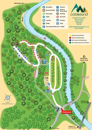
Colour-coded camping pitches, woodland routes and River Forth frontage at Cobleland Campsite.
 Explore the map ↗
United Kingdom
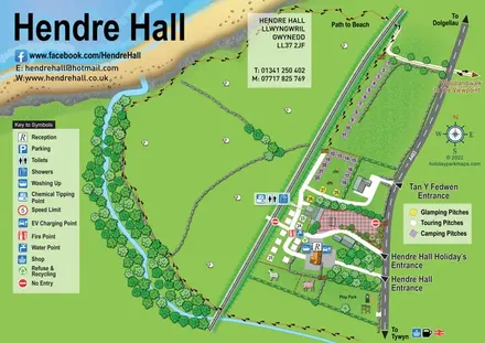
Coastal camping, touring and glamping map with a railway-side layout, beach path and illustrated rural surroundings.
Features may come from the sample artwork, its key or published park information. Approximate numbers describe the drawing and may cover only part of a park. They are intended to help you compare map examples. Current facilities and booking information should be checked with the park.
TAKE A CLOSER LOOK
View the illustrated map in detail or choose a file to download. These are sample maps; contact the park for current visitor information.


LET’S MAP YOUR PARK
For a map quotation, find your park and draw a rough boundary around it. The area you select helps us work out the design time and price.
Draw your park for a quote ↗Or talk to our map designers
01751 473136
 nicholastonfarm_large.png