
Animal paddocks
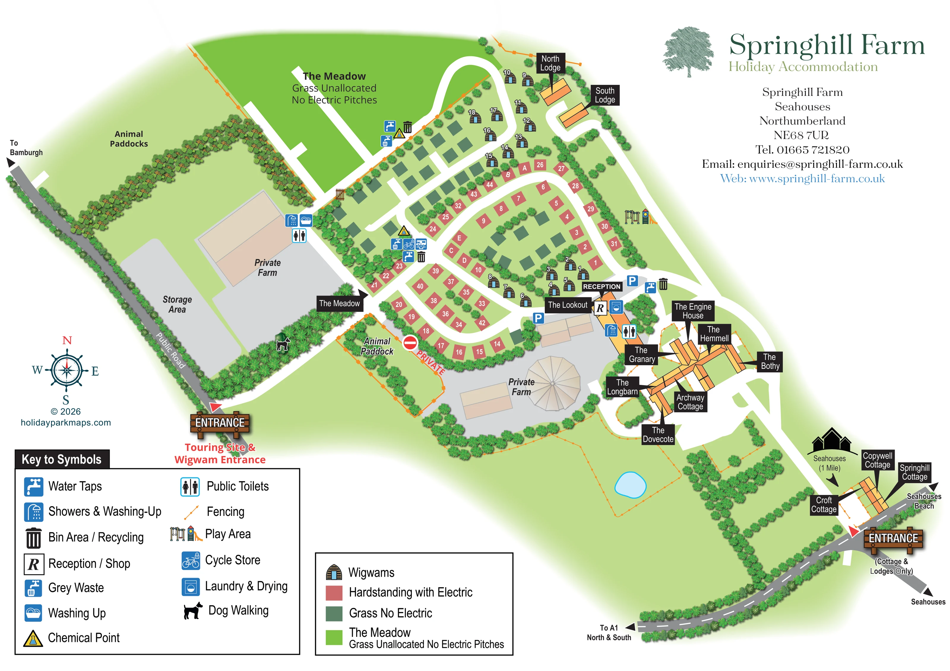
A large paddock lies west of The Meadow, with a smaller fenced animal paddock beside the touring entrance lane.
ILLUSTRATED PARK MAP · P311
Springhill Farm, Seahouses, Northumberland · United Kingdom
 Enlarge the map ↗
A SENSE OF THE PLACE
Springhill Farm offers holidays on a working farm between Seahouses and Bamburgh on the Northumberland coast. Views towards the Farne Islands, Bamburgh and the Cheviots are part of its countryside setting.
Cottages, lodges, wigwams, touring pitches and camping provide a broad choice of accommodation. Dog-friendly options are available, and the map helps visitors locate the different parts of the farm's holiday accommodation.
LOOK CLOSER
A large paddock lies west of The Meadow, with a smaller fenced animal paddock beside the touring entrance lane.
Private working-farm yards and a storage area are distinguished from visitor accommodation; a PRIVATE label and no-entry symbol mark an internal branch.
A small pale-blue pond is drawn within a fenced field below the farm-building cluster.
Dense illustrated planting divides accommodation groups and borders roads; orange fence lines define several paddocks and grounds.
An R symbol and reception callout identify the arrival hub beside The Lookout and the central farm buildings.
Grouped symbols identify washing and toilet facilities beside the western farm building and near the reception-side buildings.
Blue tap symbols appear at several service points around the camping and touring areas.
Grey-waste and yellow triangular chemical-point symbols mark service clusters near The Meadow and the central pitch lanes.
An R symbol and reception callout identify the arrival hub beside The Lookout and the central farm buildings.
Grouped symbols identify washing and toilet facilities beside the western farm building and near the reception-side buildings.
Blue tap symbols appear at several service points around the camping and touring areas.
Grey-waste and yellow triangular chemical-point symbols mark service clusters near The Meadow and the central pitch lanes.
Black bin symbols accompany several service points rather than a single isolated waste area.
A blue washing-machine symbol is placed beside the reception-side buildings.
A bicycle-and-lock symbol marks storage at the central touring service cluster.
A small illustrated swing and slide sit on the eastern edge of the main touring area.
A dog symbol marks the tree-lined strip beside the western entrance lane; no detailed walking circuit is drawn.
Blue P symbols identify parking around reception and The Lookout.
A named building beside the central arrival hub; its specific visitor function is not explained.
A large paddock lies west of The Meadow, with a smaller fenced animal paddock beside the touring entrance lane.
Private working-farm yards and a storage area are distinguished from visitor accommodation; a PRIVATE label and no-entry symbol mark an internal branch.
A small pale-blue pond is drawn within a fenced field below the farm-building cluster.
Dense illustrated planting divides accommodation groups and borders roads; orange fence lines define several paddocks and grounds.
The western entrance is labelled for the touring site and wigwams; the eastern entrance is labelled for cottages and lodges only.
Public-road arrows point towards Bamburgh, Seahouses and the A1 north and south. Seahouses Beach is labelled beside the eastern approach, and a separate Seahouses callout states one mile.
READING THE MAP
This illustrated map of Springhill Farm brings together several kinds of holiday accommodation within a working-farm setting near Seahouses on the Northumberland coast. Rather than presenting the site as one uniform block of pitches, it gives each area a clear identity: looping touring lanes, groups of timber wigwams, named cottages, two lodges and the broad green space of The Meadow.
The distinction between the two entrances is especially prominent. Wooden sign illustrations and clear captions identify the touring and wigwam approach separately from the cottage and lodge entrance. Within the grounds, coloured pitch rectangles, black building callouts and blue facility symbols help visitors move from the overall layout to the details they need.
Animal paddocks, private farm yards, tree belts and a small pond retain the character of the surrounding countryside. Road arrows towards Bamburgh, Seahouses and the A1 place the accommodation in its local context without turning the artwork into a regional road map. The result is a useful gallery example for mixed-accommodation businesses that need to explain both their visitor areas and their relationship to a wider rural property.
The plan stretches diagonally across the page, with the touring entrance at the lower left and the cottage and lodge entrance at the lower right. Grey public roads frame these approaches, while broad white internal lanes connect the accommodation areas. The central touring section uses curved rows and short branches rather than a rigid grid. Muted red rectangles identify electric hardstandings, dark-green rectangles mark non-electric grass pitches, and small arched cabin illustrations distinguish the wigwams.
At the upper left, The Meadow is shown as a large bright-green field labelled for unallocated grass pitches without electricity. Nearby service symbols mark water, waste and chemical disposal provision. Further clusters of amenity icons appear among the touring lanes and beside the buildings, covering showers, washing-up, public toilets, laundry, cycle storage and bins or recycling. A play area sits along the eastern boundary of the main pitch section, and a dog-walking symbol marks the planted strip near the western approach.
Reception and The Lookout form a central landmark beside parking symbols. Beyond them, black pointer labels identify the closely grouped farm buildings, including The Engine House, The Granary, The Hemmell, The Bothy, The Longbarn, Archway Cottage and The Dovecote. Croft Cottage, Copywell Cottage and Springhill Cottage sit near the eastern entrance, while North Lodge and South Lodge occupy a separate landscaped spur above the wigwams.
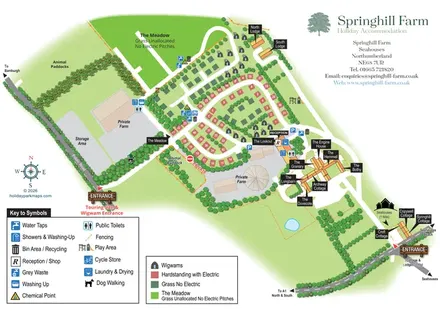
Private farm yards, storage space, animal paddocks and a fenced pond field remain part of the drawing. Two lower-page legends explain facilities and accommodation colours, balanced by the title and contact block at upper right. The enlarged details show these same legends and the eastern approach more clearly; they are not additional map variants.
KEEP EXPLORING
Chosen for shared landscapes, accommodation or facilities.
 Explore the map ↗
United Kingdom
A colour-zoned coastal park map with touring areas, woodland trails, ponds and a leisure club.
 Explore the map ↗
United Kingdom
Woodland-framed Barnsoul map with mixed accommodation, shared facilities and paw-marked walking routes.
 Explore the map ↗
United Kingdom
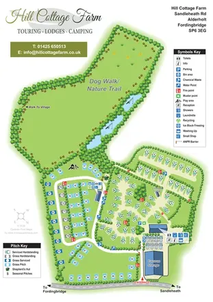
Portrait park map with mixed touring pitches, seasonal rows, ponds and an extensive dog walk.
Features may come from the sample artwork, its key or published park information. Approximate numbers describe the drawing and may cover only part of a park. They are intended to help you compare map examples. Current facilities and booking information should be checked with the park.
TAKE A CLOSER LOOK
View the illustrated map in detail or choose a file to download. These are sample maps; contact the park for current visitor information.


LET’S MAP YOUR PARK
For a map quotation, find your park and draw a rough boundary around it. The area you select helps us work out the design time and price.
Draw your park for a quote ↗Or talk to our map designers
01751 473136
 Springhill-Farm-2026-cottages2.png