
Lake with planted islands
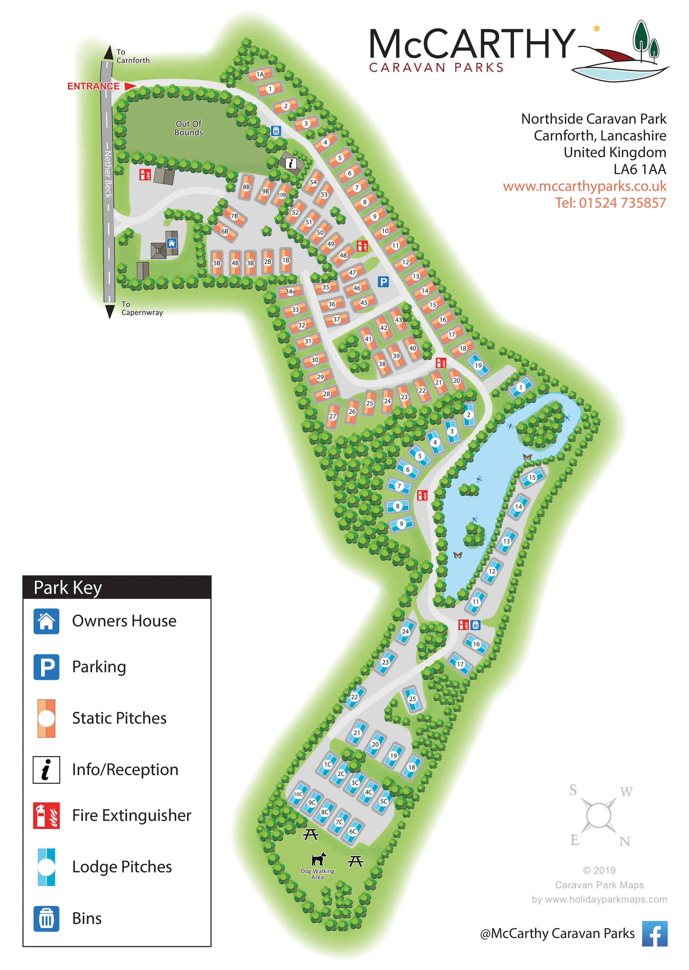
An elongated pale-blue lake forms the centrepiece of the lodge section, with several tree-covered islands and small decorative wildlife motifs.
ILLUSTRATED PARK MAP · P552
Nether Beck, near Carnforth, Lancashire · United Kingdom
 Enlarge the map ↗
A SENSE OF THE PLACE
Northside Caravan Park is a family-run holiday home park near Carnforth. Its location provides a base for enjoying Cumbria and North Lancashire.
Holiday lodges and static caravans occupy serviced plots within the grounds, which include a freshwater lake. The map brings the accommodation, water feature and internal routes together for owners and visitors.
LOOK CLOSER
An elongated pale-blue lake forms the centrepiece of the lodge section, with several tree-covered islands and small decorative wildlife motifs.
Dense clusters of stylised trees define the park boundary, separate accommodation groups and frame the lake and open grass.
A large enclosed green area beside the entrance is explicitly labelled Out Of Bounds.
A black information symbol identifies a small building just inside the entrance-side accommodation area.
A blue house symbol marks a larger roofed building in the side court near Nether Beck.
A blue P symbol marks a parking location within the upper static-pitch section.
Blue bin symbols appear near the entrance-side road and at the lower end of the lake-side loop.
Repeated red extinguisher symbols identify points distributed through the static and lodge sections.
A black information symbol identifies a small building just inside the entrance-side accommodation area.
A blue house symbol marks a larger roofed building in the side court near Nether Beck.
A blue P symbol marks a parking location within the upper static-pitch section.
Blue bin symbols appear near the entrance-side road and at the lower end of the lake-side loop.
Repeated red extinguisher symbols identify points distributed through the static and lodge sections.
A labelled grassy area with a dog pictogram occupies the far end of the park below the final lodge group.
Two picnic table illustrations appear in the grass beside the dog walking area.
An elongated pale-blue lake forms the centrepiece of the lodge section, with several tree-covered islands and small decorative wildlife motifs.
Dense clusters of stylised trees define the park boundary, separate accommodation groups and frame the lake and open grass.
A large enclosed green area beside the entrance is explicitly labelled Out Of Bounds.
A red ENTRANCE label and triangular pointer mark the connection from Nether Beck into the upper end of the park.
The roadside strip labelled Nether Beck carries directional arrows to Carnforth at one end and Capernwray at the other.
A pale-grey access spine connects the entrance courts, static-pitch loops, lake-side circuit and lower lodge groups.
READING THE MAP
This illustrated map of Northside Caravan Park near Carnforth brings a long, tree-lined holiday home park into a single portrait layout. The plan follows the site from its entrance on Nether Beck through the static caravan pitches, around a distinctive lake and onwards to the lodge groups and dog walking area at the far end.
Colour is central to the wayfinding: orange identifies static pitches, while blue picks out lodge pitches. Numbered white circles keep individual locations readable against the green landscaping and pale-grey roads. The lake, planted islands and enclosing tree belts give visitors useful landmarks as well as a sense of the park's setting.
A large Park Key explains the accommodation colours and the symbols for reception, the owner's house, parking, bins and fire extinguishers. Roadside arrows towards Carnforth and Capernwray establish the arrival context. McCarthy Caravan Parks branding and a separate contact block complete a design that combines practical pitch finding with a clear overview of the park's landscaped layout.
The plan begins at the upper left, where a red entrance pointer connects Nether Beck to the park's curving internal road. Directional arrows on the external road point towards Carnforth and Capernwray. Immediately inside, the route skirts a tree-enclosed green space labelled Out Of Bounds. Reception is marked beside the main route, while a side court contains the owner's house, several static pitches and a fire extinguisher point.
The upper accommodation area is drawn predominantly in orange. Pitches follow the outer boundary and form shorter rows around branching roads and open manoeuvring spaces. A parking symbol sits within this section, and white circular plot labels remain consistent across the different pitch alignments. Tree clusters break up the rows and distinguish the side court from the larger accommodation area.
Further down the page, blue lodge pitches gather around an elongated lake. A pale-grey road follows both sides of the water, creating a recognisable circuit with lodges facing onto the route. Small wooded islands, planted banks and decorative wildlife motifs make the water feature visually distinctive. The road then continues into further lodge groups before reaching a grassy dog walking area illustrated with a dog and picnic tables.
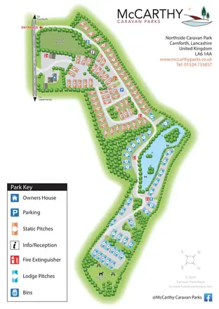
The whole artwork is presented on one portrait sheet. Its large lower-left key explains seven accommodation and facility symbols, while branding and contact information occupy the upper-right white space. A small compass and designer credit sit below. The accompanying enlargement shows the same key and a fragment of the lower park at a more readable scale; it is a detail view, not a separate map or additional accommodation area.
KEEP EXPLORING
Chosen for shared landscapes, accommodation or facilities.
 Explore the map ↗
United Kingdom
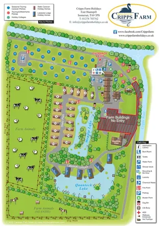
Illustrated farm holiday park plan combining riverside pitches, lakeside accommodation, animal fields and paw-print walking routes, with separate accommodation and facilities keys.
 Explore the map ↗
United Kingdom
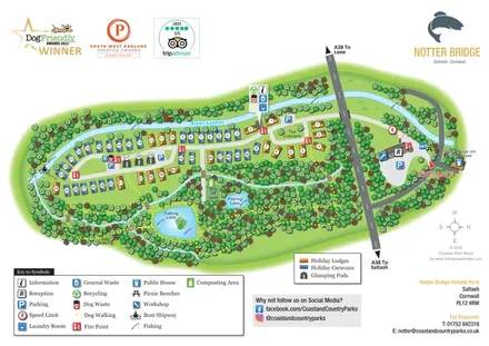
Illustrated riverside park map with colour-coded accommodation, fishing lakes and woodland dog-walking routes.
 Explore the map ↗
United Kingdom
Ashby Park map with seven fishing lakes, colour-coded accommodation and illustrated wooded shorelines.
Features may come from the sample artwork, its key or published park information. Approximate numbers describe the drawing and may cover only part of a park. They are intended to help you compare map examples. Current facilities and booking information should be checked with the park.
TAKE A CLOSER LOOK
View the illustrated map in detail or choose a file to download. These are sample maps; contact the park for current visitor information.


LET’S MAP YOUR PARK
For a map quotation, find your park and draw a rough boundary around it. The area you select helps us work out the design time and price.
Draw your park for a quote ↗Or talk to our map designers
01751 473136