
Tree-lined boundary and planted divisions
Repeated rounded tree illustrations enclose the park, divide accommodation rows and frame the central play space.
ILLUSTRATED PARK MAP · P556
California Road, near Hemsby and Caister-on-Sea, Norfolk · United Kingdom
 Enlarge the map ↗
A SENSE OF THE PLACE
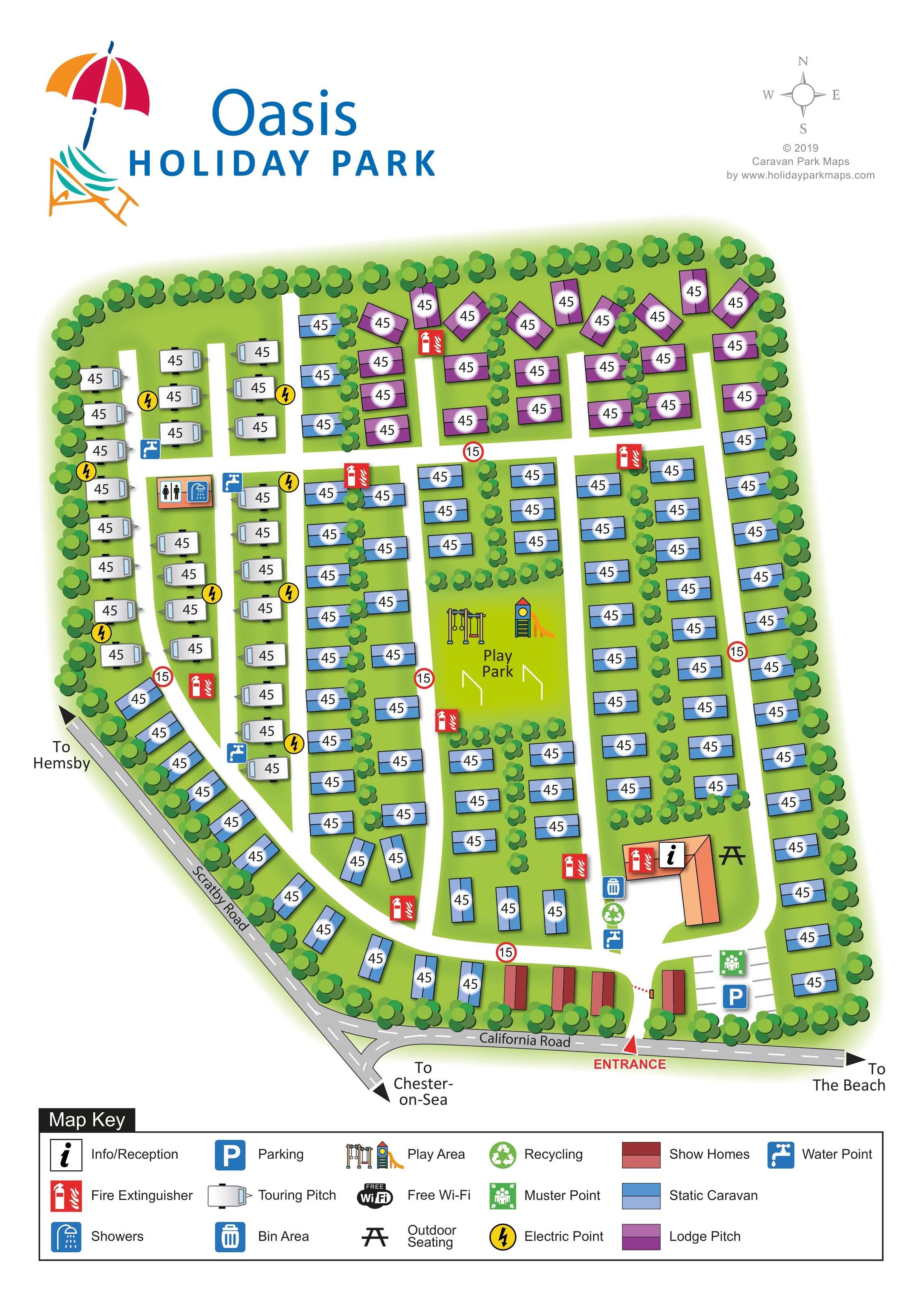
The Oasis Holiday Park artwork presents a coastal park concept in the Scratby and California area of Norfolk. It combines holiday-home areas, touring spaces and visitor facilities in one illustrated layout.
Road labels and coastal landmarks provide context around the park, while internal routes connect the different accommodation zones. The example is presented as artwork, with the map's repeated sample pitch labels retained as part of the original design.
LOOK CLOSER
Repeated rounded tree illustrations enclose the park, divide accommodation rows and frame the central play space.
An information symbol identifies the orange-roofed building immediately inside the southern entrance, beside the parking and service area.
A small group of red, two-tone show-home symbols lines the California Road frontage near the entrance, distinct from the accommodation colours.
A labelled green space in the centre of the accommodation contains illustrated swings, a slide tower and white goal-like frames.
A small orange-roofed building in the western touring section carries male and female toilet pictograms and the blue shower symbol.
Marked parking bays and a blue parking symbol sit just inside the entrance, south of reception.
A picnic-table symbol marks seating on the grass to the east of reception.
Blue tap symbols are distributed through the touring area and near the reception service cluster.
An information symbol identifies the orange-roofed building immediately inside the southern entrance, beside the parking and service area.
A small group of red, two-tone show-home symbols lines the California Road frontage near the entrance, distinct from the accommodation colours.
A labelled green space in the centre of the accommodation contains illustrated swings, a slide tower and white goal-like frames.
A small orange-roofed building in the western touring section carries male and female toilet pictograms and the blue shower symbol.
Marked parking bays and a blue parking symbol sit just inside the entrance, south of reception.
A picnic-table symbol marks seating on the grass to the east of reception.
Blue tap symbols are distributed through the touring area and near the reception service cluster.
Yellow circular lightning symbols mark several electric points in the western touring section.
A blue bin symbol and green recycling symbol appear together beside reception.
Red extinguisher symbols are distributed beside internal roads across the touring, static-caravan and lodge sections.
A green assembly symbol marks a muster point beside the entrance parking bays.
Free Wi-Fi is included in the map key, but no corresponding location or coverage area is apparent on the main plan.
Repeated rounded tree illustrations enclose the park, divide accommodation rows and frame the central play space.
A red arrow and ENTRANCE label identify the southern access from California Road.
Broad white roads connect the entrance to a curved southern route, long north–south lanes and an upper cross-road. Red-ringed 15 markers recur along the roads.
California Road follows the southern frontage and joins Scratby Road, which runs diagonally along the western boundary.
External road arrows point towards Hemsby, The Beach and the place labelled Chester-on-Sea. These are directional references rather than illustrated destinations within the park.
READING THE MAP
This illustrated map of Oasis Holiday Park presents a coastal holiday-park concept in the Scratby and California area of Norfolk. The portrait layout brings together three clearly differentiated accommodation zones: grey touring caravans to the west, purple lodge pitches across the northern end and blue static caravans through the centre and east. A generous green play park provides a focal point between the rows, while reception, parking and show homes form a compact arrival area beside California Road.
The seaside character begins in the header, where a colourful parasol and deckchair accompany the large blue park name. Within the plan, rounded trees frame the boundary and separate accommodation groups, giving the otherwise orderly road layout a softer appearance. Scratby Road, California Road and arrows towards Hemsby and the beach place the park in its local setting without extending the illustration into a wider area map.
A broad pictorial key explains the accommodation colours and visitor-service symbols. The result is a useful sample for mixed-accommodation parks that need one approachable plan to communicate both their overall organisation and the facilities visitors look for on arrival.
The plan occupies an irregular, tree-lined site between California Road along the southern frontage and Scratby Road on the diagonal western edge. Entry is marked by a red arrow at the bottom of the illustration. Immediately inside, a group of red show homes, marked parking bays and a green muster-point symbol lead the eye towards the larger orange-roofed reception building. Outdoor seating, a bin area, recycling and a water point are shown around this arrival cluster.
White internal roads organise the accommodation into long rows. The western touring section uses grey caravan illustrations with tow bars and wheels, supported by several electric and water-point symbols. Its small amenity building displays toilet and shower pictograms. Across the northern end, purple lodge pitches form a separate band, with some angled footprints introducing variety to the regular arrangement. Blue static caravans occupy the larger central and eastern areas and continue around the curved south-western boundary.
The labelled Play Park sits centrally between the accommodation lanes. Illustrated swings, a slide tower and white goal-like frames distinguish it from the surrounding grass, while planting encloses parts of its edge. Red extinguisher symbols and red-ringed 15 markers recur beside the roads. Rows of rounded trees separate accommodation groups and create a continuous perimeter.
Outside the site, grey roads with dashed centre lines carry local road names and destination arrows. Above the plan, the park logo shares the page with a compass and designer credit; below it, a wide boxed legend explains facilities and accommodation types. The accompanying detail views enlarge portions of this same legend rather than showing additional park sections. Free Wi-Fi is listed in the key without a plotted location.
KEEP EXPLORING
Chosen for shared landscapes, accommodation or facilities.
 Explore the map ↗
United Kingdom
A colour-zoned coastal park map with touring areas, woodland trails, ponds and a leisure club.
 Explore the map ↗
United Kingdom
Colour-coded accommodation, central leisure facilities and coastal paths on an illustrated headland park map.
 Explore the map ↗
United Kingdom
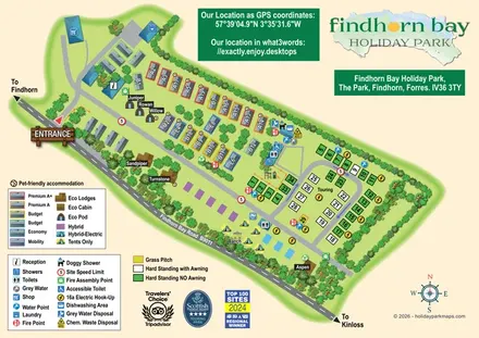
Illustrated mixed-accommodation park plan with colour-coded caravans, named eco units and a touring loop.
Features may come from the sample artwork, its key or published park information. Approximate numbers describe the drawing and may cover only part of a park. They are intended to help you compare map examples. Current facilities and booking information should be checked with the park.
LET’S MAP YOUR PARK
For a map quotation, find your park and draw a rough boundary around it. The area you select helps us work out the design time and price.
Draw your park for a quote ↗Or talk to our map designers
01751 473136