
Boundary watercourse
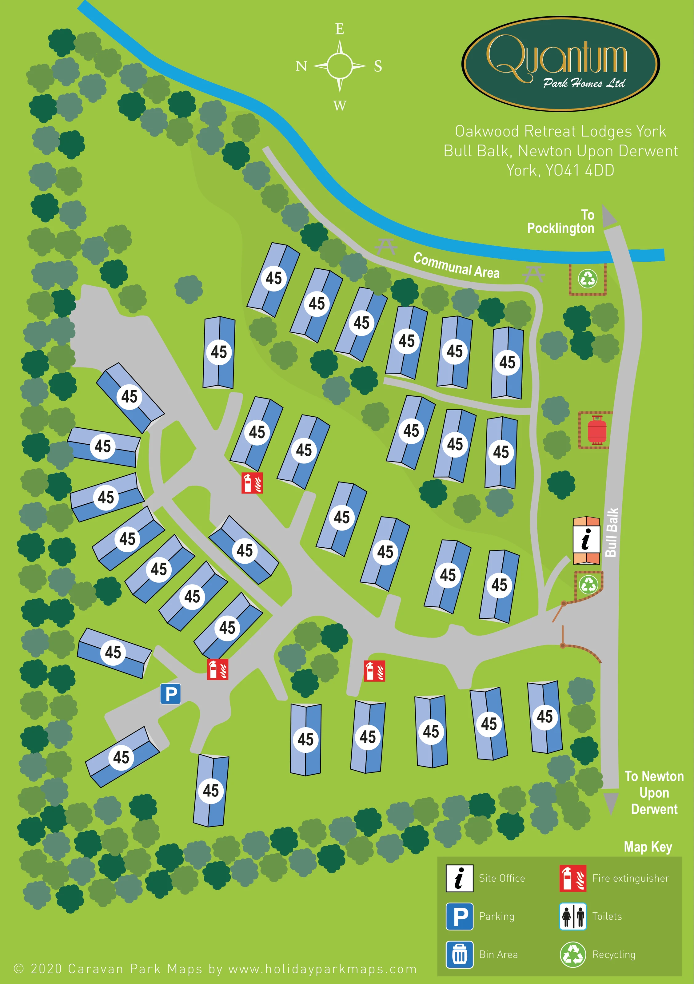
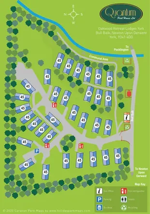
An unnamed bright-blue watercourse curves across the upper edge of the plan and meets the Bull Balk road crossing.
ILLUSTRATED PARK MAP · P555
Bull Balk, Newton upon Derwent, York · United Kingdom
 Enlarge the map ↗
A SENSE OF THE PLACE
Oakwood Retreat Country Park is based at Bull Balk, Newton upon Derwent, York. The park markets holiday homes with open-plan interiors and private decking. This is a family-owned park associated with Aaron Fletcher and Fletchers Park Estates.
The park is gated and welcomes dogs.
LOOK CLOSER
An unnamed bright-blue watercourse curves across the upper edge of the plan and meets the Bull Balk road crossing.
Dense belts of stylised trees frame the left and lower boundaries, with further planting between lodges and around the communal strip.
An orange-roofed building with the keyed information symbol stands beside Bull Balk, just above the entrance.
A blue parking symbol marks a space beside the internal road in the lower-left part of the plan.
Two green recycling symbols appear in small outlined enclosures along the Bull Balk side, one beside the communal area and one near the office and entrance.
Red fire extinguisher symbols are distributed beside the internal roads.
A labelled green strip follows the curved upper boundary between the accommodation and the blue watercourse.
Picnic-table illustrations mark the communal strip beside the watercourse.
An orange-roofed building with the keyed information symbol stands beside Bull Balk, just above the entrance.
A blue parking symbol marks a space beside the internal road in the lower-left part of the plan.
Two green recycling symbols appear in small outlined enclosures along the Bull Balk side, one beside the communal area and one near the office and entrance.
Red fire extinguisher symbols are distributed beside the internal roads.
Toilets are included in the map key, but no corresponding location is clearly identified on the main plan.
A blue bin-area symbol is included in the key. Its position is not clearly established on the plan.
A labelled green strip follows the curved upper boundary between the accommodation and the blue watercourse.
Picnic-table illustrations mark the communal strip beside the watercourse.
An unnamed bright-blue watercourse curves across the upper edge of the plan and meets the Bull Balk road crossing.
Dense belts of stylised trees frame the left and lower boundaries, with further planting between lodges and around the communal strip.
Illustrated gate leaves mark the junction between Bull Balk and the main internal access road.
The named road runs down the right-hand side of the plan, serving the park entrance and roadside office.
Directional labels at opposite ends of Bull Balk provide wider geographical orientation.
Broad grey roads branch through the lodge groups; a narrower grey route curves beside the communal area and upper accommodation.
READING THE MAP
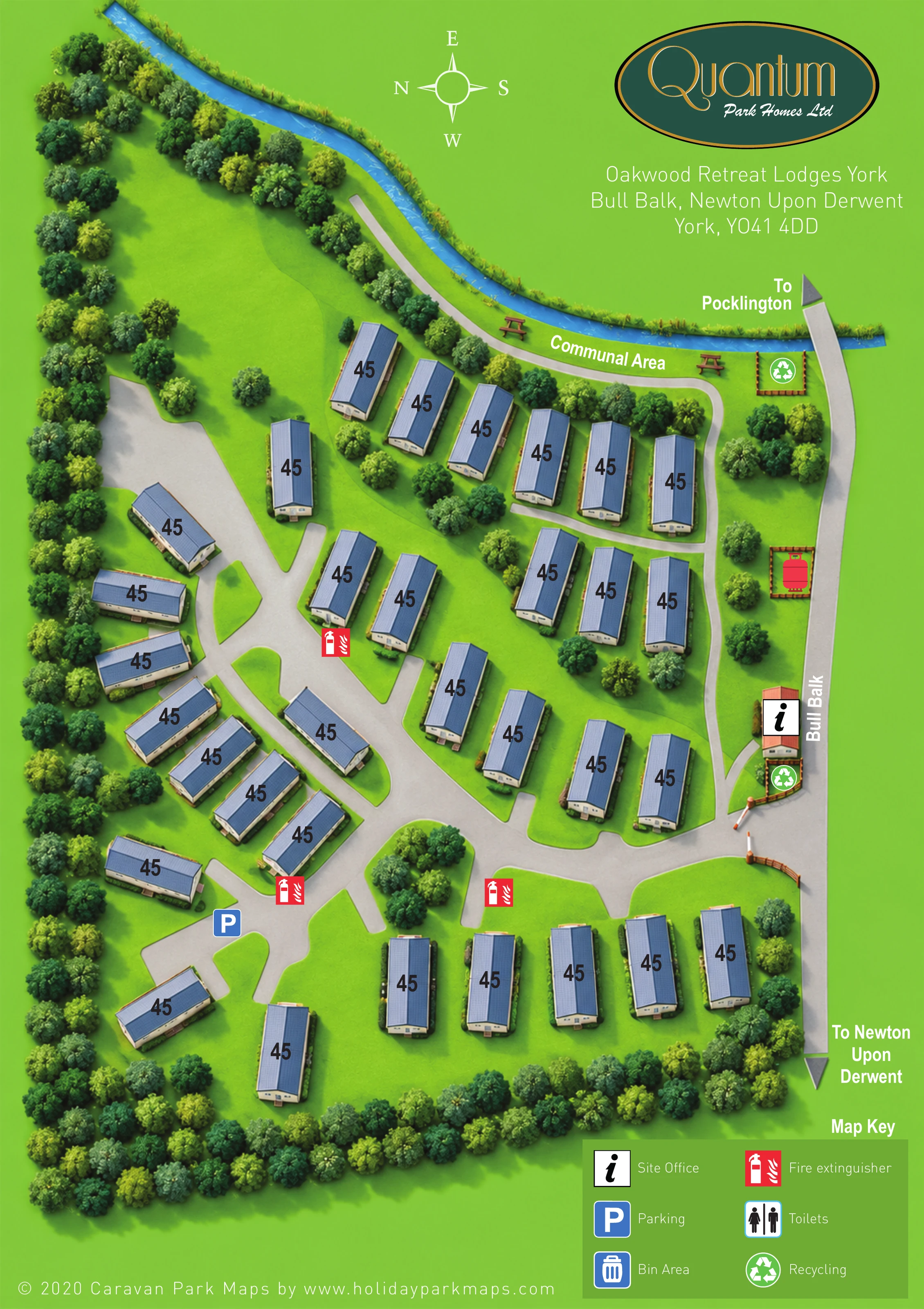
This map of Oakwood Retreat Country Park at Newton upon Derwent, near York, presents a compact lodge development within a strongly planted setting. The artwork is titled Oakwood Retreat Lodges York and shows roughly 35 blue-roofed accommodation units arranged around curved access roads, with Bull Balk providing the approach along the right-hand edge.
A bright-blue watercourse sweeps across the top of the plan, beside a labelled communal area with picnic-table illustrations. Dense tree belts enclose the opposite boundaries, while smaller groups of trees separate the lodges and soften the road junctions. The entrance gate, roadside office, parking, recycling points and fire extinguisher symbols give visitors a practical set of landmarks.
The portrait composition combines a simple overhead plan with a prominent brand panel, local direction labels and a compact map key. Its distinctive east-up orientation makes the compass particularly useful. This sample is relevant to smaller lodge and holiday-home developments that need to explain an irregular layout without losing the character of their landscaped surroundings.
The plan is organised around three clear edges: the curved blue watercourse above, Bull Balk on the right and a thick belt of trees along the left and lower boundaries. Its compass places east at the top rather than using a conventional north-up arrangement. Labels towards Pocklington and Newton upon Derwent help connect the park entrance to the surrounding road network.
Visitors enter through an illustrated gate from Bull Balk. An orange-roofed site office sits just above the entrance, identified by a large information symbol. From here, a broad grey road leads into the park and branches around a planted central island. Further curved sections and short spurs serve angled groups of lodges on the left and straighter rows towards the right and lower edge. A parking symbol appears beside the lower-left road branch.
The accommodation is drawn consistently as elongated blue pitched-roof forms with black outlines and large white circular markers. Rotating the units to match their positions gives the plan a more individual arrangement than a simple grid. Grass spaces and scattered tree symbols remain visible between the buildings.
Along the upper boundary, a narrower grey route follows the labelled communal area, with picnic tables beside the watercourse. Recycling symbols mark two roadside enclosures, and red fire extinguisher symbols appear beside internal routes. The lower-right key also includes toilets and a bin area, although these symbols do not have clearly identifiable positions on the main plan.
The single portrait artwork carries Quantum Park Homes Ltd branding above the address. The accompanying close-up views enlarge the footer and legend; they are details of this same design, not additional park sections.
 Enlarge this map ↗
KEEP EXPLORING
Chosen for shared landscapes, accommodation or facilities.
 Explore the map ↗
United Kingdom
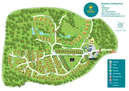
A woodland holiday-park plan with numbered homes, tree-named roads, walking loops and a distinctive entrance totem pole.
 Explore the map ↗
United Kingdom
Illustrated lakeside park plan with numbered holiday units, leisure buildings and a looping Woodland Walk.
 Explore the map ↗
United Kingdom
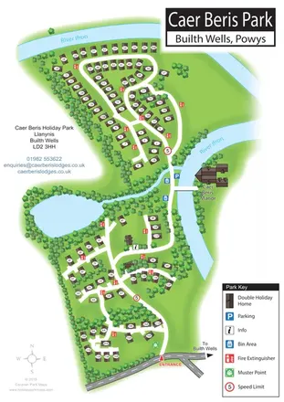
Portrait holiday-home park map with riverside loops, a tree-fringed pond and a separate manor landmark.
Features may come from the sample artwork, its key or published park information. Approximate numbers describe the drawing and may cover only part of a park. They are intended to help you compare map examples. Current facilities and booking information should be checked with the park.
TAKE A CLOSER LOOK
View the illustrated map in detail or choose a file to download. These are sample maps; contact the park for current visitor information.


LET’S MAP YOUR PARK
For a map quotation, find your park and draw a rough boundary around it. The area you select helps us work out the design time and price.
Draw your park for a quote ↗Or talk to our map designers
01751 473136