
River Avon
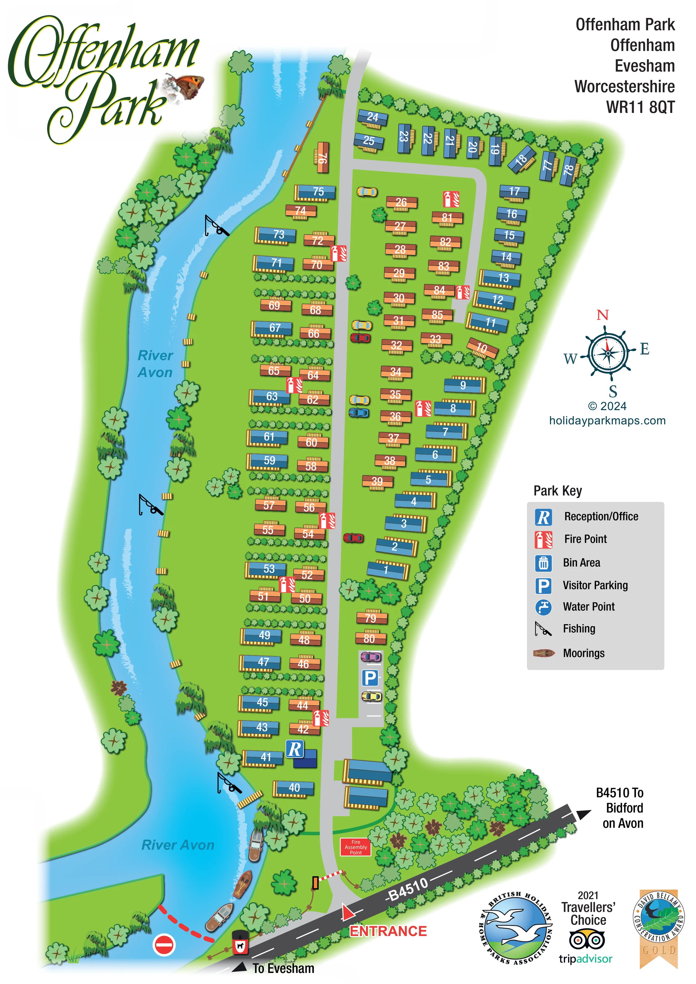
The River Avon follows the full western side of the park and broadens into a bend at the southern end.
ILLUSTRATED PARK MAP · P235
Offenham Park, Offenham, Evesham, Worcestershire · United Kingdom
 Enlarge the map ↗
A SENSE OF THE PLACE
Offenham Park is a family-run holiday home park in the Vale of Evesham. Mature landscaped grounds and surrounding countryside provide the setting for permanently sited holiday caravans.
The park is for holiday use rather than residential living. Its map sets out the plot arrangement and internal roads, helping owners and visitors understand the layout of this Worcestershire site.
LOOK CLOSER
The River Avon follows the full western side of the park and broadens into a bend at the southern end.
A continuous eastern hedge, repeated planted divisions between caravans, riverside trees and a wooded entrance area structure the grounds.
Small timber-coloured platforms punctuate the river edge. Their individual functions are not labelled.
A blue R marker identifies the reception/office building near the southern end of the accommodation rows, beside the main internal road.
A marked parking strip with a blue P symbol and illustrated cars lies on the eastern side of the main road near reception.
Repeated red fire-point symbols are distributed through the accommodation rows.
A red labelled assembly-point panel is shown in the landscaped entrance area.
Fishing-rod symbols mark several locations along the park's River Avon frontage.
A blue R marker identifies the reception/office building near the southern end of the accommodation rows, beside the main internal road.
A marked parking strip with a blue P symbol and illustrated cars lies on the eastern side of the main road near reception.
Repeated red fire-point symbols are distributed through the accommodation rows.
A red labelled assembly-point panel is shown in the landscaped entrance area.
Fishing-rod symbols mark several locations along the park's River Avon frontage.
Illustrated boats beside the southern riverbank indicate moorings, supported by the boat symbol in the key.
A bin-area symbol is included in the Park Key; a corresponding position is not clearly identifiable on the plan.
A tap symbol identifies water points in the key, without a clearly identifiable mapped location.
The River Avon follows the full western side of the park and broadens into a bend at the southern end.
A continuous eastern hedge, repeated planted divisions between caravans, riverside trees and a wooded entrance area structure the grounds.
Small timber-coloured platforms punctuate the river edge. Their individual functions are not labelled.
A large red entrance label and arrow identify access from the B4510, with an illustrated barrier across the approach.
A grey road runs north from the entrance, with a curved return around the northern accommodation group and a short parking spur near reception.
The B4510 is labelled across the bottom of the artwork, with directional arrows towards Evesham and Bidford on Avon.
READING THE MAP
The River Avon gives this Offenham Park map its distinctive shape. Running down the left-hand side of the artwork, the river frames a long, narrow holiday caravan park in Offenham, near Evesham in Worcestershire. Fishing symbols, moored boats and small riverside platforms make the waterside setting immediately recognisable, while trees and planted boundaries give structure to the accommodation areas.
The map shows approximately 80 holiday caravans arranged around a central access road, with reception and visitor parking near the southern entrance. Large white plot numbers sit directly on blue and terracotta roofs, allowing the accommodation layout to remain legible without filling the grounds with separate text labels. Red fire-point symbols provide a second, clearly contrasting layer of information.
Designed as a portrait page, the artwork uses the open right-hand margin for the address, compass and Park Key. The B4510 and directions towards Evesham and Bidford on Avon anchor the arrival route at the bottom. An ornate green title, butterfly motif and illustrated planting give the plan a recognisable park identity alongside its practical wayfinding role.
The plan follows Offenham Park from its B4510 entrance at the bottom of the page to the northern accommodation boundary at the top. A red entrance arrow draws attention to the access point, followed by an illustrated barrier and a pale grey road running through the centre of the park. Reception is marked with a blue R beside the lower accommodation rows, and a short visitor-parking strip branches off on the eastern side. A labelled fire assembly point sits within the landscaped entrance area.
Further north, the road serves parallel groups of holiday caravans before curving around the upper plots. The eastern accommodation row follows a continuous hedge, while many western plots are divided by bands of small shrubs. Blue and terracotta caravan roofs, timber-coloured decks and large white numbers create a consistent visual language. The colours are not defined as different accommodation categories in the key.
The River Avon occupies the western edge throughout. Its blue surface includes pale reflective strokes, and the banks are lined with a mixture of rounded trees and willow-like forms. Fishing symbols appear at several points along the frontage, with boats illustrated near the southern bend. Small timber-coloured platforms add further detail to the river edge.
A grey Park Key explains reception, fire points, bin area, visitor parking, water point, fishing and moorings. Bin-area and water-point locations are not clearly identifiable in the plan itself. A nautical compass, address block and designer credit occupy the right margin, with association and award graphics below. The accompanying enlarged image is a detail view of this same artwork, clarifying the key and lower-right page elements rather than depicting a separate park section.
KEEP EXPLORING
Chosen for shared landscapes, accommodation or facilities.
 Explore the map ↗
United Kingdom
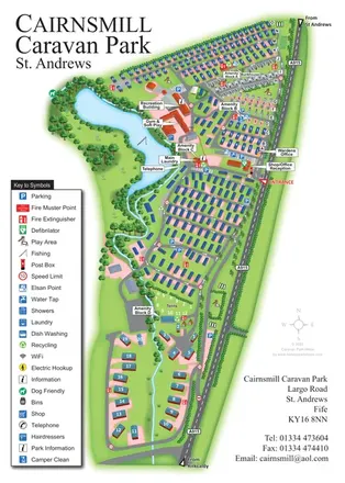
Illustrated lakeside park plan with numbered holiday units, leisure buildings and a looping Woodland Walk.
 Explore the map ↗
United Kingdom
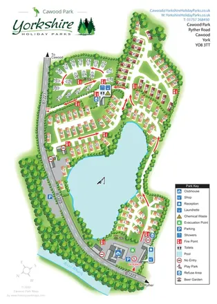
Portrait park map combining numbered caravan rows, touring and tent areas with a reservoir-side recreation hub.
 Explore the map ↗
United Kingdom
A lake-centred Cawood Park map with touring pitches, tree-lined holiday homes and clear entrance facilities.
Features may come from the sample artwork, its key or published park information. Approximate numbers describe the drawing and may cover only part of a park. They are intended to help you compare map examples. Current facilities and booking information should be checked with the park.
TAKE A CLOSER LOOK
View the illustrated map in detail or choose a file to download. These are sample maps; contact the park for current visitor information.


LET’S MAP YOUR PARK
For a map quotation, find your park and draw a rough boundary around it. The area you select helps us work out the design time and price.
Draw your park for a quote ↗Or talk to our map designers
01751 473136