
Working farm and farmyard
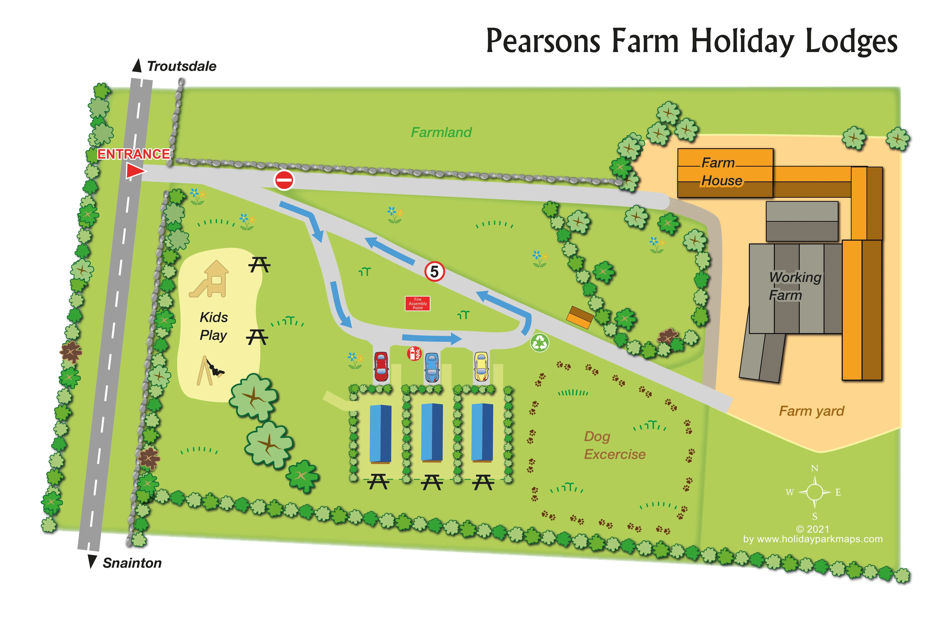
The eastern side contains a tan farmyard with large grey and orange building footprints, labelled 'Working Farm' and 'Farm yard'.
ILLUSTRATED PARK MAP · P565
Moorsome Farm, Snainton, Scarborough, North Yorkshire · United Kingdom
 Enlarge the map ↗
A SENSE OF THE PLACE
The Pearsons Farm Holiday Lodges map depicts lodge accommodation within a working-farm setting near Snainton. Directions towards Snainton and Troutsdale place the artwork in the North Yorkshire countryside.
The drawing identifies the farmyard and farmhouse alongside lodge spaces, a dog exercise area and children's play space. It is presented as a map showcase, describing the features illustrated without assuming current booking availability.
LOOK CLOSER
The eastern side contains a tan farmyard with large grey and orange building footprints, labelled 'Working Farm' and 'Farm yard'.
An orange-roofed farmhouse is labelled at the northern edge of the farmyard; it is not identified as guest accommodation.
A broad green field across the top of the plan is labelled 'Farmland' and separated from the drive by a stone boundary.
Repeated leafy symbols form perimeter planting, lodge divisions and a planted enclosure beside the farm access. Grey stone symbols line the roadside and northern drive.
The pale-yellow area labelled 'Kids Play' lies west of the lodges and includes slide and swing illustrations.
Black picnic-table symbols appear beside the play area and at the southern ends of the lodge spaces.
A large grass area east of the lodges is labelled for dog exercise and outlined with decorative brown paw prints.
Individual bays containing coloured car illustrations sit between the lodge spaces and the internal loop road.
The pale-yellow area labelled 'Kids Play' lies west of the lodges and includes slide and swing illustrations.
Black picnic-table symbols appear beside the play area and at the southern ends of the lodge spaces.
A large grass area east of the lodges is labelled for dog exercise and outlined with decorative brown paw prints.
Individual bays containing coloured car illustrations sit between the lodge spaces and the internal loop road.
A white recycling symbol in a green circle is positioned beside the eastern bend of the lodge access loop.
A red circular extinguisher-and-flame symbol marks a point beside the lodge parking bays.
A red labelled assembly-point marker stands on the grass within the internal road loop.
The eastern side contains a tan farmyard with large grey and orange building footprints, labelled 'Working Farm' and 'Farm yard'.
An orange-roofed farmhouse is labelled at the northern edge of the farmyard; it is not identified as guest accommodation.
A broad green field across the top of the plan is labelled 'Farmland' and separated from the drive by a stone boundary.
Repeated leafy symbols form perimeter planting, lodge divisions and a planted enclosure beside the farm access. Grey stone symbols line the roadside and northern drive.
A red entrance arrow marks the turn from the road along the western edge into the site.
Grey drives split into access towards the farmhouse and farmyard and a compact loop serving the lodges. Blue arrows show the illustrated circulation direction.
A red no-entry symbol appears on the upper drive near the entrance, and a red-bordered circular '5' marker appears on the diagonal internal route.
Black arrowheads at the ends of the western road indicate Troutsdale towards the top of the page and Snainton towards the bottom.
READING THE MAP
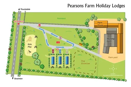
This illustrated map of Pearsons Farm Holiday Lodges presents a small lodge setting beside a working farm near Snainton in North Yorkshire. Rather than filling the page with numbered plots, it concentrates on the relationship between a short row of lodges, their parking spaces, the shared outdoor areas and the neighbouring farmyard. Directions towards Snainton and Troutsdale give the roadside entrance a clear local context.
The map shows blue-roofed lodges divided by planting, a children's play area to one side and a dog exercise area to the other. Large blue arrows explain the internal vehicle loop, while the farmhouse and working-farm buildings occupy a contrasting tan area on the right. Stone boundaries, leafy hedges and scattered tree symbols reinforce the rural character without obscuring the routes.
For a gallery of holiday-park mapping, this sample illustrates an approach suited to a compact farm-based lodge site: direct labels, recognisable activity symbols and a clear distinction between guest spaces and agricultural surroundings. Its small scale allows individual parking and outdoor seating to remain prominent.
The plan places the public road along the left edge, with directional labels for Troutsdale at the top and Snainton at the bottom. A red entrance arrow marks the turn into the site. From here, light-grey drives lead towards the farm and around a compact lodge access loop. Broad blue arrows show circulation around the loop, accompanied by a circular '5' marker and a no-entry symbol on the upper drive.
Approximately three lodges occupy the lower centre of the map. Their blue rectangular roof forms sit in parallel spaces divided by hedges. Each has an illustrated car bay at the road end and a black picnic-table symbol beyond the opposite end. The nearby fire-equipment symbol, labelled fire assembly point and recycling symbol provide practical landmarks without requiring a separate legend.
West of the lodges, a pale-yellow play area contains slide and swing illustrations, with picnic tables nearby. To the east, the dog exercise area is identified by a large label and a loose outline of brown paw prints. The upper portion of the plan shows farmland behind a stone boundary. On the right, the farmhouse and larger working-farm structures are drawn in orange, ochre and grey within a tan farmyard, making the agricultural part of the site visually distinct.
Repeated trees and shrubs frame the site and divide its spaces. Small flowers and grass marks soften the open green areas. A large serif title sits above the illustration, while a compass and designer credit occupy the lower right. The single landscape-format plan uses direct labels and pictorial symbols throughout, with no inset or separate map variant.
KEEP EXPLORING
Chosen for shared landscapes, accommodation or facilities.
 Explore the map ↗
United Kingdom
Woodland-framed Barnsoul map with mixed accommodation, shared facilities and paw-marked walking routes.
 Explore the map ↗
United Kingdom
A wooded, streamside park map with a linked farm, café, touring and cottage area.
 Explore the map ↗
United Kingdom
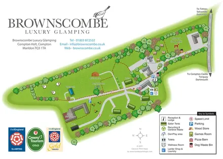
A branded rural glamping map combining named safari tents and distinctive structures with an orchard dog walk, shared amenities and farm-themed illustration.
Features may come from the sample artwork, its key or published park information. Approximate numbers describe the drawing and may cover only part of a park. They are intended to help you compare map examples. Current facilities and booking information should be checked with the park.
TAKE A CLOSER LOOK
View the illustrated map in detail or choose a file to download. These are sample maps; contact the park for current visitor information.


LET’S MAP YOUR PARK
For a map quotation, find your park and draw a rough boundary around it. The area you select helps us work out the design time and price.
Draw your park for a quote ↗Or talk to our map designers
01751 473136