
Y Goedwig / The Woods
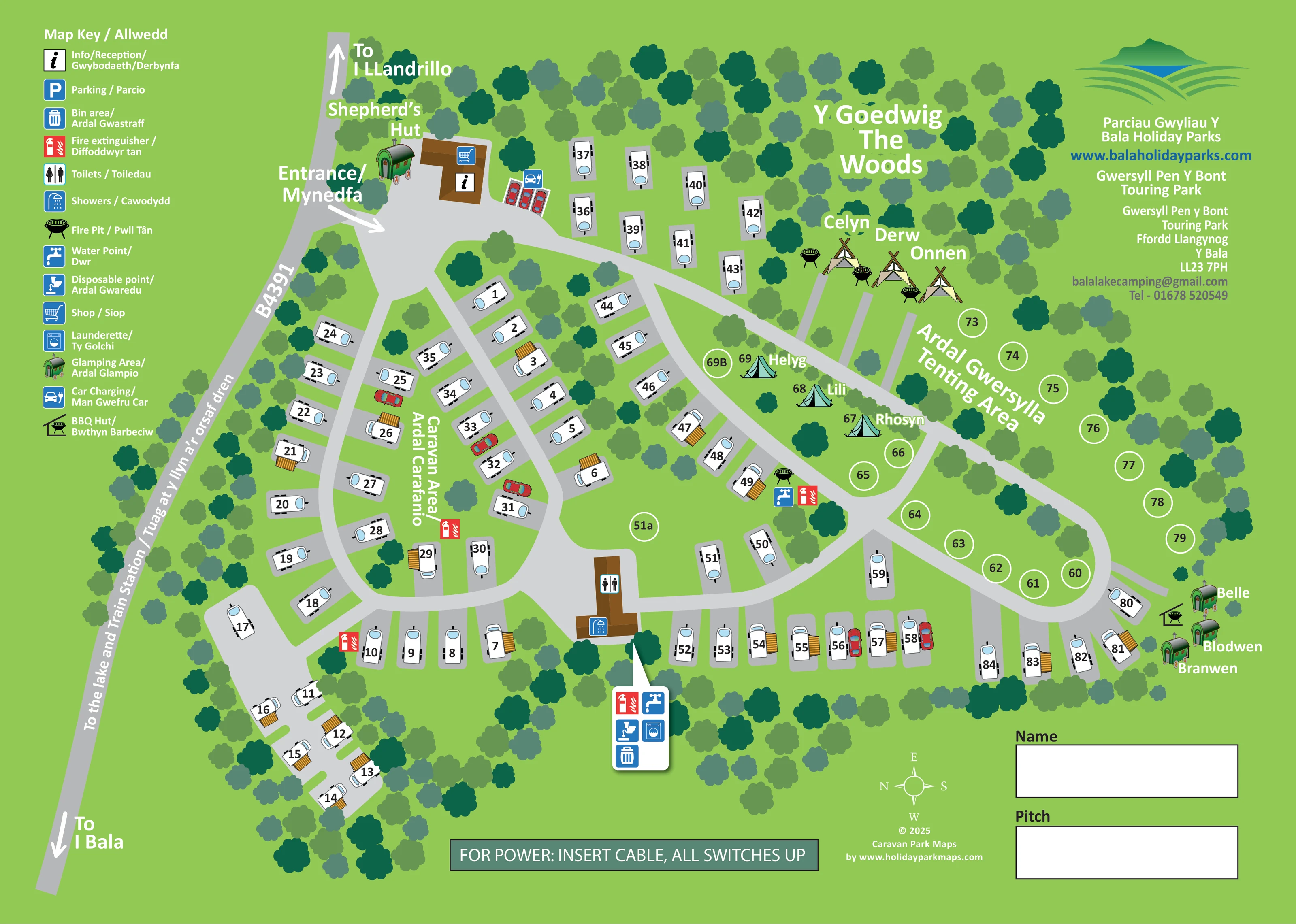
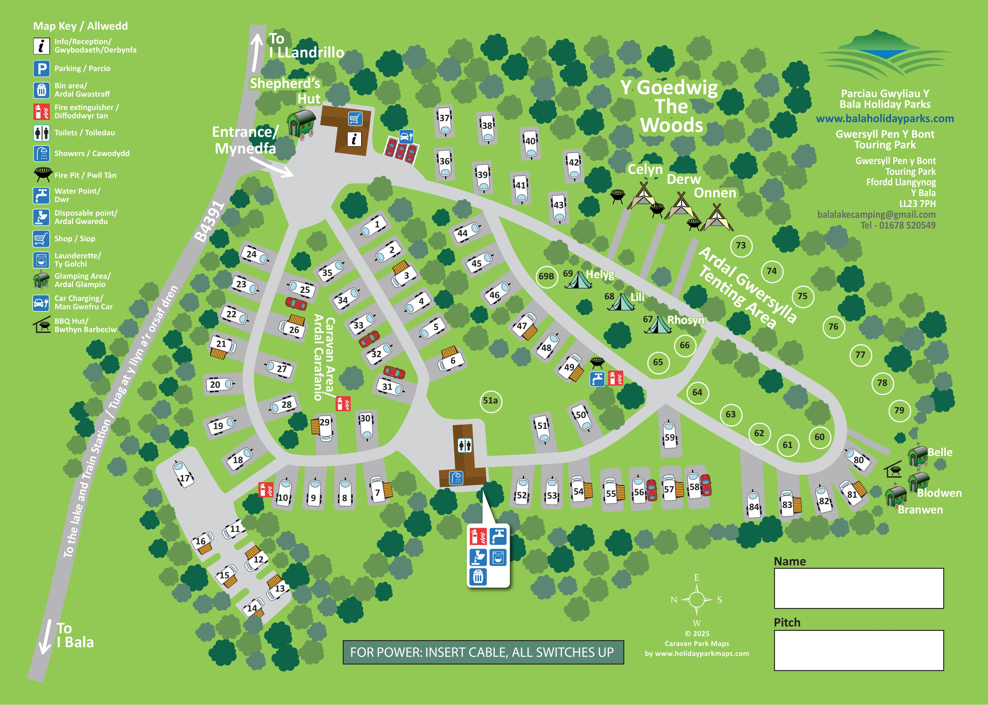
A named woodland area occupies the upper-right portion of the plan, illustrated with closely spaced tree crowns.
ILLUSTRATED PARK MAP · P247
Gwersyll Pen y Bont Touring Park, Ffordd Llangynog, Y Bala · United Kingdom
 Enlarge the map ↗
A SENSE OF THE PLACE
Pen y Bont is a family-run caravan, camping and glamping park near Bala and Llyn Tegid. A choice of pitches allows visitors to stay with their own touring or camping equipment.
A shop and reception serve the site, with the lake and surrounding Eryri countryside central to the location. The map helps guests locate pitches and understand the arrangement of the park.
LOOK CLOSER
A named woodland area occupies the upper-right portion of the plan, illustrated with closely spaced tree crowns.
Trees frame much of the site and form planted islands between pitches, roads and accommodation groups.
An angular brown building beside the entrance carries information and shopping symbols.
A central brown amenity building is marked with toilet and shower symbols.
A washing-machine symbol appears in the grouped service marker south of the amenity building.
Tap symbols identify water points beside the eastern touring area and in the southern service cluster.
The legend’s 'Disposable point / Ardal Gwaredu' symbol is positioned in the southern service cluster.
A bin symbol marks the southern service cluster.
An angular brown building beside the entrance carries information and shopping symbols.
A central brown amenity building is marked with toilet and shower symbols.
A washing-machine symbol appears in the grouped service marker south of the amenity building.
Tap symbols identify water points beside the eastern touring area and in the southern service cluster.
The legend’s 'Disposable point / Ardal Gwaredu' symbol is positioned in the southern service cluster.
A bin symbol marks the southern service cluster.
Red extinguisher symbols are distributed around the caravan area and grouped services.
A charging symbol marks a small row of cars beside the entrance reception building.
A blue parking symbol is included in the key; a separate matching parking marker is not clearly visible on the plan.
Black bowl-shaped symbols occur beside the northern tipi-style accommodation and near the eastern touring pitches.
A roofed barbecue symbol is placed beside the eastern cluster of named hut-style accommodation.
A named woodland area occupies the upper-right portion of the plan, illustrated with closely spaced tree crowns.
Trees frame much of the site and form planted islands between pitches, roads and accommodation groups.
A white entrance arrow leads from the B4391 into the reception forecourt on the upper-left side.
Broad grey roads form branching loops around the touring pitches and a curved route through the eastern tenting area.
Opposing arrows on the roadside strip indicate Bala towards the lower-left and Llandrillo towards the upper-left.
Bilingual wording along the B4391 indicates the direction to the lake and train station; neither destination is drawn within the park plan.
READING THE MAP
This bilingual map of Pen Y Bont Touring Park near Bala brings touring pitches, tenting areas and named glamping accommodation together on one illustrated sheet. Set against a bright-green background, the plan uses broad grey roads and belts of trees to explain a site that combines closely arranged caravan pitches with more open accommodation beside woodland.
Arrival is easy to identify: an arrow leads off the B4391 into a forecourt beside reception and the shop, with car charging marked nearby. From here, branching roads connect the main caravan area, central amenities and eastern tenting ground. Individual pitch numbers sit directly on caravan drawings or inside circles, while glamping names appear beside distinctive hut and tent illustrations.
English and Welsh labels are a defining part of the design, extending from the facility key to the entrance, accommodation areas and directions towards the lake and train station. The page also includes Bala Holiday Parks branding and guest Name and Pitch boxes, making it a practical visitor handout as well as an overview of the park’s arrangement.
The plan places the B4391 along its sloping left edge, with directions towards Bala and Llandrillo. A clearly labelled entrance turns into a broad forecourt beside the brown reception and shop building. A Shepherd’s Hut stands nearby, and a car-charging symbol identifies a small row of vehicles on the other side of reception.
Most touring pitches occupy the western and southern portions of the map. White caravan drawings sit on individual grey pads, arranged along branching lanes and curved loops. Their black pitch numbers contrast with pale-blue window details, while selected units have ochre awning-like extensions. Tree crowns fill the spaces between rows and create a substantial green perimeter.
A central brown building carries toilet and shower symbols. Nearby service markers group water, disposal, laundry, bins and fire extinguishers; additional water and extinguisher points appear elsewhere around the touring area. The eastern road curves around a grassed tenting area represented by numbered circles. Above it, the woodland labelled ‘Y Goedwig / The Woods’ forms a backdrop to Celyn, Derw and Onnen, shown as tipi-style tents with adjacent fire-pit symbols. Helyg, Lili and Rhosyn use smaller tent illustrations. Belle, Blodwen and Branwen form a separate hut-style group at the far right, beside a BBQ hut symbol.
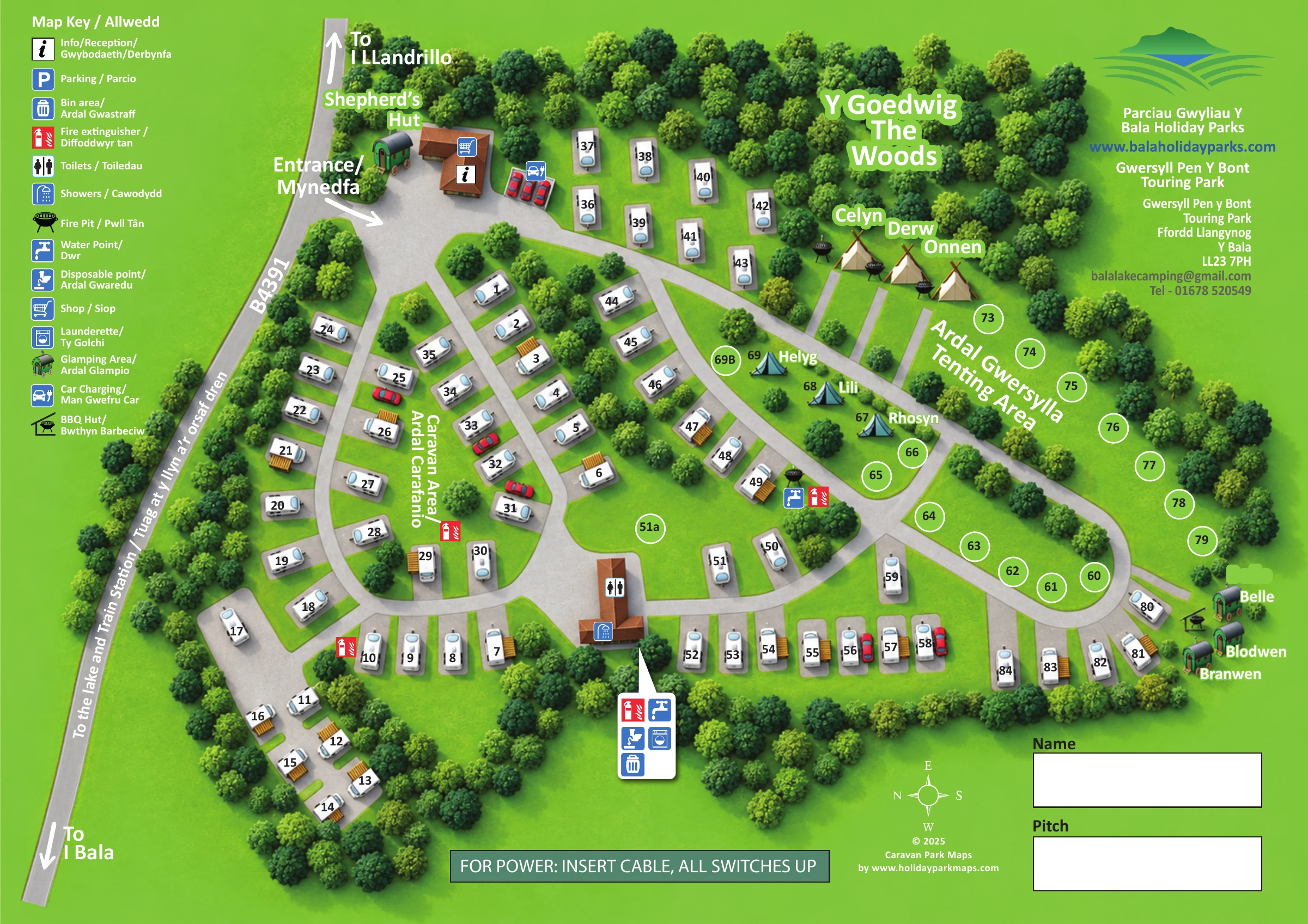
The bilingual key runs down the upper-left margin, while branding and contact details occupy the upper-right. Guest allocation boxes, a compass and a power-connection panel complete the lower edge. The accompanying enlargement shows the same artwork in greater detail, particularly the key, entrance and western pitches; it is not a separate map variant.
 Enlarge this map ↗
KEEP EXPLORING
Chosen for shared landscapes, accommodation or facilities.
 Explore the map ↗
United Kingdom
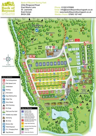
Colour-coded touring pitches, named glamping units and woodland routes at Back of Beyond Touring Park.
 Explore the map ↗
United Kingdom
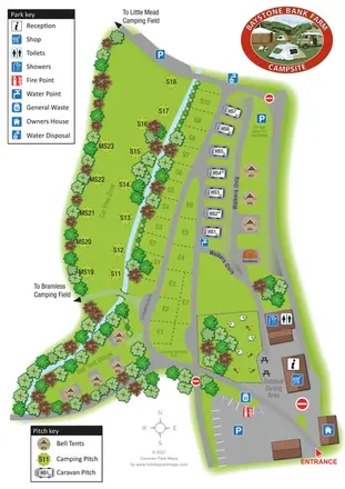
A stream-side farm campsite plan with car-free camping, caravan pitches and separate bell-tent areas.
 Explore the map ↗
United Kingdom
Woodland park map with mixed pitches, bell tents, lodges and a fishing lake.
Features may come from the sample artwork, its key or published park information. Approximate numbers describe the drawing and may cover only part of a park. They are intended to help you compare map examples. Current facilities and booking information should be checked with the park.
TAKE A CLOSER LOOK
View the illustrated map in detail or choose a file to download. These are sample maps; contact the park for current visitor information.


LET’S MAP YOUR PARK
For a map quotation, find your park and draw a rough boundary around it. The area you select helps us work out the design time and price.
Draw your park for a quote ↗Or talk to our map designers
01751 473136
 penybont_large.png