
Fishing lakes
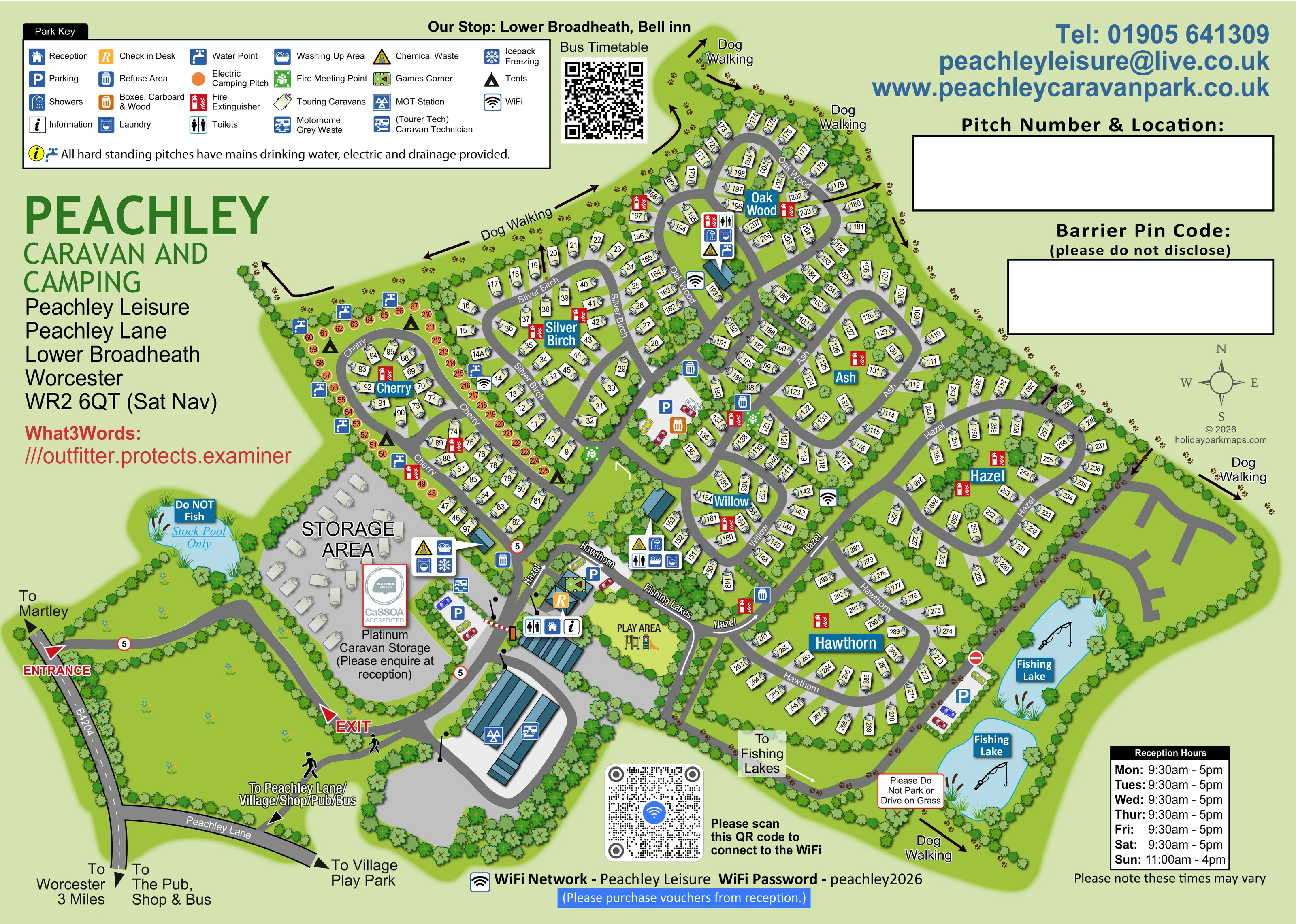
Two blue lakes on the south-eastern edge have fishing labels, rod illustrations and adjacent parking.
ILLUSTRATED PARK MAP · P246
Peachley Leisure, Peachley Lane, Lower Broadheath, Worcester · United Kingdom
 Enlarge the map ↗
A SENSE OF THE PLACE
Peachley Caravan and Camping is a family-run park at Lower Broadheath near Worcester. Grass and hardstanding pitches are arranged across separate fields, with touring, camping and seasonal areas.
Serviced pitches provide electricity, water and wastewater connections. Heated washrooms, accessible facilities and laundry support stays, while the countryside setting offers views across the surrounding area.
LOOK CLOSER
Two blue lakes on the south-eastern edge have fishing labels, rod illustrations and adjacent parking.
A separate small pool beside the storage compound is explicitly labelled as a stock pool rather than a fishing lake.
Dense illustrated trees define the perimeter and divide pitch groups, with grass islands and planted spaces between roads.
Reception, check-in and information symbols identify the arrival building beside the barrier and central entrance junction.
Blue parking symbols mark spaces near arrival, within the central site and beside the fishing lakes.
Grouped toilet and shower symbols identify service buildings near arrival, Willow and Oak Wood.
Laundry and washing-up symbols accompany several washroom and service clusters.
Water taps are mapped particularly around camping and service areas. The key states that all hardstanding pitches have mains drinking water, electricity and drainage.
Reception, check-in and information symbols identify the arrival building beside the barrier and central entrance junction.
Blue parking symbols mark spaces near arrival, within the central site and beside the fishing lakes.
Grouped toilet and shower symbols identify service buildings near arrival, Willow and Oak Wood.
Laundry and washing-up symbols accompany several washroom and service clusters.
Water taps are mapped particularly around camping and service areas. The key states that all hardstanding pitches have mains drinking water, electricity and drainage.
Repeated refuse symbols and a separate orange symbol for boxes, cardboard and wood appear around the arrival and central service areas.
Chemical disposal points are mapped at service clusters, with a motorhome grey-waste point near the arrival-side parking.
An icepack-freezing symbol appears in the service cluster next to the storage area.
WiFi symbols are distributed through the accommodation areas. The page also includes a connection panel.
A games symbol marks the arrival building close to reception and check-in.
A labelled play area with illustrated play equipment occupies a green enclosure beside reception.
A substantial separate storage compound is labelled with a CaSSOA Platinum accreditation graphic and an enquiry-at-reception note.
MOT and Tourer Tech caravan-technician symbols identify the large workshop buildings south of reception.
Red extinguisher symbols recur across the pitch groups; green fire meeting-point symbols appear near the central circulation area.
Two blue lakes on the south-eastern edge have fishing labels, rod illustrations and adjacent parking.
A separate small pool beside the storage compound is explicitly labelled as a stock pool rather than a fishing lake.
Dense illustrated trees define the perimeter and divide pitch groups, with grass islands and planted spaces between roads.
Brown arrows and paw prints trace dog-walking routes around the northern boundary and the lakeside edge.
The western access from the B4204 leads past the storage compound to reception; a separately labelled exit connects back to this approach.
A connected network of grey roads serves Cherry, Silver Birch, Oak Wood, Ash, Willow, Hazel and Hawthorn.
Directional labels refer to Peachley Lane, Worcester, Martley, the village, pub, shop, bus and a village play park; these are off-site destinations.
A timetable QR panel identifies the local stop as Lower Broadheath, Bell inn.
READING THE MAP
This illustrated map of Peachley Leisure brings together a large touring and camping layout, a practical arrival hub and a distinctive lakeside setting at Lower Broadheath near Worcester. Rather than presenting the park as one continuous field of pitches, the artwork divides it into recognisable tree-named areas: Cherry, Silver Birch, Oak Wood, Ash, Willow, Hazel and Hawthorn. Curving roads, blue area labels and individually numbered pitches help visitors understand how these neighbourhoods connect.
The map shows touring caravans on pale pitch pads, with electric camping pitches picked out in orange around Cherry. Reception, check-in, parking and the play area sit close to the entrance, while washrooms and other service points are distributed across the plan. A separate caravan storage compound and vehicle-service buildings give the arrival end its own character.
Two fishing lakes, a smaller stock pool and perimeter dog-walking routes add useful landscape landmarks. The result is a detailed visitor sheet that combines pitch finding with facilities, local direction references and a clear visual distinction between accommodation, storage and recreation.
The single landscape-format artwork places the park diagonally across a pale green page, leaving space around it for the key, branding and visitor information. Its western entrance connects with the B4204 and leads past a large caravan storage compound towards reception. A separately marked exit, barrier illustration and parking symbols make the arrival arrangement easy to distinguish from the accommodation roads. Reception and check-in share this hub with information, a games corner and a nearby illustrated play area. Larger blue-roofed buildings to the south carry MOT station and caravan-technician symbols.
Beyond arrival, grey roads branch into a series of planted loops. Cherry and Silver Birch occupy the western side; Oak Wood extends to the north; Ash and Willow form the middle; and Hazel and Hawthorn spread towards the eastern lakes. Touring caravans are drawn on pale pads with individual numbers, while orange circles identify the electric camping pitches around Cherry. The road names follow their curves, and blue area-name panels provide a second, more prominent layer of orientation.
Service symbols identify toilets, showers, laundry, washing-up, water, waste disposal and WiFi at relevant points. Fire extinguishers and meeting points are also marked. The broad upper-left key explains these symbols and includes the hardstanding service statement.
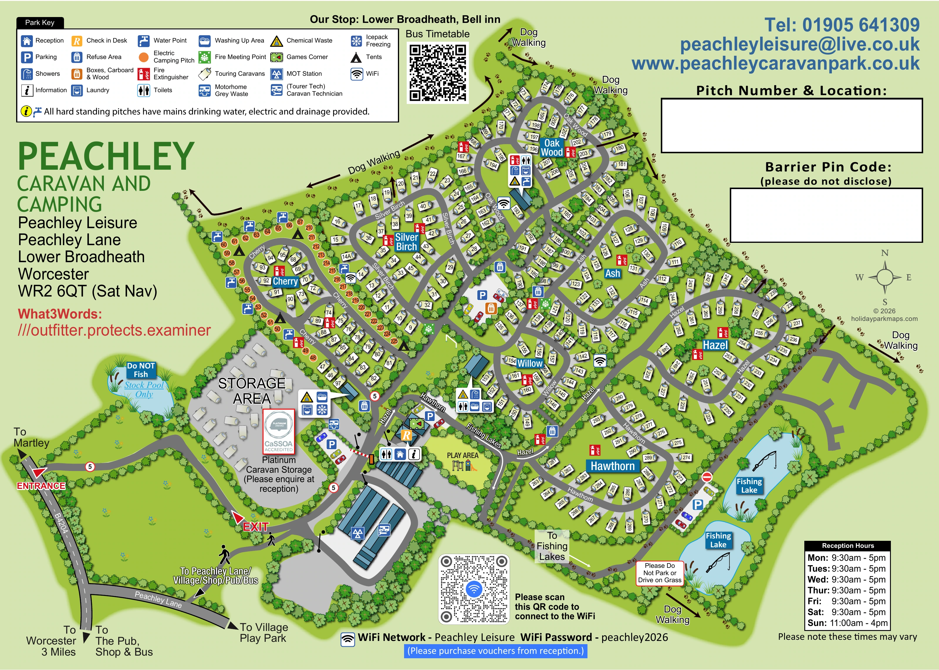
Trees and hedges frame the pitch groups and the site boundary. Brown arrows and paw prints describe perimeter dog-walking routes, including the lakeside edge. Two fishing lakes have rod illustrations and nearby parking; the separate stock pool is clearly differentiated. External arrows point towards the village and local destinations. The accompanying enlargement reveals the same page’s legend and western pitch treatment in more detail, rather than adding another site or accommodation area.
KEEP EXPLORING
Chosen for shared landscapes, accommodation or facilities.
 Explore the map ↗
United Kingdom
Woodland park map with mixed pitches, bell tents, lodges and a fishing lake.
 Explore the map ↗
United Kingdom
Illustrated caravan park plan with woodland and riverside walks, fishing pools and wildlife panels.
 Explore the map ↗
United Kingdom
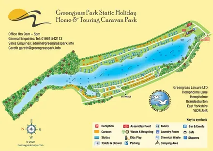
Colour-coded lakeside accommodation and illustrated facilities at Greengrass Park, East Yorkshire.
Features may come from the sample artwork, its key or published park information. Approximate numbers describe the drawing and may cover only part of a park. They are intended to help you compare map examples. Current facilities and booking information should be checked with the park.
TAKE A CLOSER LOOK
View the illustrated map in detail or choose a file to download. These are sample maps; contact the park for current visitor information.


LET’S MAP YOUR PARK
For a map quotation, find your park and draw a rough boundary around it. The area you select helps us work out the design time and price.
Draw your park for a quote ↗Or talk to our map designers
01751 473136