
Pond / Llyn
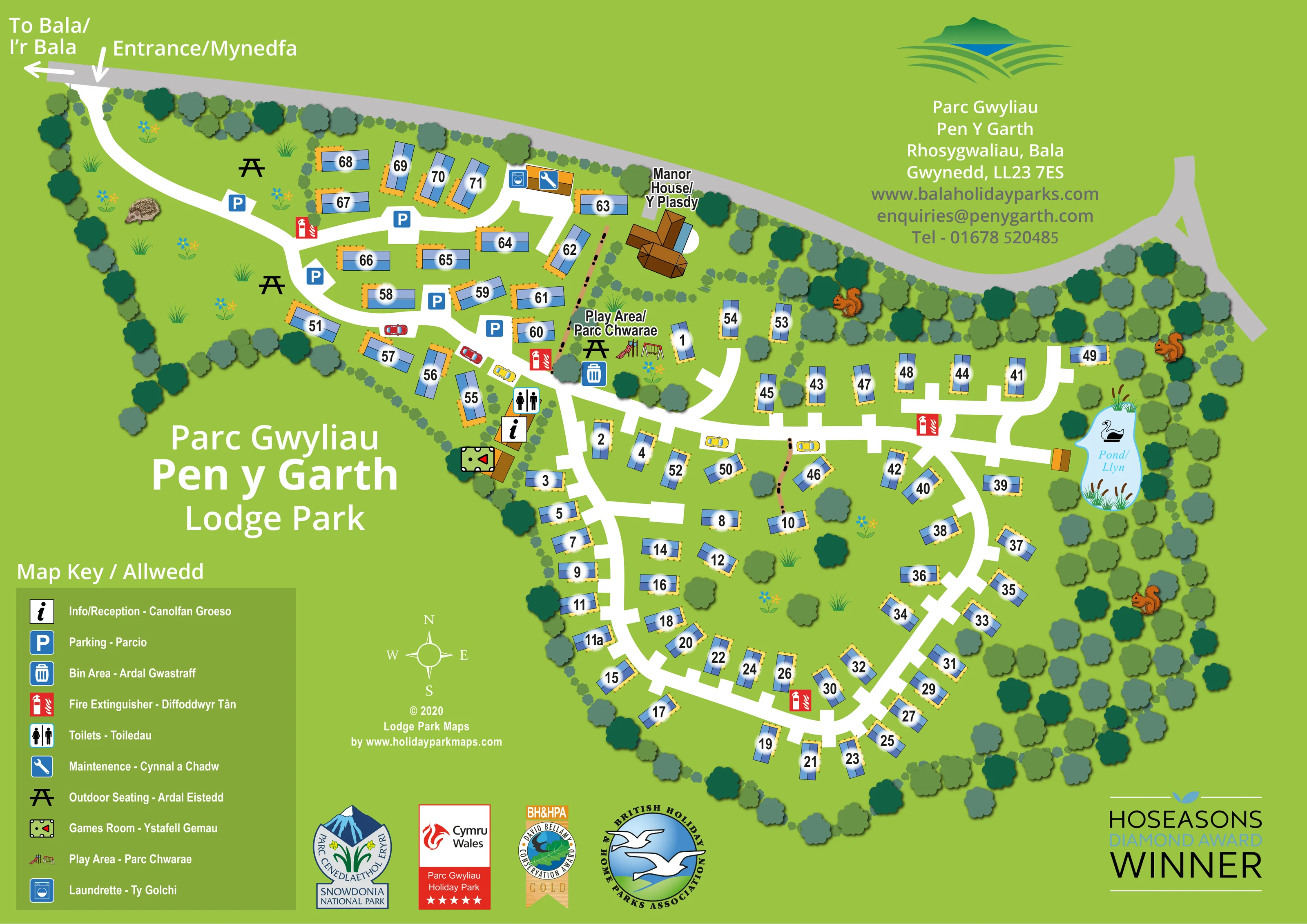
A small pale-blue pond lies on the right-hand side of the park, illustrated with a swan, reeds and an adjacent golden rectangular feature.
ILLUSTRATED PARK MAP · P566
Pen Y Garth, Rhosygwaliau, Bala, Gwynedd · United Kingdom
 Enlarge the map ↗
A SENSE OF THE PLACE
Pen y Garth Lodge Park is part of the family-run Bala Holiday Parks group near Llyn Tegid. Its holiday lodges provide a self-catering base in the landscapes around Bala and Eryri.
The group's long association with the area informs its holiday home offering. The map focuses on Pen y Garth's lodge layout, helping visitors locate individual properties and the routes through the grounds.
LOOK CLOSER
A small pale-blue pond lies on the right-hand side of the park, illustrated with a swan, reeds and an adjacent golden rectangular feature.
Dense belts of stylised trees enclose much of the park, with hedge-like divisions, scattered trees and open green spaces between lodge groups.
An information symbol identifies the reception building beside the central-western road junction, close to the toilets and games room.
Several blue parking symbols mark spaces around the entrance-side lodge group and its connecting roads.
A male/female toilet symbol appears beside the reception area.
A pool-table pictogram identifies a building immediately beside the reception cluster.
A washing-machine symbol marks the service building near the upper lodge group, alongside the maintenance symbol.
A blue spanner symbol identifies the maintenance location in the upper part of the park.
An information symbol identifies the reception building beside the central-western road junction, close to the toilets and games room.
Several blue parking symbols mark spaces around the entrance-side lodge group and its connecting roads.
A male/female toilet symbol appears beside the reception area.
A pool-table pictogram identifies a building immediately beside the reception cluster.
A washing-machine symbol marks the service building near the upper lodge group, alongside the maintenance symbol.
A blue spanner symbol identifies the maintenance location in the upper part of the park.
Illustrated slide and swing equipment marks the bilingual-labelled play area below the Manor House and beside the central road junction.
Black picnic-table symbols mark seating on the entrance-side lawns and beside the play area.
A blue bin symbol marks a waste area next to the play area and central routes.
Repeated red extinguisher symbols are distributed along the internal roads, including the entrance-side group, central junction and lower loop.
A prominent brown-roofed building is labelled in English and Welsh near the upper boundary. Its accommodation or visitor-service role is not specified.
A small pale-blue pond lies on the right-hand side of the park, illustrated with a swan, reeds and an adjacent golden rectangular feature.
Dense belts of stylised trees enclose much of the park, with hedge-like divisions, scattered trees and open green spaces between lodge groups.
The entrance is marked at the upper-left edge, where a white internal road leaves the grey external road.
A left-pointing arrow on the external road is labelled 'To Bala / I’r Bala'; it is a directional reference rather than a mapped town location.
Broad white routes connect the upper lodge cluster, central facilities and larger curved lower layout, with short branches serving individual groups.
READING THE MAP
This bilingual map of Pen y Garth Lodge Park presents a tree-lined lodge setting at Rhosygwaliau, near Bala in Gwynedd. Approximately 70 numbered lodges sit within a bright-green illustrated plan, connected by white roads that curve from the entrance into smaller branches and a larger lower loop. Blue roofs and golden decking surrounds give the accommodation a consistent visual identity, while generous number labels make individual properties easy to pick out.
The map brings together practical visitor information and distinctive features of the grounds. Reception, parking, toilets, a games room, laundrette and maintenance location are marked with pictograms, alongside outdoor seating, the play area and fire extinguisher points. The Manor House and a small pond provide recognisable landmarks within the layout.
English and Welsh appear together in the title, key and principal directions. Tree belts, flowers and illustrated wildlife soften the functional plan, creating a sample that combines property-level wayfinding with the character of a landscaped Welsh lodge park.
The complete artwork is a landscape-format plan with the park entrance at the upper left. A grey road follows the upper boundary, carrying the bilingual direction to Bala. From it, a broad white internal road curves through open lawns and trees before dividing among the entrance-side lodges. Several parking symbols and picnic-table icons are concentrated in this part of the plan.
The upper lodge group connects to a service building marked for the laundrette and maintenance. Nearby, the Manor House is drawn as a larger, multi-wing brown-roofed building. Below it, a labelled play area includes illustrated swings and a slide, with outdoor seating and a bin point close by. Reception, toilets and the games room form another recognisable cluster beside the central-western junction.
The larger lower section uses curved roads and short branches to organise lodges around interior lawns and tree planting. Units face different directions along the routes, each carrying a bold black number on a soft white glow. The eastern edge contains a pale-blue pond with reeds and a swan, enclosed by the surrounding tree belt. Red extinguisher symbols punctuate the road network.
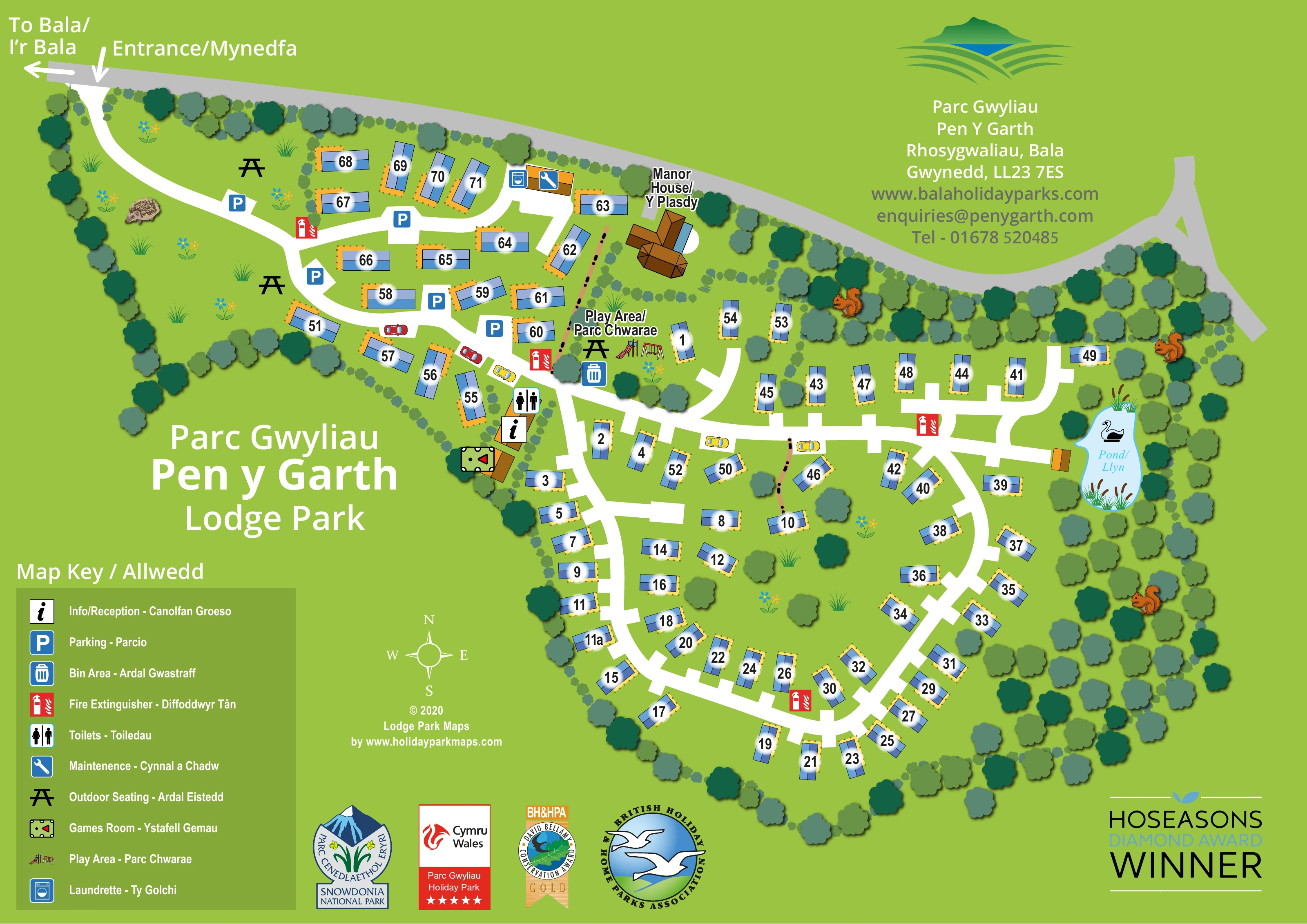
A large bilingual title and darker-green map key occupy the lower-left space. The contact block and park logo sit at upper right, while a compass, designer credit and tourism or award graphics fill the lower margins. Decorative squirrels, a hedgehog and small flower groups add local character without becoming wayfinding symbols. The accompanying enlargement shows the same artwork’s title and legend in greater detail; it is not a separate park section or an additional accommodation plan.
KEEP EXPLORING
Chosen for shared landscapes, accommodation or facilities.
 Explore the map ↗
United Kingdom
Woodland camping, lodges, lakes and colour-coded bike trails at Avon Tyrrell Outdoor Centre.
 Explore the map ↗
United Kingdom
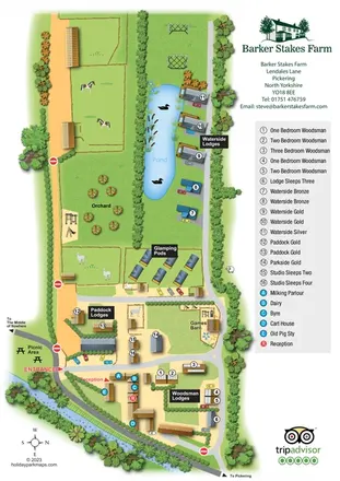
Portrait farm-stay map with pond-side lodges, glamping pods, orchard and illustrated animal paddocks.
 Explore the map ↗
United Kingdom
Woodland-framed Barnsoul map with mixed accommodation, shared facilities and paw-marked walking routes.
Features may come from the sample artwork, its key or published park information. Approximate numbers describe the drawing and may cover only part of a park. They are intended to help you compare map examples. Current facilities and booking information should be checked with the park.
TAKE A CLOSER LOOK
View the illustrated map in detail or choose a file to download. These are sample maps; contact the park for current visitor information.


LET’S MAP YOUR PARK
For a map quotation, find your park and draw a rough boundary around it. The area you select helps us work out the design time and price.
Draw your park for a quote ↗Or talk to our map designers
01751 473136
 pengarth_large.png