
Neighbouring livestock pasture
A fenced field below the campsite contains cartoon cattle and sheep, conveying the agricultural surroundings rather than a visitor animal attraction.
ILLUSTRATED PARK MAP · P567
Pengraig, Llanfairynghornwy, Holyhead · United Kingdom
 Enlarge the map ↗
A SENSE OF THE PLACE
Pengraig Campsite is located at Llanfairynghornwy in north-west Anglesey. Visitor descriptions emphasise a simple camping experience, sea views and access to coastal walks.
Basic toilet provision is described, with the attraction centred on the location rather than extensive leisure facilities. The map gives an overview of the campsite and its access arrangements within the surrounding countryside.
LOOK CLOSER
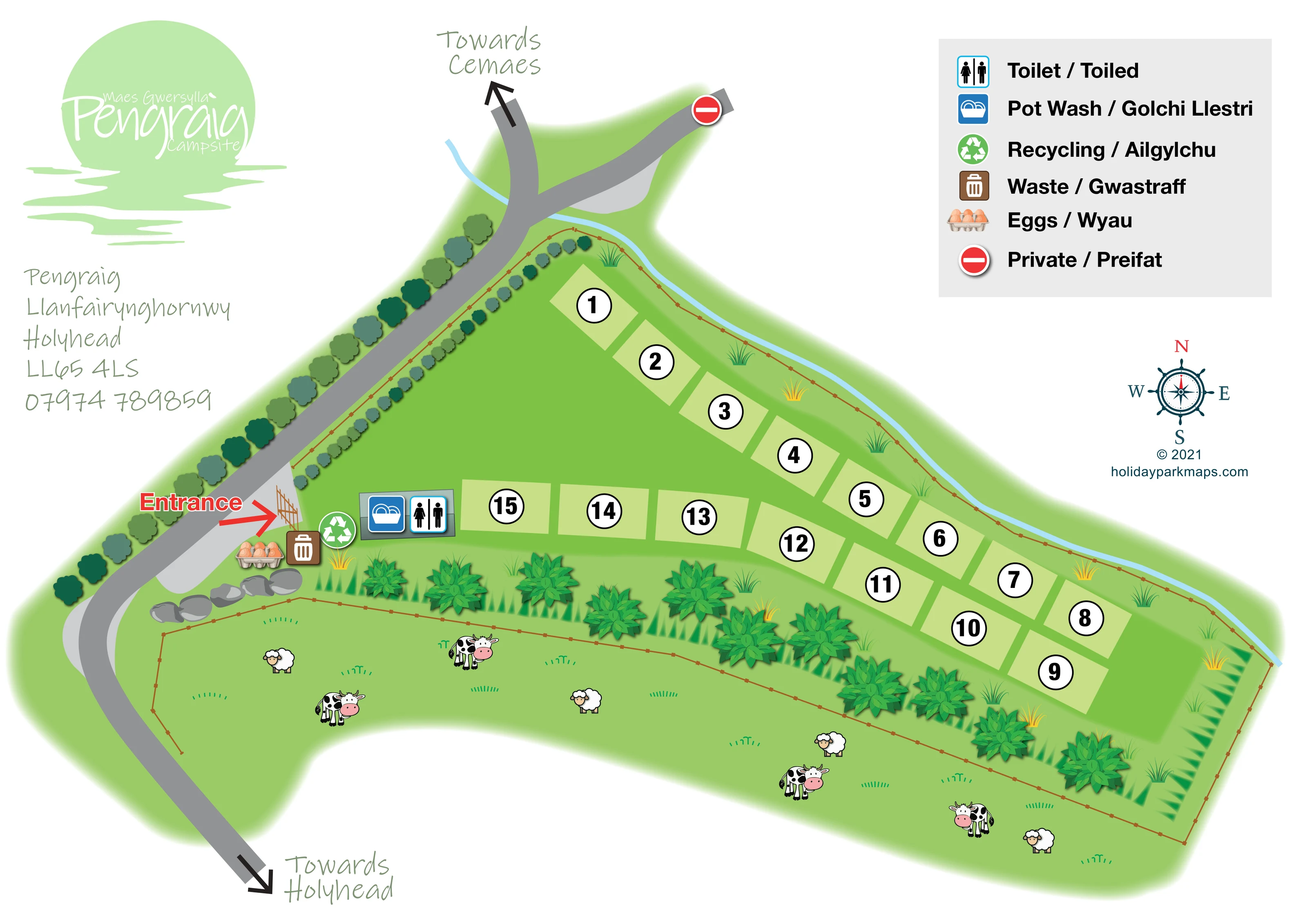
A fenced field below the campsite contains cartoon cattle and sheep, conveying the agricultural surroundings rather than a visitor animal attraction.
Repeated tree crowns line the road; larger leafy shrubs and pointed green planting separate the campsite from the pasture. Brown post-and-wire-style lines describe field boundaries.
A narrow pale-blue line follows the upper campsite boundary and passes across the road area. It visually suggests a watercourse or drainage feature, but is not named.
A short group of grey boulders is illustrated beside the roadside entrance apron and neighbouring field boundary.
A toilet symbol sits on the small rectangular facility footprint immediately inside the entrance.
The pot-washing symbol shares the entrance-side facility footprint with the toilet symbol.
Separate green recycling and brown waste symbols are grouped beside the entrance, identified bilingually in the key.
An illustrated egg carton marks an eggs point near the entrance; no transaction arrangements are specified.
A toilet symbol sits on the small rectangular facility footprint immediately inside the entrance.
The pot-washing symbol shares the entrance-side facility footprint with the toilet symbol.
Separate green recycling and brown waste symbols are grouped beside the entrance, identified bilingually in the key.
An illustrated egg carton marks an eggs point near the entrance; no transaction arrangements are specified.
A prominent red Entrance label and arrow point from the roadside apron towards a drawn gate into the camping field.
The grey road along the left-hand side has directional arrows towards Cemaes at the top and Holyhead at the bottom.
The upper road junction includes a right-hand branch marked with the red symbol defined as Private / Preifat.
A fenced field below the campsite contains cartoon cattle and sheep, conveying the agricultural surroundings rather than a visitor animal attraction.
Repeated tree crowns line the road; larger leafy shrubs and pointed green planting separate the campsite from the pasture. Brown post-and-wire-style lines describe field boundaries.
A narrow pale-blue line follows the upper campsite boundary and passes across the road area. It visually suggests a watercourse or drainage feature, but is not named.
A short group of grey boulders is illustrated beside the roadside entrance apron and neighbouring field boundary.
Park information describes sea views and access to coastal walks in north-west Anglesey. Neither the coastline nor a coastal walking route is drawn on this plan.
READING THE MAP
This illustrated map of Pengraig Campsite presents a small camping field in the countryside at Llanfairynghornwy, near Holyhead in north-west Anglesey. Its focus is straightforward: help visitors recognise the entrance, find a numbered pitch and locate the practical facilities clustered nearby. Approximately 15 pitches appear as pale-green rectangles around a generous central grass area, rather than as drawings of tents or caravans.
The rural setting is an important part of the composition. Trees line the approach road, planted boundaries separate the campsite from neighbouring pasture, and cartoon cattle and sheep give that adjoining field a recognisably agricultural character. Directional arrows towards Cemaes and Holyhead place the entrance within the local road arrangement.
A substantial English/Welsh key explains the toilet, pot wash, recycling, waste, eggs and private-access symbols. The bright red entrance arrow stands out against the predominantly green plan, while large circular pitch numbers keep accommodation references easy to spot. With its handwritten place labels and prominent Pengraig branding, this sample combines practical campsite wayfinding with a distinctly informal rural presentation.
The plan is arranged around a long, tapering grass field extending from the roadside entrance on the left towards the right-hand edge of the page. Two angled runs of pale-green pitch rectangles frame an open central area. Each pitch carries a large black number inside a white, black-outlined circle, making the accommodation references visually stronger than the surrounding landscape detail.
At the entrance end, a red label and arrow point towards an illustrated gate from a light-grey roadside apron. Immediately inside, a small rectangular facility footprint carries the toilet and pot-wash symbols. Recycling, waste and an egg-carton marker sit alongside this service area. These symbols are explained in the large bilingual key above the right-hand side of the plan, using English and Welsh labels on a light-grey panel.
The external road curves down the left side of the artwork, with arrows indicating the directions towards Cemaes and Holyhead. Its upper junction includes another branch marked private. A narrow, unlabelled pale-blue line follows the upper field boundary, while brown fence lines and repeated planting motifs articulate the edges of the site.
Below the camping pitches, a separate pasture is illustrated with cattle, sheep and scattered grass tufts. Large leafy shrubs form a visual divide between the two fields, and a group of grey rocks adds detail beside the entrance. The overall artwork uses flat plan geometry with shaded pictorial accents rather than a fully three-dimensional view.
A pale-green Pengraig logo and address block balance the key on the opposite side of the page. A nautical-style compass rose sits beneath the key. This is a single landscape-format campsite plan, with no separate inset or walking-map panel.
KEEP EXPLORING
Chosen for shared landscapes, accommodation or facilities.
 Explore the map ↗
United Kingdom
A colour-zoned coastal park map with touring areas, woodland trails, ponds and a leisure club.
 Explore the map ↗
United Kingdom
Tree-framed mixed-accommodation park map with two entrances, touring loops and a clearly illustrated social hub.
 Explore the map ↗
United Kingdom
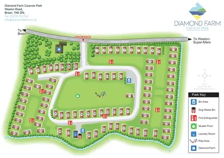
Numbered accommodation, a central green and tree-lined rhyne on the Diamond Farm park map.
Features may come from the sample artwork, its key or published park information. Approximate numbers describe the drawing and may cover only part of a park. They are intended to help you compare map examples. Current facilities and booking information should be checked with the park.
LET’S MAP YOUR PARK
For a map quotation, find your park and draw a rough boundary around it. The area you select helps us work out the design time and price.
Draw your park for a quote ↗Or talk to our map designers
01751 473136