
Nature ponds
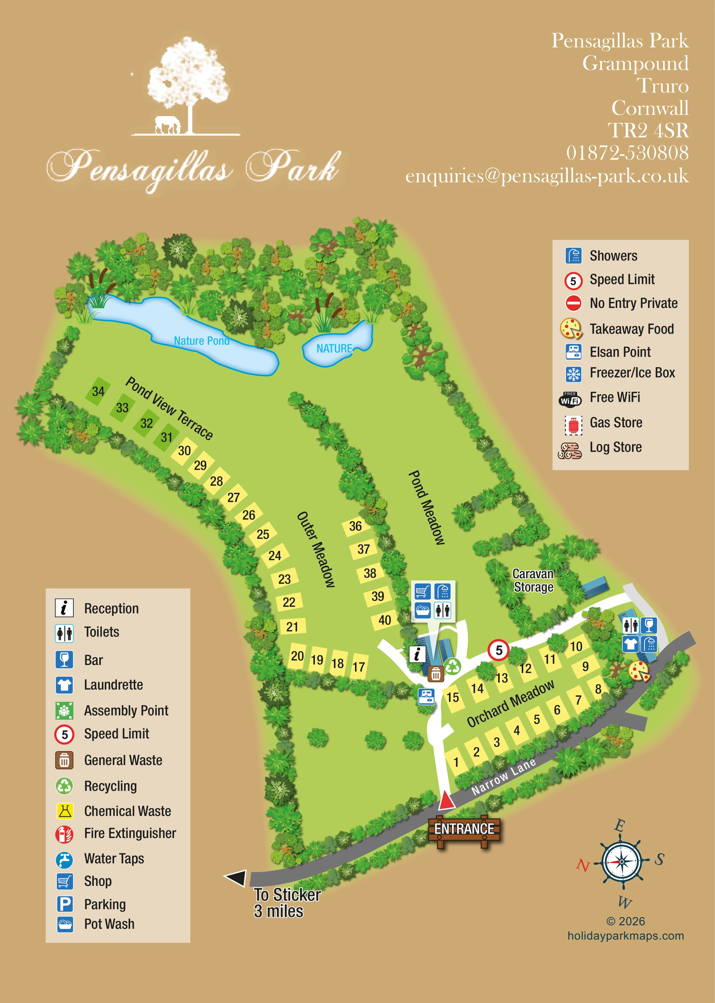
Two pale-blue water bodies at the upper end of the plan, labelled 'Nature Pond' and 'NATURE', with reeds and dense surrounding trees.
ILLUSTRATED PARK MAP · P252
Pensagillas Park, Grampound, Truro, Cornwall · United Kingdom
 Enlarge the map ↗
A SENSE OF THE PLACE
Pensagillas Park provides tent and touring stays near Grampound in Cornwall. Its camping areas are divided into named meadows connected by surfaced roads.
Showers, toilets and laundry facilities support visits, while campfires are permitted in designated fire pits or baskets. The map helps visitors distinguish the meadow areas and find shared facilities across the park.
LOOK CLOSER
Two pale-blue water bodies at the upper end of the plan, labelled 'Nature Pond' and 'NATURE', with reeds and dense surrounding trees.
Orchard Meadow, Outer Meadow, Pond Meadow and Pond View Terrace provide the main area-level landmarks.
Dense illustrated planting frames the park, divides its meadows and encloses the caravan storage area; scattered trees occupy the lower grass area.
Information symbol placed on the blue-roofed central building beside the internal road junction.
Shop symbol in the central facilities cluster near reception.
Grouped symbols identify toilets and showers at both the central facilities and the building beside Narrow Lane.
Pot-washing symbol included in the central shop and washroom cluster.
Laundry symbol at the roadside facilities building on the right of the plan.
Information symbol placed on the blue-roofed central building beside the internal road junction.
Shop symbol in the central facilities cluster near reception.
Grouped symbols identify toilets and showers at both the central facilities and the building beside Narrow Lane.
Pot-washing symbol included in the central shop and washroom cluster.
Laundry symbol at the roadside facilities building on the right of the plan.
Wine-glass symbol at the roadside building beside Orchard Meadow.
Illustrated pizza symbol beside the roadside facilities building.
Brown bin and green recycling symbols grouped beside reception.
Disposal-point symbol beside the arrival road, just below the reception cluster.
Named storage area enclosed by planting above Orchard Meadow, beside a small blue-roofed structure.
Two pale-blue water bodies at the upper end of the plan, labelled 'Nature Pond' and 'NATURE', with reeds and dense surrounding trees.
Orchard Meadow, Outer Meadow, Pond Meadow and Pond View Terrace provide the main area-level landmarks.
Dense illustrated planting frames the park, divides its meadows and encloses the caravan storage area; scattered trees occupy the lower grass area.
A timber-style entrance sign and red triangular marker identify the arrival point from the grey road labelled Narrow Lane.
White routes lead from the entrance to reception, with branches towards the meadows, storage area and roadside facilities.
An outward arrow at the lower-left end of Narrow Lane is labelled 'To Sticker 3 miles'.
A red-ringed symbol displaying 5 is placed on the internal route beside Orchard Meadow.
Included in the legend, without a clearly identifiable plotted position.
A parking symbol is explained in the legend, but no corresponding location is clearly plotted.
A separate chemical-waste symbol appears in the legend; the visibly plotted disposal facility uses the Elsan-point symbol.
Both symbols are listed in the legend, without clearly identifiable positions on the plan.
Both amenities are named in the upper-right legend, without plotted locations.
Fuel-store symbols appear in the legend, without clearly identifiable locations on the plan.
The legend explains a private no-entry symbol, but no corresponding restricted route is clearly marked.
Park information describes campfires in designated fire pits or baskets; these are not located on the artwork.
READING THE MAP
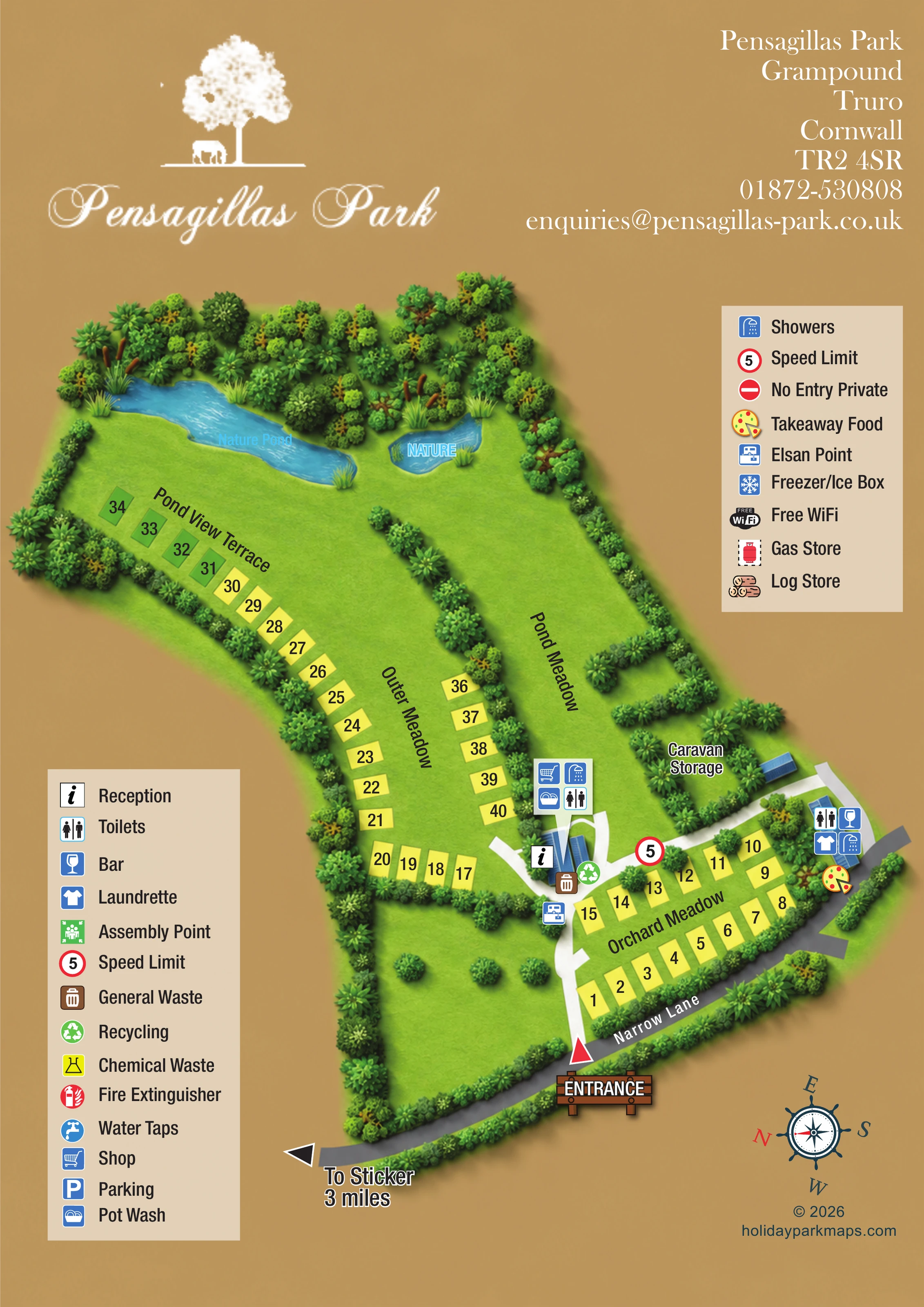
This illustrated map of Pensagillas Park near Grampound, Cornwall, presents a meadow-based camping and touring setting through named areas, numbered pitches and a distinctive pair of nature ponds. Rather than filling the site with caravan or tent drawings, the design uses simple pitch rectangles and gives the surrounding trees, hedges and water much of the visual emphasis.
The entrance from Narrow Lane sits at the lower edge of the portrait page. White internal routes lead towards reception and connect the facilities around Orchard Meadow, while the longer sweep of Outer Meadow and Pond View Terrace draws the eye towards the ponds. Large area names help visitors understand the park in sections before looking for an individual pitch.
A warm tan background brings the branding, contact details and two cream legend panels together. Blue amenity symbols identify the main service clusters, including washrooms, the shop, laundry, bar and takeaway food. The result is a useful sample for smaller rural parks that need to explain several meadow areas without losing the landscape character that makes their site memorable.
The plan follows a long diagonal footprint, beginning at Narrow Lane and widening towards the tree-lined nature ponds. A timber-style entrance sign and red triangular marker establish the arrival point. From there, a white route leads to the central reception building and a branching junction. A grey external road contrasts clearly with the white internal connections, and an outward arrow indicates the direction to Sticker.
Orchard Meadow occupies the roadside portion of the park, with numbered yellow pitch rectangles arranged in two facing rows. Outer Meadow extends up the left side, where pitches follow the planted perimeter around an open grass interior. Pond View Terrace continues towards the larger pond, with some markers coloured green rather than yellow. The artwork does not provide a key for that colour difference. Pond Meadow is a separate open compartment divided from its neighbour by a long hedge.
Reception is illustrated with blue-roofed buildings and an information symbol. A nearby four-icon group identifies the shop, showers, pot wash and toilets. General waste, recycling and an Elsan point sit around this central arrival area. A second blue-roofed building beside Narrow Lane carries symbols for toilets, a bar, laundry and showers, with a pizza illustration marking takeaway food. Caravan storage is named within a planted enclosure above Orchard Meadow.
At the far end, two pale-blue ponds are edged with reeds and dense stylised trees. The surrounding vegetation also defines field boundaries and screens the roadside edge. Two cream legend panels explain the symbols, including additional entries not visibly located on the plan. A decorative rotated compass completes the single-page composition, alongside the designer credit.
 Enlarge this map ↗
KEEP EXPLORING
Chosen for shared landscapes, accommodation or facilities.
 Explore the map ↗
United Kingdom
Woodland-framed Barnsoul map with mixed accommodation, shared facilities and paw-marked walking routes.
 Explore the map ↗
United Kingdom
A colour-zoned coastal park map with touring areas, woodland trails, ponds and a leisure club.
 Explore the map ↗
United Kingdom
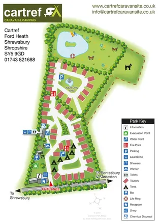
Tree-lined touring and camping map with an adult-only loop, island pond and clear facility key.
Features may come from the sample artwork, its key or published park information. Approximate numbers describe the drawing and may cover only part of a park. They are intended to help you compare map examples. Current facilities and booking information should be checked with the park.
LET’S MAP YOUR PARK
For a map quotation, find your park and draw a rough boundary around it. The area you select helps us work out the design time and price.
Draw your park for a quote ↗Or talk to our map designers
01751 473136