
Solar installation
A narrow row of pale blue panels beside the parking area is labelled Solar on the walking map.
ILLUSTRATED PARK MAP · P257
Pineapple Estate, Salway Ash, Bridport, Dorset · United Kingdom
 Enlarge the map ↗
A SENSE OF THE PLACE
Pineapple Farm Holidays is based at Pineapple Estate, Salway Ash, Bridport, Dorset. Pineapple Farm Holidays is a working-farm campsite at Salway Ash near Bridport in West Dorset.
The park provides individual electric hook-ups and water on each pitch, showers, Wi-Fi and a fire pit.
LOOK CLOSER
A narrow row of pale blue panels beside the parking area is labelled Solar on the walking map.
A tree-filled enclosure sits west of the campsite pitches. Orchard is also named on the wider walking map.
The long north-eastern end of the campsite plan contains a labelled wildlife area illustrated with grasses, trees, bees, butterflies and a dragonfly.
The wider map names Lower Cowlee, Home Ground, The Meadow, Orchard, Apples and Rough Cowlee, with tree belts and field boundaries organising the landscape.
Light blue wetland and pond shapes occur among the fields, while narrow blue watercourses follow several tree-lined boundaries.
A Play Space is labelled south of the village streets on the walking map, outside the campsite depiction.
Blue shower and black-and-white toilet symbols identify the small facilities cluster beside the orchard and entrance-side pitches.
A blue washing-up symbol is positioned beside the information symbol at the orchard-side facilities.
Blue shower and black-and-white toilet symbols identify the small facilities cluster beside the orchard and entrance-side pitches.
A blue washing-up symbol is positioned beside the information symbol at the orchard-side facilities.
An information symbol marks the small building cluster near the campsite entrance.
A blue bin symbol marks the grey entrance-side area.
Green assembly symbols appear near the entrance and within the wildlife area.
The walking map locates Reception/Shop beside Pineapple Lane, south-west of the campsite symbol.
The walking map marks parking north-west of Reception/Shop, alongside a row labelled Solar.
A narrow row of pale blue panels beside the parking area is labelled Solar on the walking map.
A tree-filled enclosure sits west of the campsite pitches. Orchard is also named on the wider walking map.
The campsite artwork includes a dog silhouette and a note about off-lead use in the orchard. This is an annotation on the artwork, not a statement of current policy.
The long north-eastern end of the campsite plan contains a labelled wildlife area illustrated with grasses, trees, bees, butterflies and a dragonfly.
A winding olive-coloured route with white paw prints loops through the wildlife area; the key describes walks, including dogs, and relaxation.
A red arrow marks the south-western entrance, with text describing arrival through Pineapple Business Park past Reception.
The northern boundary of the campsite plan labels a stile to footpaths and access to permissive footpaths.
The walking map distinguishes public footpaths with black dots, permissive footpaths with blue dots and campers' footpaths with red dots.
The wider map names Lower Cowlee, Home Ground, The Meadow, Orchard, Apples and Rough Cowlee, with tree belts and field boundaries organising the landscape.
Light blue wetland and pond shapes occur among the fields, while narrow blue watercourses follow several tree-lined boundaries.
Both artworks use red arrows to indicate the direction of a pub and cider farm beyond the depicted campsite; the walking map adds mug and apple-tree pictograms.
The walking map labels Salway Ash, the B3162, Pineapple Lane, Ash Lane, Ash Farm Close, Salway Drive and Pitchers.
A Play Space is labelled south of the village streets on the walking map, outside the campsite depiction.
Private labels identify neighbouring land along the western and north-western sides of the campsite plan.
Published park information describes individual electric hook-ups and water on each pitch, Wi-Fi and a fire pit. These are wider park facts rather than located features of the artwork.
READING THE MAP
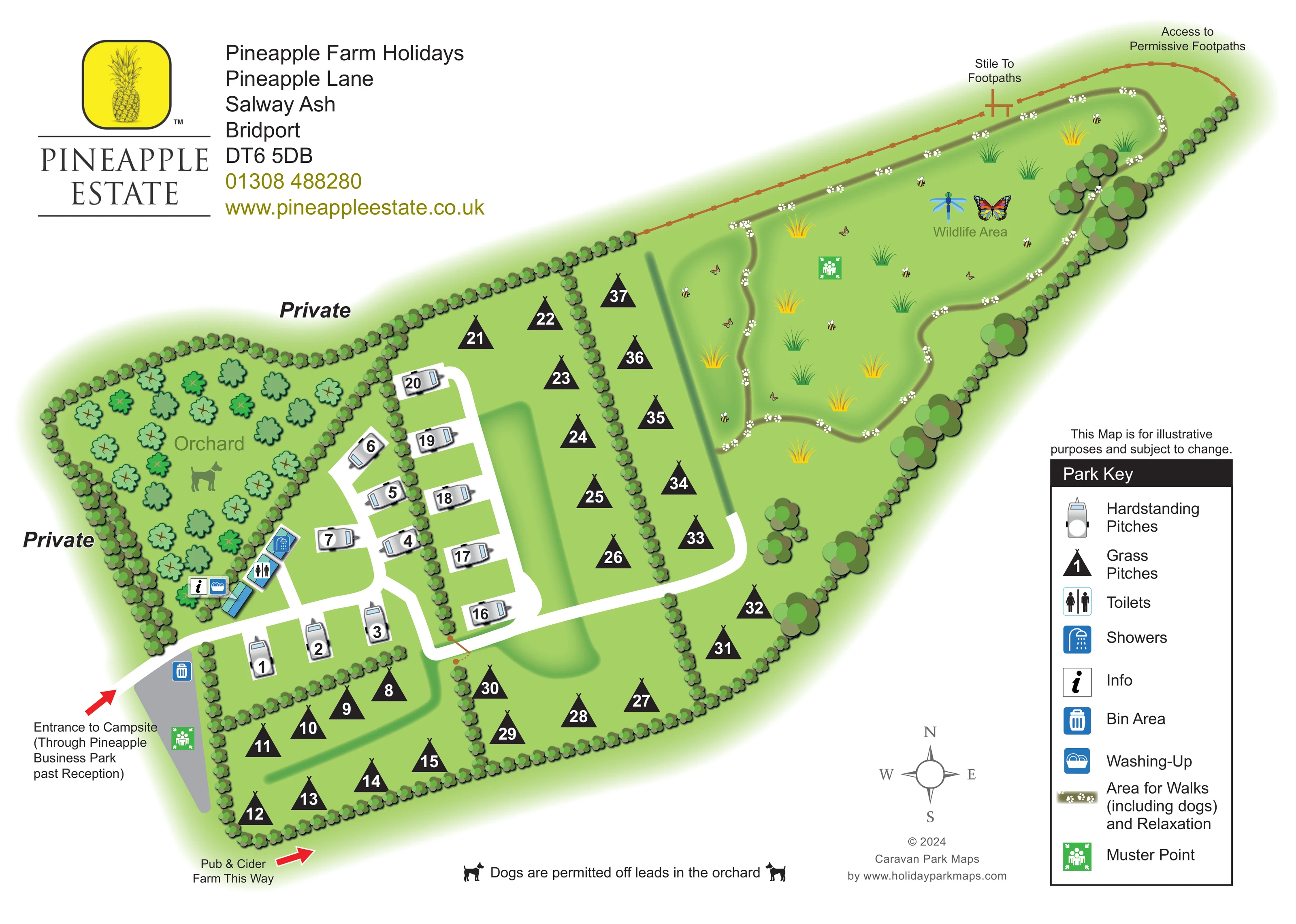
These two maps show how a small working-farm campsite can be presented at both pitch level and landscape scale. Pineapple Farm Holidays, at Salway Ash near Bridport in Dorset, is depicted in a detailed campsite plan alongside a companion walking map of the surrounding estate and village.
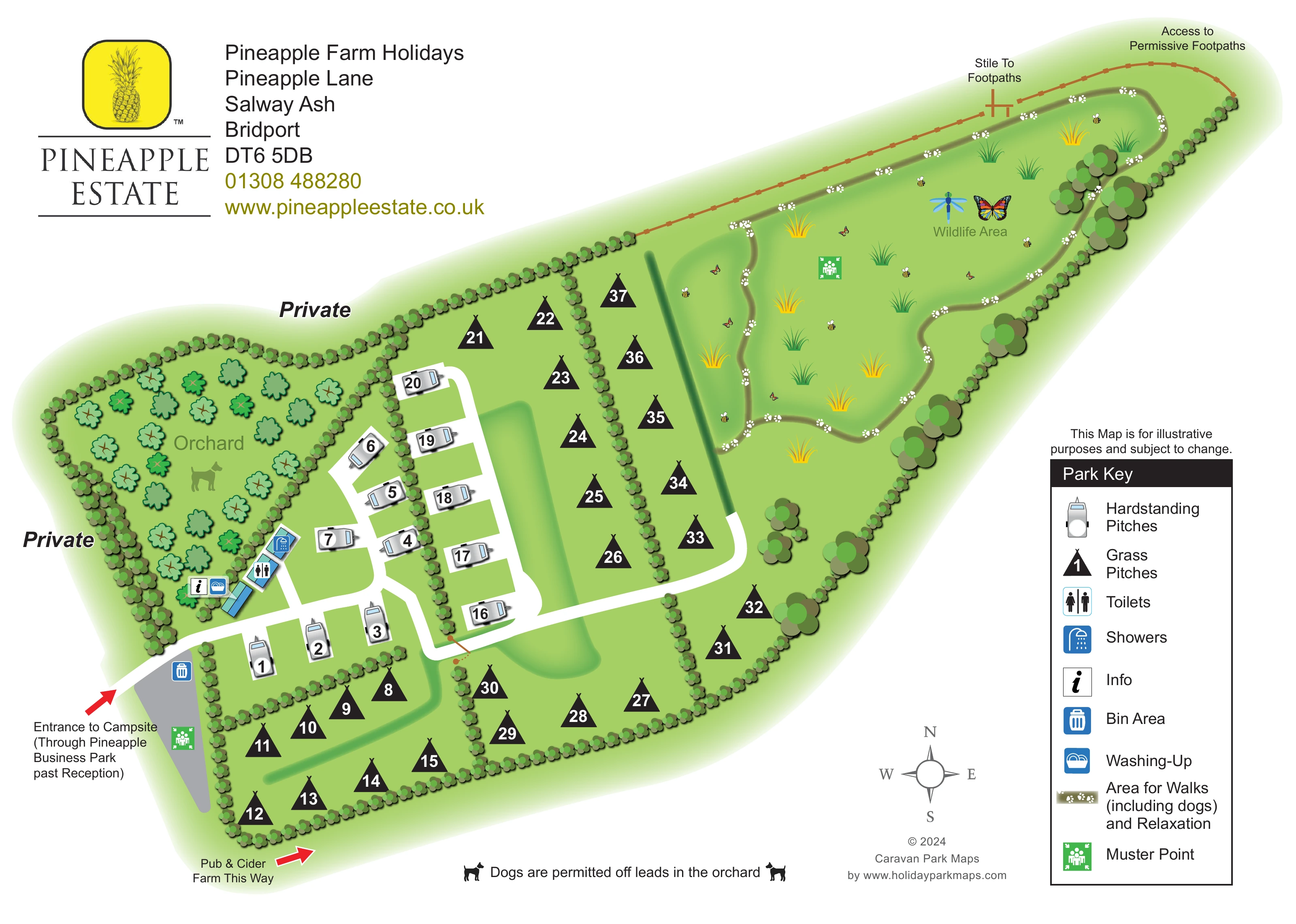
The campsite sheet gives visitors a clear picture of the numbered hardstanding and grass pitches, their access roads and the facilities beside the orchard. Its elongated layout leads towards a wildlife area, where a winding paw-print route, trees and insect illustrations introduce the quieter walking and relaxation space. The pineapple branding and generous white margins give the practical plan a recognisable estate identity.
The walking sheet changes emphasis. Instead of repeating the pitches, it locates the campsite, Reception/Shop and parking among named fields, village roads, ponds and tree-lined boundaries. Blue, black and red dotted routes separate permissive, public and campers' footpaths. Together, the artworks demonstrate a useful approach for rural campsites that need to explain both where guests stay and how the surrounding countryside connects.
The campsite plan runs diagonally across the page, from an entrance at the lower left to a broad wildlife area at the upper right. A white access road branches through hedge-divided pitch groups. Grey caravan illustrations identify hardstanding pitches, while bold black tent-shaped symbols identify grass pitches; both carry prominent white numbers. The accommodation scale is modest, at roughly 40 pitches across the whole depiction.
A tree-filled orchard occupies the western enclosure. Along its lower edge, small buildings and service symbols mark toilets, showers, information and washing-up. The bin area sits near the entrance, and green muster-point symbols appear at the entrance end and in the wildlife area. Arrival text refers to access through Pineapple Business Park past Reception. Private labels distinguish neighbouring land, while the far boundary marks a stile and access to permissive footpaths.
The wildlife area has a looping olive path decorated with white paw prints, surrounded by grass tufts, trees and colourful insects. A tall key on the right explains the symbols, with a compass and designer credit below the plan. The upper-left branding block combines the yellow pineapple emblem with the estate name and contact details.
The companion walking map shows Salway Ash and the B3162 to the west, with Pineapple Lane leading towards Reception/Shop and the campsite. Named fields, including Lower Cowlee, Home Ground and The Meadow, organise the countryside view. Blue permissive routes, black public routes and red campers' routes follow field edges and connect around the site. Ponds, wetlands, watercourses, parking, a solar installation and a village play space add landmarks. Red arrows on both sheets point towards a pub and cider farm beyond the campsite.
KEEP EXPLORING
Chosen for shared landscapes, accommodation or facilities.
 Explore the map ↗
United Kingdom
Woodland-framed Barnsoul map with mixed accommodation, shared facilities and paw-marked walking routes.
 Explore the map ↗
United Kingdom
A colour-zoned coastal park map with touring areas, woodland trails, ponds and a leisure club.
 Explore the map ↗
United Kingdom
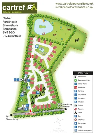
Tree-lined touring and camping map with an adult-only loop, island pond and clear facility key.
Features may come from the sample artwork, its key or published park information. Approximate numbers describe the drawing and may cover only part of a park. They are intended to help you compare map examples. Current facilities and booking information should be checked with the park.
TAKE A CLOSER LOOK
View the illustrated map in detail or choose a file to download. These are sample maps; contact the park for current visitor information.


LET’S MAP YOUR PARK
For a map quotation, find your park and draw a rough boundary around it. The area you select helps us work out the design time and price.
Draw your park for a quote ↗Or talk to our map designers
01751 473136
 pineapplebusinesspark_large.png
 pineapplebusinesspark_large.png
 pineapplebusinesspark.png