
Violet Square
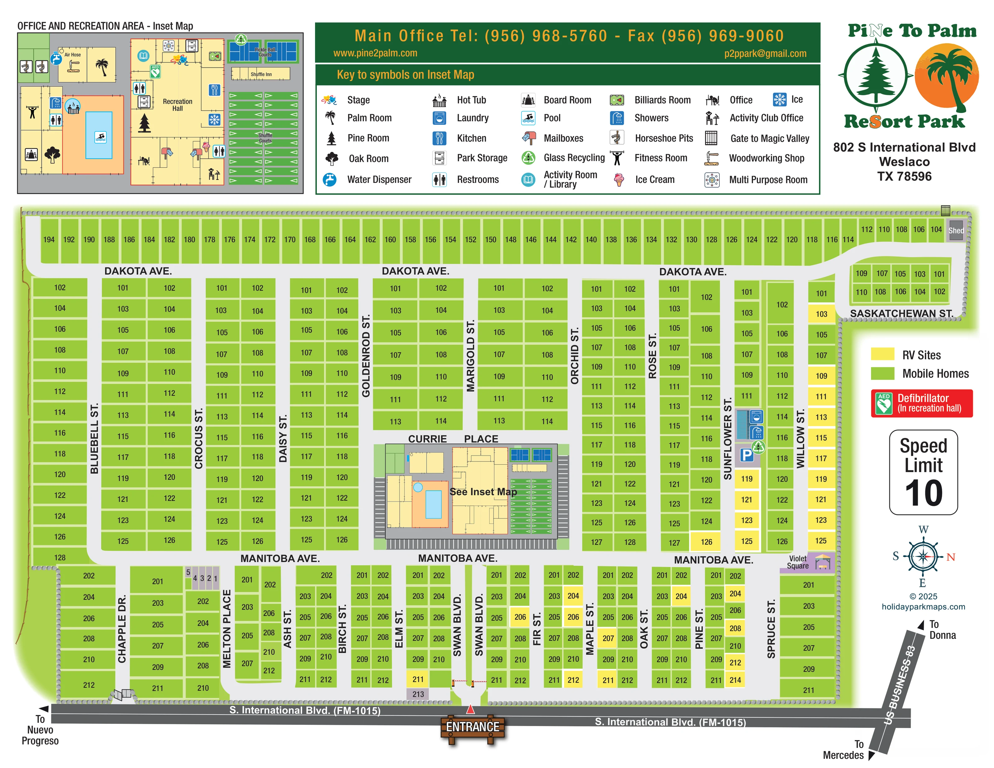
A small purple square with a shelter-like illustration is labelled near the right-hand end of Manitoba Avenue.
ILLUSTRATED PARK MAP · P256
802 S. International Boulevard, Weslaco, Texas, USA · United States
 Enlarge the map ↗
A SENSE OF THE PLACE
Pine to Palm Resort Park is based at 802 S. International Boulevard, Weslaco, Texas, USA. The park provides information for RV visitors, mobile homes and leased lots. The resort is owned by resident shareholders and caters for people aged 55 and over.
Amenities include a heated pool/hot tub, recreation and exercise rooms, shuffleboard and pickleball. Coin laundry, showers and complimentary Wi-Fi in the main building are advertised.
LOOK CLOSER
A small purple square with a shelter-like illustration is labelled near the right-hand end of Manitoba Avenue.
Repeated grey boundary marks enclose most of the plan, with a softer green edge and a narrow irregular strip along the left side.
The principal communal building occupies the central recreation campus and is enlarged in the inset.
Separate office and activity-office symbols appear along the lower side of the recreation hall, with mailbox symbols nearby.
Distinctive palm, conifer and broadleaf-tree symbols identify named rooms across the communal buildings.
An open-book symbol locates the activity room/library near the upper-left corner of the recreation hall.
The board room is shown in the building beside the pool; the multi-purpose room is marked along the upper edge of the recreation hall.
The inset locates a stage in the recreation hall and a kitchen along its right-hand side.
The principal communal building occupies the central recreation campus and is enlarged in the inset.
Separate office and activity-office symbols appear along the lower side of the recreation hall, with mailbox symbols nearby.
Distinctive palm, conifer and broadleaf-tree symbols identify named rooms across the communal buildings.
An open-book symbol locates the activity room/library near the upper-left corner of the recreation hall.
The board room is shown in the building beside the pool; the multi-purpose room is marked along the upper edge of the recreation hall.
The inset locates a stage in the recreation hall and a kitchen along its right-hand side.
A green billiard-table icon marks a room in the upper-right part of the recreation hall.
A bright blue rectangular pool and small circular hot tub occupy the orange-coloured enclosure beside the communal buildings.
A weightlifting symbol identifies the fitness room in the building to the left of the pool.
Two blue court rectangles appear at the upper-right corner of the recreation area.
A substantial bank of green shuffleboard lanes occupies the right side of the recreation campus, beneath the labelled Shuffle Inn building.
Two horseshoe-pit symbols sit at the upper-left side of the recreation inset.
The woodworking-shop symbol appears within the Palm Room building in the inset.
Service symbols occur within the recreation complex; an additional laundry and shower cluster is shown beside Sunflower Street.
The inset locates a water dispenser near the Palm Room building, ice beside the recreation hall and an ice-cream point near its lower edge.
A labelled air hose is shown beside the water dispenser in the recreation inset.
Green recycling symbols appear near the pickleball courts and beside the Sunflower Street service area.
Storage symbols occur in the recreation hall, while a separate labelled shed occupies the upper-right perimeter.
An AED symbol is positioned in the recreation hall and reinforced by a prominent red sidebar notice.
Striped parking borders several sides of the central recreation campus; a blue parking symbol marks the Sunflower Street service cluster.
A small purple square with a shelter-like illustration is labelled near the right-hand end of Manitoba Avenue.
Repeated grey boundary marks enclose most of the plan, with a softer green edge and a narrow irregular strip along the left side.
A prominent entrance sign and red marker identify arrival from S. International Boulevard (FM-1015), leading into Swan Boulevard.
Dakota and Manitoba avenues organise the main blocks, with flower-named streets above Manitoba Avenue and predominantly tree-named streets below it.
A gate symbol appears on the upper-right boundary and is identified in the key as the Gate to Magic Valley.
The lower edge shows FM-1015 and its connection with US Business 83, with direction arrows to Nuevo Progreso, Donna and Mercedes.
A large sidebar sign displays a speed limit of 10; no unit is printed on the sign.
READING THE MAP
This map of Pine to Palm Resort Park in Weslaco, Texas, combines a large residential-style street plan with a detailed guide to its communal recreation area. Green mobile-home lots form the main pattern, while yellow RV sites stand out within the same network of named streets. The result is a map that helps visitors find both an individual address and the shared spaces at the heart of the resort.
The main entrance is clearly marked on S. International Boulevard, with surrounding road connections and arrows towards Donna, Mercedes and Nuevo Progreso providing useful arrival context. Inside the park, broad grey roads, bold street names and numbered lots keep the extensive grid readable.
A separate inset enlarges the office and recreation campus, showing the pool, hot tub, recreation hall, pickleball courts and shuffleboard area alongside smaller rooms and services. The dark green header, orange lettering and pine-and-palm logo give the page a recognisable identity without competing with its practical wayfinding content.
The main plan is organised around Dakota Avenue near the top and Manitoba Avenue across the lower-middle section. Short connecting streets divide the accommodation into repeated paired rows, with flower names such as Crocus, Daisy and Marigold in the upper blocks and tree names including Birch, Elm, Maple and Pine below. A long row of lots follows the upper boundary, while a small extension around Saskatchewan Street changes the otherwise rectangular outline.
Green parcels identify mobile-home lots and yellow parcels identify RV sites. The RV provision is dispersed, especially through the right-hand streets and selected lower blocks. The entrance connects S. International Boulevard to Swan Boulevard near the centre of the lower edge. External road labels and directional arrows sit outside the park boundary, separating regional arrival information from internal navigation.
The central recreation campus lies between Currie Place and Manitoba Avenue, with striped parking around its edges. Its enlarged inset reveals the recreation hall, Palm, Pine and Oak rooms, activity room/library, board room, multi-purpose room, billiards room, stage and kitchen. The pool and hot tub sit beside the fitness room, while pickleball courts, the Shuffle Inn and a bank of shuffle courts occupy the opposite side. Horseshoe pits and a woodworking shop add further recreation detail.
Service symbols locate offices, mailboxes, laundry, showers, restrooms, storage, glass recycling, a water dispenser, ice, ice cream and an air hose. A further service cluster appears beside Sunflower Street. Violet Square, the perimeter shed and the gate to Magic Valley provide additional landmarks. The upper key explains the inset symbols, while the right sidebar carries the accommodation key, AED notice, speed-limit sign and compass.
KEEP EXPLORING
Chosen for shared landscapes, accommodation or facilities.
 Explore the map ↗
United States
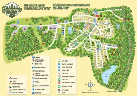
Woodland RV campground map with mixed camping, three water landmarks and a central recreation hub.
 Explore the map ↗
United States
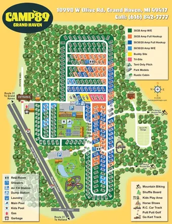
Colour-coded RV pitches, woodland borders and two activity hubs at Camp '89 Grand Haven.
 Explore the map ↗
United States
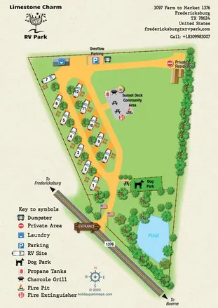
Portrait RV park map with angled pitches, a community deck, dog park and landscaped pond.
Features may come from the sample artwork, its key or published park information. Approximate numbers describe the drawing and may cover only part of a park. They are intended to help you compare map examples. Current facilities and booking information should be checked with the park.
LET’S MAP YOUR PARK
For a map quotation, find your park and draw a rough boundary around it. The area you select helps us work out the design time and price.
Draw your park for a quote ↗Or talk to our map designers
01751 473136