
Wooded edges and planted divisions
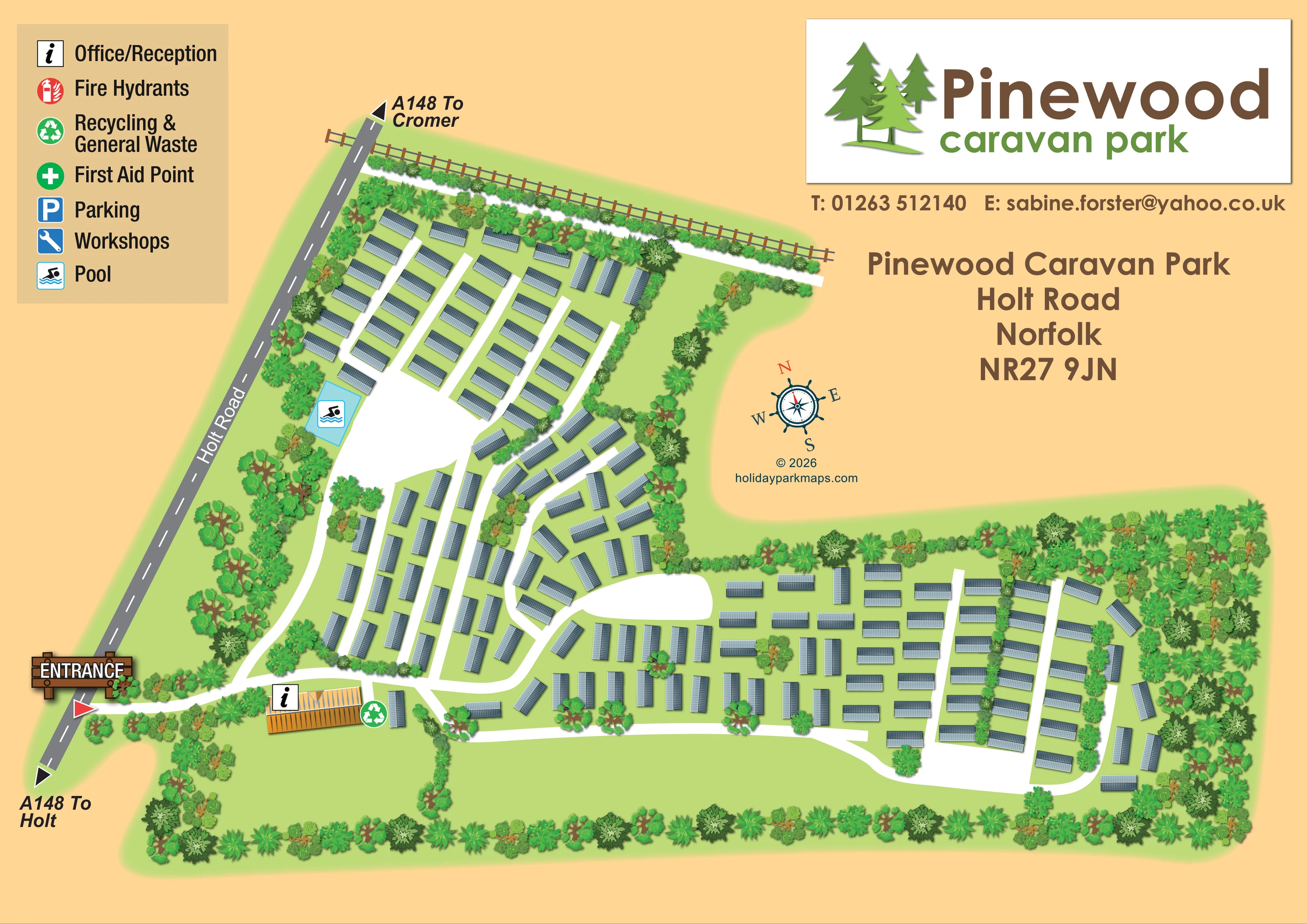
Dense illustrated trees and shrubs frame the perimeter, thicken at the far right and divide several accommodation groups.
ILLUSTRATED PARK MAP · P258
Holt Road, Cromer, Norfolk · United Kingdom
 Enlarge the map ↗
A SENSE OF THE PLACE
Pinewood Caravan Park is a family-run holiday caravan site on Holt Road in Norfolk. Its partly wooded grounds are arranged across different levels.
The park's visitor listing describes indoor and outdoor swimming pools and an owners' setting without holiday letting, touring or tent camping. The map helps explain the terraced layout and location of shared spaces.
LOOK CLOSER
Dense illustrated trees and shrubs frame the perimeter, thicken at the far right and divide several accommodation groups.
Broad unlabelled green spaces appear along the lower edge and within planted boundaries; no specific recreational use is assigned.
A brown post-and-rail fence follows the upper boundary behind a planted strip and a narrow white route.
An information symbol identifies the distinctive orange-roofed building just inside the entrance.
A cyan rectangular pool area with a swimmer symbol is shown beside the western road, below the upper caravan rows.
A green recycling symbol beside reception marks the mapped waste and recycling location.
A timber-style ENTRANCE sign and red triangular pointer highlight the access from Holt Road at the lower left.
Holt Road runs diagonally along the left edge, with directional arrows labelled A148 to Cromer and A148 to Holt.
An information symbol identifies the distinctive orange-roofed building just inside the entrance.
A cyan rectangular pool area with a swimmer symbol is shown beside the western road, below the upper caravan rows.
A green recycling symbol beside reception marks the mapped waste and recycling location.
Listed with a red fire-safety symbol in the legend; no corresponding positions are apparent on the main plan.
A green cross appears in the legend, without a clearly identifiable placement on the main plan.
The legend includes a blue parking symbol, but does not establish the location of a designated parking area.
A blue spanner symbol is included in the key; a workshop location is not clearly marked in the illustrated grounds.
A timber-style ENTRANCE sign and red triangular pointer highlight the access from Holt Road at the lower left.
Holt Road runs diagonally along the left edge, with directional arrows labelled A148 to Cromer and A148 to Holt.
Broad white routes connect reception with the upper rows, central clusters and long right-hand section, including curved connections and short access spurs.
Dense illustrated trees and shrubs frame the perimeter, thicken at the far right and divide several accommodation groups.
Broad unlabelled green spaces appear along the lower edge and within planted boundaries; no specific recreational use is assigned.
A brown post-and-rail fence follows the upper boundary behind a planted strip and a narrow white route.
Park context describes partly wooded grounds arranged across different levels; the artwork does not explicitly mark contours or elevation changes.
The visitor listing describes indoor and outdoor pools. The artwork marks one pool area without distinguishing the two facilities.
READING THE MAP
This illustrated map of Pinewood Caravan Park on Holt Road in Cromer presents a wooded Norfolk caravan site through a clear overhead layout. Grey-blue caravans sit in rows and smaller angled groups, linked by white internal roads that stand out against light green grounds. Dense planting around the edges and between sections gives the drawing its woodland character without obscuring the main routes.
The arrival point is especially easy to recognise. A timber-style entrance sign marks the turn from Holt Road, while an orange-roofed reception building provides a distinctive landmark just inside the park. A pool area and recycling point are also marked on the plan. Directional arrows towards Cromer and Holt connect the internal layout with the surrounding road network.
The page combines practical orientation with prominent park branding: a large pine-tree logo and address panel occupy the upper right, balanced by a facility key at the upper left. It is a useful sample for caravan parks needing to explain a branching site layout while retaining the visual importance of wooded boundaries and planted divisions.
The single landscape-format map shows an irregular site extending upwards beside Holt Road and across a longer lower section to the right. Its entrance is positioned at the lower left, where a red pointer and illustrated wooden sign identify the turn into the grounds. Reception sits immediately beyond this arrival point, distinguished from the caravans by an orange roof and a black information symbol. A green recycling marker appears alongside it.
From reception, broad white routes branch into the accommodation areas. The upper section contains relatively regular caravan rows separated by straight access lanes, with a cyan pool rectangle beside the western edge. Towards the centre, the roads bend and the caravans turn to follow them, producing more angled and irregular groups. The elongated right-hand section combines several horizontal rows with upright units and a curved outer connection. Broad white spaces at junctions make the route structure visually prominent, although they are not labelled as parking areas.
Trees and shrubs surround much of the site and form internal screens between groups of caravans. The planting becomes particularly dense at the far right, while larger unlabelled grass areas remain along the lower boundary. A brown post-and-rail fence follows the upper edge.
Holt Road is drawn in grey with a dashed centre line and arrows towards Cromer and Holt. The upper-left legend includes reception, fire hydrants, waste and recycling, first aid, parking, workshops and pool symbols; reception, recycling and pool have clear placements within the plan. A large logo, contact line, address and decorative compass complete the composition. Accommodation is illustrated without individual plot numbers, making this primarily an overview and orientation design.
KEEP EXPLORING
Chosen for shared landscapes, accommodation or facilities.
 Explore the map ↗
United Kingdom
A colour-zoned coastal park map with touring areas, woodland trails, ponds and a leisure club.
 Explore the map ↗
United Kingdom
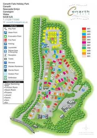
Woodland-edged caravan and touring park plan with colourful plots, clear arrivals information and a dedicated health-club panel.
 Explore the map ↗
United Kingdom
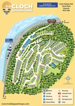
Woodland caravan-park map with coastal context, Cloch Lighthouse and clearly marked visitor facilities.
Features may come from the sample artwork, its key or published park information. Approximate numbers describe the drawing and may cover only part of a park. They are intended to help you compare map examples. Current facilities and booking information should be checked with the park.
LET’S MAP YOUR PARK
For a map quotation, find your park and draw a rough boundary around it. The area you select helps us work out the design time and price.
Draw your park for a quote ↗Or talk to our map designers
01751 473136