
Tree-lined boundaries and internal planting
Dense stylised trees enclose the park, line the western approach and divide selected accommodation and facility areas.
ILLUSTRATED PARK MAP · P074
Cenarth Falls Holiday Park, Cenarth, Newcastle Emlyn, Ceredigion, Wales · United Kingdom
 Enlarge the map ↗
A SENSE OF THE PLACE
Cenarth Falls Resort offers self-catering holidays near Cenarth village, where the counties of Pembrokeshire, Ceredigion and Carmarthenshire meet. Caravan accommodation and pods provide options for a stay close to the village's river and falls.
The resort also describes hardstanding touring pitches with electric connections, showers and laundry facilities. The map gives visitors an overview of accommodation areas and the shared spaces within the site.
LOOK CLOSER
Dense stylised trees enclose the park, line the western approach and divide selected accommodation and facility areas.
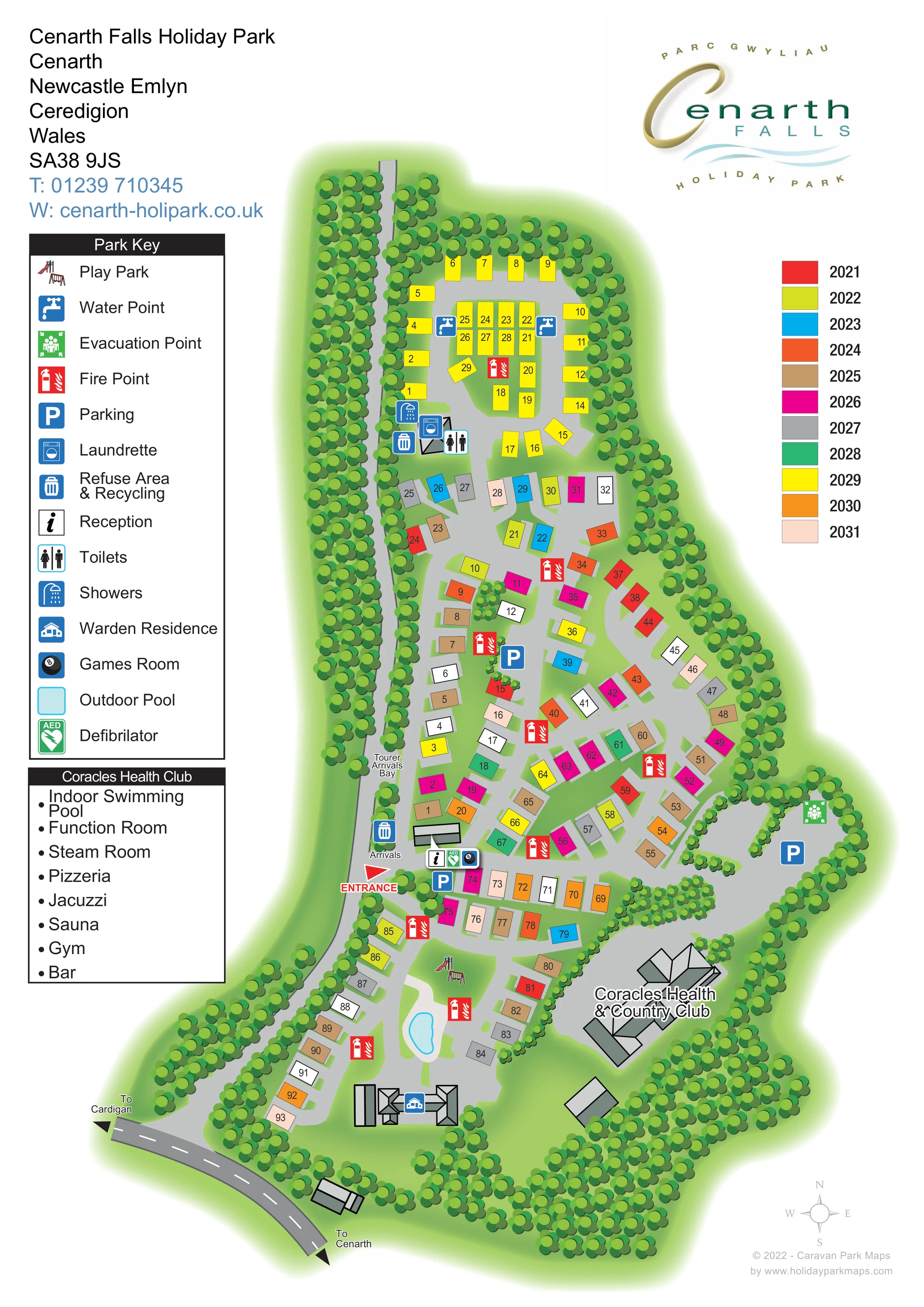
Reception is marked beside the entrance and the building labelled Arrivals, forming a clear check-in focal point.
A labelled waiting bay runs along the tree-lined approach, just north of the entrance.
Blue parking symbols identify spaces beside arrivals, within the central accommodation area and in the larger eastern clearing.
A grouped service building at the southern edge of the northern pitch loop is marked with toilets, showers and laundrette symbols.
Water-point symbols appear on opposite sides of the northern pitch loop.
Refuse and recycling symbols appear near the northern service building and on the arrivals approach.
A small illustration of a slide and swings marks the play area on the southern central green.
Reception is marked beside the entrance and the building labelled Arrivals, forming a clear check-in focal point.
A labelled waiting bay runs along the tree-lined approach, just north of the entrance.
Blue parking symbols identify spaces beside arrivals, within the central accommodation area and in the larger eastern clearing.
A grouped service building at the southern edge of the northern pitch loop is marked with toilets, showers and laundrette symbols.
Water-point symbols appear on opposite sides of the northern pitch loop.
Refuse and recycling symbols appear near the northern service building and on the arrivals approach.
A small illustration of a slide and swings marks the play area on the southern central green.
A pale-blue, irregularly shaped pool sits within a light surround beside the southern play area.
The games-room symbol is grouped with reception and the defibrillator beside arrivals.
A green AED symbol marks a defibrillator beside the reception and arrivals facilities.
A blue house symbol identifies the substantial building south of the outdoor pool.
A prominent labelled complex with angular grey roof forms occupies the wooded south-eastern part of the park.
The separate club panel lists an indoor swimming pool, function room, steam room, pizzeria, jacuzzi, sauna, gym and bar. Individual rooms are not located within the building drawing.
Repeated red fire-point symbols are distributed through the northern pitches and the main caravan areas.
A green evacuation-point symbol is shown in the eastern parking clearing.
Dense stylised trees enclose the park, line the western approach and divide selected accommodation and facility areas.
A red entrance marker leads from the western approach into branching grey roads, a northern pitch loop and curved southern accommodation lanes.
The external road along the lower edge has directional arrows labelled To Cardigan and To Cenarth.
READING THE MAP
This map of Cenarth Falls Holiday Park presents a tree-lined holiday site in Cenarth, near Newcastle Emlyn in west Wales. Its tall portrait layout follows the shape of the park, from the compact northern pitch loop through the main caravan areas to the recreation spaces and Coracles Health & Country Club in the south. Dense green planting gives the accommodation a clear woodland setting without obscuring the roads or numbered plots.
Visitors can pick out the entrance, reception and tourer arrivals bay before following the branching internal lanes. Blue amenity symbols identify practical facilities, while red fire points and green safety markers remain distinct from the colourful accommodation rectangles. The outdoor pool, play park and large club building provide recognisable landmarks beyond the pitch numbers.
The page combines a detailed site plan with a generous facility key, a separate health-club information panel and prominent park branding. A year-based colour panel adds another information layer to the accommodation drawing, making this a useful example of a visitor map that also carries plot-specific colour coding.
The artwork uses an overhead plan with simplified accommodation footprints and more detailed roof shapes for shared buildings. A local road crosses the lower edge, with arrows towards Cardigan and Cenarth. From here, the approach travels up the wooded western side to a red entrance marker beside the arrivals building. Reception, the games room, a defibrillator and nearby parking are grouped at this arrival point, while the tourer arrivals bay is labelled along the approach immediately to the north.
The main accommodation area spreads across a series of grey branching lanes. Coloured numbered rectangles sit at varied angles, with small standing areas and pockets of planting breaking up the rows. Farther north, a separate compact loop contains another group of pitches around a central island. Water points flank this loop, and a service building at its lower edge is marked with toilets, showers and laundrette symbols. Refuse and recycling points and repeated fire-point symbols provide additional practical references.
In the southern section, an illustrated slide and swings mark the play park beside a pale-blue outdoor pool. The warden residence stands below this recreation area. To the east, the angular roofs of Coracles Health & Country Club form a prominent landmark; a separate parking clearing includes an evacuation-point marker. The club panel lists an indoor pool, function room, steam room, pizzeria, jacuzzi, sauna, gym and bar without drawing their individual positions.
The large left-hand key, upper-right logo, year-colour panel and lower-right compass frame the plan. The enlarged detail repeats part of this same artwork, making the key and arrivals area easier to read rather than introducing another site section.
KEEP EXPLORING
Chosen for shared landscapes, accommodation or facilities.
 Explore the map ↗
United Kingdom
A colour-zoned coastal park map with touring areas, woodland trails, ponds and a leisure club.
 Explore the map ↗
United Kingdom
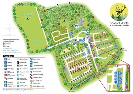
A woodland holiday-park map with colour-coded accommodation, camping fields and an enlarged facilities inset.
 Explore the map ↗
United Kingdom
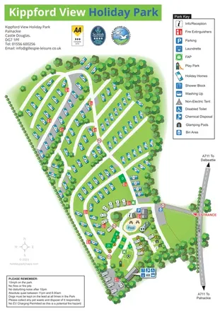
Tree-lined holiday-park plan with numbered holiday homes, touring pitches, glamping pods and a pool-centred arrival hub.
Features may come from the sample artwork, its key or published park information. Approximate numbers describe the drawing and may cover only part of a park. They are intended to help you compare map examples. Current facilities and booking information should be checked with the park.
TAKE A CLOSER LOOK
View the illustrated map in detail or choose a file to download. These are sample maps; contact the park for current visitor information.


LET’S MAP YOUR PARK
For a map quotation, find your park and draw a rough boundary around it. The area you select helps us work out the design time and price.
Draw your park for a quote ↗Or talk to our map designers
01751 473136