
Pond with wooded island
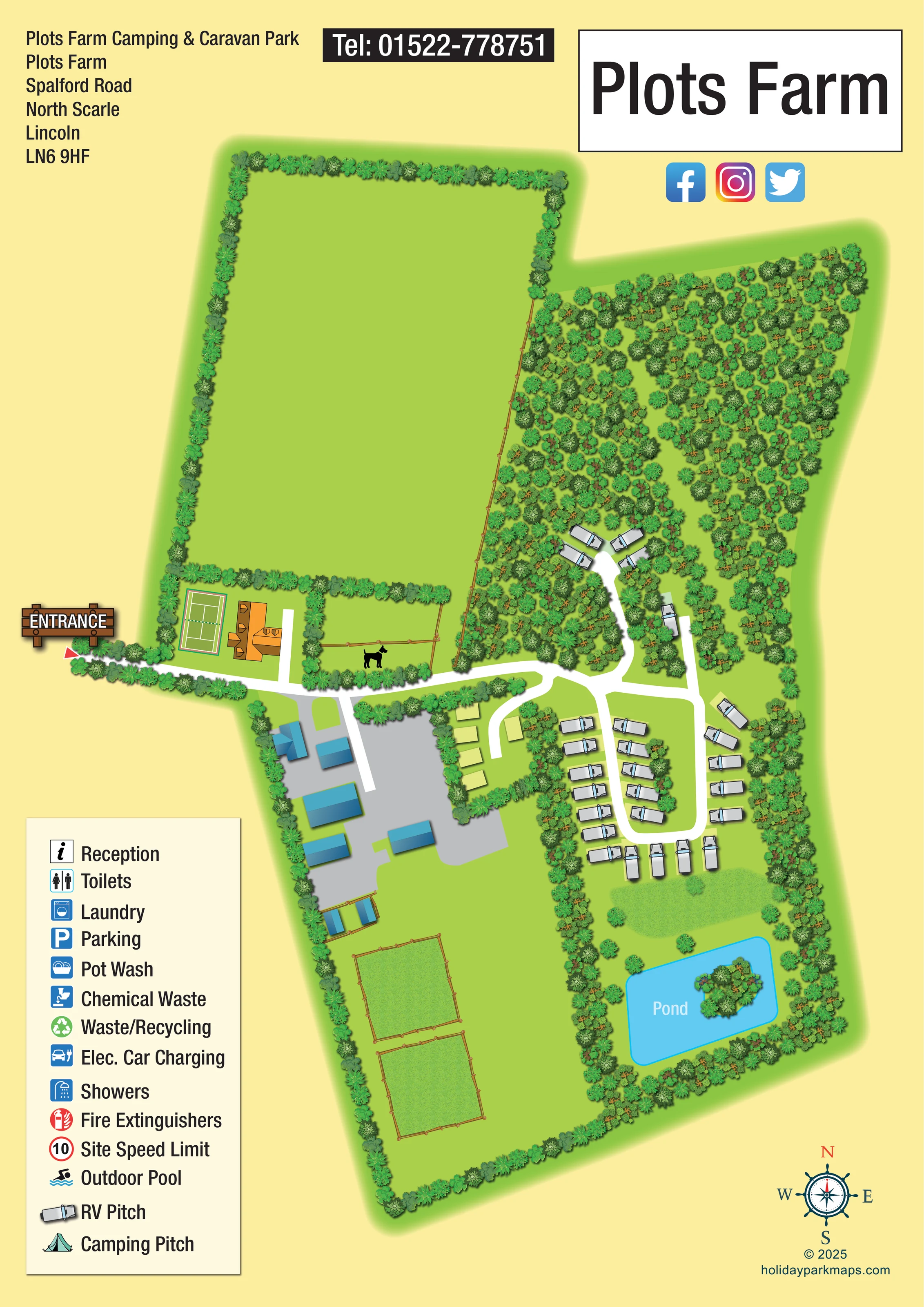
A bright blue pond labelled 'Pond' occupies the south-eastern corner and contains a densely planted island.
ILLUSTRATED PARK MAP · P260
Spalford Road, North Scarle, Lincoln, Lincolnshire · United Kingdom
 Enlarge the map ↗
A SENSE OF THE PLACE
Plots Farm Caravan and Camping is based at Spalford Road, North Scarle, Lincoln, Lincolnshire. The booking description places the rural site near Lincoln and Doddington Hall. The detailed booking entry advertises hardstanding pitches with 16-amp electricity for touring vehicles.
The map brings the site layout and its access routes together in one view, providing a reference for understanding the arrangement of the grounds.
LOOK CLOSER
A bright blue pond labelled 'Pond' occupies the south-eastern corner and contains a densely planted island.
Dense woodland fills the north-east, while continuous tree and shrub belts frame the grounds and divide several internal areas.
A large northern field and open southern lawns contrast with the woodland. Two rectangular fenced grass plots appear south of the building yard; their use is not labelled.
A wooden-style ENTRANCE sign and red triangular marker identify the approach from the left of the plan.
White lanes connect the entrance, building yard, eastern touring loop and a short spur into the woodland.
A green court with white tennis markings and a central net is drawn beside the orange-roofed building near the entrance.
A fenced, hedge-edged area beside the entrance lane contains a black dog silhouette. It suggests a dog-related outdoor area, without stating its rules or exact purpose.
Several blue-roofed buildings stand around a broad grey yard south of the entrance lane. Their individual functions are not labelled.
A wooden-style ENTRANCE sign and red triangular marker identify the approach from the left of the plan.
White lanes connect the entrance, building yard, eastern touring loop and a short spur into the woodland.
A bright blue pond labelled 'Pond' occupies the south-eastern corner and contains a densely planted island.
Dense woodland fills the north-east, while continuous tree and shrub belts frame the grounds and divide several internal areas.
A large northern field and open southern lawns contrast with the woodland. Two rectangular fenced grass plots appear south of the building yard; their use is not labelled.
A green court with white tennis markings and a central net is drawn beside the orange-roofed building near the entrance.
A fenced, hedge-edged area beside the entrance lane contains a black dog silhouette. It suggests a dog-related outdoor area, without stating its rules or exact purpose.
Several blue-roofed buildings stand around a broad grey yard south of the entrance lane. Their individual functions are not labelled.
Listed with an information symbol; no corresponding location is marked on the plan.
Separate toilet and shower symbols are explained in the legend but are not visibly assigned to buildings.
A washing-machine symbol appears in the legend without a mapped position.
A blue parking symbol is included in the key; the grey yard is not explicitly labelled as parking.
The key includes a washing-up symbol and 'Pot Wash' label, without locating it.
Chemical waste disposal is named in the legend but has no visible location marker.
A green recycling symbol is listed in the key, with no positioned collection point.
Electric car charging appears as a legend entry only.
A red fire-extinguisher symbol is explained in the key, but extinguisher positions are not shown.
The legend contains a red-ringed '10' symbol labelled 'Site Speed Limit'; no units or positioned signs are shown.
An outdoor-pool symbol is included in the legend, but no pool is identified on the plan. The labelled pond is a separate feature.
READING THE MAP
This illustrated map presents Plots Farm Camping & Caravan Park in North Scarle, Lincolnshire, as a rural site of open fields, wooded boundaries and a compact touring area. A pale yellow page surrounds the green grounds, while bright white lanes make the route from the western entrance easy to follow through the drawing.
The main RV pitches are arranged around an eastern loop, with a smaller group tucked into the woodland above. Below them, a blue pond with a tree-covered island provides a distinctive visual landmark. On the opposite side of the site, blue-roofed buildings cluster around a grey yard, and an orange-roofed building stands beside an illustrated tennis court near the entrance. A fenced area carrying a dog silhouette adds another recognisable feature.
Large park branding, an address block and a tall pictorial legend give the portrait artwork the character of a visitor information sheet. This sample is particularly relevant to rural caravan parks needing to explain access and the relationship between touring pitches, buildings and landscaped grounds without relying on a numbered plot plan.
The plan is organised around a west-to-east entrance lane. A wooden-style ENTRANCE sign and red marker identify the arrival point at the left edge, beside a hedge-framed building and tennis court. Just beyond this is a fenced area marked with a dog silhouette. The lane then divides, connecting the surfaced building yard to the south with the accommodation routes to the east.
The main touring group follows a rounded white loop, with motorhome illustrations placed on pale rectangular bases along both sides and across its lower end. A separate curving spur leads into the dense northern woodland, where a smaller cluster of RV pitches is shown. Several empty rectangular pads appear between the yard and the main touring group, but their purpose is not labelled. The large northern field and two fenced grass plots in the south-west remain visually open rather than being populated with accommodation symbols.
Landscape carries much of the map's identity. Repeated tree and shrub illustrations form a continuous perimeter, internal screens and a substantial wooded area. The south-eastern pond is outlined in cyan, labelled in white and given a densely planted island. Selected grass areas have a fine textured fill, distinguishing them from the flat green lawns.
The lower-left legend lists reception, toilets, showers, laundry, parking, pot wash, chemical waste, recycling, electric car charging, fire extinguishers, a speed-limit symbol and an outdoor pool, followed by RV and camping-pitch symbols. These service entries are not positioned on the plan. A compass at the lower right complements the sparse labels. The artwork is a single portrait map; the enlarged views show overlapping details of that same composition.
KEEP EXPLORING
Chosen for shared landscapes, accommodation or facilities.
 Explore the map ↗
United Kingdom
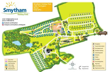
Colour-coded accommodation, woodland ponds and a Tarka Trail footpath on Smytham’s illustrated park map.
 Explore the map ↗
United Kingdom
A colour-zoned coastal park map with touring areas, woodland trails, ponds and a leisure club.
 Explore the map ↗
United Kingdom
Woodland holiday-park map with named accommodation areas, touring loops and illustrated recreation facilities.
Features may come from the sample artwork, its key or published park information. Approximate numbers describe the drawing and may cover only part of a park. They are intended to help you compare map examples. Current facilities and booking information should be checked with the park.
LET’S MAP YOUR PARK
For a map quotation, find your park and draw a rough boundary around it. The area you select helps us work out the design time and price.
Draw your park for a quote ↗Or talk to our map designers
01751 473136