
Events field
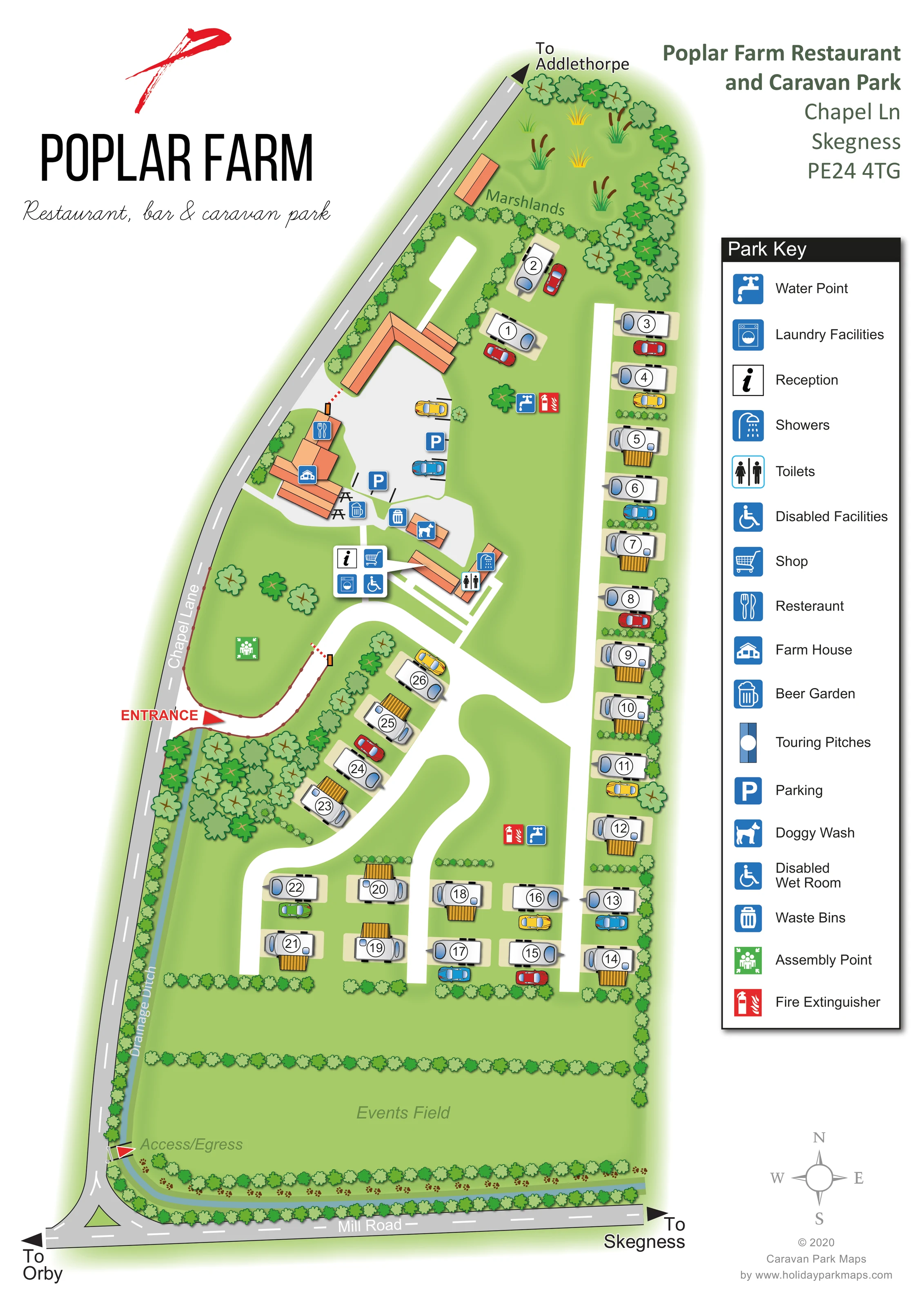
A broad, hedge-enclosed open field occupies the southern end of the plan, separate from the illustrated touring pitches.
ILLUSTRATED PARK MAP · P574
Poplar Farm Restaurant, and Caravan Park, Chapel Ln, Skegness · United Kingdom
 Enlarge the map ↗
A SENSE OF THE PLACE
Poplar Farm Touring and Camping Park is set in countryside at Addlethorpe near Skegness. It offers spacious touring pitches, including serviced spaces with all-weather bases and parking.
Showers, toilets and barrier-controlled access support stays. The Lincolnshire coast and seaside attractions are nearby, while the separate Addlethorpe Golf and Country Club provides another local leisure option.
LOOK CLOSER
A broad, hedge-enclosed open field occupies the southern end of the plan, separate from the illustrated touring pitches.
The northern tip is labelled Marshlands and illustrated with reeds, rushes and a curved tree boundary.
A narrow blue-green drainage channel runs along the Chapel Lane boundary and continues around the southern edge.
Repeated tree and shrub symbols enclose the site, divide pitch groups and separate the events field from the touring area.
An information symbol identifies reception within the central facilities cluster beside the internal arrival road.
A shopping-trolley symbol marks the shop in the central facilities cluster.
A cutlery symbol identifies the restaurant in the orange-roofed building group beside Chapel Lane.
The farmhouse symbol appears on the roadside building group adjoining the restaurant and beer garden.
An information symbol identifies reception within the central facilities cluster beside the internal arrival road.
A shopping-trolley symbol marks the shop in the central facilities cluster.
A cutlery symbol identifies the restaurant in the orange-roofed building group beside Chapel Lane.
The farmhouse symbol appears on the roadside building group adjoining the restaurant and beer garden.
A beer-mug symbol and illustrated picnic tables identify the outdoor area beside the restaurant buildings.
A washing-machine symbol is grouped with reception, shop and disabled-facility symbols near the central service buildings.
Shower and toilet symbols mark the central amenity buildings, with white connecting paths drawn around them.
A wheelchair symbol is shown in the central facilities cluster. It identifies a mapped facility rather than establishing site-wide accessibility.
The key separately lists a disabled wet room using the same wheelchair pictogram as disabled facilities; a distinct wet-room location is not identifiable.
A dog symbol marks a small building between the restaurant-side parking area and the main amenity cluster.
Blue parking symbols identify the grey forecourt beside the restaurant buildings; cars also help illustrate the arrangement of individual touring spaces.
Tap symbols are distributed between the northern pitches and central touring area.
Waste-bin symbols are grouped around the central buildings and arrival area.
Red extinguisher symbols appear beside water points within the touring area.
A green assembly-point symbol appears on the grass just inside the Chapel Lane entrance.
A broad, hedge-enclosed open field occupies the southern end of the plan, separate from the illustrated touring pitches.
The northern tip is labelled Marshlands and illustrated with reeds, rushes and a curved tree boundary.
A narrow blue-green drainage channel runs along the Chapel Lane boundary and continues around the southern edge.
Repeated tree and shrub symbols enclose the site, divide pitch groups and separate the events field from the touring area.
A red ENTRANCE label and arrow mark access from Chapel Lane into a curving internal road.
Red-and-white barrier illustrations appear on the main arrival route and at the restaurant-side forecourt.
A separate access/egress arrow is shown near the southern end of Chapel Lane, beside the events field.
Chapel Lane follows the western edge and meets Mill Road at the bottom of the page. Direction arrows point towards Addlethorpe, Orby and Skegness.
READING THE MAP
This illustrated map of Poplar Farm Restaurant and Caravan Park brings together a small touring site, its restaurant buildings and the surrounding rural landscape near Addlethorpe and Skegness. The tall portrait composition follows the shape of the grounds, with Chapel Lane down the western side and Mill Road across the southern boundary. Direction arrows connect the plan to Addlethorpe, Orby and Skegness without requiring a separate location inset.
Approximately 25 touring pitches are shown with individual caravan illustrations, circular number markers and a mixture of parked cars and striped awnings. White internal lanes make their relationship to the entrance and central facilities easy to follow. The restaurant, farmhouse and beer garden form a recognisable building group beside the roadside forecourt, while reception, the shop and washing facilities sit close to the main arrival route.
The landscape is more than a green backdrop: reeds identify the marshlands at the northern tip, a drainage ditch traces the boundary, and a large events field gives the southern end its own character. A prominent right-hand key keeps the many visitor-service symbols separate from the pitch labels.
The plan presents the park from above, using a long, tapering footprint rather than forcing the grounds into a regular rectangular layout. Chapel Lane forms the sloping western edge, meeting Mill Road at the bottom. The main entrance is picked out with red lettering and an arrow, leading into a white curving road with a barrier illustration. A separate access/egress marker appears beside the southern events field.
Touring pitches are arranged in a long eastern row, compact southern groups and a diagonal run near the entrance. A few spaces sit farther north beside the marshlands. Pale pitch bases, numbered white circles, colourful cars and occasional striped awnings distinguish the accommodation from the orange-roofed service buildings. Hedge strips break up the groups, while broad white routes remain visually continuous between them.
The central building area carries symbols for reception, the shop, laundry and disabled facilities, with showers and toilets marked on adjoining structures. A doggy wash occupies a small building nearby. The restaurant and farmhouse sit beside a grey parking forecourt; picnic-table drawings and a beer-garden symbol identify the outdoor social space. Water points, waste bins, fire extinguishers and an assembly point are also marked. The key additionally names a disabled wet room.
At the northern end, reed motifs and trees establish the marshland character. To the south, the events field is kept largely open and enclosed by hedges. A blue-green drainage ditch follows the roadside boundary and southern edge. The large branded heading, address block, vertical Park Key and lower-right compass complete a single portrait artwork; the enlarged detail view shows the same key and neighbouring pitches rather than a separate map.
KEEP EXPLORING
Chosen for shared landscapes, accommodation or facilities.
 Explore the map ↗
United Kingdom
Ashby Park map with seven fishing lakes, colour-coded accommodation and illustrated wooded shorelines.
 Explore the map ↗
United Kingdom
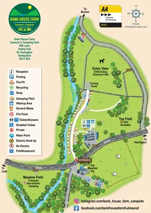
Riverside campsite map with named camping fields, touring-caravan rows and illustrated stone-wall boundaries.
 Explore the map ↗
United Kingdom
Woodland-framed Barnsoul map with mixed accommodation, shared facilities and paw-marked walking routes.
Features may come from the sample artwork, its key or published park information. Approximate numbers describe the drawing and may cover only part of a park. They are intended to help you compare map examples. Current facilities and booking information should be checked with the park.
TAKE A CLOSER LOOK
View the illustrated map in detail or choose a file to download. These are sample maps; contact the park for current visitor information.


LET’S MAP YOUR PARK
For a map quotation, find your park and draw a rough boundary around it. The area you select helps us work out the design time and price.
Draw your park for a quote ↗Or talk to our map designers
01751 473136