
Dog-walking area
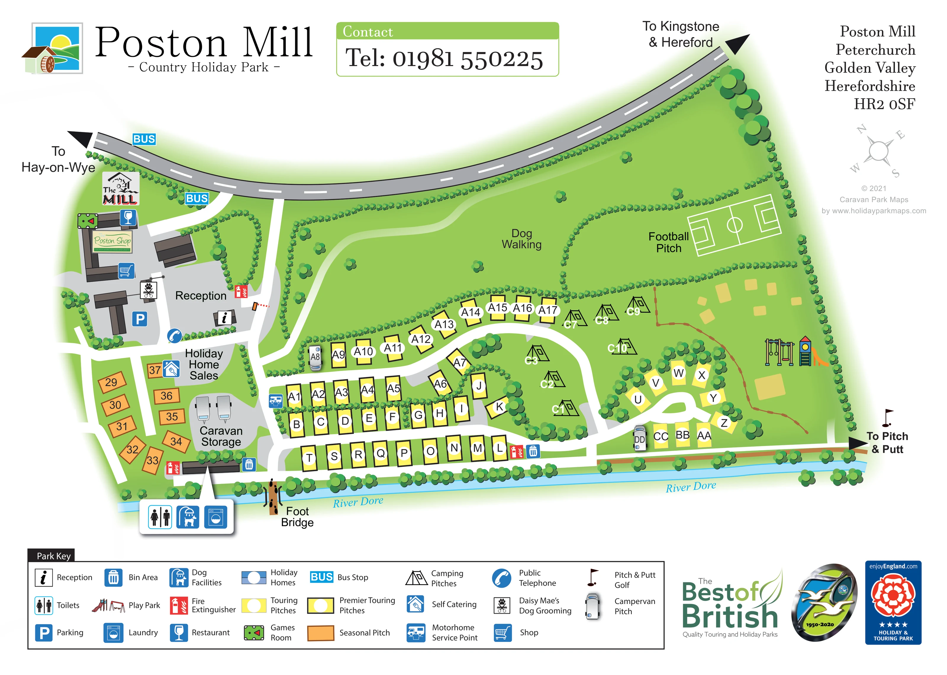
A broad central green area labelled Dog Walking contains a pale winding route and scattered trees.
ILLUSTRATED PARK MAP · P575
Poston Mill, Peterchurch, Golden Valley, Herefordshire · United Kingdom
 Enlarge the map ↗
A SENSE OF THE PLACE
Poston Mill is a holiday and touring park in Herefordshire's Golden Valley near Peterchurch. Self-catering caravans and touring pitches provide different ways to stay in the countryside.
An on-site pub and leisure activities including pitch-and-putt add options within the park. Rental caravans occupy designated areas, some with enclosed outdoor seating, and the map helps guests understand the layout.
LOOK CLOSER
A broad central green area labelled Dog Walking contains a pale winding route and scattered trees.
A narrow blue river runs along the southern edge, with repeated italic labels and riverside planting.
Continuous miniature shrub borders divide pitches, recreation spaces and park edges; larger circular trees emphasise the riverside and eastern loop.
Labelled reception and information symbol within the western arrival courtyard.
A blue parking symbol marks the arrival courtyard beside the reception buildings.
The shop sign and shopping-trolley symbol appear on the western building cluster.
The Mill branding and restaurant symbol identify a building near the roadside entrance; park context describes an on-site pub.
A snooker-table symbol marks the games room beside The Mill building.
Labelled reception and information symbol within the western arrival courtyard.
A blue parking symbol marks the arrival courtyard beside the reception buildings.
The shop sign and shopping-trolley symbol appear on the western building cluster.
The Mill branding and restaurant symbol identify a building near the roadside entrance; park context describes an on-site pub.
A snooker-table symbol marks the games room beside The Mill building.
The dog-grooming symbol is positioned within the arrival building group and named in the key.
A telephone symbol appears on the southern edge of the reception courtyard.
A labelled sales area sits south of reception, beside a blue house-and-key symbol.
The key names the house-and-key symbol as self-catering. Its mapped position is beside Holiday Home Sales, so it does not establish a separate rental accommodation area.
A grey storage area with caravan illustrations lies between the seasonal pitches and main touring rows.
An enlarged three-symbol callout points to the riverside service building beside the seasonal area, identifying toilets, dog facilities and laundry.
The dog-facilities symbol is included in the riverside service-building callout.
A blue service-point symbol marks the western entrance to the main touring area.
Repeated blue bin and red fire-extinguisher symbols identify service locations near reception and the southern accommodation rows.
Colourful climbing, swing and slide equipment is illustrated in the eastern recreation area.
A labelled football pitch with white field markings occupies a hedge-enclosed area in the north-east.
An eastward arrow and golf-flag symbol indicate the route to pitch-and-putt beyond the illustrated park boundary.
A broad central green area labelled Dog Walking contains a pale winding route and scattered trees.
A narrow blue river runs along the southern edge, with repeated italic labels and riverside planting.
A timber-style illustrated footbridge crosses the River Dore beside the western touring entrance.
Two blue BUS markers are shown along the public road near the western entrance.
The curving northern road has directional arrows towards Hay-on-Wye on the left and Kingstone and Hereford on the right.
A small orange and red-white barrier illustration appears on the internal approach beside reception.
Continuous miniature shrub borders divide pitches, recreation spaces and park edges; larger circular trees emphasise the riverside and eastern loop.
READING THE MAP
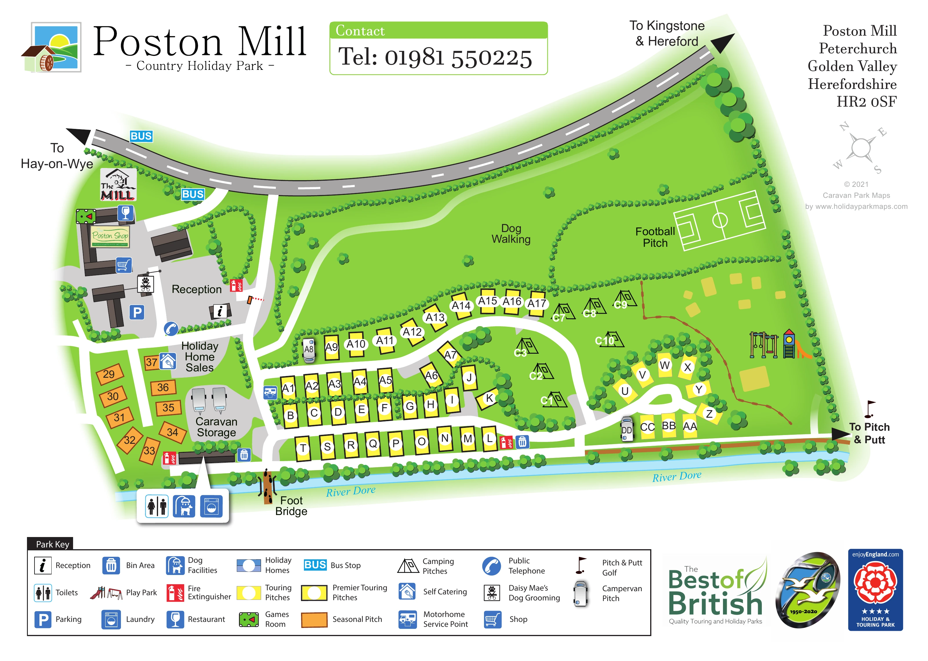
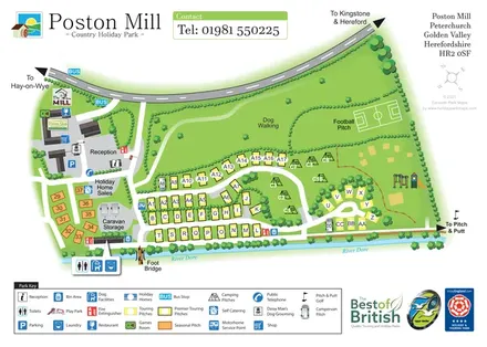
This illustrated map of Poston Mill Country Holiday Park brings together riverside accommodation, arrival facilities and open recreation spaces in Herefordshire’s Golden Valley. The River Dore runs along the lower edge of the artwork, while a sweeping road above the park points towards Hay-on-Wye, Kingstone and Hereford. Between these two strong boundaries, the plan gives guests a clear picture of how the different parts of the park fit together.
The western entrance contains reception, parking, the shop and The Mill building. Touring pitches extend across the lower half in rows and curved groups, with orange seasonal pitches set apart near the caravan storage area. Tent symbols mark a smaller camping section beside the central loop. Large green spaces identify dog walking and a football pitch, while an illustrated play park adds a recognisable landmark on the eastern side.
A broad pictorial key explains pitch categories and practical services. The result is a useful sample for countryside touring parks that need to combine accommodation wayfinding with leisure areas, landscape features and a busy arrival hub.
The main plan is arranged around a western arrival courtyard, a central touring area and a smaller eastern accommodation loop. Reception is labelled beside an information symbol, with parking, a public telephone and Daisy Mae’s Dog Grooming nearby. The western buildings also carry the Poston Shop sign, The Mill branding, a restaurant symbol and a games-room icon. A barrier illustration marks the internal approach beside reception.
Below this hub, orange seasonal pitches sit alongside Holiday Home Sales and a grey caravan storage area. The principal touring section uses yellow rectangular pitches arranged in straight rows and around a curved white lane. Heavy black borders identify premier touring pitches, while top-down campervan illustrations provide a different visual marker within the same layout. A smaller tree-lined loop lies farther east, with outlined camping tents occupying the adjoining grass.
The northern half is deliberately more open. A winding pale route crosses the labelled dog-walking area, and hedges separate it from the football pitch. The eastern play area is illustrated with swings and climbing equipment. A route along the southern edge ends in an arrow towards pitch-and-putt golf, leaving the course itself outside the plan.
The River Dore provides a continuous blue landmark beneath the accommodation rows. Near the western end, an illustrated footbridge crosses the water. An enlarged callout identifies toilets, dog facilities and laundry at the riverside service building; further symbols locate bins, fire extinguishers and the motorhome service point. The single-page composition is completed by a three-row legend, compass, contact panel and park branding, giving visitors both an overview and the detail needed to recognise individual destinations.
KEEP EXPLORING
Chosen for shared landscapes, accommodation or facilities.
 Explore the map ↗
United Kingdom
Riverside park map with named pitch fields, illustrated huts and a paw-print dog walk.
 Explore the map ↗
United Kingdom
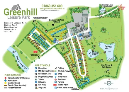
Illustrated camping and touring map with fishing lakes, dog areas and colour-coded pitches.
 Explore the map ↗
United Kingdom
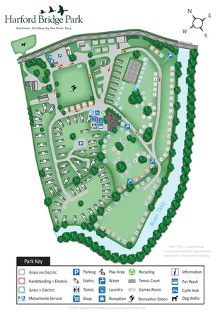
Riverside park map with colour-coded pitches, static caravan groups and a comprehensive facilities key.
Features may come from the sample artwork, its key or published park information. Approximate numbers describe the drawing and may cover only part of a park. They are intended to help you compare map examples. Current facilities and booking information should be checked with the park.
TAKE A CLOSER LOOK
View the illustrated map in detail or choose a file to download. These are sample maps; contact the park for current visitor information.


LET’S MAP YOUR PARK
For a map quotation, find your park and draw a rough boundary around it. The area you select helps us work out the design time and price.
Draw your park for a quote ↗Or talk to our map designers
01751 473136