
Tree and shrub planting
Repeated green tree and shrub illustrations form pitch dividers, cabin-side screens, perimeter bands and scattered planting across sandy-coloured ground.
ILLUSTRATED PARK MAP · P579
12138 Augusta Highway, Napperby, South Australia · Australia
 Enlarge the map ↗
A SENSE OF THE PLACE
Rangeview Caravan and Cabin Park is located on the Augusta Highway near Port Pirie in South Australia. The Flinders Ranges provide the backdrop to this road-trip stopping place.
Caravan and cabin accommodation offer options for an overnight stop or a longer stay exploring the Southern Flinders Ranges and Spencer Gulf area. The map provides a practical overview of accommodation and access routes.
LOOK CLOSER
Repeated green tree and shrub illustrations form pitch dividers, cabin-side screens, perimeter bands and scattered planting across sandy-coloured ground.
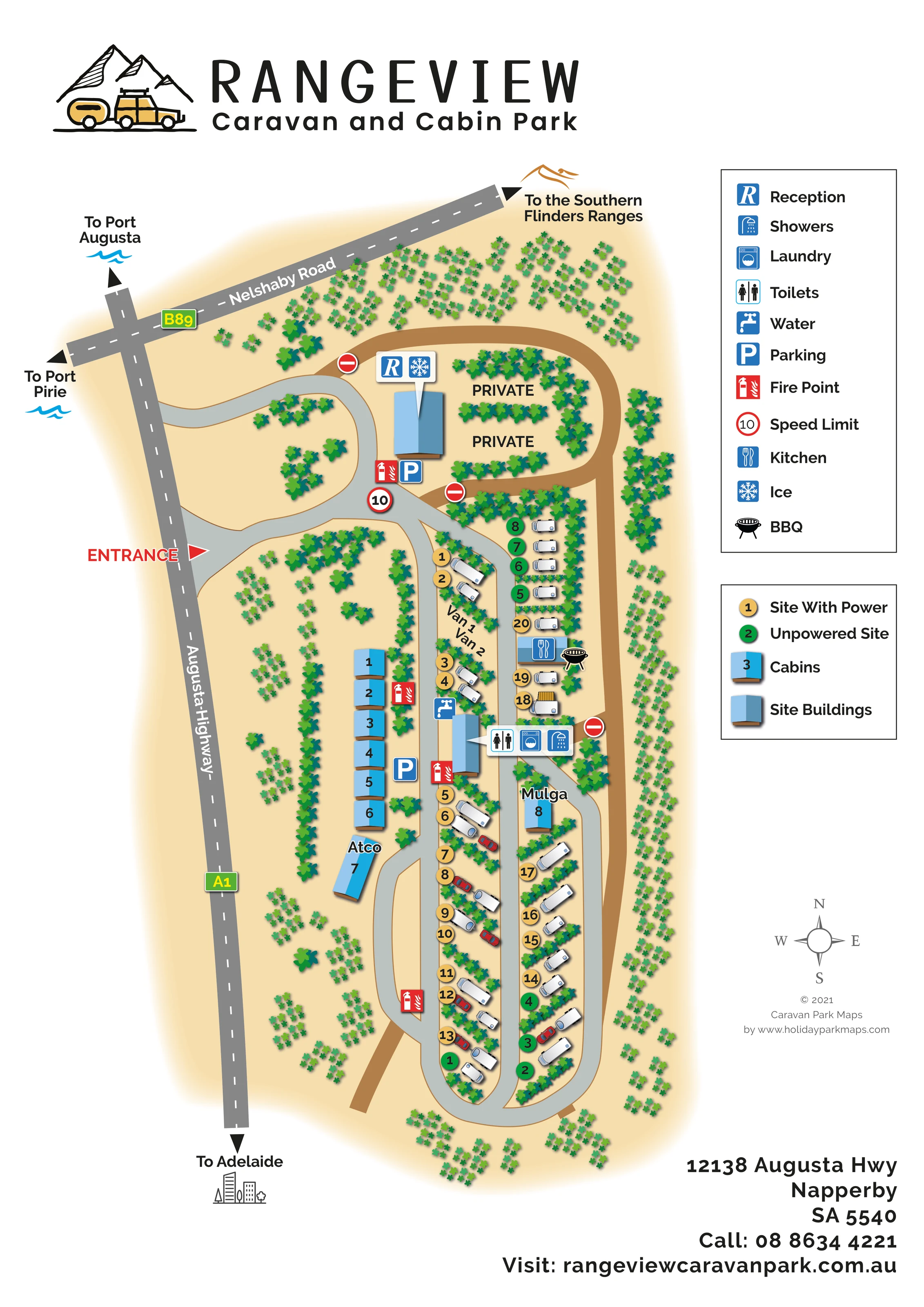
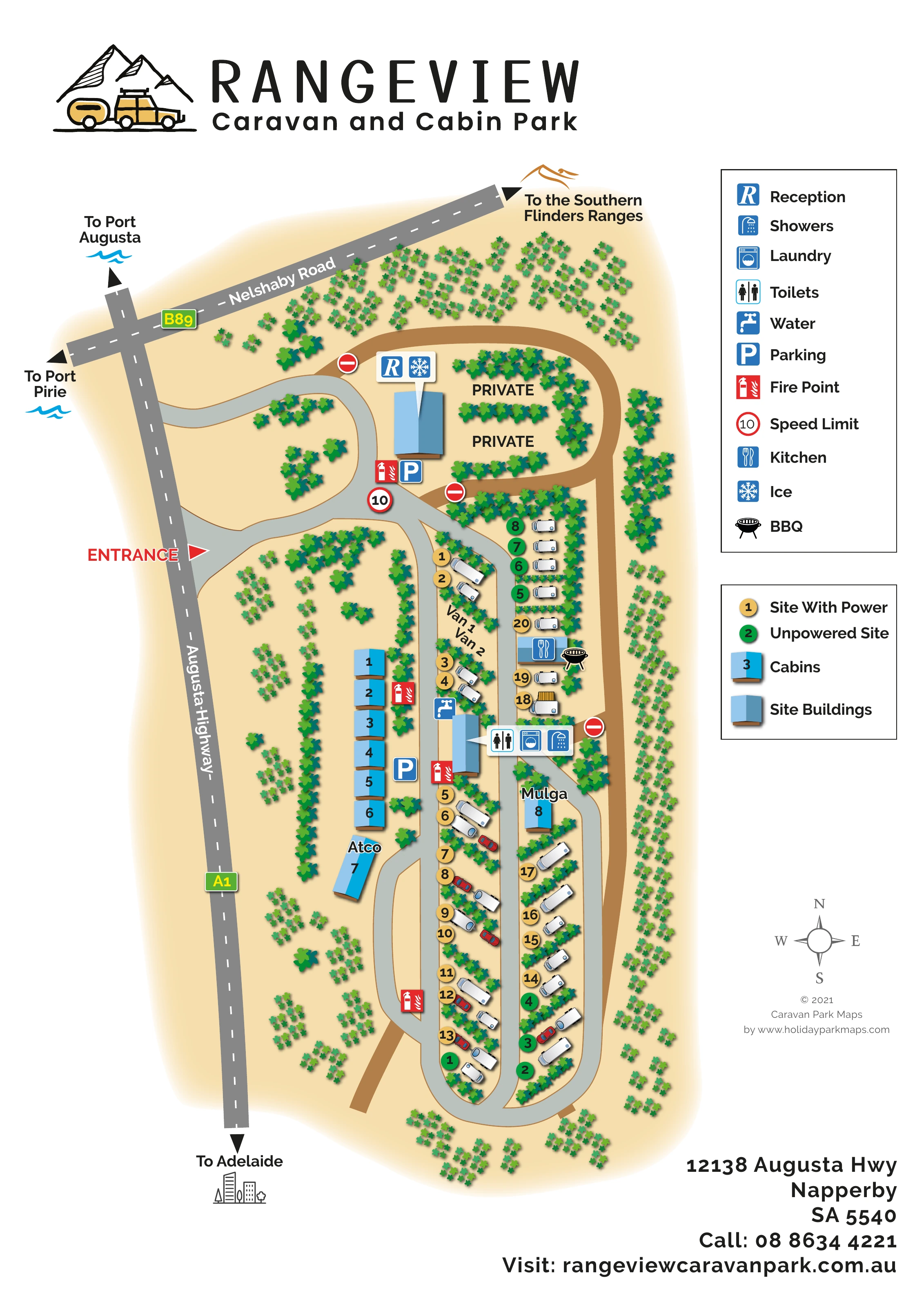
A blue-roofed reception building stands near the northern arrival junction, identified by a raised symbol callout.
The ice symbol shares the reception building's callout.
A central building between the cabin row and touring pitches is identified by a combined toilets, laundry and showers callout.
A kitchen symbol marks a small building among the northern pitches on the eastern side.
A black barbecue illustration appears beside the kitchen building.
A blue tap symbol is positioned beside the central amenities building.
Parking symbols identify locations beside reception and near the cabin row.
A blue-roofed reception building stands near the northern arrival junction, identified by a raised symbol callout.
The ice symbol shares the reception building's callout.
A central building between the cabin row and touring pitches is identified by a combined toilets, laundry and showers callout.
A kitchen symbol marks a small building among the northern pitches on the eastern side.
A black barbecue illustration appears beside the kitchen building.
A blue tap symbol is positioned beside the central amenities building.
Parking symbols identify locations beside reception and near the cabin row.
Repeated red fire-point symbols are distributed around reception, the cabins, the amenities building and the southern internal road.
A bold red ENTRANCE label and triangular pointer mark the park's access from Augusta Highway.
Light-grey roads connect the arrival area, cabin frontage and elongated touring section, with a rounded loop at the southern end.
Two PRIVATE labels occupy planted areas behind reception. Red no-entry symbols mark junctions with a brown peripheral route.
A red-bordered circular sign displaying 10 appears near the reception junction; the artwork does not state a unit.
Augusta Highway is marked A1 and Nelshaby Road B89. Directional arrows point towards Port Augusta, Port Pirie, Adelaide and the Southern Flinders Ranges.
Repeated green tree and shrub illustrations form pitch dividers, cabin-side screens, perimeter bands and scattered planting across sandy-coloured ground.
The park's wider setting has the Flinders Ranges as a backdrop. The plan references the Southern Flinders Ranges with a directional label and a small mountain motif rather than depicting mountain terrain within the park.
READING THE MAP
This illustrated map of Rangeview Caravan and Cabin Park presents a compact roadside park at Napperby, near Port Pirie in South Australia. A warm sandy background and repeated green planting establish the setting, while blue-roofed cabins and white caravan illustrations make the accommodation easy to recognise. The tall page follows the park's elongated shape beside Augusta Highway, with reception at the northern end and the accommodation arranged along a network of curved internal roads.
The map combines local orientation with practical on-site information. Augusta Highway and Nelshaby Road are named, and outward arrows indicate Port Augusta, Port Pirie, Adelaide and the Southern Flinders Ranges. Within the park, yellow and green numbered circles distinguish powered and unpowered sites. Facility callouts identify reception, ice, toilets, showers, laundry and the kitchen, with parking, water, BBQ and fire-point symbols positioned around the plan.
A prominent mountain-and-caravan logo, two clear legend panels and a bottom contact block complete a design suited to a small caravan and cabin park welcoming road-trip visitors.
The portrait plan places Augusta Highway along the western edge and Nelshaby Road across the top, establishing the park's relationship to the surrounding road network. A red entrance label points to the access road, which curves into the reception area before joining the routes through the accommodation. Reception is shown as a blue-roofed building with a combined reception and ice callout, nearby parking and a fire-point marker. Behind it, two planted spaces are labelled PRIVATE, with red no-entry symbols at adjoining junctions.
Most cabins form a neat row on the western side of the internal road, separated from the highway by bands of illustrated trees and shrubs. The longer Atco cabin sits below this row, while Mulga appears within the eastern accommodation strip. Touring pitches extend southwards in two narrow rows, with white caravan illustrations, occasional red cars and planting between neighbouring sites. Yellow numbered circles denote powered sites and green circles denote unpowered sites. The grey roads wrap around the southern end to connect the accommodation areas.
The central amenities building carries a pointer panel for toilets, laundry and showers, with a water symbol alongside. Farther north on the eastern side, a kitchen building and adjacent BBQ illustration create a second recognisable facility cluster. Parking and fire-point symbols are repeated where useful, and a circular 10 sign is shown near arrival.
Two boxed legends occupy the right-hand column, above a compass and designer credit. Small mountain, wave and city motifs accompany the regional destination arrows. The artwork is a single complete site plan; the enlarged views reveal details of the same composition rather than separate sections or additional maps.
KEEP EXPLORING
Chosen for shared landscapes, accommodation or facilities.
 Explore the map ↗
Australia
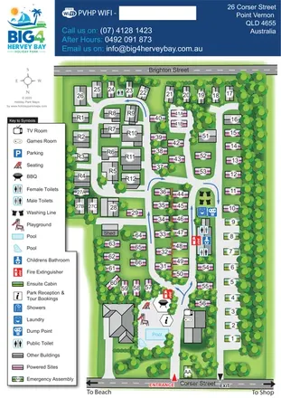
Tree-lined coastal park plan with colour-coded sites, separate entry and exit routes, and a pool-side visitor hub.
 Explore the map ↗
Australia
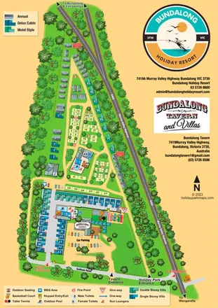
A combined resort, villa and tavern map with separate entrances, two pool areas and illustrated leisure facilities.
 Explore the map ↗
Australia
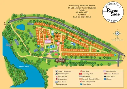
Numbered cabin rows, central amenities and wooded Ovens River frontage at Bundalong Riverside Resort.
Features may come from the sample artwork, its key or published park information. Approximate numbers describe the drawing and may cover only part of a park. They are intended to help you compare map examples. Current facilities and booking information should be checked with the park.
TAKE A CLOSER LOOK
View the illustrated map in detail or choose a file to download. These are sample maps; contact the park for current visitor information.


LET’S MAP YOUR PARK
For a map quotation, find your park and draw a rough boundary around it. The area you select helps us work out the design time and price.
Draw your park for a quote ↗Or talk to our map designers
01751 473136
 rangeveiwmap_large.png