
Woodland and tree-lined boundaries
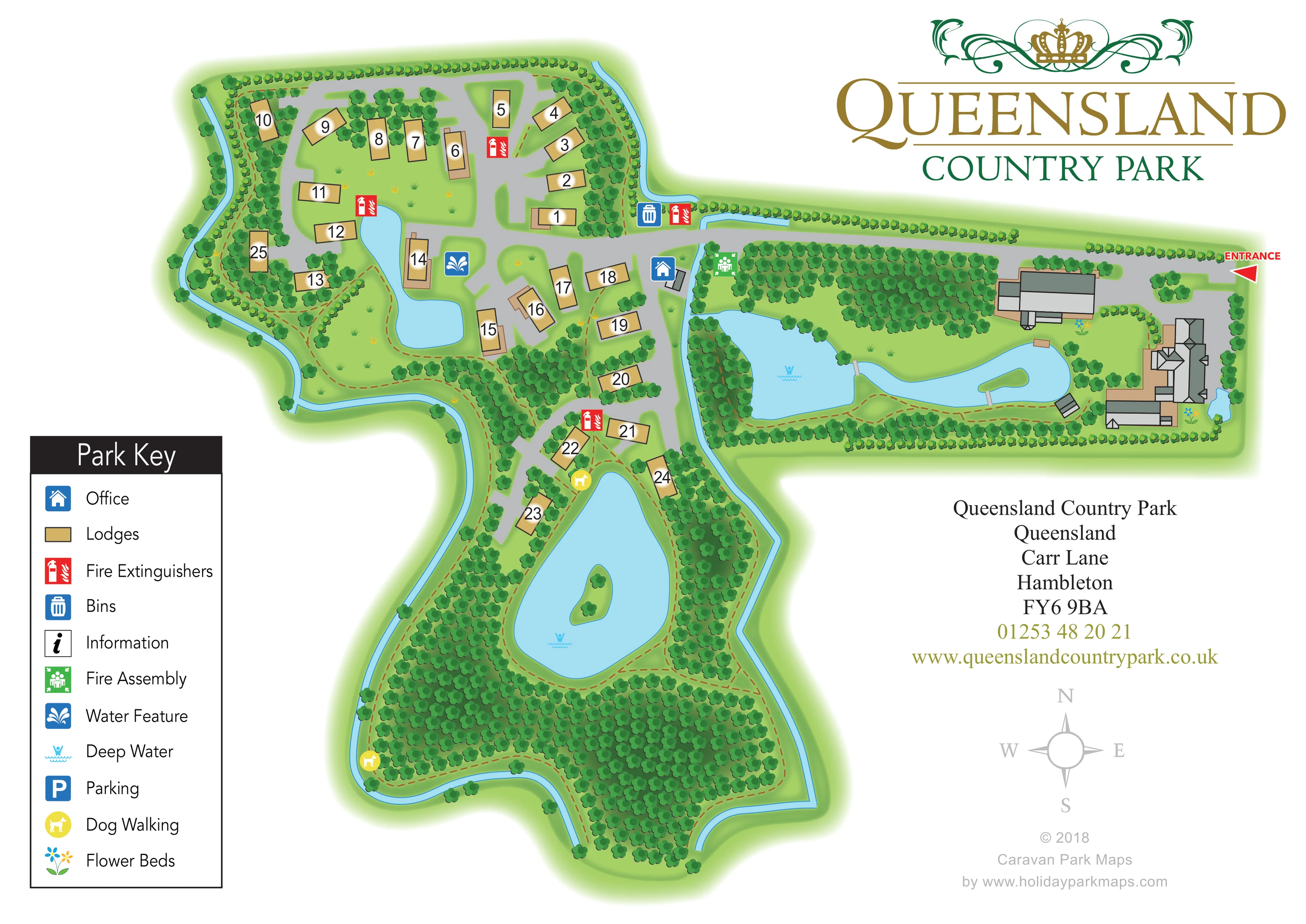
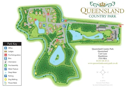
Dense illustrated tree cover dominates the southern grounds and eastern pond area, with smaller clusters screening lodges and continuous planting along several boundaries.
ILLUSTRATED PARK MAP · P578
Carr Lane, Hambleton, Lancashire · United Kingdom
 Enlarge the map ↗
A SENSE OF THE PLACE
Queensland Country Park is a family-owned holiday lodge park with gated grounds. Woodland, wildflower meadows and lake views shape the setting.
A coarse-fishing lake and dog-friendly woodland walks offer ways to enjoy time outdoors. Holiday lodges are sold for private leisure use, with the map showing their relationship to the landscape and shared routes.
LOOK CLOSER
Dense illustrated tree cover dominates the southern grounds and eastern pond area, with smaller clusters screening lodges and continuous planting along several boundaries.
The plan shows a small pond within the lodge area, an elongated eastern pond and a larger southern pond. The eastern and southern waters include small green islands.
Narrow blue watercourses follow much of the irregular perimeter and run between the eastern grounds and the main lodge area.
A blue fountain-style symbol identifies a water feature beside the small pond among the lodges.
Blue deep-water symbols appear within the eastern and southern ponds.
Small blue-and-yellow floral symbols identify planted beds beside buildings in the eastern grounds.
A blue office symbol marks a small building at the central road junction, beside the watercourse separating the lodge area from the eastern grounds.
A red arrow and ENTRANCE label identify access at the far eastern end of the long approach road.
A blue office symbol marks a small building at the central road junction, beside the watercourse separating the lodge area from the eastern grounds.
A red arrow and ENTRANCE label identify access at the far eastern end of the long approach road.
Broad grey roads lead west from the entrance and divide into curving lodge-access branches, including a northern loop and a southern spur.
Brown dashed paths wind around ponds, through wooded areas and along the outer boundary, forming several connected walking circuits.
Yellow dog symbols identify walking areas near the northern end of the large southern pond and at the south-western edge of the woodland.
Dense illustrated tree cover dominates the southern grounds and eastern pond area, with smaller clusters screening lodges and continuous planting along several boundaries.
The plan shows a small pond within the lodge area, an elongated eastern pond and a larger southern pond. The eastern and southern waters include small green islands.
Narrow blue watercourses follow much of the irregular perimeter and run between the eastern grounds and the main lodge area.
A blue fountain-style symbol identifies a water feature beside the small pond among the lodges.
Blue deep-water symbols appear within the eastern and southern ponds.
Small blue-and-yellow floral symbols identify planted beds beside buildings in the eastern grounds.
Repeated red fire-extinguisher symbols mark locations around the lodge roads and beside the main approach junction.
A green assembly symbol is placed near the western end of the eastern grounds, close to the approach road and office junction.
A blue bin symbol marks a location beside the main road near the central junction.
Parking is included in the Park Key, but a corresponding marked location is not clearly identifiable on the plan.
An information symbol appears in the Park Key without a clearly identifiable placement in the illustrated grounds.
Operator information describes a coarse-fishing lake; the artwork does not label which waterbody serves this purpose.
READING THE MAP
This illustrated map of Queensland Country Park in Hambleton, Lancashire, presents a small lodge development within a much larger landscape of trees, ponds and winding walks. Roughly 25 lodge plots sit mainly in the northern and western part of the plan, while dense woodland and a large island pond give the southern grounds a distinct character. A long approach from the eastern entrance connects these areas through a clear grey road network.
The design gives the landscape as much attention as the accommodation. Blue watercourses trace much of the park boundary, brown dashed paths distinguish walking routes from vehicle access, and repeated tree canopies show how the lodges relate to their wooded surroundings. Numbered gold lodge footprints stand out against the greens without overwhelming the plan.
A prominent green-and-gold park identity occupies the upper right, balanced by a practical Park Key at lower left. Office, dog-walking, fire-equipment and assembly symbols add useful visitor information to a map whose main purpose is to explain the relationship between arrival, individual lodges and shared outdoor spaces.
The single-page plan has three connected areas: a lodge cluster in the north-west, a long eastern entrance zone with larger buildings and an elongated pond, and a wooded southern extension surrounding a second large pond. The entrance is marked at the far right with a red arrow. From here, a broad grey road follows the northern edge of the eastern grounds before reaching the office and branching towards the lodges.
Gold lodge footprints are positioned at different angles along curving roads and short access branches. Large black numbers make individual plots easy to locate. Trees separate many of the units, while open green spaces and a smaller pond interrupt the accommodation area. A fountain-style symbol identifies a water feature beside this pond.
The walking network uses brown dashed lines, clearly different from the grey vehicle routes. Paths follow the water, weave through the southern woodland and connect back towards the lodge area. Yellow dog-walking markers appear in two parts of this network. Narrow blue channels run around much of the boundary, and small islands distinguish the eastern and southern ponds. Deep-water symbols are placed within both larger waters.
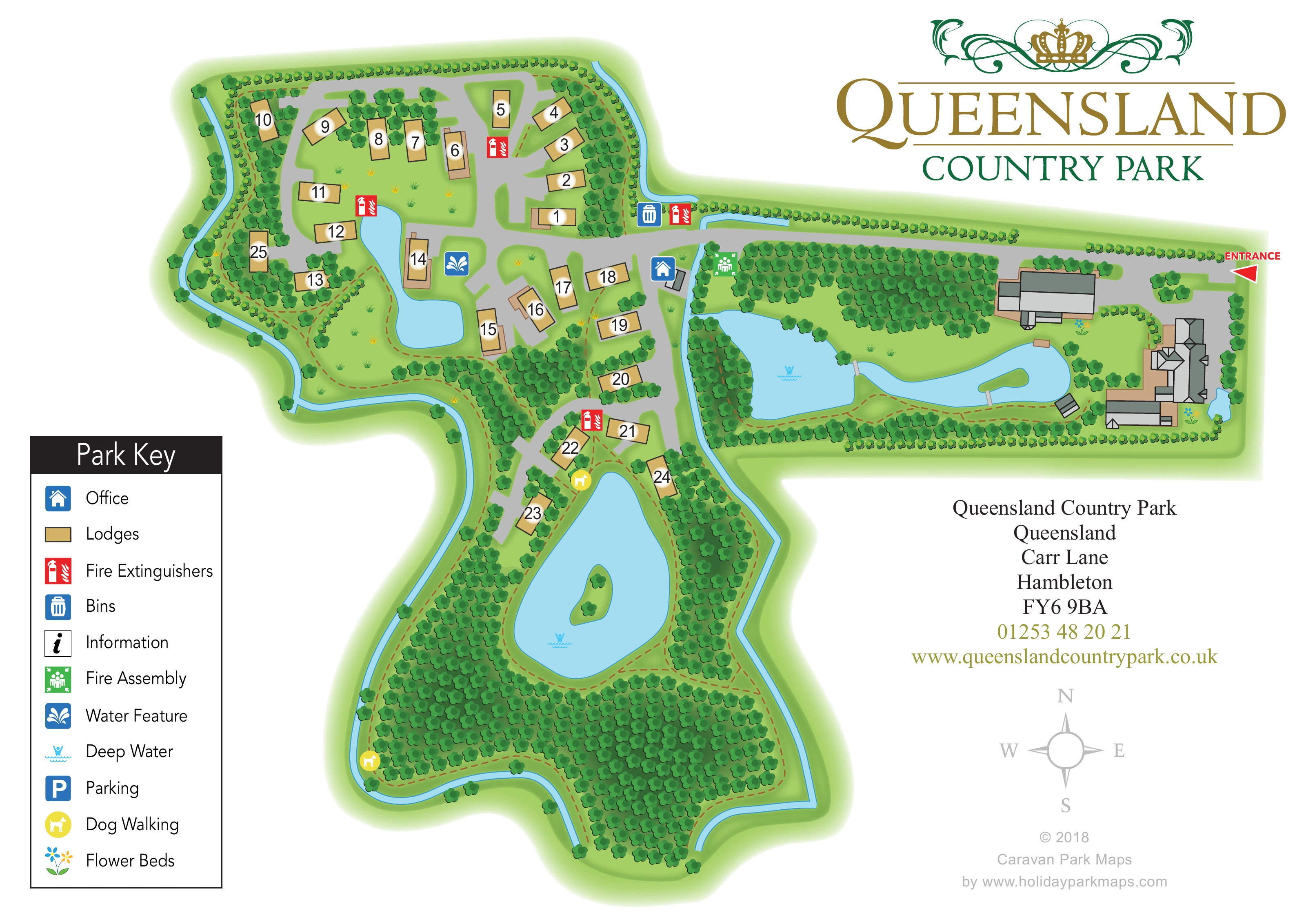
Red fire-extinguisher markers are distributed around the road system, with a green assembly point near the eastern grounds and a bin marker beside the central approach. Flower-bed symbols add detail around the eastern buildings, whose functions are otherwise unlabelled. The boxed Park Key also includes parking and information symbols, although their locations are not clearly marked. The large ornamental wordmark, contact block and compass occupy the surrounding white space. The accompanying enlargement is a closer view of this same artwork, not a separate park section or alternative map.
KEEP EXPLORING
Chosen for shared landscapes, accommodation or facilities.
 Explore the map ↗
United Kingdom
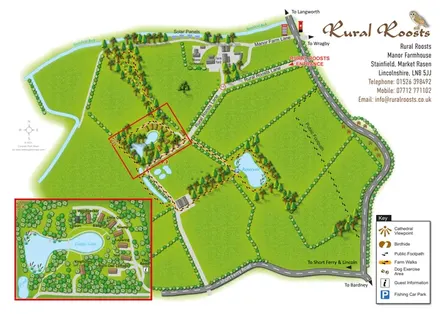
Rural Roosts farm overview with lakeside lodge inset, walking routes and countryside visitor features.
 Explore the map ↗
United Kingdom
Illustrated lakeside park plan with numbered holiday units, leisure buildings and a looping Woodland Walk.
 Explore the map ↗
United Kingdom
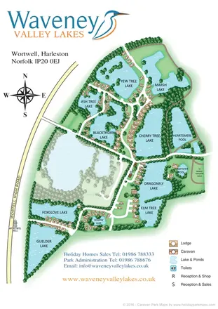
Illustrated lakeside caravan and lodge park map with numbered homes, wooded banks and a central reception cluster.
Features may come from the sample artwork, its key or published park information. Approximate numbers describe the drawing and may cover only part of a park. They are intended to help you compare map examples. Current facilities and booking information should be checked with the park.
TAKE A CLOSER LOOK
View the illustrated map in detail or choose a file to download. These are sample maps; contact the park for current visitor information.


LET’S MAP YOUR PARK
For a map quotation, find your park and draw a rough boundary around it. The area you select helps us work out the design time and price.
Draw your park for a quote ↗Or talk to our map designers
01751 473136
 queensland_large.png