
Tree and hedge boundaries
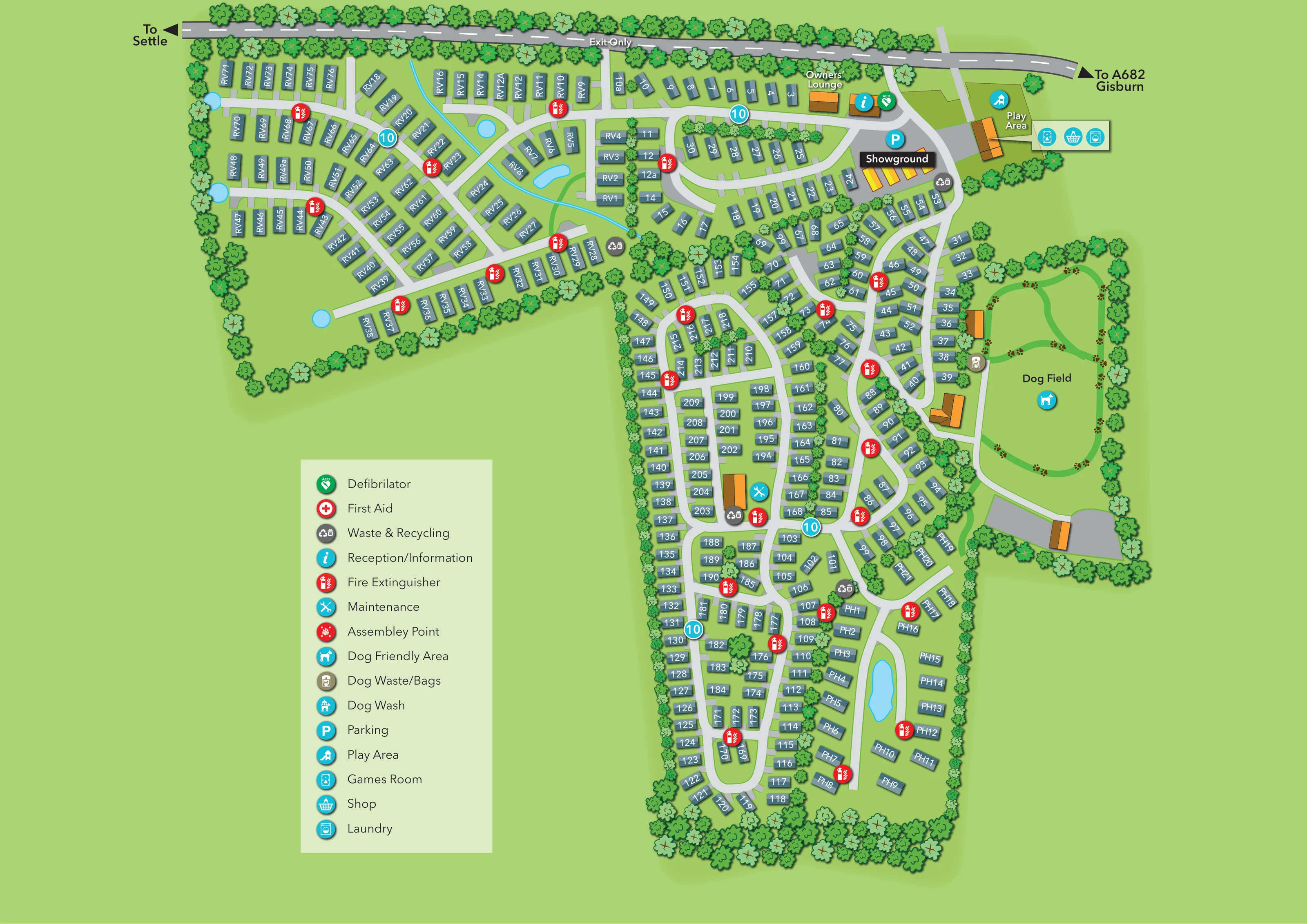
Continuous illustrated tree belts enclose much of the park, with smaller trees and hedges separating accommodation rows.
ILLUSTRATED PARK MAP · P580
Settle Lane, Paythorne, Lancashire · United Kingdom
 Enlarge the map ↗
A SENSE OF THE PLACE
Ribble Valley Country and Leisure Park is an owners-only holiday park at Paythorne. Its countryside setting provides a base for exploring the Ribble Valley and Yorkshire Dales.
The map records the arrangement of holiday homes and internal routes. The wider location suits repeated rural breaks and outings towards the market towns and landscapes of northern Lancashire and Yorkshire.
LOOK CLOSER
Continuous illustrated tree belts enclose much of the park, with smaller trees and hedges separating accommodation rows.
Several small blue water shapes and a narrow blue watercourse appear in the western section; an elongated pond sits within the southern PH-labelled loop.
Information symbol on an orange-roofed building beside the northern arrival junction.
Named building immediately west of reception, close to the roadside boundary.
Green AED symbol beside the reception building.
Parking symbol on the grey arrival and showground area.
Prominent black-backed label over a row of orange and yellow display units near reception.
Named green area with a play symbol at the upper-right edge of the arrival hub.
Information symbol on an orange-roofed building beside the northern arrival junction.
Named building immediately west of reception, close to the roadside boundary.
Green AED symbol beside the reception building.
Parking symbol on the grey arrival and showground area.
Prominent black-backed label over a row of orange and yellow display units near reception.
Named green area with a play symbol at the upper-right edge of the arrival hub.
Games-room symbol in a three-icon callout linked to the building beside the play area.
Shopping-basket symbol in the building callout beside the play area.
Washing-machine symbol grouped with the games room and shop in the upper-right building callout.
Large named green enclosure on the eastern side, marked with a dog-friendly-area symbol and illustrated with looping green routes and paw prints.
Dog-waste/bag symbol at the western edge of the dog field beside the adjoining internal road.
Crossed-tools symbol beside an orange-roofed building within the central southern accommodation section.
Repeated grey recycling and bin symbols distributed near the showground, section junctions and maintenance area.
Repeated red fire-extinguisher symbols throughout both main accommodation sections.
Listed in the legend; no separate first-aid position is clearly identifiable on the plan.
Included in the legend without a clearly identifiable plotted location.
Included in the legend, but no dog-wash location is clearly shown.
Continuous illustrated tree belts enclose much of the park, with smaller trees and hedges separating accommodation rows.
Several small blue water shapes and a narrow blue watercourse appear in the western section; an elongated pond sits within the southern PH-labelled loop.
The road along the top edge carries directional arrows towards Settle on the left and the A682 / Gisburn on the right.
The northern road connects to the reception and showground hub; a separate connection farther west is labelled Exit Only.
Pale-grey roads form intersecting branches in the west and a series of elongated loops through the southern section. Repeated turquoise circles marked 10 appear along selected roads.
READING THE MAP
This illustrated map of Ribble Valley Country & Leisure Park presents a substantial owners’ holiday-home park in the Lancashire countryside. Its distinctive shape combines a broad western neighbourhood with a longer southern section, all linked by pale-grey roads and framed by illustrated trees. Blue-grey roofs and white plot labels keep the accommodation visually consistent, while orange-roofed buildings draw attention to the shared facilities.
The northern arrival area brings reception, the owners’ lounge, parking and the showground together beside the road towards Settle and Gisburn. Nearby, a compact callout identifies the games room, shop and laundry beside the play area. Farther down the eastern edge, a clearly named dog field becomes a memorable landmark through its looping green lines and paw-print decoration.
Small water features, hedge divisions and planted boundaries give the plan a countryside character without obscuring its practical purpose. A large pictogram legend occupies the open space at lower left, allowing the dense accommodation layout to remain the main focus. The result is a useful sample for owners’ parks needing both individual-home navigation and clear orientation around shared amenities.
The map is arranged around two connected accommodation areas rather than a single regular grid. In the west, rows of RV-labelled homes follow branching and intersecting roads, with small blue water features and a narrow watercourse adding visual landmarks. The longer southern section uses a succession of loops and connecting lanes, with plain-numbered homes in its central rows and a PH-labelled group around a pond near the bottom. Short grey connections link individual home footprints to the roads, while trees and hedges help distinguish neighbouring rows.
Across the top, a darker road with dashed white markings points towards Settle on the left and the A682 and Gisburn on the right. An arrival connection leads into the reception and showground area, while another junction is labelled Exit Only. Reception is marked by an information badge and a green AED symbol. The owners’ lounge sits alongside it, and a parking badge identifies the adjacent hardstanding. Bright display-unit roofs and a black Showground label make this hub particularly easy to recognise.
At the upper right, the play area sits beside an orange-roofed building. A linked panel contains symbols for the games room, shop and laundry. The eastern dog field is a much larger green space, illustrated with looping lines and paw prints; a dog-waste/bag point is marked beside its roadside edge. Maintenance is identified farther south, and waste and recycling points and red fire-extinguisher badges recur across the plan.
The lower-left legend explains the circular symbols, including additional first-aid, assembly-point and dog-wash entries. Two-tone roofs, varied tree canopies and restrained shadows give the overhead drawing depth without sacrificing the clarity of roads or individual labels.
KEEP EXPLORING
Chosen for shared landscapes, accommodation or facilities.
 Explore the map ↗
United Kingdom
A woodland estate park map combining caravan loops, touring pitches, riverside paths and Bruce’s Cave landmarks.
 Explore the map ↗
United Kingdom
Illustrated lakeside park plan with numbered holiday units, leisure buildings and a looping Woodland Walk.
 Explore the map ↗
United Kingdom
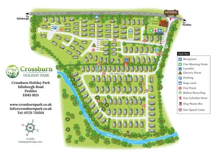
Numbered holiday homes, three named areas and a riverside dog walk at Crossburn Holiday Park, Peebles.
Features may come from the sample artwork, its key or published park information. Approximate numbers describe the drawing and may cover only part of a park. They are intended to help you compare map examples. Current facilities and booking information should be checked with the park.
LET’S MAP YOUR PARK
For a map quotation, find your park and draw a rough boundary around it. The area you select helps us work out the design time and price.
Draw your park for a quote ↗Or talk to our map designers
01751 473136