
Lake
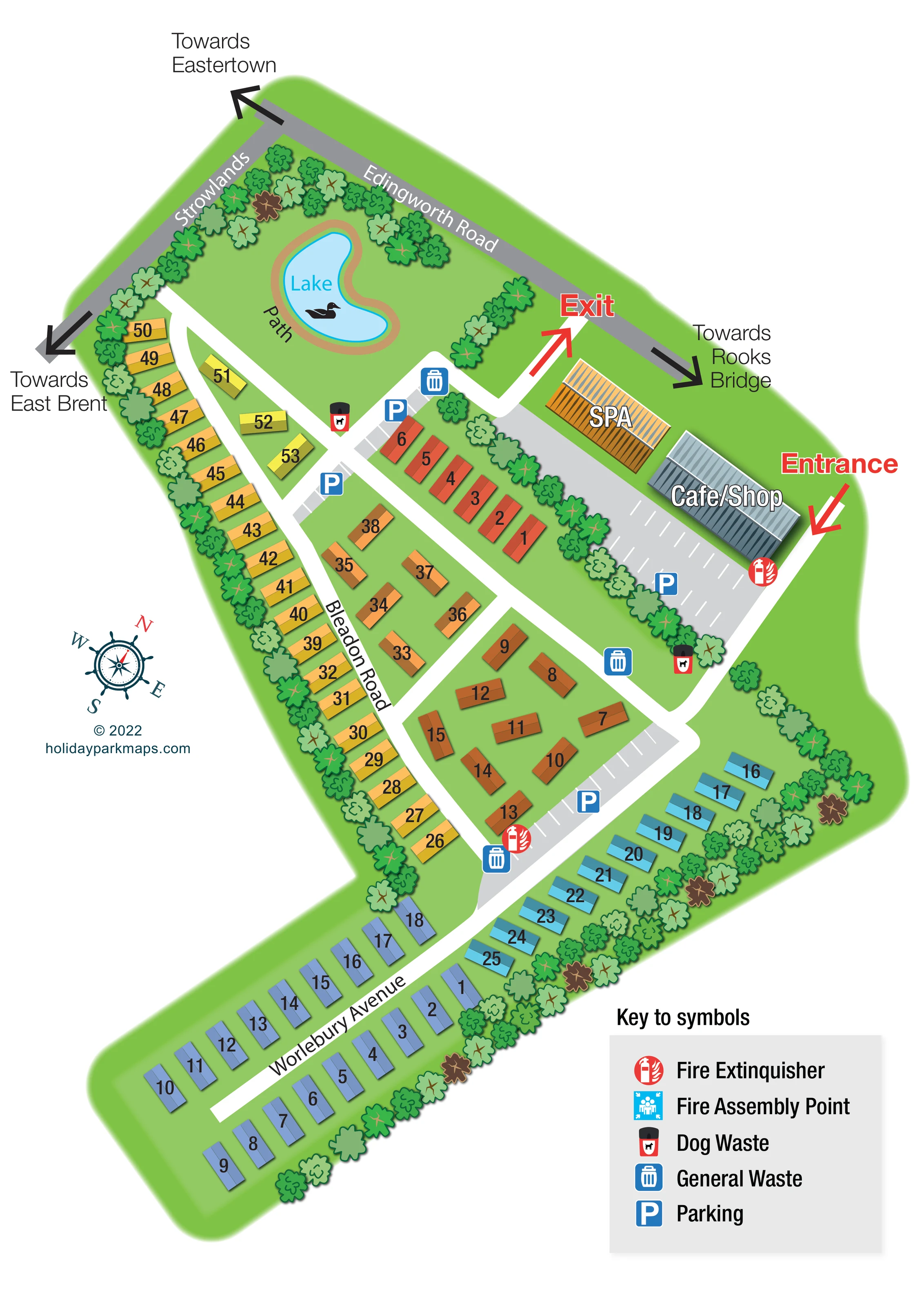
A curved blue lake occupies an open green area near Edingworth Road, with a tan perimeter path and a decorative duck silhouette.
ILLUSTRATED PARK MAP · P279
Edingworth Road, Weston-super-Mare · United Kingdom
 Enlarge the map ↗
A SENSE OF THE PLACE
Rookery Manor offers self-catering lodge and cottage accommodation in Somerset. Private hot-tub options provide outdoor space for a relaxing break.
A bar and coffee shop, games room and farm shop are listed among the shared facilities, alongside electric vehicle charging. The map helps guests find accommodation and amenities within the grounds.
LOOK CLOSER
A curved blue lake occupies an open green area near Edingworth Road, with a tan perimeter path and a decorative duck silhouette.
Dense bands of stylised trees frame the accommodation areas, with additional planting between the amenity parking and nearby units.
A large illustrated building labelled SPA stands beside the exit route and the café/shop.
A prominent grey-roofed building labelled Cafe/Shop overlooks the main parking area near the entrance.
Grey parking courts and smaller parking strips have white bay markings and blue P symbols, including spaces by the amenities and within the accommodation layout.
Repeated blue general-waste symbols and red-and-black dog-waste symbols mark positions along the internal routes.
Red circular extinguisher symbols appear near the café/shop entrance area and the lower central parking court.
A tan route follows the outline of the lake and is labelled Path.
A large illustrated building labelled SPA stands beside the exit route and the café/shop.
A prominent grey-roofed building labelled Cafe/Shop overlooks the main parking area near the entrance.
Grey parking courts and smaller parking strips have white bay markings and blue P symbols, including spaces by the amenities and within the accommodation layout.
Repeated blue general-waste symbols and red-and-black dog-waste symbols mark positions along the internal routes.
Red circular extinguisher symbols appear near the café/shop entrance area and the lower central parking court.
Included in the key, but no corresponding position is clearly identifiable on the plan.
A curved blue lake occupies an open green area near Edingworth Road, with a tan perimeter path and a decorative duck silhouette.
A tan route follows the outline of the lake and is labelled Path.
Dense bands of stylised trees frame the accommodation areas, with additional planting between the amenity parking and nearby units.
Large red arrows distinguish the entrance beside the café/shop from the exit beside the spa, both connecting with Edingworth Road.
Named white internal roads organise the main accommodation area and the long projecting avenue.
Grey external roads and black arrows provide directions towards Eastertown, East Brent and Rooks Bridge.
Park information lists a bar and coffee shop, games room, farm shop and electric vehicle charging. These are not all separately located or labelled in the artwork.
Private hot-tub options are described in the park information but are not illustrated or keyed on this map.
READING THE MAP
This illustrated map of Rookery Manor in Somerset brings together numbered accommodation, shared amenities and local approach roads in a single portrait layout. The grounds stretch diagonally across the page, with a long, tree-lined accommodation avenue extending away from the main site. Brightly coloured building groups make the different areas easy to recognise, while large numbers and named internal roads provide practical reference points for guests.
At the upper end of the plan, a curved lake and surrounding path create a distinctive landscape landmark. Nearby, the spa and café/shop are drawn as larger roofed buildings beside parking and the clearly marked entrance and exit. Directions towards Eastertown, East Brent and Rooks Bridge connect the site plan to its immediate surroundings.
The design combines an uncomplicated overhead view with selective illustrative detail: varied tree canopies, shaded roofs, a duck on the lake and a nautical-style compass. It is a useful sample for accommodation sites that need a readable guest map with recognisable amenities, numbered buildings and an unusually elongated layout.
The plan is arranged around a broad main accommodation area and a narrower extension along Worlebury Avenue. Numbered buildings sit in colour-coded rows around the edges and in smaller groups between the internal roads. Bleadon Road runs through the main accommodation area, while Worlebury Avenue serves paired rows of blue units in the projecting section. Broad white roads stand out against the green ground, and grey parking strips with white bay markings are distributed beside the accommodation.
Edingworth Road forms the upper external boundary. A large red entrance arrow leads into the site beside the café/shop and its parking court; a separate exit arrow sits beside the spa. Both amenity buildings have striped pitched roofs and prominent labels, giving them more visual weight than the individual accommodation symbols. Black arrows on the surrounding roads point towards Rooks Bridge, Eastertown and East Brent, with Strowlands also named.
The lake occupies an open green area away from the building clusters. Its pale blue water, cyan edge, duck silhouette and tan perimeter path provide a memorable point of orientation. Bands of varied tree symbols frame the site and separate parts of the parking and accommodation layout.
A lower-right key explains parking, general waste, dog waste, fire extinguishers and the fire assembly point symbol. Waste, parking and extinguisher symbols are visibly positioned on the plan; the assembly-point entry appears in the key without a clearly identifiable mapped location. The page also includes a decorative compass and designer credit. The accompanying enlargements show portions of the same artwork and its key, rather than separate map variants.
KEEP EXPLORING
Chosen for shared landscapes, accommodation or facilities.
 Explore the map ↗
United Kingdom
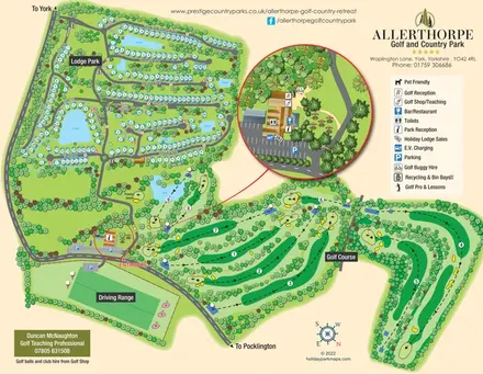
Lakeside lodge neighbourhoods and a nine-hole golf course, with an enlarged reception and facilities inset.
 Explore the map ↗
United Kingdom
Woodland camping, lodges, lakes and colour-coded bike trails at Avon Tyrrell Outdoor Centre.
 Explore the map ↗
United Kingdom
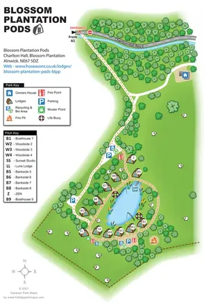
Illustrated lakeside pod map with woodland arrival routes, named lodges and a waterside circuit.
Features may come from the sample artwork, its key or published park information. Approximate numbers describe the drawing and may cover only part of a park. They are intended to help you compare map examples. Current facilities and booking information should be checked with the park.
LET’S MAP YOUR PARK
For a map quotation, find your park and draw a rough boundary around it. The area you select helps us work out the design time and price.
Draw your park for a quote ↗Or talk to our map designers
01751 473136