
River Wye
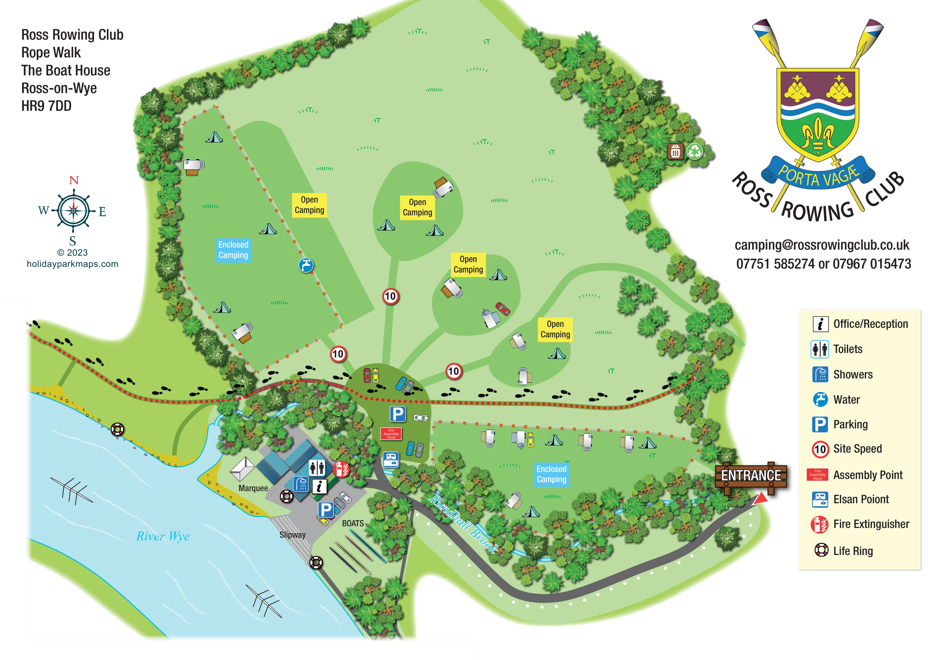
A broad, named river runs diagonally across the lower-left of the plan, illustrated with pale wave lines and rowing boats.
ILLUSTRATED PARK MAP · P281
Rope Walk, Ross-on-Wye, Herefordshire · United Kingdom
 Enlarge the map ↗
A SENSE OF THE PLACE
Ross Rowing Club offers camping beside the River Wye within walking distance of Ross-on-Wye town centre. The riverside setting is a central feature of the campsite.
A river-access ramp serves canoes, kayaks and paddleboards. Pitches are arranged separately from the public footpath crossing the site, with the map helping campers understand the camping areas and access to the water.
LOOK CLOSER
A broad, named river runs diagonally across the lower-left of the plan, illustrated with pale wave lines and rowing boats.
A narrow blue watercourse follows the wooded southern camping boundary and meets the River Wye beside the club buildings.
Dense illustrated planting encloses much of the campsite, frames the brook and screens the riverside building cluster.
A prominent timber-style entrance sign and red pointer identify arrival from the curved road at the lower-right.
A grey approach road leads towards the club and parking, while green branching routes connect the central arrival area with the open camping zones.
A red dotted line with repeated black footprints crosses the site between camping areas and the riverside facilities. The operator context identifies the crossing route as a public footpath.
An information symbol locates office/reception within the riverside building cluster.
Separate toilet and shower symbols mark the service buildings near reception and the slipway.
A broad, named river runs diagonally across the lower-left of the plan, illustrated with pale wave lines and rowing boats.
A narrow blue watercourse follows the wooded southern camping boundary and meets the River Wye beside the club buildings.
Dense illustrated planting encloses much of the campsite, frames the brook and screens the riverside building cluster.
A prominent timber-style entrance sign and red pointer identify arrival from the curved road at the lower-right.
A grey approach road leads towards the club and parking, while green branching routes connect the central arrival area with the open camping zones.
A red dotted line with repeated black footprints crosses the site between camping areas and the riverside facilities. The operator context identifies the crossing route as a public footpath.
An information symbol locates office/reception within the riverside building cluster.
Separate toilet and shower symbols mark the service buildings near reception and the slipway.
A blue tap symbol marks a water point along the edge of the western enclosed camping area.
Parking symbols identify the central arrival area and a second area beside the riverside buildings.
A chemical toilet disposal symbol is positioned beside the central parking area, near the brook crossing.
Paired bin and recycling symbols mark a location at the upper-right wooded edge of the camping field.
A labelled white marquee stands beside the club buildings on the riverside lawn.
A striped ramp connects the paved club forecourt to the River Wye.
The label BOATS and a row of long, colourful boat illustrations identify an area beside the slipway.
The plan locates a fire assembly point beside central parking, a fire extinguisher at the service buildings and life rings at several riverside positions.
Red-bordered signs displaying 10 are placed on the green routes into the camping field; the legend calls these Site Speed.
The operator context describes a river-access ramp serving canoes, kayaks and paddleboards. The artwork itself labels the ramp as a slipway.
READING THE MAP
This illustrated map of Ross Rowing Club Campsite places its riverside setting at the centre of the visitor experience. The River Wye sweeps across the lower-left of the page, with rowing boats on the water and a clearly labelled slipway beside the club buildings. Above the riverside hub, a broad green field contains a mixture of open and enclosed camping areas, illustrated with tents and touring caravans rather than numbered pitches.
The map makes several overlapping uses of the site easy to understand. A footprint-marked route crosses the grounds, green access routes lead into the camping areas, and the arrival road curves towards parking and the service buildings. Reception, toilets, showers, water and chemical toilet disposal are identified with bold symbols, alongside mapped safety points.
Dense tree belts and the winding Rundhall Brook give the plan a recognisable landscape structure. The large club crest, crossed oars and nautical compass make this a distinctive example of campsite mapping for a rowing-club setting in Ross-on-Wye, Herefordshire.
The single-page plan is organised around the relationship between camping, pedestrian movement and river access. Arrival is marked at the lower-right by a timber-style ENTRANCE sign and red pointer. A curved grey road follows the southern edge towards the club facilities, while a central parking area provides the visual junction for green routes branching into the main camping field.
Within that field, darker-green shapes identify open camping areas, each carrying a bright yellow label. Two enclosed camping areas are outlined with fine fence lines and orange posts: one along the western tree belt and another beside the entrance, above Rundhall Brook. Their blue labels stand apart from the open camping labels. Small tents, touring units with striped awnings and occasional cars illustrate the intended use without presenting a numbered pitch plan.
A red dotted line, accompanied by repeated black footprints, crosses the grounds between the main camping field and the riverside hub. Below it, blue-roofed buildings carry reception, toilet and shower symbols. A white marquee occupies the adjacent lawn, and a striped slipway descends from the paved forecourt to the River Wye. Long, colourful boats sit beside the labelled boat area.
Other mapped details include parking, a water point, an Elsan point, waste and recycling symbols, site-speed markers, an assembly point, a fire extinguisher and riverside life rings. The brook is traced through dense planting into the river. A cream legend panel occupies the right margin beneath the club branding and contact block, while the left margin holds the address, nautical compass and designer credit.
KEEP EXPLORING
Chosen for shared landscapes, accommodation or facilities.
 Explore the map ↗
United Kingdom
Colour-coded campsite map with riverside pitches, bell tents, a swimming pool and fishing lake.
 Explore the map ↗
United Kingdom
Woodland camping, lodges, lakes and colour-coded bike trails at Avon Tyrrell Outdoor Centre.
 Explore the map ↗
United Kingdom
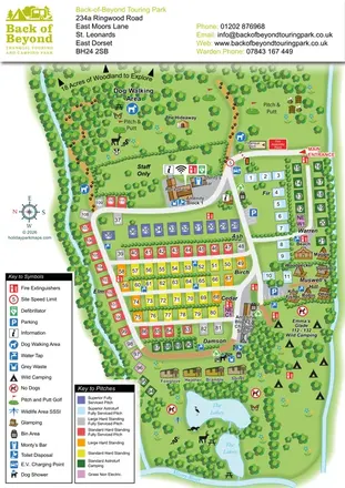
Colour-coded touring pitches, named glamping units and woodland routes at Back of Beyond Touring Park.
Features may come from the sample artwork, its key or published park information. Approximate numbers describe the drawing and may cover only part of a park. They are intended to help you compare map examples. Current facilities and booking information should be checked with the park.
LET’S MAP YOUR PARK
For a map quotation, find your park and draw a rough boundary around it. The area you select helps us work out the design time and price.
Draw your park for a quote ↗Or talk to our map designers
01751 473136