
Railway boundary
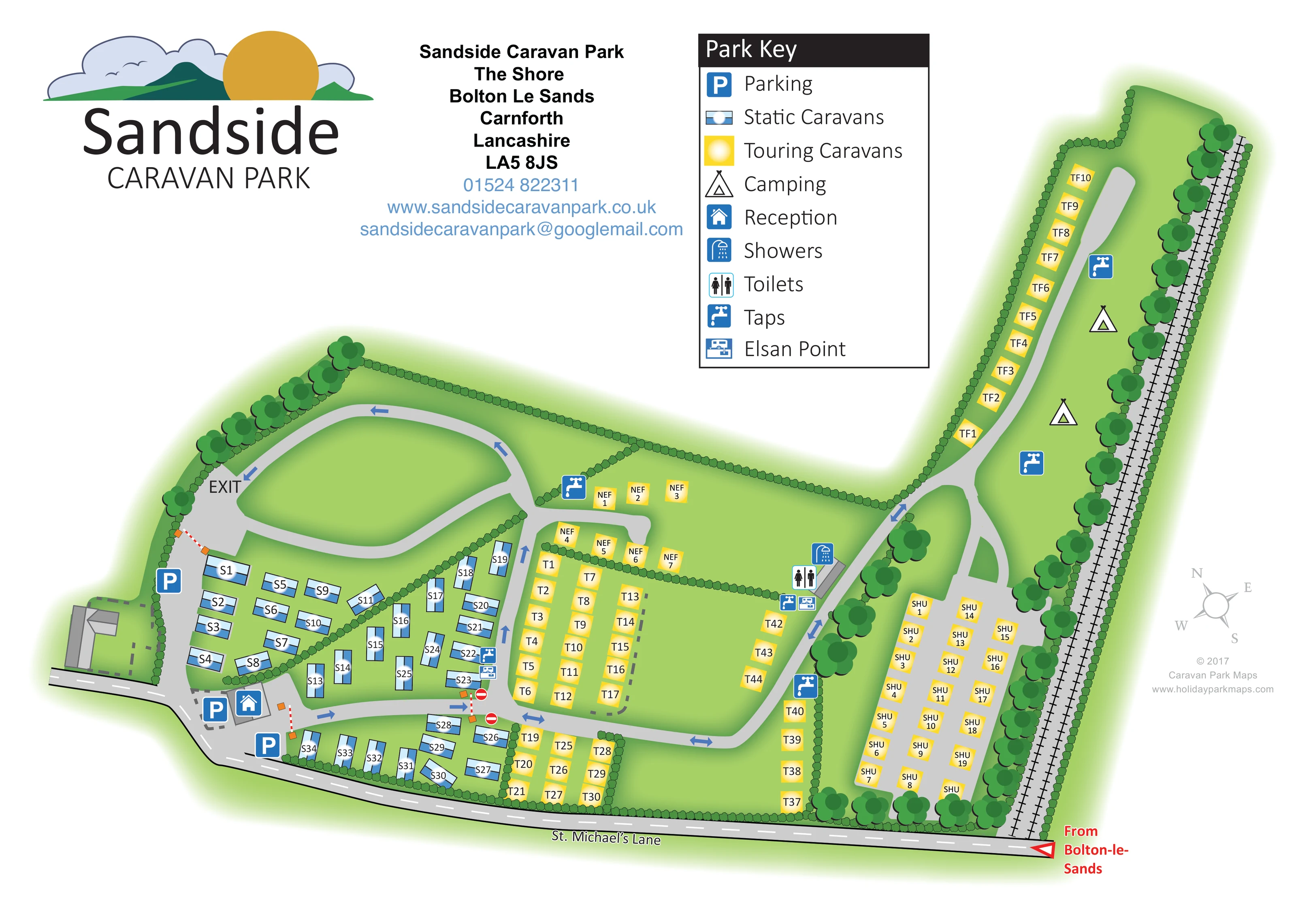
A railway drawn with paired rails and repeated sleepers runs along the eastern edge, screened from the park by a line of trees.
ILLUSTRATED PARK MAP · P590
Sandside Caravan Park, The Shore, Bolton Le Sands, Carnforth, Lancashire · United Kingdom
 Enlarge the map ↗
A SENSE OF THE PLACE
Sandside Caravan Park is a family-run holiday site at Bolton-le-Sands near Lancaster and Morecambe. It offers static caravans, touring and motorhome provision, including seasonal touring.
The park promotes a quieter holiday atmosphere with access to the surrounding coast and countryside. Its map shows the accommodation areas and internal routes within this location close to Morecambe Bay.
LOOK CLOSER
A railway drawn with paired rails and repeated sleepers runs along the eastern edge, screened from the park by a line of trees.
Continuous small hedge symbols outline the park and divide accommodation groups; larger rounded trees emphasise the western and railway-side boundaries.
Green spaces separate pitch groups, fill the western road loop and accommodate the northern camping symbols.
A blue reception symbol marks a small grey building beside the western arrival area.
Several blue P symbols identify parking around reception and the western approach.
Shower and toilet symbols mark a grey amenity building beside the central-eastern touring road.
Repeated blue tap symbols serve the main caravan areas and the northern touring and camping strip.
Elsan symbols appear beside a western internal junction and near the shower and toilet building.
A blue reception symbol marks a small grey building beside the western arrival area.
Several blue P symbols identify parking around reception and the western approach.
Shower and toilet symbols mark a grey amenity building beside the central-eastern touring road.
Repeated blue tap symbols serve the main caravan areas and the northern touring and camping strip.
Elsan symbols appear beside a western internal junction and near the shower and toilet building.
The named public road follows the lower edge of the plan, with a red directional annotation showing the approach from Bolton-le-Sands.
Grey roads connect reception, the accommodation groups and the northern extension. Blue arrows show selected travel directions, with red no-entry symbols at central junctions.
A broad loop around an open green area is labelled EXIT near its western end.
Red-and-white barrier illustrations appear at the western access area and near internal junctions.
A railway drawn with paired rails and repeated sleepers runs along the eastern edge, screened from the park by a line of trees.
Continuous small hedge symbols outline the park and divide accommodation groups; larger rounded trees emphasise the western and railway-side boundaries.
Green spaces separate pitch groups, fill the western road loop and accommodate the northern camping symbols.
A pale grey compass rose sits in the white margin to the right of the site.
READING THE MAP
This map of Sandside Caravan Park presents a mixed caravan and camping site at Bolton-le-Sands, near Morecambe Bay in Lancashire. Its distinctive shape combines a broad main park with a long, narrow touring and camping extension beside a railway. The design makes those connected areas easy to understand without relying on a conventional rectangular site plan.
Blue caravan footprints identify the static accommodation, while bright yellow markers organise the touring areas into clearly labelled groups. Grey roads connect the sections, with blue arrows, barrier illustrations and an exit label adding practical detail to the visitor’s route through the park. Reception and parking are grouped near the western arrival area, and prominent symbols locate showers, toilets, water taps and Elsan points.
The presentation balances this functional information with a recognisable landscape treatment: green lawns, continuous hedges and rounded tree belts establish the park’s boundaries and separate its accommodation areas. Above the plan, a large Sandside logo, contact block and boxed key give the artwork a clear identity and make it suitable for a visitor information sheet.
The plan is arranged around St. Michael’s Lane, which runs across the lower edge of the artwork. A red annotation points towards the approach from Bolton-le-Sands. At the western arrival area, reception is marked on a small grey building with parking symbols nearby. Blue static-caravan footprints occupy the adjoining hedged sections and continue along the roadside edge.
Internal roads connect these western areas to the central touring pitches. A broad loop curves around an open green space in the upper-left portion of the site, with directional arrows leading towards the labelled exit. Elsewhere, arrows, red no-entry symbols and illustrated barriers distinguish movements through the road network. Yellow touring markers form several compact groups, separated by hedges and short access lanes. Their letter prefixes help distinguish sections, although the key does not expand those abbreviations.
Towards the eastern side, shower and toilet symbols identify an amenity building close to the touring road. Water taps and Elsan points are marked at useful locations across the main plan. A separate eastern touring group sits between tree belts, beside the railway boundary. From here, the road extends north into a narrow strip containing a row of touring pitches, camping symbols and additional water points. The tent illustrations identify camping space rather than individually numbered pitches.
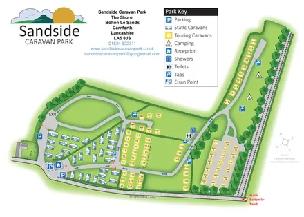
The artwork uses a top-down vector style, with light-grey roads, soft green ground shading and repeated hedge and tree symbols. A prominent nine-entry key explains the accommodation and service graphics. The large park logo and contact block occupy the upper white space, while a compass rose sits to the right. The accompanying enlarged view repeats part of this same artwork; it is not a separate park section or alternative map.
KEEP EXPLORING
Chosen for shared landscapes, accommodation or facilities.
 Explore the map ↗
United Kingdom
Coastal park map with static-caravan rows, touring pitches, a camping field and two leisure clusters.
 Explore the map ↗
United Kingdom
A wooded Allerton park plan with colour-coded neighbourhoods, touring pitches and a central facilities hub.
 Explore the map ↗
United Kingdom
Illustrated touring-park plan with facilities, public footpaths and adjoining field-access details.
Features may come from the sample artwork, its key or published park information. Approximate numbers describe the drawing and may cover only part of a park. They are intended to help you compare map examples. Current facilities and booking information should be checked with the park.
TAKE A CLOSER LOOK
View the illustrated map in detail or choose a file to download. These are sample maps; contact the park for current visitor information.


LET’S MAP YOUR PARK
For a map quotation, find your park and draw a rough boundary around it. The area you select helps us work out the design time and price.
Draw your park for a quote ↗Or talk to our map designers
01751 473136