
Sandy beach and bay
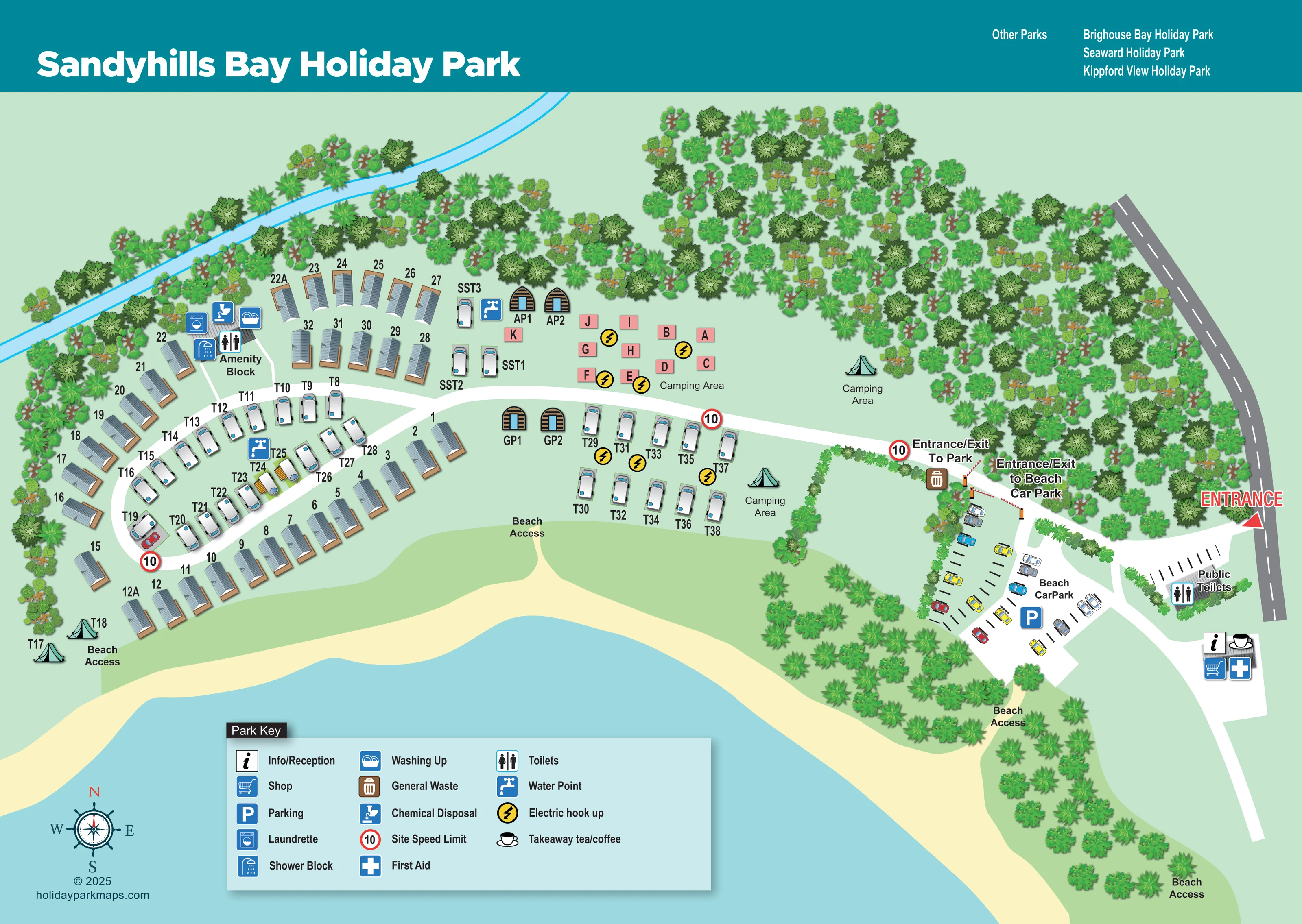
A broad pale-yellow shoreline borders blue water across the lower edge of the plan.
ILLUSTRATED PARK MAP · P288
Sandyhills, Dalbeattie · United Kingdom
 Enlarge the map ↗
A SENSE OF THE PLACE
Sandyhills Bay Holiday Park is based at Sandyhills, Dalbeattie. The park is beside Sandyhills Bay on the Solway coast. Holiday homes, glamping pods, touring and camping pitches are offered.
The park provides a small shop, heated washrooms, launderette and washing-up area.
LOOK CLOSER
A broad pale-yellow shoreline borders blue water across the lower edge of the plan.
Dense tree illustrations enclose the northern and eastern boundaries, with smaller planted belts around the car park and beach approaches.
An unnamed narrow blue watercourse runs diagonally behind the northern accommodation and tree belt.
Information/reception symbol on the building south-east of the beach car park.
Shop symbol grouped with reception, refreshments and first aid at the entrance-side building.
Cup symbol at the entrance-side building, identified in the key as takeaway tea/coffee.
First-aid cross at the same entrance-side service building.
Named building within the western accommodation group, carrying the washroom and utility symbols.
Information/reception symbol on the building south-east of the beach car park.
Shop symbol grouped with reception, refreshments and first aid at the entrance-side building.
Cup symbol at the entrance-side building, identified in the key as takeaway tea/coffee.
First-aid cross at the same entrance-side service building.
Named building within the western accommodation group, carrying the washroom and utility symbols.
Toilet and shower symbols at the amenity block; a separate public toilet building is labelled beside the road and beach parking.
Washing-machine symbol at the western amenity block.
Washing-up symbol at the amenity block.
Chemical disposal symbol beside the amenity block.
Tap symbols within the western touring group and beside the northern caravan pitches.
Yellow lightning symbols identify hook-ups in the lettered camping group and the central touring group.
Brown bin symbol near the park entrance barrier.
A substantial entrance-side parking area with marked bays, illustrated cars and a blue parking symbol.
A broad pale-yellow shoreline borders blue water across the lower edge of the plan.
Dense tree illustrations enclose the northern and eastern boundaries, with smaller planted belts around the car park and beach approaches.
An unnamed narrow blue watercourse runs diagonally behind the northern accommodation and tree belt.
A prominent red entrance arrow marks access from the grey road along the right-hand edge.
Distinct labelled entrance/exit points and red-and-white barriers separate the park drive from the beach car park.
Several beach access labels identify approaches from the accommodation areas and the entrance-side landscape.
A white drive extends west from the entrance, branching into the loop serving the main holiday-home and touring groups.
Red-ringed 10 markers appear at the park approach and along the internal route.
Operator information describes heated washrooms; heating is not separately indicated on the artwork.
READING THE MAP
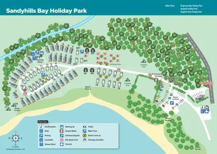
This illustrated map of Sandyhills Bay Holiday Park places the beach at the heart of the visitor experience. Set beside Sandyhills Bay on the Solway coast at Sandyhills, Dalbeattie, the park is presented as a compact coastal site framed by trees, sand and water. A broad sweep of pale-yellow beach runs beneath the accommodation, while the entrance and beach car park occupy the right-hand side of the plan.
The map shows static holiday homes, touring caravan pitches, paired glamping pods and camping areas, each given a recognisable visual treatment. Curving white roads link the main accommodation groups, with clearly labelled beach access points connecting the park to the shore. Arrival information is particularly prominent: separate entrances to the park and beach car park, public toilets and the reception-side service building are all easy to pick out.
A teal title banner, illustrated trees and nautical compass give the page its coastal character. The large Park Key keeps practical facilities readable without crowding the accommodation, making this a useful example of a mixed-accommodation park map with both guest and beach-visitor routes to explain.
The single-page plan is organised around a long sandy frontage, with the main holiday-home area on the left and the roadside entrance on the right. Static units follow curved outer rows near the shore and northern tree belt. Touring caravans occupy the inner western loop, while another small group is arranged in two rows nearer the centre. Four arched timber pod illustrations appear in pairs beside the main drive. North of that drive, salmon-coloured letter blocks identify a camping group with electric hook-up symbols; other camping spaces are indicated by tent illustrations and area labels.
The white internal drive leads west from a clearly labelled entrance/exit barrier. A second barrier serves the beach car park, where marked bays and colourful car illustrations explain the parking layout. Public toilets sit close to the external road. Farther down the entrance-side route, a building carries symbols for information/reception, the shop, takeaway tea and coffee, and first aid.
Within the western accommodation area, the named amenity block groups toilets, showers, a launderette, washing-up and chemical disposal. Water-point symbols appear among the pitches, with a general-waste marker near the park entrance. Repeated red-ringed speed markers punctuate the drive, and several beach access labels identify connections to the shore.
Dense tree illustrations form the inland boundary and screen parts of the parking area. An unnamed blue watercourse crosses the upper-left landscape. The pale-blue, three-column key occupies open water at the bottom of the page, leaving the accommodation unobscured. A compass sits to its left, while the teal header combines the park title with a short list of other parks.
KEEP EXPLORING
Chosen for shared landscapes, accommodation or facilities.
 Explore the map ↗
United Kingdom
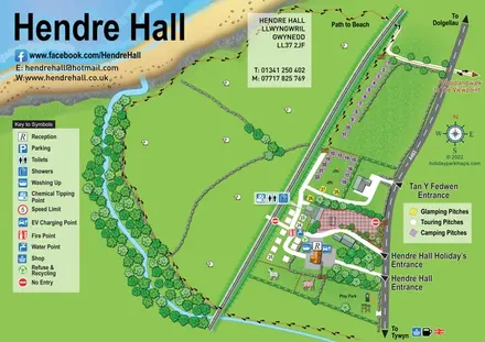
Coastal camping, touring and glamping map with a railway-side layout, beach path and illustrated rural surroundings.
 Explore the map ↗
United Kingdom
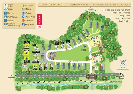
A tree-framed mixed-accommodation park map with a central green, service icons and coastal walking connections.
 Explore the map ↗
United Kingdom
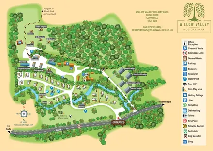
A woodland-valley park map combining named glamping stays, numbered pitches, riverside lodges and footprint-marked walking routes.
Features may come from the sample artwork, its key or published park information. Approximate numbers describe the drawing and may cover only part of a park. They are intended to help you compare map examples. Current facilities and booking information should be checked with the park.
TAKE A CLOSER LOOK
View the illustrated map in detail or choose a file to download. These are sample maps; contact the park for current visitor information.

LET’S MAP YOUR PARK
For a map quotation, find your park and draw a rough boundary around it. The area you select helps us work out the design time and price.
Draw your park for a quote ↗Or talk to our map designers
01751 473136