
Fishing pond
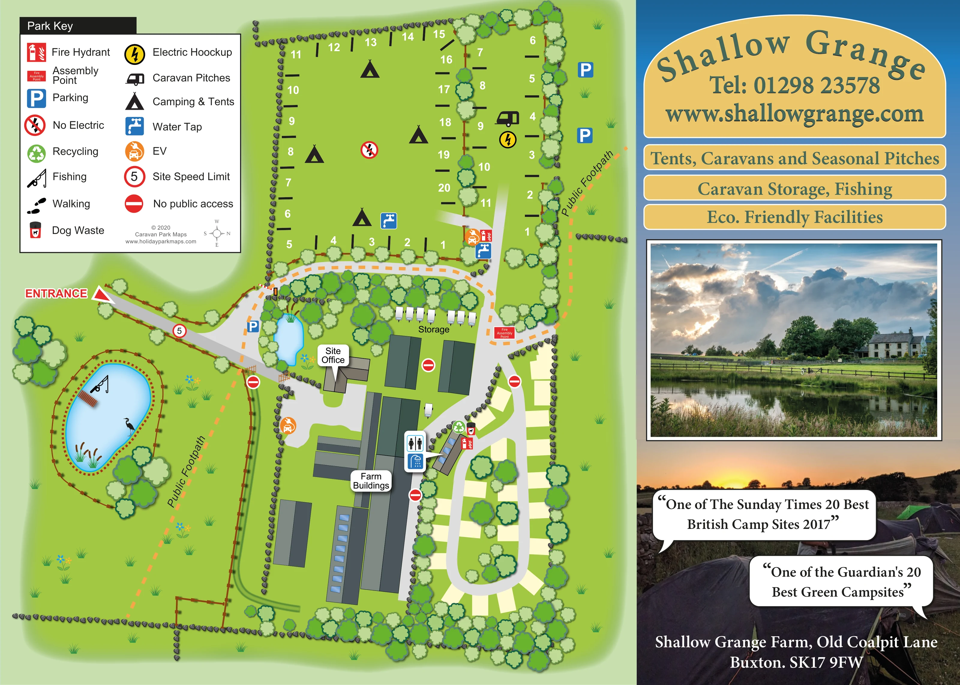
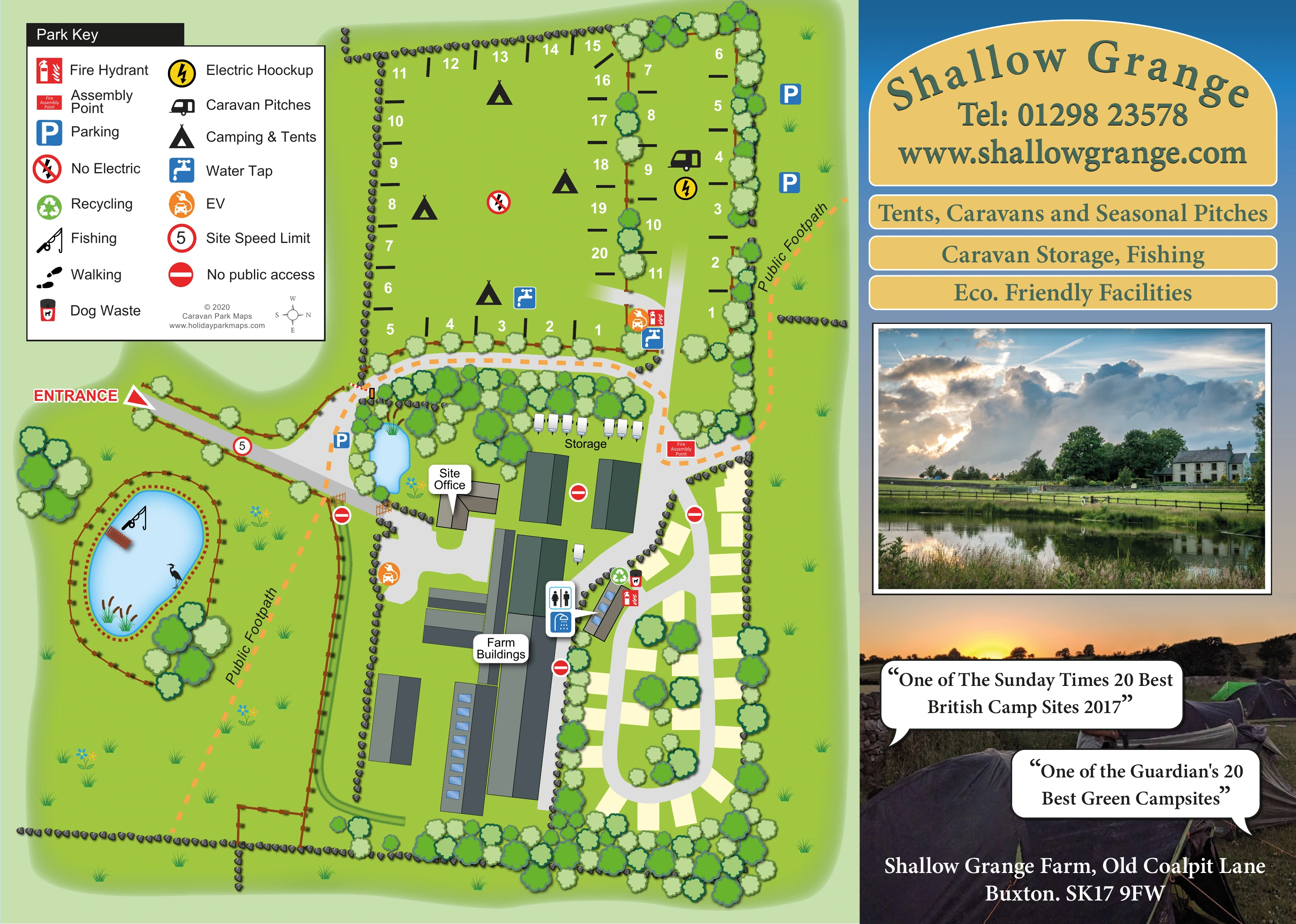
A large fenced blue pond west of the farmyard includes a fishing symbol, a small timber platform, reeds and a bird illustration.
ILLUSTRATED PARK MAP · P597
Old Coalpit Lane, Chelmorton, near Buxton, Derbyshire · United Kingdom
 Enlarge the map ↗
A SENSE OF THE PLACE
Shallow Grange is a working farm and campsite near Chelmorton, between Buxton and Bakewell. Sheep, cattle and grassy farmland surround the camping area in the Peak District.
A level field accommodates tourers and tents, with electric connections supplied from renewable energy. Walking routes start from the farm, and views across the Derbyshire landscape are part of the appeal of a stay.
LOOK CLOSER
A large fenced blue pond west of the farmyard includes a fishing symbol, a small timber platform, reeds and a bird illustration.
A second, narrower pond sits among trees beside the arrival road and site office.
Repeated stone shapes, brown fences and dense rows of trees distinguish camping fields, caravan strips, ponds and the farmyard.
A labelled office building beside the arrival road, small pond and farmyard.
Toilet and shower symbols mark a building on the eastern side of the farm building group.
A yellow lightning symbol identifies the upper caravan strip as an electric-hookup area.
A crossed-out electricity symbol appears within the main tent camping field.
Blue tap symbols appear within the camping field and near the junction beside the caravan strip.
A labelled office building beside the arrival road, small pond and farmyard.
Toilet and shower symbols mark a building on the eastern side of the farm building group.
A yellow lightning symbol identifies the upper caravan strip as an electric-hookup area.
A crossed-out electricity symbol appears within the main tent camping field.
Blue tap symbols appear within the camping field and near the junction beside the caravan strip.
Orange plug-and-car symbols, identified as EV in the key, appear near the upper pitch junction and west of the farm buildings.
Blue parking symbols mark an arrival-side location and two locations beside the upper caravan strip.
A row of illustrated caravans labelled Storage sits immediately above the farm buildings, separate from the accommodation pitch areas.
Recycling and dog-waste symbols are grouped near the facilities building and lower road junction.
Red symbols identified as fire hydrants in the key appear near service locations; a fire assembly point is marked beside the eastern road bend.
A large fenced blue pond west of the farmyard includes a fishing symbol, a small timber platform, reeds and a bird illustration.
A second, narrower pond sits among trees beside the arrival road and site office.
A substantial central group of long agricultural buildings is labelled Farm Buildings, with public-access restrictions marked at several adjoining routes.
Repeated stone shapes, brown fences and dense rows of trees distinguish camping fields, caravan strips, ponds and the farmyard.
Orange dashed routes cross the western grassland, follow part of the arrival road and continue along the eastern boundary; Public Footpath labels identify their purpose.
A prominent red entrance arrow leads from the left to a branching grey road network and a lower loop around pitch bays.
No-public-access symbols distinguish farm and service routes. A circular 5 speed symbol is shown on the entrance road.
The supplied park context describes electric connections supplied from renewable energy; the artwork advertises eco-friendly facilities without explaining the energy system.
READING THE MAP
This illustrated map presents Shallow Grange Farm as both a campsite and a working rural property near Chelmorton in the Derbyshire Peak District. Rather than showing pitches in isolation, it places the camping fields, caravan areas and visitor facilities around a substantial group of farm buildings, with stone boundaries, tree belts and two ponds giving the plan its character.
The entrance is clearly marked on the left, leading towards the site office and the roads serving the accommodation areas. A large tent field and a narrower caravan strip occupy the upper part of the plan, while additional pitch bays follow a loop below. The fishing pond is a prominent landmark, and orange dashed public footpaths show how walking routes pass through the depicted grounds.
A generous key makes the service and access symbols easy to interpret. Alongside the plan, a separate promotional column combines the Shallow Grange name, accommodation and activity headings, countryside photography and historical press quotations. The result is a useful example of campsite mapping integrated with a visitor-facing brochure layout.
The plan is organised around the relationship between visitor space and the working farm. From the red entrance arrow on the left, a grey approach road passes the fishing pond and reaches a junction beside a smaller pond and the labelled site office. One branch serves the upper camping areas; another continues through the central layout towards a lower road loop lined with pale pitch bays.
At the top, the main grass camping field has white perimeter numbers, short black pitch divisions and tent symbols within its open centre. A crossed-out electricity symbol distinguishes this area from the adjoining caravan strip, where a caravan silhouette and yellow hookup symbol identify the accommodation and service provision. Trees form a strong dividing line between the two areas. Parking symbols sit beside the approach and along the outer side of the caravan strip.
The central farm buildings are drawn as long, dark-roofed structures. Above them, a separate row of caravans is labelled Storage. Toilets and showers are marked on the eastern side of the building group, with recycling, dog-waste and fire symbols nearby. Water taps and EV symbols appear at other service points, and a fire assembly point is marked beside the eastern bend. Red no-public-access signs distinguish several farm routes from visitor circulation.
Orange dashed public footpaths cross the western grassland and continue around the eastern edge. Stone walls, fences, tree clusters, reeds and small flower motifs make these spaces visually distinct. The right-hand panel adds branding, service headings, two photographs and endorsement callouts. The enlarged key view repeats part of this same artwork, making the symbols and upper camping layout easier to read rather than introducing another site section.
KEEP EXPLORING
Chosen for shared landscapes, accommodation or facilities.
 Explore the map ↗
United Kingdom
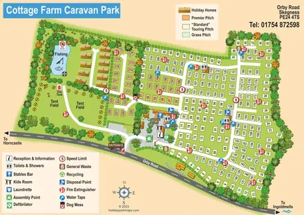
Illustrated touring and camping park map with numbered pitches, a fishing pond and a central farm courtyard.
 Explore the map ↗
United Kingdom
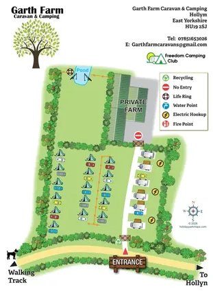
Illustrated farm campsite map with tent camping, electric touring bays, a pond and clearly marked private farm access.
 Explore the map ↗
United Kingdom
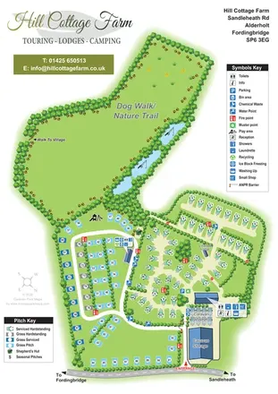
Portrait park map with mixed touring pitches, seasonal rows, ponds and an extensive dog walk.
Features may come from the sample artwork, its key or published park information. Approximate numbers describe the drawing and may cover only part of a park. They are intended to help you compare map examples. Current facilities and booking information should be checked with the park.
TAKE A CLOSER LOOK
View the illustrated map in detail or choose a file to download. These are sample maps; contact the park for current visitor information.


LET’S MAP YOUR PARK
For a map quotation, find your park and draw a rough boundary around it. The area you select helps us work out the design time and price.
Draw your park for a quote ↗Or talk to our map designers
01751 473136