
River Wyre
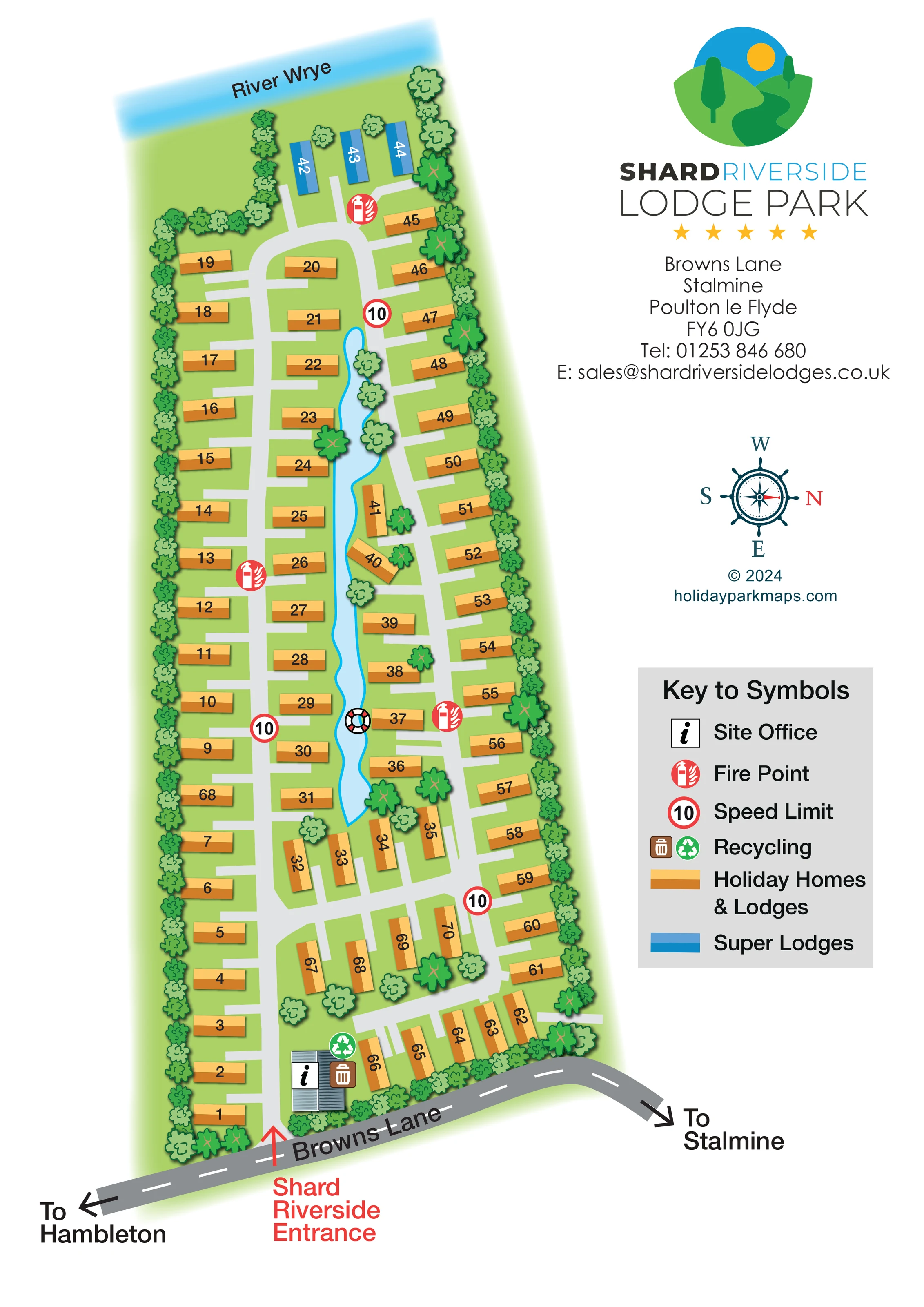
A broad blue strip forms the river boundary at the upper end of the drawing. The artwork labels it River Wrye.
ILLUSTRATED PARK MAP · P293
Browns Lane, Stalmine, Poulton-le-Fylde · United Kingdom
 Enlarge the map ↗
A SENSE OF THE PLACE
Shard Riverside Lodge Park is a holiday home ownership development beside the River Wyre estuary in Lancashire. Lodges and static caravans provide places for owners to spend leisure time near the coast.
The river setting shapes the character of the park. Its map presents the arrangement of holiday homes and access roads within the grounds, helping owners and visiting guests find their way around.
LOOK CLOSER
A broad blue strip forms the river boundary at the upper end of the drawing. The artwork labels it River Wrye.
A long, narrow, irregular blue water feature runs through the middle of the park. It is not named, and no connection to the river is shown.
Closely spaced tree symbols frame the long boundaries, with additional trees around the water feature, entrance and accommodation groups.
A grey, roof-textured building with the office information symbol stands just inside the Browns Lane entrance.
Green recycling and brown bin symbols are grouped beside the site office near the entrance.
Red circular extinguisher symbols mark several locations along the internal roads.
Repeated red-bordered signs marked 10 provide conspicuous road reminders; the legend calls these Speed Limit.
An unkeyed lifebuoy symbol appears beside the lower part of the central water feature.
A grey, roof-textured building with the office information symbol stands just inside the Browns Lane entrance.
Green recycling and brown bin symbols are grouped beside the site office near the entrance.
Red circular extinguisher symbols mark several locations along the internal roads.
Repeated red-bordered signs marked 10 provide conspicuous road reminders; the legend calls these Speed Limit.
An unkeyed lifebuoy symbol appears beside the lower part of the central water feature.
A broad blue strip forms the river boundary at the upper end of the drawing. The artwork labels it River Wrye.
A long, narrow, irregular blue water feature runs through the middle of the park. It is not named, and no connection to the river is shown.
Closely spaced tree symbols frame the long boundaries, with additional trees around the water feature, entrance and accommodation groups.
A red arrow and Shard Riverside Entrance label identify access from Browns Lane at the lower end of the plan.
Browns Lane is drawn across the foot of the page, with outward arrows towards Hambleton on the left and Stalmine on the right.
Pale roads run lengthways through the park, connect around accommodation groups and extend into short individual plot approaches.
READING THE MAP
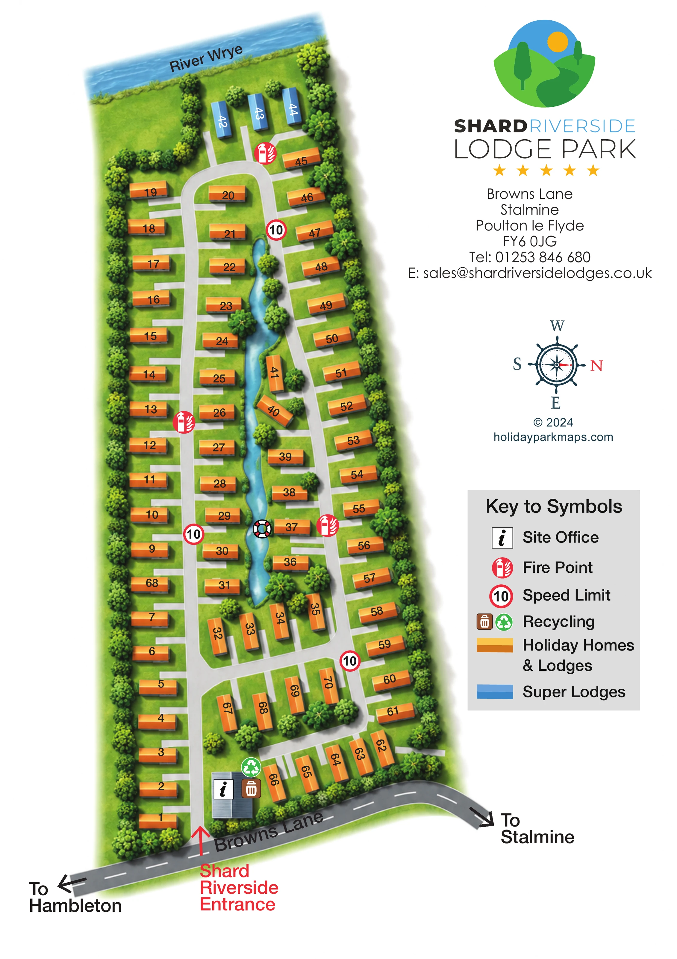
This illustrated map of Shard Riverside Lodge Park presents a long, tree-lined holiday-home development beside the River Wyre in Lancashire. The plan leads the eye from the Browns Lane entrance at the foot of the page towards the river at the opposite end, making the site's elongated shape easy to understand. A narrow blue water feature runs through the centre, with accommodation arranged along pale internal roads on either side.
The map shows approximately 70 holiday homes and lodges. Most use warm orange blocks, while a small riverside group of Super Lodges is picked out in blue. Large plot numbers support everyday navigation without requiring detailed architectural drawings. The site office and recycling point sit close to the entrance, and clearly coloured fire-point and speed-limit symbols stand out along the roads.
A separate right-hand column gives the park's branding, contact details, compass and symbol key room to breathe. Together, these elements create a practical visitor plan that also retains the character of a landscaped riverside ownership park.
The artwork is a single portrait plan, with the illustrated park occupying the left-hand side and an information column on the right. Browns Lane crosses the bottom edge as a dark grey road with dashed white markings. Direction arrows point towards Hambleton and Stalmine, while a red entrance arrow identifies the turn into Shard Riverside. Immediately inside, the office is shown as a grey roof-textured building beside recycling and bin symbols.
Pale internal roads extend along the narrow site and branch into short approaches serving the numbered accommodation. Most units form regular rows, but groups nearer the entrance and around the central water feature change angle to fit the road layout. Orange blocks represent the combined Holiday Homes & Lodges category. Three blue Super Lodges create a contrasting group at the river end, where the road curves between planting and the accommodation.
The landscape is an important part of the drawing. Repeated green tree crowns line the boundaries, with larger trees scattered beside units and around the long, irregular central water feature. A lifebuoy symbol appears beside its lower section. The River Wyre is represented by a broad blue band across the far end of the park, visually distinguishing the external river frontage from the smaller internal water feature.
Red fire-point symbols and circular signs marked 10 remain conspicuous against the green grounds. The large grey legend explains these alongside the office, recycling and accommodation colours. Above it, the branding block and nautical compass complete the page. The enlarged legend view shows this same artwork in greater detail rather than adding another park section.
 Enlarge this map ↗
KEEP EXPLORING
Chosen for shared landscapes, accommodation or facilities.
 Explore the map ↗
United Kingdom
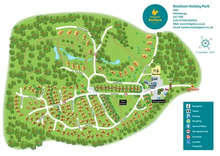
A woodland holiday-park plan with numbered homes, tree-named roads, walking loops and a distinctive entrance totem pole.
 Explore the map ↗
United Kingdom
Illustrated lakeside park plan with numbered holiday units, leisure buildings and a looping Woodland Walk.
 Explore the map ↗
United Kingdom
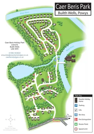
Portrait holiday-home park map with riverside loops, a tree-fringed pond and a separate manor landmark.
Features may come from the sample artwork, its key or published park information. Approximate numbers describe the drawing and may cover only part of a park. They are intended to help you compare map examples. Current facilities and booking information should be checked with the park.
LET’S MAP YOUR PARK
For a map quotation, find your park and draw a rough boundary around it. The area you select helps us work out the design time and price.
Draw your park for a quote ↗Or talk to our map designers
01751 473136