
Pond and life ring
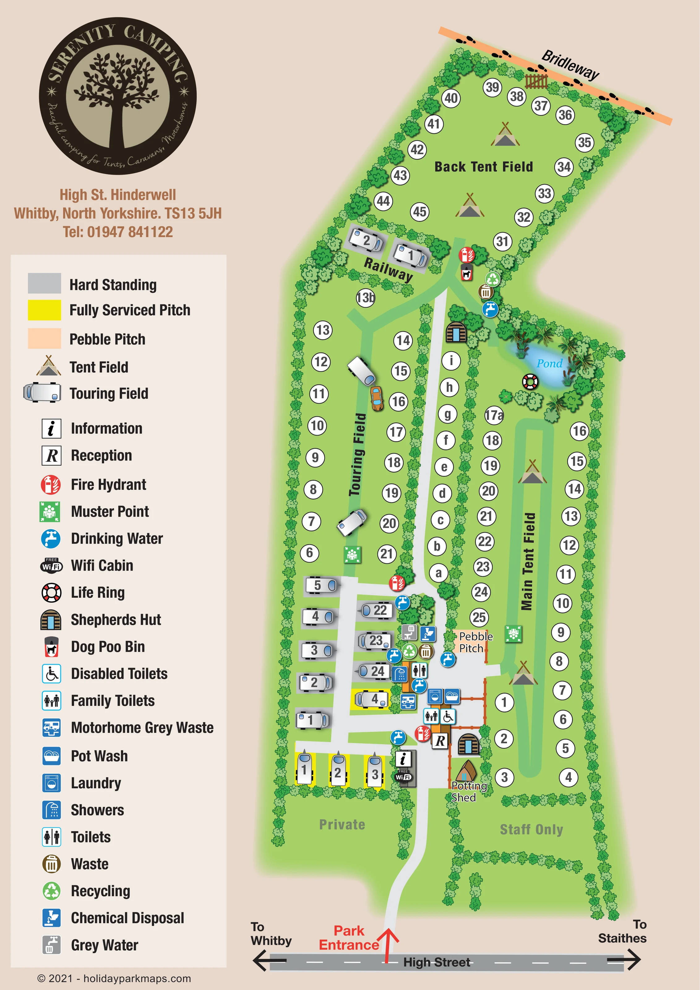
A blue pond with reeds and surrounding planting forms a landmark between the Main Tent Field and the back-field approach, with a life-ring symbol beside it.
ILLUSTRATED PARK MAP · P596
High Street, Hinderwell, Whitby, North Yorkshire · United Kingdom
 Enlarge the map ↗
A SENSE OF THE PLACE
Serenity Camping is based at High Street, Hinderwell, Whitby, North Yorkshire. The campsite is at Hinderwell, overlooking the North York Moors. The contact page also advertises a cabin and shepherd's huts for hire. The park offers spacious grass camping, hardstanding and fully serviced touring pitches.
The contact page says group and family-group bookings cannot be accommodated. Dogs must be controlled on a lead or tether on the campsite.
LOOK CLOSER
A blue pond with reeds and surrounding planting forms a landmark between the Main Tent Field and the back-field approach, with a life-ring symbol beside it.
Continuous illustrated planting outlines the site, separates its fields and encloses the central lettered strip.
Railway names a small hedge-separated area containing two touring illustrations below the Back Tent Field; no railway track is drawn.
Separate reception and information symbols mark the lower central arrival and facilities area.
A Wi-Fi symbol identifies a cabin beside the information point near the entrance facilities.
Toilet and shower symbols are grouped around the service buildings between touring and tent camping.
Family-toilet and wheelchair symbols identify facilities beside reception; the legend labels the latter Disabled Toilets.
Adjacent laundry and washing-up symbols appear in the central facilities cluster.
Separate reception and information symbols mark the lower central arrival and facilities area.
A Wi-Fi symbol identifies a cabin beside the information point near the entrance facilities.
Toilet and shower symbols are grouped around the service buildings between touring and tent camping.
Family-toilet and wheelchair symbols identify facilities beside reception; the legend labels the latter Disabled Toilets.
Adjacent laundry and washing-up symbols appear in the central facilities cluster.
Blue tap symbols are distributed around the facilities and at the junction leading towards the back field.
Paired waste and recycling symbols appear near the main service buildings and the back-field approach.
Chemical disposal, grey water and motorhome grey-waste symbols are shown around the touring-side facilities.
A dog-waste bin is marked at the approach to the Back Tent Field.
Red fire symbols and green assembly symbols are positioned in the touring, main tent and back-field areas; the legend calls the red symbols Fire Hydrant.
A blue pond with reeds and surrounding planting forms a landmark between the Main Tent Field and the back-field approach, with a life-ring symbol beside it.
Continuous illustrated planting outlines the site, separates its fields and encloses the central lettered strip.
A peach-coloured bridleway with footprint marks follows the upper boundary, with a gate drawn beside the Back Tent Field.
A red entrance arrow links High Street to the internal access lane. Road-end arrows indicate Whitby and Staithes.
A pale central access lane branches into the touring hardstandings, while green tracks organise movement within the grass fields.
A peach rectangular pitch is explicitly labelled beside the central facilities and Main Tent Field.
A small brown, pointed-roof building is labelled Potting Shed near the lower shepherds’ hut; no further use is stated.
Railway names a small hedge-separated area containing two touring illustrations below the Back Tent Field; no railway track is drawn.
Muted labels distinguish Private ground to the left of the entrance lane and Staff Only ground to its right.
The park is described as being at Hinderwell overlooking the North York Moors; the artwork itself concentrates on the campsite rather than a wider landscape panorama.
READING THE MAP
This illustrated map of Serenity Camping in Hinderwell, North Yorkshire, brings a long, hedge-divided campsite into a single portrait layout. The plan separates touring accommodation from the Main Tent Field and Back Tent Field, while keeping arrival, reception and everyday facilities easy to locate. High Street runs across the foot of the page, with arrows towards Whitby and Staithes and a prominent red marker identifying the park entrance.
The campsite’s green character is expressed through continuous bands of trees and shrubs, open grass areas and a reed-fringed pond. Small caravan drawings, tent symbols and shepherds’ huts give the accommodation areas distinct identities without overwhelming the pitch references. Grey hardstandings, yellow fully serviced bays and a peach Pebble Pitch introduce useful surface distinctions.
A large tree-emblem logo and a comprehensive left-hand key balance the tall site plan. This sample is particularly relevant to campsites that need to explain several pitch types, separate fields and a concentrated facilities area within a compact visitor handout.
The map follows the campsite from its High Street entrance at the bottom to the bridleway along the far boundary. A pale access lane leads past reception, information and the Wi-Fi cabin before continuing between the accommodation areas. Private and staff-only ground is labelled on either side of the entrance approach, distinguishing it from the visitor fields.
On the left, the Touring Field combines grass positions with a cluster of grey hardstandings and bright yellow fully serviced pitches near the main facilities. Further back, a small area labelled Railway contains two touring illustrations. The Main Tent Field occupies the long right-hand enclosure, with pitch markers around its edges and a green route through its centre. The Back Tent Field widens into an angled enclosure at the top, beside a drawn gate and the footprint-marked bridleway. Between the main fields, a narrow hedge-lined strip carries lettered positions.
The service area uses closely grouped pictograms for showers, toilets, family and accessible toilets, laundry, pot wash and touring-waste disposal. Drinking-water, waste and recycling points also appear farther along the site. Fire and muster symbols are distributed across the principal camping areas. Two shepherds’ hut illustrations, the named Potting Shed and a blue pond with reeds and a life ring provide additional landmarks.
The portrait page pairs this elongated plan with a large circular logo, contact block and tall legend. Bold field names and white circular pitch references sit above a softer landscape treatment of repeated foliage and shaded grass. The artwork is a single site plan; the enlarged detail views show overlapping portions of the same design rather than separate accommodation areas.
KEEP EXPLORING
Chosen for shared landscapes, accommodation or facilities.
 Explore the map ↗
United Kingdom
Woodland holiday-park map with named accommodation areas, touring loops and illustrated recreation facilities.
 Explore the map ↗
United Kingdom
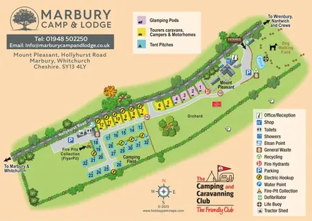
Colour-coded camping, touring and glamping map with an orchard, pond and dog-walking field.
 Explore the map ↗
United Kingdom
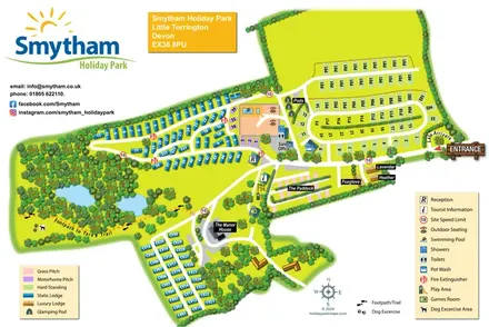
Colour-coded accommodation, woodland ponds and a Tarka Trail footpath on Smytham’s illustrated park map.
Features may come from the sample artwork, its key or published park information. Approximate numbers describe the drawing and may cover only part of a park. They are intended to help you compare map examples. Current facilities and booking information should be checked with the park.
LET’S MAP YOUR PARK
For a map quotation, find your park and draw a rough boundary around it. The area you select helps us work out the design time and price.
Draw your park for a quote ↗Or talk to our map designers
01751 473136