
Tree and hedge boundaries
Repeated trees and hedge-like planting frame the long perimeter and form a planted division through the centre of the park.
ILLUSTRATED PARK MAP · P598
Slyne Caravan Park, Bottomdale Road, Slyne, Lancaster · United Kingdom
 Enlarge the map ↗
A SENSE OF THE PLACE
Slyne Caravan Park is a small family-owned holiday home park near Lancaster and Morecambe. Its countryside setting provides a base for repeated breaks in North Lancashire.
Walking opportunities start nearby, with the Lake District and Yorkshire Dales available for longer excursions. The map sets out the caravan plots and internal roads, helping owners and visitors understand the park's layout.
LOOK CLOSER
Repeated trees and hedge-like planting frame the long perimeter and form a planted division through the centre of the park.
A continuous lime-green ground treatment surrounds the units, with scattered larger trees between plots and at road junctions.
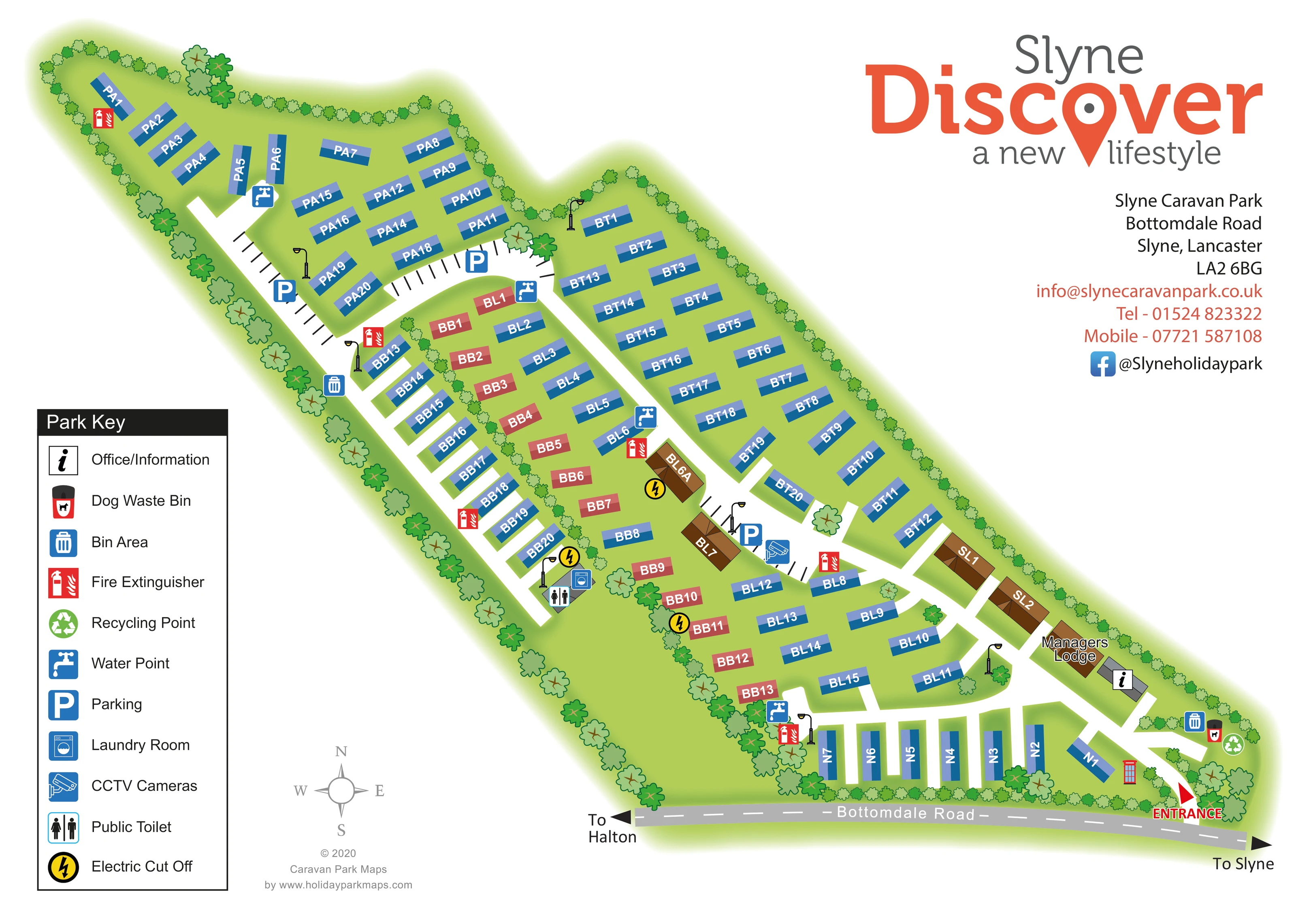
An information symbol marks a small grey building beside the manager's lodge, just inside the entrance.
A named brown building stands beside the arrival road and office / information building.
Blue P symbols identify parking in the upper accommodation area and beside the central road; black bay lines show the parking arrangement.
A washing-machine symbol identifies the laundry at the end of a western internal road, alongside the public toilet.
The public-toilet symbol is placed on the small grey service building beside the laundry.
Blue tap symbols are distributed between the upper, central and lower accommodation groups.
An information symbol marks a small grey building beside the manager's lodge, just inside the entrance.
A named brown building stands beside the arrival road and office / information building.
Blue P symbols identify parking in the upper accommodation area and beside the central road; black bay lines show the parking arrangement.
A washing-machine symbol identifies the laundry at the end of a western internal road, alongside the public toilet.
The public-toilet symbol is placed on the small grey service building beside the laundry.
Blue tap symbols are distributed between the upper, central and lower accommodation groups.
Bin-area symbols appear near the entrance and along the western road. A recycling point and dog-waste bin are marked together near the entrance-side boundary.
Repeated red extinguisher symbols mark points throughout the accommodation areas.
Yellow circles containing black lightning bolts identify several electrical cut-off points in the central and western parts of the park.
A blue camera symbol is positioned beside the central parking area.
Small black lamp-post drawings provide landmarks beside roads and service areas; they are not separately explained in the key.
A small red telephone-box-style illustration stands near the entrance. No label establishes its function or availability.
Repeated trees and hedge-like planting frame the long perimeter and form a planted division through the centre of the park.
A continuous lime-green ground treatment surrounds the units, with scattered larger trees between plots and at road junctions.
A red arrow and ENTRANCE label identify the access from Bottomdale Road at the lower right of the plan.
Bottomdale Road is named along the lower edge, with directional arrows towards Halton on the left and Slyne on the right.
White roads lead from the entrance into a long central spine and western branch, with short access spurs, parking bays and terminating road ends.
A grey four-point compass occupies the open space between the key and lower boundary.
READING THE MAP
This illustrated map of Slyne Caravan Park presents a compact holiday-home park in Slyne, near Lancaster and Morecambe. Its long, tapering layout stretches diagonally across the page, with tree-lined boundaries enclosing rows of caravan-style units and a branching network of white internal roads. Bottomdale Road anchors the lower edge, where a prominent red entrance arrow and directions towards Slyne and Halton establish the approach.
The artwork combines plot-level navigation with a clear overview of everyday facilities. Bold white accommodation references sit directly on the coloured unit symbols, while parking, water points, waste facilities, laundry and the public toilet are identified by matching pictograms. The manager's lodge and office / information building form recognisable landmarks just inside the entrance.
A large Slyne brand panel occupies the open upper-right corner, balancing the detailed plan with the park's identity and contact information. The result is a useful example for smaller holiday-home parks that need to explain an irregular site, distinguish local plot groups and make practical services easy to find without relying on a dense technical drawing.
The plan follows an elongated site that broadens through the middle and narrows towards its upper-left end. From the entrance on Bottomdale Road, the white road network passes the office / information building and manager's lodge before branching through the accommodation. A lower row sits close to the roadside boundary, longer groups occupy the central and eastern areas, and a western road leads towards the laundry and public toilet before continuing into the upper accommodation area.
The units are drawn as simple two-tone rectangles, mainly blue with a smaller muted-red group. A few larger brown symbols use roof-like divisions. Each carries a bold white letter-and-number reference, rotated with the building rather than set horizontally across the page. The colour differences are visually useful, although the key does not define them as particular accommodation types.
Parking is shown with blue P symbols and black bay markings. Tap icons appear at several road junctions and between plot groups. Bin areas, entrance-side recycling and a dog-waste bin are also mapped. Red fire-extinguisher symbols and yellow electrical cut-off markers stand out from the green ground, while a CCTV icon sits beside central parking. Illustrated lamp posts and a red telephone-box-style landmark add recognisable details without dominating the plan.
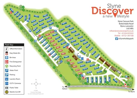
Trees outline the perimeter and form a central planted divider, with larger crowns scattered between units. Outside the site, the grey Bottomdale Road has destination arrows at both ends. A compass and boxed eleven-entry Park Key complete the navigation system. The accompanying enlargement shows this same key and adjacent artwork in greater detail; it is not a separate section map.
KEEP EXPLORING
Chosen for shared landscapes, accommodation or facilities.
 Explore the map ↗
United Kingdom
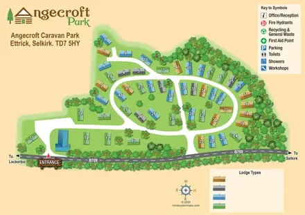
Tree-framed Angecroft Park map with colour-coded roofs, looping roads and a signed B709 entrance.
 Explore the map ↗
United Kingdom
Ashby Park map with seven fishing lakes, colour-coded accommodation and illustrated wooded shorelines.
 Explore the map ↗
United Kingdom
Woodland-framed Barnsoul map with mixed accommodation, shared facilities and paw-marked walking routes.
Features may come from the sample artwork, its key or published park information. Approximate numbers describe the drawing and may cover only part of a park. They are intended to help you compare map examples. Current facilities and booking information should be checked with the park.
TAKE A CLOSER LOOK
View the illustrated map in detail or choose a file to download. These are sample maps; contact the park for current visitor information.


LET’S MAP YOUR PARK
For a map quotation, find your park and draw a rough boundary around it. The area you select helps us work out the design time and price.
Draw your park for a quote ↗Or talk to our map designers
01751 473136
 slyneholidayparksign_large.png
 slyneholidayparksign.png