
River Ure
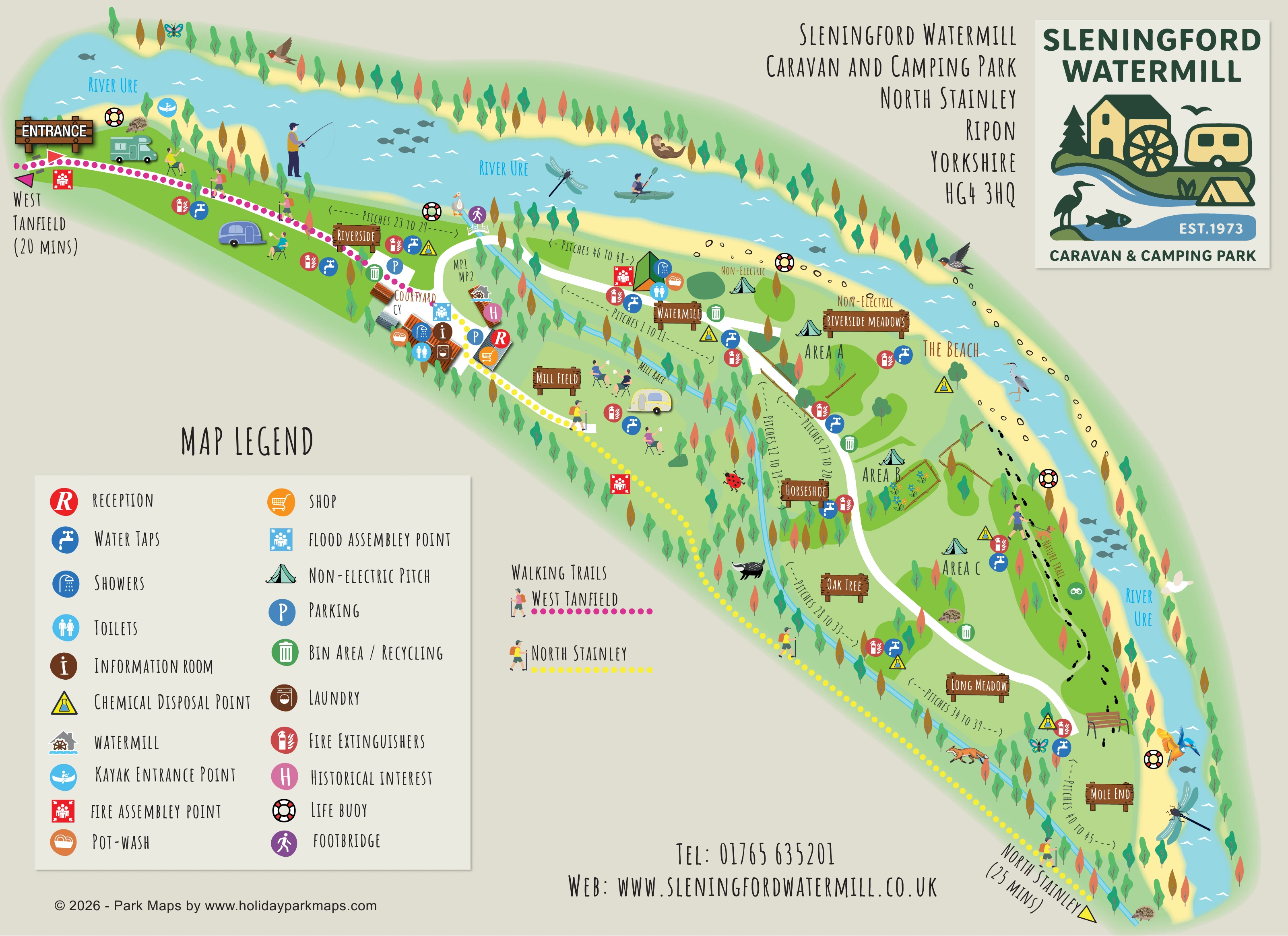
The broad river curves around the upper and right-hand edges of the park, forming its principal landscape boundary.
ILLUSTRATED PARK MAP · P303
Sleningford Watermill, North Stainley, Ripon, Yorkshire · United Kingdom
 Enlarge the map ↗
A SENSE OF THE PLACE
Sleningford Watermill is a family-run campsite beside the River Ure near North Stainley. It welcomes tents, caravans and motorhomes in a riverside setting north of Ripon.
Grass and hardstanding pitches include electric options. Heated showers and accessible toilets support stays, while walking, cycling and canoeing feature among the outdoor activities associated with the site and surrounding Yorkshire countryside.
LOOK CLOSER
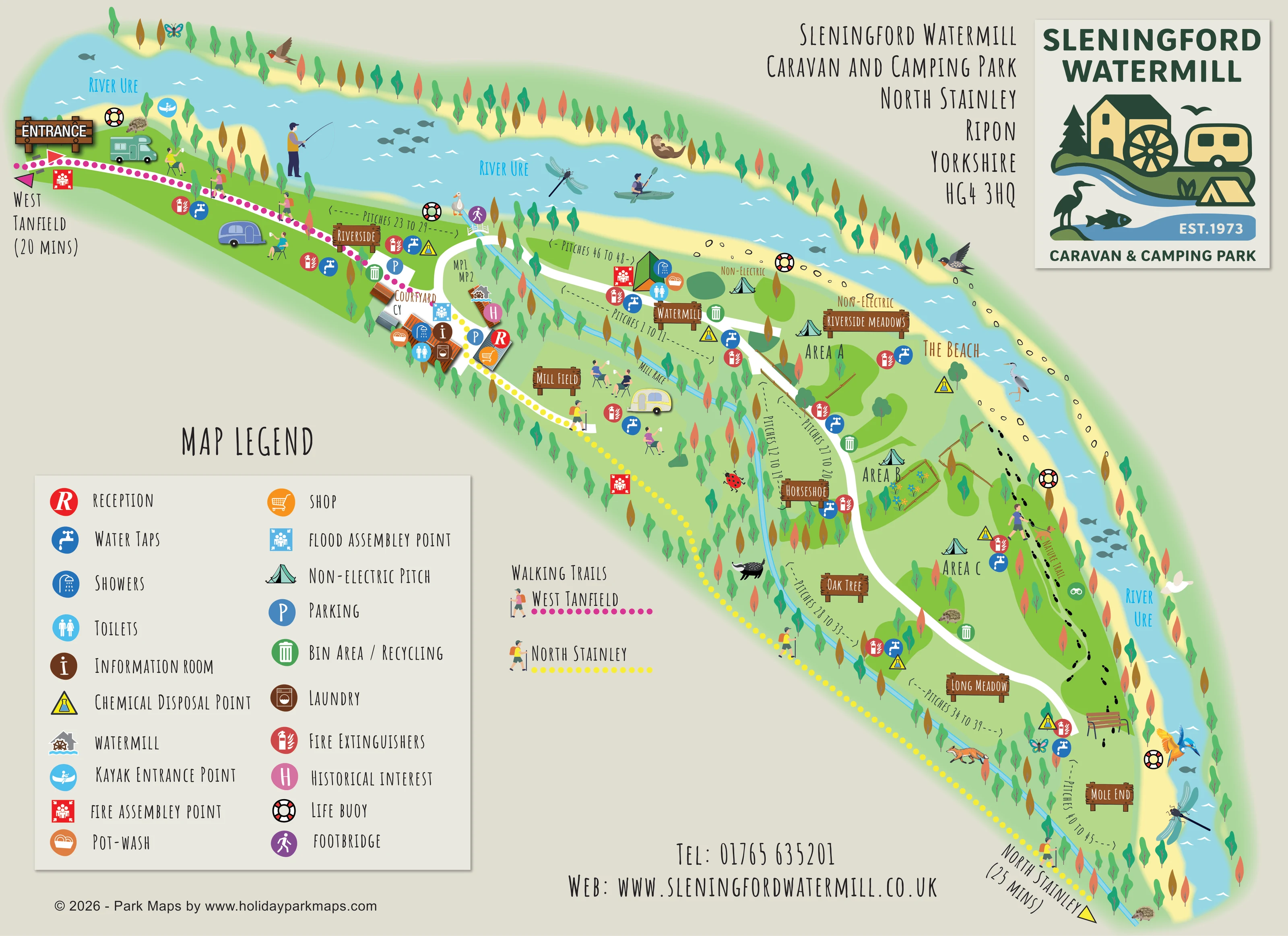
The broad river curves around the upper and right-hand edges of the park, forming its principal landscape boundary.
A narrow blue watercourse runs diagonally through the site, separating several pitch sections from the eastern camping meadows.
A named pale-yellow riverside strip appears beside Riverside Meadows and the nature trail.
Rows of stylised trees define the riverbanks, mill race and boundaries, with broad green meadow spaces between them.
A timber-style entrance sign marks arrival at the upper-left end of the long site.
A white road leads from the entrance to the courtyard and then curves through the central and lower pitch areas.
A red R symbol locates reception within the courtyard service cluster.
An orange shopping-trolley symbol identifies the shop beside reception.
The broad river curves around the upper and right-hand edges of the park, forming its principal landscape boundary.
A narrow blue watercourse runs diagonally through the site, separating several pitch sections from the eastern camping meadows.
A named pale-yellow riverside strip appears beside Riverside Meadows and the nature trail.
Rows of stylised trees define the riverbanks, mill race and boundaries, with broad green meadow spaces between them.
A timber-style entrance sign marks arrival at the upper-left end of the long site.
A white road leads from the entrance to the courtyard and then curves through the central and lower pitch areas.
A red R symbol locates reception within the courtyard service cluster.
An orange shopping-trolley symbol identifies the shop beside reception.
A brown information symbol marks a room in the courtyard building group.
Blue facility symbols identify toilets and showers in the courtyard and Watermill areas.
Orange washing-up symbols appear at the courtyard and Watermill facility clusters.
A brown washing-machine symbol marks laundry facilities in the courtyard.
Blue P symbols identify parking near the courtyard and arrival-side pitch sections.
Repeated blue tap symbols distribute water points across the named touring and camping sections.
Yellow triangular symbols mark disposal points at several locations along the site.
Green bin symbols appear beside the courtyard, internal road and meadow sections.
Red extinguisher symbols are repeated throughout the accommodation areas.
Red fire assembly symbols and a blue flood assembly symbol are positioned on the plan and distinguished in the legend.
Black, white and red ring symbols mark several positions along the river edge.
A watermill pictogram and pink historical-interest marker identify heritage features close to the courtyard and mill race.
A blue paddling symbol marks a river access point near the upper-left entrance end.
A purple walking symbol identifies a small crossing near the upper end of the mill race.
A black footprint route follows the eastern riverside through the camping meadows, accompanied by a binocular symbol and illustrated benches.
A magenta dotted route follows the upper side of the park and points towards West Tanfield, labelled 20 minutes.
A yellow dotted route follows the opposite side of the park and continues towards North Stainley, labelled 25 minutes.
READING THE MAP
This illustrated map of Sleningford Watermill Caravan & Camping Park places the River Ure at the heart of the visitor experience. The site curves around the water near North Stainley, north of Ripon in Yorkshire, with touring sections, non-electric camping meadows and a historic watermill setting brought together on one landscape-format page.
Rather than filling the plan with repeated caravan symbols, the artwork uses named areas, pitch-range labels and a few representative vehicles and tents. Wooden-style signs identify places such as Riverside, Mill Field, Horseshoe and Mole End, while the white access road provides a clear route through the park. The courtyard forms a recognisable service hub, with reception, shop and practical facilities grouped close together.
The map also gives walking its own visual language. Magenta and yellow dotted trails point towards West Tanfield and North Stainley, and a footprint route follows the riverside nature trail. Trees, wildlife, paddlers and relaxed campers give the plan a distinctly outdoor character, supported by a substantial facility legend and prominent park branding.
The plan follows an elongated strip of land beside a broad bend in the River Ure. Arrival is marked at the upper left, where the internal road leads towards the courtyard before continuing through the park. A narrow mill race runs diagonally across the illustration, providing a second landscape reference alongside the much larger river.
Accommodation is organised into named sections rather than a dense grid of individually drawn units. Riverside occupies the entrance-side river frontage; Courtyard and Watermill sit around the principal buildings. Mill Field, Horseshoe, Oak Tree, Long Meadow and Mole End extend towards the lower end of the site. On the river side of the road, Riverside Meadows is divided into Areas A, B and C. Tent symbols and non-electric labels distinguish camping spaces, while bracketed pitch ranges identify the numbered touring sections.
The courtyard cluster includes reception, shop, information room, laundry, toilets, showers and pot-wash symbols. Another facility cluster appears at Watermill. Water taps, bins and recycling, chemical disposal points and fire extinguishers are distributed through the plan. Fire and flood assembly markers are differentiated, and life-buoy symbols punctuate the riverbank. A watermill icon, historical-interest marker, footbridge and kayak entrance point add locally specific reference points.
White roads, magenta and yellow walking trails, and a black footprint nature trail remain visually distinct. The Beach is named along the pale river margin, with trees and benches helping describe the riverside setting. The large lower-left legend explains the service symbols, while the upper-right title and illustrated logo anchor the page. The accompanying enlargement repeats part of this same artwork to make legend entries easier to read; it is not a separate map or additional accommodation area.
KEEP EXPLORING
Chosen for shared landscapes, accommodation or facilities.
 Explore the map ↗
Ireland
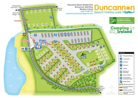
Beachside park plan with colour-coded mobile homes, touring/camping areas, glamping cabins and grouped service symbols.
 Explore the map ↗
United Kingdom
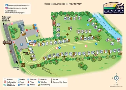
Illustrated touring-pitch plan and colour-coded coastal walking guide for Cannon Camping & Caravan Park.
 Explore the map ↗
United Kingdom
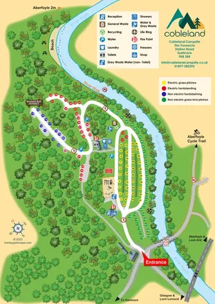
Colour-coded camping pitches, woodland routes and River Forth frontage at Cobleland Campsite.
Features may come from the sample artwork, its key or published park information. Approximate numbers describe the drawing and may cover only part of a park. They are intended to help you compare map examples. Current facilities and booking information should be checked with the park.
TAKE A CLOSER LOOK
View the illustrated map in detail or choose a file to download. These are sample maps; contact the park for current visitor information.


LET’S MAP YOUR PARK
For a map quotation, find your park and draw a rough boundary around it. The area you select helps us work out the design time and price.
Draw your park for a quote ↗Or talk to our map designers
01751 473136
 sleningfordmap_large.png