
Headland
A broad open northern area enclosed by fencing and crossed by looping footpaths.
ILLUSTRATED PARK MAP · P603
The St Madoc Centre, Llanmadoc, Swansea · United Kingdom
 Enlarge the map ↗
A SENSE OF THE PLACE
St Madoc is a Christian youth and group activity centre on the Gower Peninsula. Its grounds provide space for group stays, outdoor activities and time together in a coastal countryside setting.
Bunkhouse accommodation is supported by a commercial kitchen, dining space, common room and historic chapel. Indoor recreation includes table tennis and a pool table, while the map helps groups navigate the accommodation and activity areas.
LOOK CLOSER
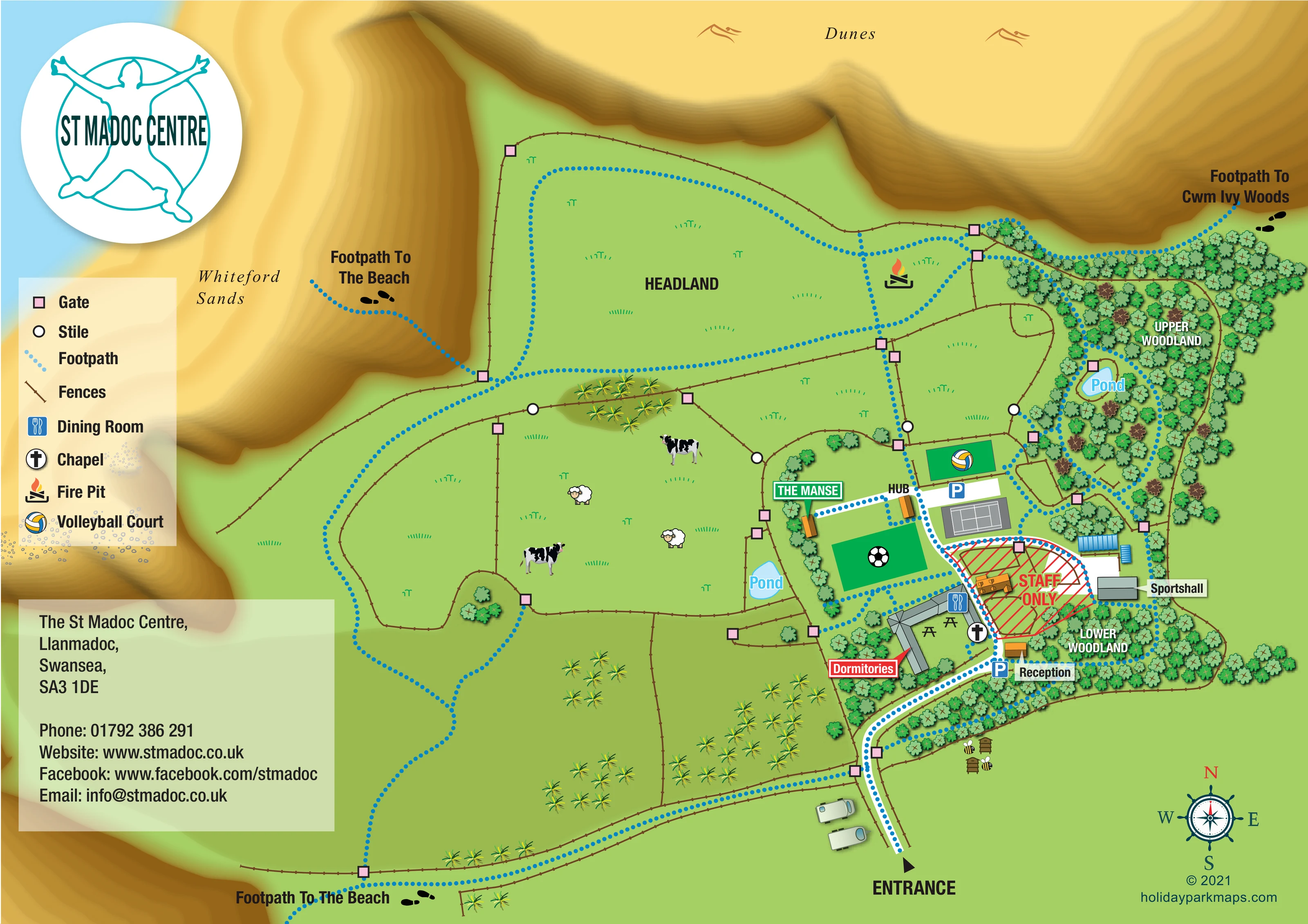
A broad open northern area enclosed by fencing and crossed by looping footpaths.
Two named wooded areas wrap around the eastern and southern sides of the activity complex.
Two blue ponds are labelled, one within Upper Woodland and one west of the football area.
Golden shaded dunes frame the northern and western edges, with Whiteford Sands named beside the pale-blue coastal margin.
Irregular green fields occupy much of the western and southern grounds, with grass, scrub and livestock illustrations.
A small labelled building beside the entrance drive and lower parking area.
The principal accommodation complex, marked with a red pointer label west of reception.
A blue cutlery symbol locates the dining room within the main building complex.
A small labelled building beside the entrance drive and lower parking area.
The principal accommodation complex, marked with a red pointer label west of reception.
A blue cutlery symbol locates the dining room within the main building complex.
A circular cross symbol identifies the chapel beside the dormitory courtyard.
A separate grey-roofed building east of the staff-only area.
A small orange-roofed building labelled HUB near the upper parking area and playing spaces.
A named building at the western edge of the activity cluster; its visitor function is not specified.
A green rectangular court with a volleyball symbol north of the upper parking area.
A green rectangle with a football symbol between the Manse and dormitories.
A grey court with white tennis-style markings lies immediately south of the upper parking area; it is not text-labelled.
A flame-and-logs symbol places the fire pit near the eastern side of the headland.
Picnic-table symbols appear in the open courtyard of the main accommodation complex.
Blue P symbols mark parking beside reception and near the Hub and outdoor court.
Red diagonal hatching and large lettering distinguish a staff-only enclosure within the building cluster.
The entrance is marked at the southern edge; a white drive curves past reception and branches through the activity complex.
Blue dotted paths link the buildings, fields, headland and woodland. Pink squares mark gates, white circles mark stiles, and brown ticked lines show fences.
Two outward routes are labelled Footpath To The Beach, one on the western side and one at the south-western edge.
A labelled route leaves the upper woodland towards the north-east.
A broad open northern area enclosed by fencing and crossed by looping footpaths.
Two named wooded areas wrap around the eastern and southern sides of the activity complex.
Two blue ponds are labelled, one within Upper Woodland and one west of the football area.
Golden shaded dunes frame the northern and western edges, with Whiteford Sands named beside the pale-blue coastal margin.
Irregular green fields occupy much of the western and southern grounds, with grass, scrub and livestock illustrations.
Catalogue context identifies a commercial kitchen, common room, table tennis and pool table. These are not individually located on the artwork.
READING THE MAP
This illustrated map of St Madoc Centre in Llanmadoc, Swansea brings together group accommodation, activity spaces and the coastal landscape of the Gower Peninsula. Rather than presenting rows of holiday pitches, it focuses on a compact centre set within open fields, woodland and dunes, with walking routes extending towards the beach and Cwm Ivy Woods.
The main buildings occupy the lower-right portion of the artwork. Dormitories, reception, the sports hall, Hub and the Manse are identified with prominent labels, while recognisable symbols locate dining, the chapel, volleyball and a fire pit. Blue dotted footpaths connect these everyday destinations with the wider grounds, making the landscape an integral part of the visitor map.
Golden dunes frame the plan, contrasting with green fields, densely illustrated woodland and pale-blue ponds. A large circular centre logo, a concise symbol key and a contact panel complete the composition. This sample is particularly relevant to residential activity centres and group venues that need one map to explain both their buildings and their outdoor setting.
The plan is arranged around an entrance at the southern edge. A curving white drive leads towards reception and a marked parking point, then continues through the building and activity cluster. The grey-roofed dormitory complex encloses an open courtyard containing picnic-table symbols, with dining and chapel icons positioned along its eastern side. Nearby, a red-hatched enclosure is clearly labelled Staff Only, separating it visually from the visitor destinations around it.
Further north, the Hub and the Manse sit close to a green football area, a grey court with white tennis-style markings and a second parking area. A volleyball symbol identifies another green court beyond the parking. The sports hall occupies a separate building to the east. These compact illustrated structures contrast with the much larger areas of open ground surrounding them.
Blue dotted footpaths form loops through the fenced fields, around the headland and within Upper and Lower Woodland. Pink square gates and white circular stiles identify crossing points along brown fence lines. Two ponds provide useful landscape landmarks: one in Upper Woodland and another beside the fields west of the activity spaces. A fire-pit symbol sits near the eastern side of the headland.
Two paths lead out towards the beach, while a north-eastern connection is labelled for Cwm Ivy Woods. Whiteford Sands and the dunes establish the coastal context, with layered golden shading suggesting raised sandy terrain. Trees, livestock, grass tufts and bee-and-hive illustrations give the grounds a distinctive countryside character. The single landscape-format page combines this estate overview with a left-hand legend and contact panel, a large centre logo and a lower-right compass rose.
KEEP EXPLORING
Chosen for shared landscapes, accommodation or facilities.
 Explore the map ↗
United Kingdom
A colour-zoned coastal park map with touring areas, woodland trails, ponds and a leisure club.
 Explore the map ↗
United Kingdom
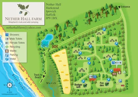
Tree-sheltered camping and named shepherd’s huts beside the River Stour at Nether Hall Farm.
 Explore the map ↗
United Kingdom
Woodland-framed Barnsoul map with mixed accommodation, shared facilities and paw-marked walking routes.
Features may come from the sample artwork, its key or published park information. Approximate numbers describe the drawing and may cover only part of a park. They are intended to help you compare map examples. Current facilities and booking information should be checked with the park.
LET’S MAP YOUR PARK
For a map quotation, find your park and draw a rough boundary around it. The area you select helps us work out the design time and price.
Draw your park for a quote ↗Or talk to our map designers
01751 473136