
Bramhope Beck
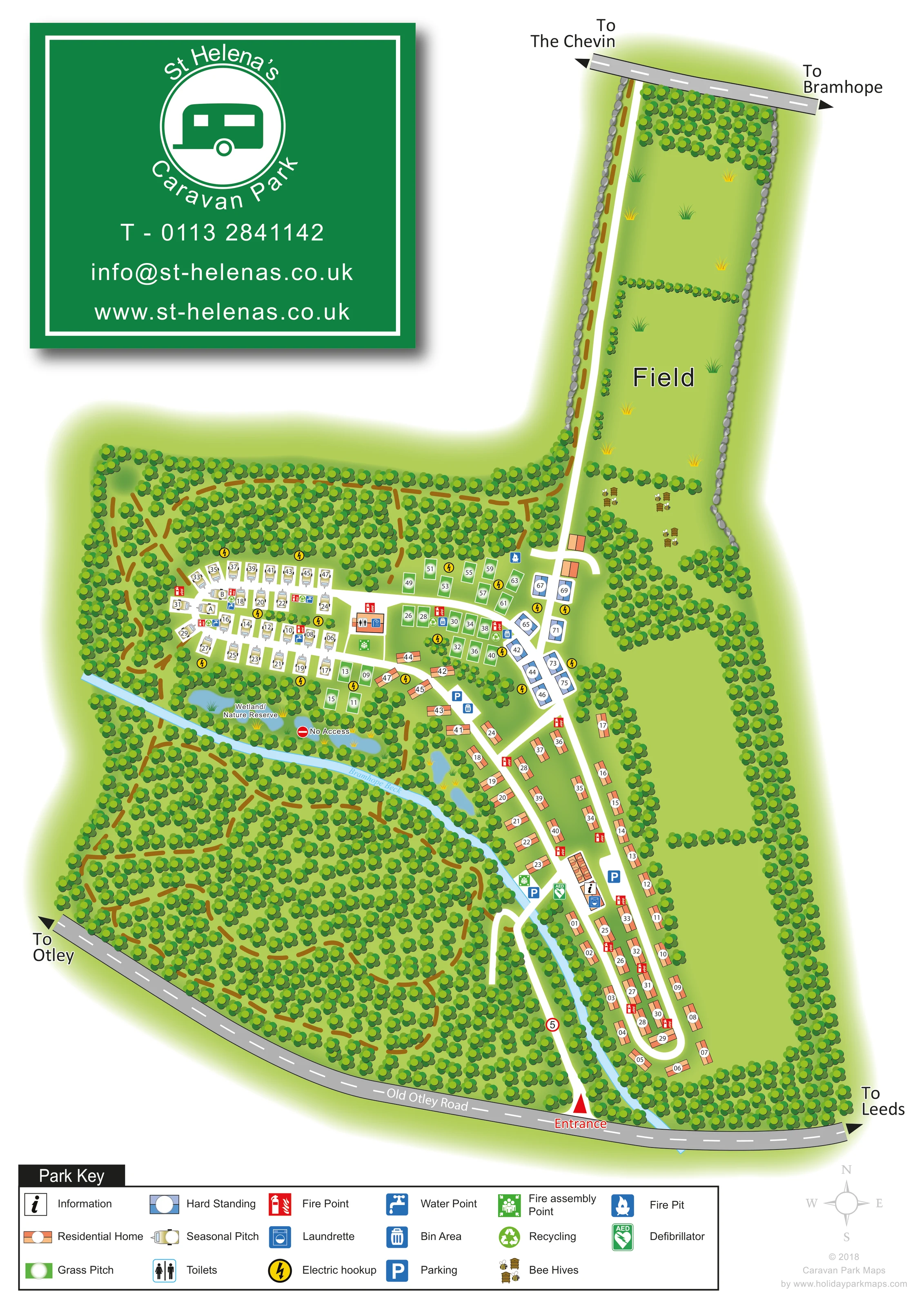
A named pale-blue watercourse crosses the wooded western grounds and follows the arrival corridor towards Old Otley Road.
ILLUSTRATED PARK MAP · P604
Otley Old Road, Horsforth, Leeds · United Kingdom
 Enlarge the map ↗
A SENSE OF THE PLACE
St. Helena's Caravan Park is based at Otley Old Road, Horsforth, Leeds. St Helena's offers touring and camping, bell tents, seasonal stays and a separate residential park. Hardstanding and grass pitch options have optional electric hook-ups; washrooms, laundry and disposal facilities are provided.
The map brings the site layout and its access routes together in one view, providing a reference for understanding the arrangement of the grounds.
LOOK CLOSER
A named pale-blue watercourse crosses the wooded western grounds and follows the arrival corridor towards Old Otley Road.
Blue pools and reeds identify a wetland beneath the western pitch area. A nearby No Access label marks a restricted part of this landscape.
Dense illustrated woodland surrounds the western and southern grounds, threaded by numerous brown paths.
An elongated field extends north of the accommodation, enclosed by trees, hedges and stone-like boundary marks.
An information symbol marks a small building beside the central arrival and residential-road junction.
Toilet symbols identify facilities within the western seasonal area and at the central service building.
Blue washing-machine symbols mark laundry provision at the central service building and near the information point.
Yellow lightning symbols recur around the seasonal, grass and hardstanding pitch groups.
An information symbol marks a small building beside the central arrival and residential-road junction.
Toilet symbols identify facilities within the western seasonal area and at the central service building.
Blue washing-machine symbols mark laundry provision at the central service building and near the information point.
Yellow lightning symbols recur around the seasonal, grass and hardstanding pitch groups.
Blue tap symbols are distributed through the pitch areas.
Blue bin and green recycling symbols show waste facilities at several accommodation and service locations.
Blue P symbols identify parking near the central facilities and the junction serving the residential area.
Repeated red fire-point symbols appear throughout the residential and pitch areas.
Green assembly symbols are shown beside the central facilities and near the arrival-side junction.
A green AED symbol is placed beside the information and arrival-side facilities.
The key includes a blue fire-pit symbol; its position is not sufficiently clear in the overview to describe confidently.
Illustrated hive-and-bee groups appear in the northern field beside the access spine.
A named pale-blue watercourse crosses the wooded western grounds and follows the arrival corridor towards Old Otley Road.
Blue pools and reeds identify a wetland beneath the western pitch area. A nearby No Access label marks a restricted part of this landscape.
Dense illustrated woodland surrounds the western and southern grounds, threaded by numerous brown paths.
An elongated field extends north of the accommodation, enclosed by trees, hedges and stone-like boundary marks.
The entrance is labelled on Old Otley Road, with arrows towards Otley and Leeds. A road along the top of the field is signed towards The Chevin and Bramhope.
White roads connect the southern entrance, central facilities, residential loop, western pitch branches and the northern field edge.
READING THE MAP
This illustrated map of St Helena’s Caravan Park in Horsforth, Leeds, brings a mixed residential and touring site together with its wooded surroundings. Rather than presenting accommodation as an isolated grid, the artwork shows how the seasonal pitches, grass pitches, hardstandings and residential homes fit around Bramhope Beck, a wetland area and an extensive network of woodland paths.
The entrance from Old Otley Road provides a clear starting point. White internal roads lead visitors towards the information point and service buildings before dividing between the compact western pitch area and the longer residential loop to the east. A narrow field extends towards the top of the page, with bee hives adding a distinctive site-specific detail.
Colour-coded accommodation, numbered markers and a comprehensive Park Key make the different areas easy to distinguish. The large green branding panel gives the portrait composition a strong identity, while the landscape illustration explains the character of the grounds. This sample is particularly relevant to parks that need to communicate several accommodation uses within one coherent, landscape-led plan.
The portrait artwork follows the park’s irregular footprint, with Old Otley Road curving along the bottom and a second road crossing the top of the northern field. Directional arrows identify Leeds, Otley, The Chevin and Bramhope. Between these road edges, the map combines a broad wooded western area with an elongated eastern accommodation strip.
The labelled entrance opens onto a white access road beside Bramhope Beck. Near the central junction, information, laundry, parking, a fire assembly point and a defibrillator are marked with pictograms. The road then divides: one branch serves the long residential loop, while others connect the seasonal and touring areas. Orange residential-home symbols follow the eastern loop and several shorter central roads. Caravan-shaped seasonal markers form close-set western rows, with green grass pitches and blue hardstandings grouped farther north and east.
Toilet and laundry symbols identify service locations around the pitch areas. Water points, electric hook-ups, bins and fire points recur where visitors need to find them, while the bottom key explains the full symbol system, including recycling and a fire-pit entry.
Landscape has a substantial role in the drawing. Repeated green tree crowns enclose the site, and brown paths branch through the woodland. The pale-blue beck passes a labelled Wetland / Nature Reserve, illustrated with pools and reeds; a nearby No Access marker distinguishes a restricted area. The northern field has hedge divisions, boundary stones and small bee-hive illustrations.
A large green logo and contact panel fills the upper-left space. The wide legend, lower-right compass and restrained designer credit complete the page. The accompanying detail views enlarge this same legend rather than showing additional park sections.
KEEP EXPLORING
Chosen for shared landscapes, accommodation or facilities.
 Explore the map ↗
United Kingdom
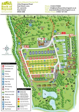
Colour-coded touring pitches, named glamping units and woodland routes at Back of Beyond Touring Park.
 Explore the map ↗
United Kingdom
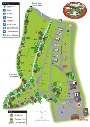
A stream-side farm campsite plan with car-free camping, caravan pitches and separate bell-tent areas.
 Explore the map ↗
United Kingdom
Woodland park map with mixed pitches, bell tents, lodges and a fishing lake.
Features may come from the sample artwork, its key or published park information. Approximate numbers describe the drawing and may cover only part of a park. They are intended to help you compare map examples. Current facilities and booking information should be checked with the park.
TAKE A CLOSER LOOK
View the illustrated map in detail or choose a file to download. These are sample maps; contact the park for current visitor information.

LET’S MAP YOUR PARK
For a map quotation, find your park and draw a rough boundary around it. The area you select helps us work out the design time and price.
Draw your park for a quote ↗Or talk to our map designers
01751 473136